I’d been eyeing up Orkney for some time, especially after I visited the Outer Hebrides back in the summer of 2019. Of course, then the Covid Pandemic hit and cut back on a lot of travel traffic. In a way this pushed Orkney higher up my list of ‘places to visit’, since it was somewhere it was possible to go without too much hassle. So, at the end of May 2021, I took a train up to Aberdeen, then a ferry to Kirkwall, to explore what I could of the islands in a week.
I’d originally planned a route to visit several of them, as they’re each not terribly big, but a combination of fitness and weather cut this down a bit – I never made it to neither Eday nor the Brough of Birsay. That said, I saw a lot of what I intended to, and it was a very interesting trip.
Overview of Orkney
Orkney, if you look on a map, feels like it’s just at the edge of European civilisation, and the vast, cold, seas that separate the islands on the edge of the continent with the islands on the edge of North America. While the North of Scotland has seen an uplift in tourism recently, especially as a result of Covid meaning Brits have been unable to go abroad so they’re exploring places in the UK, the majority of visitors seem to be headed either to the North Coast 500 road trip (a loop around the far north of Scotland that goes through some spectacular scenery), or to ‘nearby’ islands in the Inner Hebrides like Skye and Mull. Even now, places like the Outer Hebrides and Orkney feel just slightly ‘too far’ for many people.
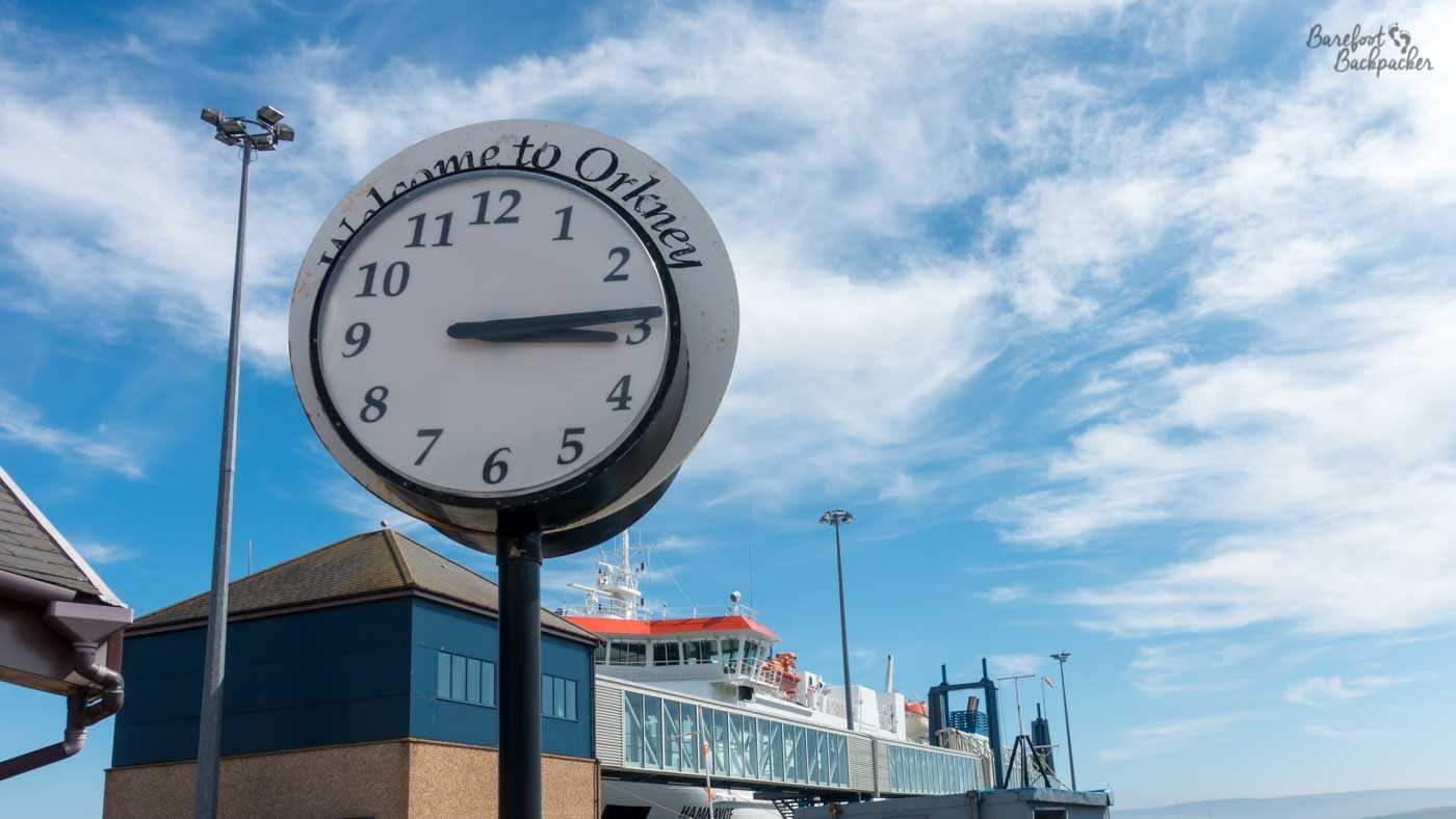
“Welcome To Orkney”, as seen at Stromness Harbour.
Orkney lies about 15km off the very northeast coast of Scotland, just north of Dunnet Head (the most northerly point of Great Britain). Indeed they provide the only reason really to go to John O’Groats – there’s a passenger ferry from there to the island of South Ronaldsay. Cars (and, in this case, me) generally go to the capital (Kirkwall) from Aberdeen on a 6-hour ferry that occasionally continues on to Shetland, though there’s also a ferry from Stromness to Scrabster, near Thurso, that only takes 90 minutes but Thurso is a long way up Scotland; the train even to Inverness takes 4 hours.
The island group covers an area of just under 1,000 square kilometres, and are about 80km end to end. There’s about 70 islands in total, but the majority are very small and uninhabited. About 22,000 people live on the islands, though the main town and centre of the Orkney Islands is Kirkwall, towards the eastern side of the largest island (known awkwardly as Mainland – the Scottish Mainland is known simply as ‘Scotland’), and has 9,300 people in it. This suggests the population is a bit more spread out than you might expect.
Kirkwall’s quite a pleasant town. There’s enough shops and services there to mean that trips to the larger towns of Inverness or Aberdeen don’t need to be undertaken for everyday needs, and it acts as the central hub for the ferries so it’s an easy day trip for weekly shopping if you live on one of the islands like Stronsay or Westray. Probably not North Ronaldsay though – that island is quite remote even for Orkney, and ferries and even planes are regularly cancelled due to weather.
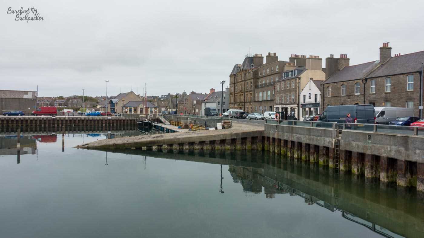
Kirkwall Harbour. Most of the inter-island ferries depart from the end of the pier to the left of shot.
I went there with the knowledge that I was always going to be comparing and contrasting with the Outer Hebrides (more on which in Podcast 22), although in truth I’d say there were far more differences than similarities; there’s a bit of a shared history but for the most part they have a much more distinctive vibe. A better comparison might be to the Shetland archipelago, a further 80km north, but I’ve never been there. When I mentioned Shetland to some of the people on Orkney, very few of them had ever been there and there didn’t seem to be any real desire to go either – ‘it’s great if you like oil and sheep, but apart from that there’s nothing there’ was the general consensus.
Interestingly, in the Scottish Independence Referendum in 2014, while the Outer Hebrides voted against independence they did so only with 53.4% of the vote. Orkney was the council area in Scotland with the highest No vote, with 67.2%. Some believe this was because they’d rather be independent themselves and they’d find it easier to get that independence from London rather than Edinburgh. Others have said, in a similar vein, Orkney’s so far from both that wherever the capital is, it probably doesn’t matter.
Note that with an independent Scotland, Edinburgh would be the nearest national capital from Kirkwall. As it stands, and discounting Tórshavn (pronounced Torsholm) because the Faeroes aren’t independent, the nearest national capital is in fact … Dublin, about 660km away. Oslo (at 780km) is nearer than London (850km) though.
One important point to note, btw. Never call them ‘The Orkneys’. It’s always ‘The Orkney Islands’ or, simply, ‘Orkney’.
Getting around Orkney
The main obvious difference between the Outer Hebrides and Orkney is shape. The Outer Hebrides are basically a line of islands that make it easy to explore in succession, but which does mean you don’t have much a choice about which islands to visit. The only way to get between them is by the ‘spine route’, the long road and ferry hops that connect them all together. Orkney is more of a rectangle; there’s one large island (known as Mainland) in the south-centre, and the other islands are kind of scattered around it. This means it’s a lot easier to pick and choose which islands to visit.
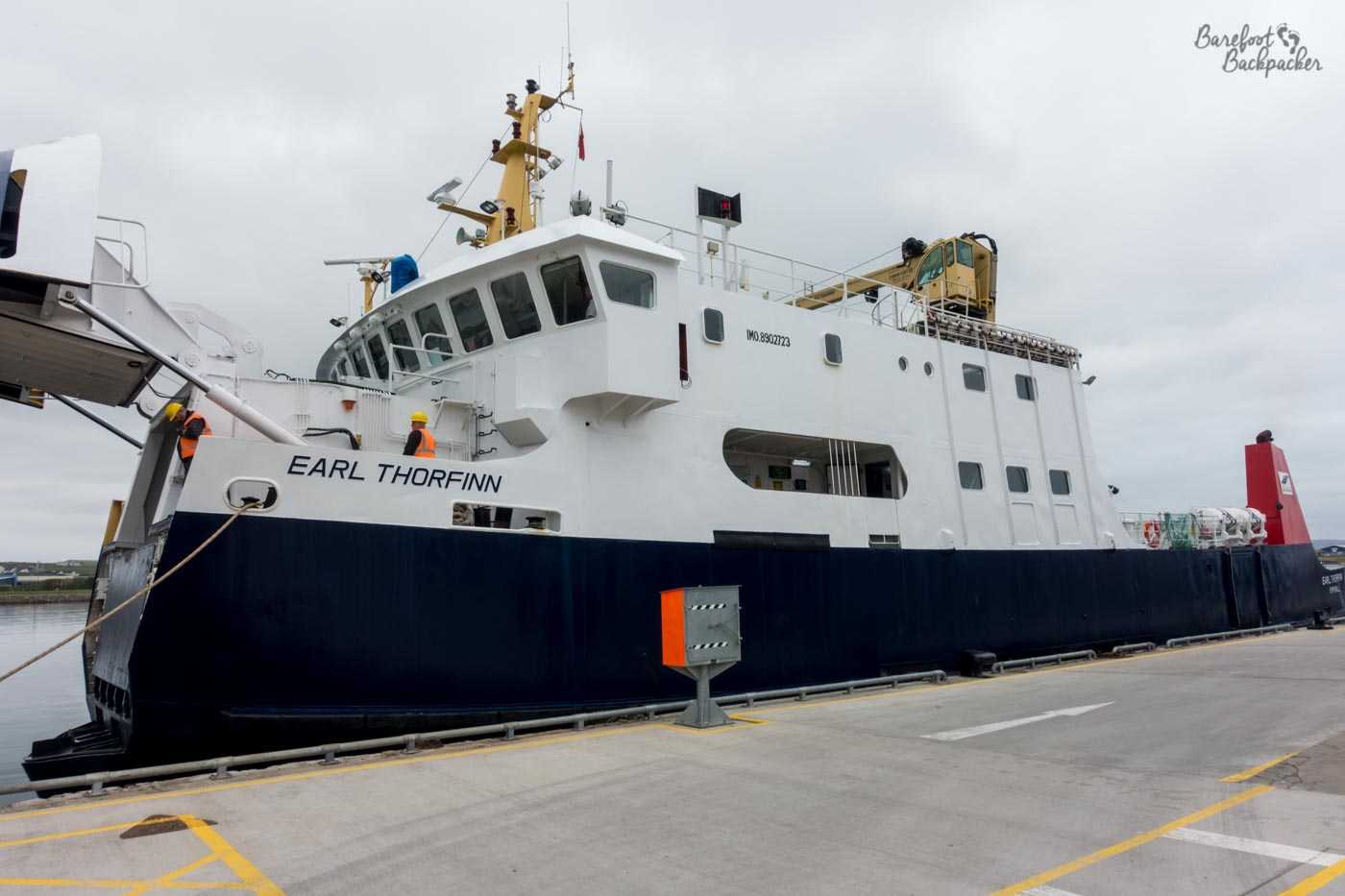
An inter-island ferry at Stromness Harbour. I think it’s going to the island of Hoy.
Getting around Orkney is thus relatively easy, in a sense. There’s both ferries and flights that connect all the islands to Orkney Mainland, that operate between once and about seven times a day, depending on route and season. The downside is, aside from a couple of specific weekly services, for the most part you have to go back to Mainland rather than being able to go between the islands directly. The only exception to this is some close islands that are served by the same routings (eg ferries taking in the islands around Rousay), but even here sometimes they only go in one direction so doing return journeys is logistically tricky.
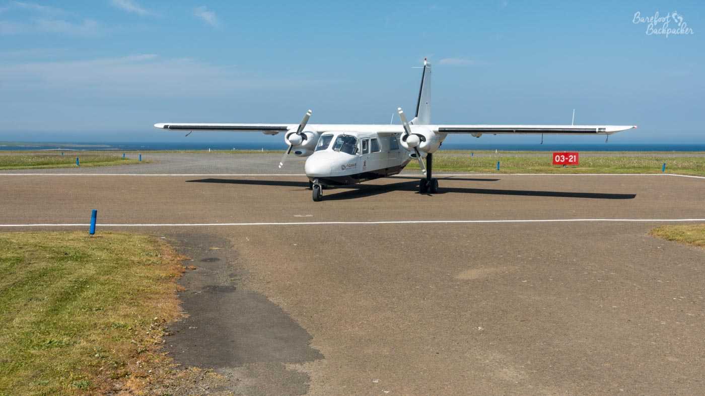
An inter-island plane at Papa Westray airport. It’s going to Orkney Mainland.
This is true for both planes and ferries. One of the few things about Orkney that most people know is it’s the location of the world’s shortest scheduled aeroplane journey – between the islands of Westray and Papa Westray. The straight-line distance between the two terminal buildings (for a given definition of building) is 3km, and the flight time is around 90-100 seconds. The reason the flight exists though is because it’s one leg of a three leg loop from Mainland; in the mornings the flight visits Westray first, while the afternoon leg visits Papa Westray first. I did not take this flight – I took the ferry from Westray to Papa Westray in the company of 6 schoolkids, one of whom sounded like they had a Northern Ireland accent – and my flight back from Papa Westray was direct to Mainland, on an 8-seater propeller plane that never got that high, and which felt like I was basically sitting in an airborne minibus – the pilot and co-pilot were literally in front of me and I could see the entire flight dashboard panel. I did however stand at Papa Westray airfield and watch an afternoon flight to Westray; it’s the only time I’ve ever seen an entire flight from take-off to landing. Probably the only time I ever will.
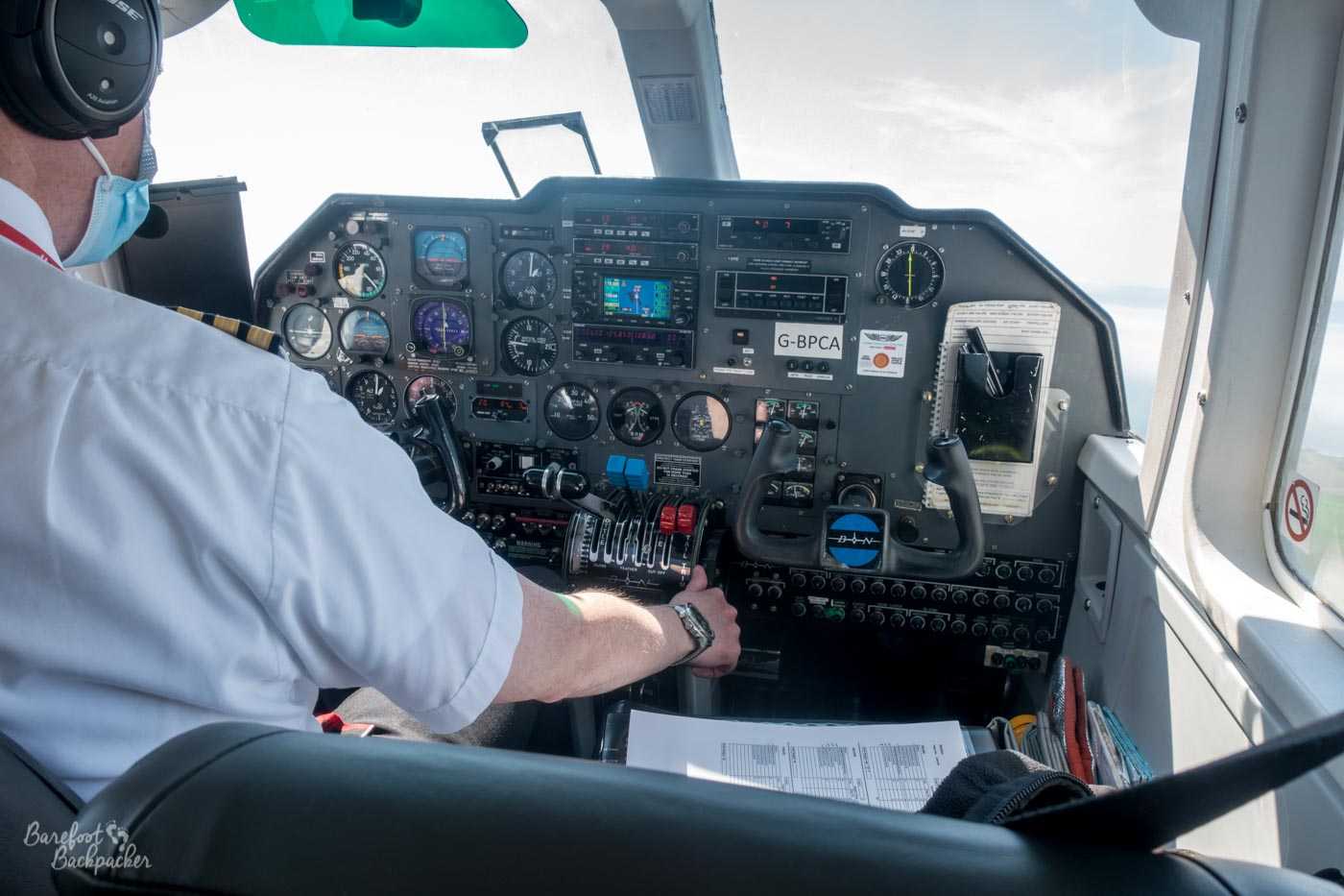
The inside of the flight from Papa Westray to Orkney Mainland. It’s fascinating to be able to read the dials.
I had intended to take that route at some point, headed back to Mainland, but the reason I didn’t was because of one of the major problems with transportation in Orkney. More so with flights than ferries, but both are affected by the weather. Because all the airfields on the islands are visual navigation only, it’s only safe to land on them in clear weather. Orkney gets a lot of fog; I ended up effectively trapped on Papa Westray for three days when I’d only intended to spend a night there. Technically I could have left by ferry, but because of Covid restrictions, Orkney Ferries had a policy of only pre-booked journeys being allowed on the main routes (ie the facility to buy a ticket on board wasn’t currently an option). And their telephone line isn’t staffed at weekends. And the ferry terminal on Westray is some 8km away from everywhere, at the very southern end of the island. I felt it was a long way to go to be turned away. And besides, Papa Westray’s nice enough.
Recent Orkney History
Orkney has been inhabited for several thousand years, and its most famous sites all date from the Neolithic period. There are so many, in fact, that its been designated a World Heritage Site, and this means it deserves its own blog post. But that’s not to say that Orkney’s later history has been any less interesting.
Orkney, along with neighbouring Shetland, was a Viking (and, subsequently, Norwegian) state until as recently as 1469, a couple of hundred years after the Outer Hebrides came under the control of the Scottish Kings. Indeed the flag of Orkney is, like other flags on Scottish Islands flags (eg South Uist and Barra over in the Western Isles), based on the Nordic Cross so familiar from the Scandinavian flags. The Vikings were very interested in Orkney because of its location in the northern seas – given in those days much trade and migration took place by sea, Orkney was in the favourable position of being at a ‘crossroads’ between Scandinavia, Great Britain, Iceland/Faeroes, and more westerly islands like the Hebrides.
However, the Norse lost Orkney (and Shetland) in a slightly unusual way. It seems they were offered as a dowry by King Christian I of Norway & Denmark (he had been King of Sweden too for a few years but that union hadn’t worked out), to persuade King James III of Scotland to marry his daughter Margaret. That she was 13 and he about 17 at the time proves that this marriage was more about power than about love. Well, money, actually, it appears to have been more-or-less a tax/debt write-off scheme. Regardless, it seems that the islands were offered more as a security deposit than an actual payment, and would be returned to the Norwegian throne once King Christian came up with the necessary cash. He never did. A couple of years later James III formally took control of the islands personally. It must be said however that the feeling amongst historians is he probably would have done this anyway at some point. That said, there are still some people who feel the Scottish takeover was strictly speaking illegal.
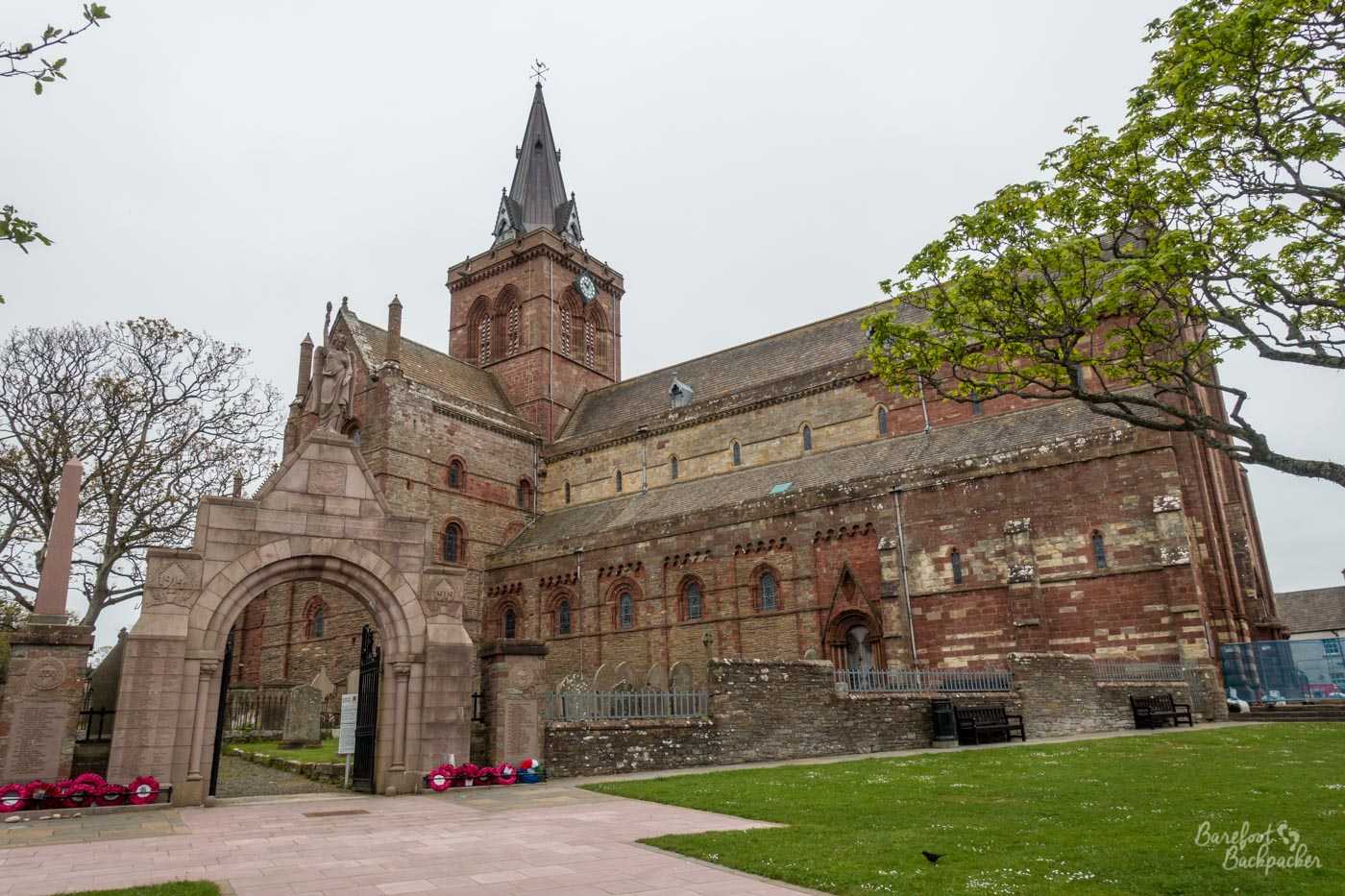
Kirkwall Cathedral.
The capital of Orkney, Kirkwall, has a couple of museums (including one dedicated to the history of Orkney), and a cathedral (no, that does not mean Kirkwall is a city, for reasons well-attested previously on this blog), dedicated to the Viking Earl St Magnus, who was betrayed and executed by his cousin. Magnus’ nephew took revenge a few years later and built the cathedral in his honour.
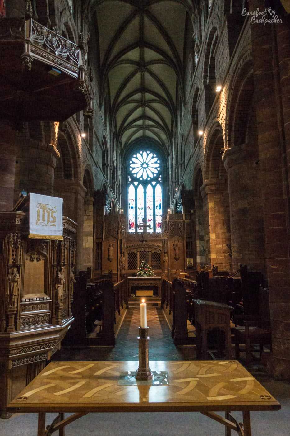
Inside Kirkwall Cathedral.
Next to the cathedral are the remains of the Bishop’s Palace and Earl’s Palace. The Bishop’s Palace came first, being built around the same time as the cathedral (we’re talking the mid-1100s), and originally housed the bishop, while the Earl’s Palace was built several centuries later, in the very early 1600s, by Patrick Stewart, 2nd Earl of Orkney, who by all accounts was a bit of an asshole and not at all like his much later, and unrelated, actor namesake. Who is unlikely to ever be executed for treason, as the 2nd Earl was. Both palaces had fallen into ruin by the end of the 17th Century.
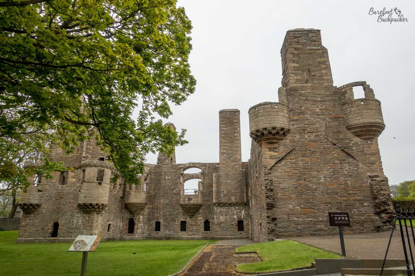
What remains of the Earl’s Palace.
More recent Orkney history has concerned warfare, and specifically naval war. The area of sea to the south of Mainland, penned in by the islands of Hoy, Flotta, and South Ronaldsay (amongst others), is known as ‘Scapa Flow’. Because of its location, protected from the wilds of the sea by so many islands, and its size, it’s served as a natural harbour since Viking times, but it really came to the fore in the wars of the 20th Century. It was used as the main northern base for the British Navy in World War One, with defensive fortifications added on the surrounding coasts. Further defences were added in World War Two after, very early on in the war, a German U-boat had the audacity to sneak in and sink a couple of British battleships.
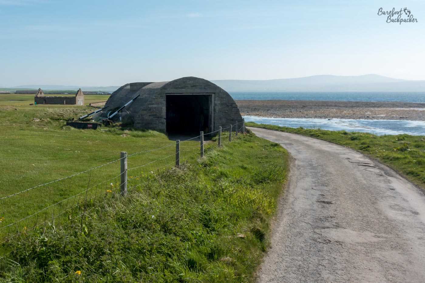
A Nissen Hut at a ruined artillery, just up the coast from Stromness.
Some of the defences are still visible and, would you believe, even used today, albeit not for the same purpose. To prevent further incursions by enemy vessels, a huge amount of rock and concrete was set in the sea to essentially block access to Scapa Flow. These became known as ‘Churchill Barriers’, after the then Prime Minister who ordered their construction, and they formed a wall between the islands of Orkney Mainland, Burray, South Ronaldsay, and a couple of smaller islands in between. There’s now a road on them, so, just like in the Outer Hebrides, you can drive between the islands on a causeway. There’s no pavement though, and the road is much busier than the one at either end of South Uist.
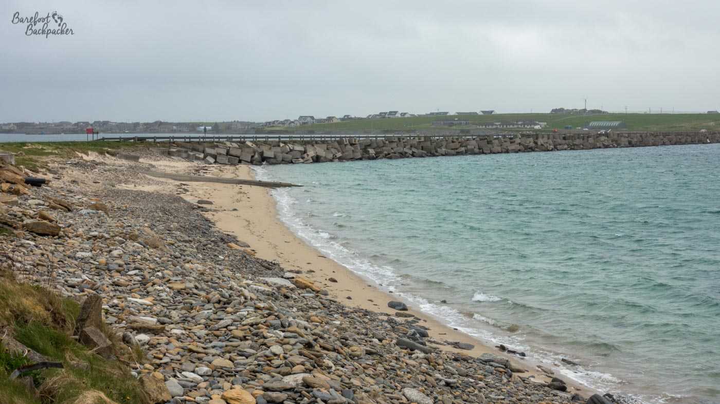
One of the Churchill Barriers, just south of Orkney Mainland.
Much of the construction was done by Italian prisoners of war. Over 1,300 were brought here from Africa and they were set to work. Interestingly, on one of the small islands they were housed on at the time (Lamb Holm), they built a small Catholic chapel out of standard-issue military prefab Nissen Huts (the kind that, oh, you’d absolutely know them if you saw them. They look like half a very long cylinder). Although not fully completed by the time the war ended (not unlike the Churchill Barriers if we’re being honest), it was deemed worthy enough to be preserved rather than dismantled, and now serves as one of the most popular tourist attractions in Orkney as a whole.
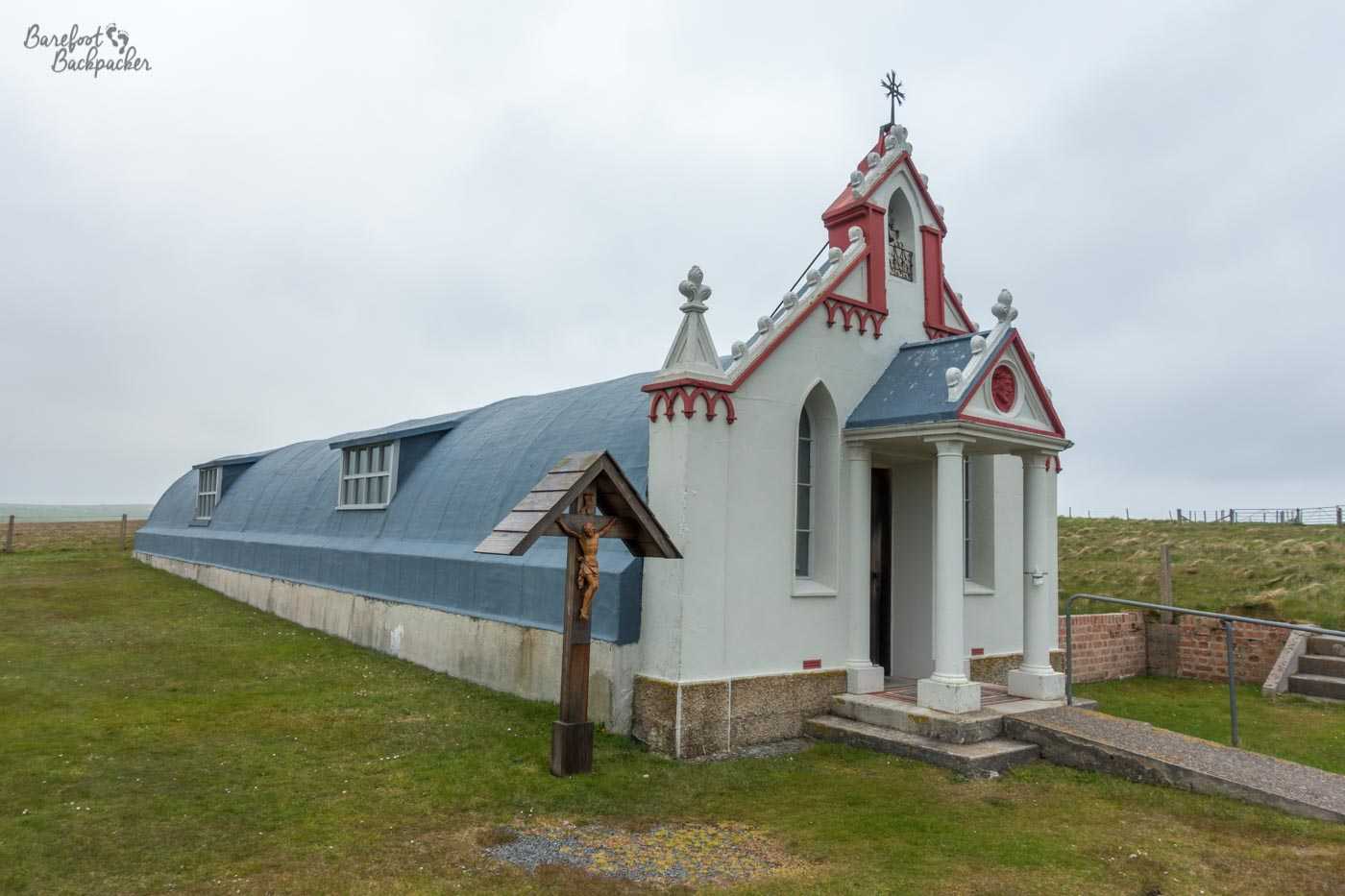
The outside of the Italian Chapel.
The reason is not (just) because of its history, but also, I guess through a combination of having a group of people with nothing else to do, and them wanting to make the best of a bad situation, being incredibly ornately designed and decorated inside, with lots of well-painted frescoes and design features. This is doubly impressive considering the tools and equipment they had to hand when they were building it – making unusual and unexpected use of food cans and parts of old cars.
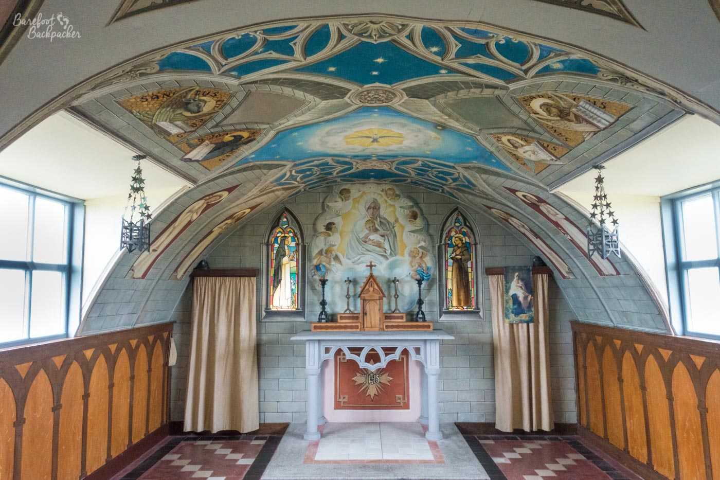
The inside of the Italian Chapel.
Summary
So, to sum up, there’s 70 islands in Orkney; I’d planned to visit maybe 6 or 7 of them in my week travelling around, and in the end I saw 3. While this might feel like a failure to many people, I think I’m comfortable with what I saw and I certainly had experiences and adventures I wasn’t expecting, and I think that’s a perfect example of the way I travel and how I like to travel.
And if you’re wondering about whether I feel slightly awkward doing a podcast and several blog posts about an archipelago I spent only a week on and explored only a few of the islands of, on my podcast is a contribution from my friend Clazz, who blogs under the name of ‘An Orcadian Abroad‘. She grew up in Orkney, and spent many years of her life there.
She’s never been to Eday either.