I visited the Outer Hebrides in July 2019. It came off the back of my trek from the Easternmost to Westernmost point of Great Britain; the walk finished conveniently close to the port town of Oban, and as I’d never been there and had no idea when I’d be back this way again, I thought I’d take the opportunity to go even further west.
A house on the island of Vatersay – not quite Caolas but not far off.
As an aside, it seems fitting that on Vatersay I passed through the very small settlement of Caolas – being the most westerly inhabited place in Scotland, although it’s so spread out that I can’t honestly say was the most westerly person in the country at any point. While not the most westerly inhabited point of the UK – that’s Belleek, in Northern Ireland – the Outer Hebrides does provide the furthest Westerly point in the UK. That’s Soay, in the St Kilda archipelago, but you can’t walk there. Unless you’re Jesus, I guess.
It’s a part of the UK I didn’t really know a lot about. On many of the road atlases when I was growing up, they were assigned a page at the back end, just before Orkney and Shetland, and tended to have a different scale to the rest of the country; the reduced size meant there was far less detail shown. It suggested that the mapmakers didn’t think there was much of relevance over there and put it in more because they had to than because they felt people would find it useful.
Island overview
There’s around 70 islands in the archipelago, of which 15 are inhabited – the total population is around 26,000, or similar to that of Kirkby-in-Ashfield, the town I normally live in. As many of these inhabited islands are linked by causeway, and much of the land at the edges is low-lying and heavily indented with lochs (what’s the difference between a loch and a fjord, anyway?), it’s often hard to tell where one island ends and another starts. The main ones are Barra in the south, South Uist (which I always think looks like Chile), Benbecula, North Uist, Berneray, and the oft-forgotten Harris-and-Lewis, two named islands on one otherwise unnamed land-mass (it’s seemingly never had one name, and the boundary between the two sections is not where you imagine it is if you look at it on a map), which despite being the third largest island in the whole of the British Isles chain, and constituting both 71% of the land mass and 76% of the population of the Outer Hebrides, is not an island many people outside Scotland have heard of. It looks a little like a tree growing out of a plant-pot.
Apart from on maps, the only other place I’d come across the islands was, oddly enough, on the radio. Hebrides is one of the areas around the UK that gets mentioned in the four-times-daily cultural icon that is the famous Shipping Forecast, and Stornoway (the capital, largest town, it’s on Lewis, obviously) is one of the coastal water stations in the same broadcast.
They always thus seemed like a bleak, windy, isolated place, at the edge of the world, where strange mythical beasts outnumbered people, and where I wouldn’t survive without a thick woolly coat, possibly made out of some local mammoth.
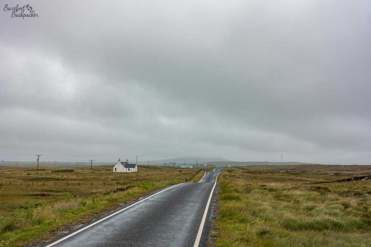
A lonely building in North Uist, remote and isolated, under a leaden sky.
It may not altogether surprise you to learn that on the hottest day ever recorded in the UK, Thursday 25 July 2019, when it reached 38.7°C in Cambridge, I was on the island of Hirta, out in the Atlantic Ocean, wrapped in a coat, getting blasted by a strong wind (about a force 6 gale), very damp, with the temperature recording about 17°C. Even a few days before, whilst staying in a hostel on Benbecula, the heatmap on the TV’s weather forecast had the whole country covered in orange and red, even up to the northern tip of the mainland at John O’Groats, except … for the Outer Hebrides which were green bordering on yellow.
Yet this was a minor aberration, the only stereotype that really held true. I mean, I imagine in the middle of Winter it’s not a terribly enjoyable place to be stuck outside in – parts of the island group are on the same latitude as Alaska – but it does benefit from the Gulf Stream so it’s not quite Winterfell. [Side note; Winterfell is actually further south, in terms of filming location]
This means the beaches are pretty tropical. According to the Thailand tourist board.
Religion
Religion, of varying kinds, has always been strong in these parts; that, plus the relative isolation and strong Celtic tradition means the Outer Hebrides are a good place to indulge in all your hippy pagan fantasies. Stonehenge? That is to prehistoric life what Peggy Porschen is to cake shops – all style and no substance, and expensive to match.
That said, a more modern religious divide is present up here too, and the extent of which may surprise you. Despite the vast majority of the population living north of Benbecula, the town serving the army base has the most northerly open shop on a Sunday,
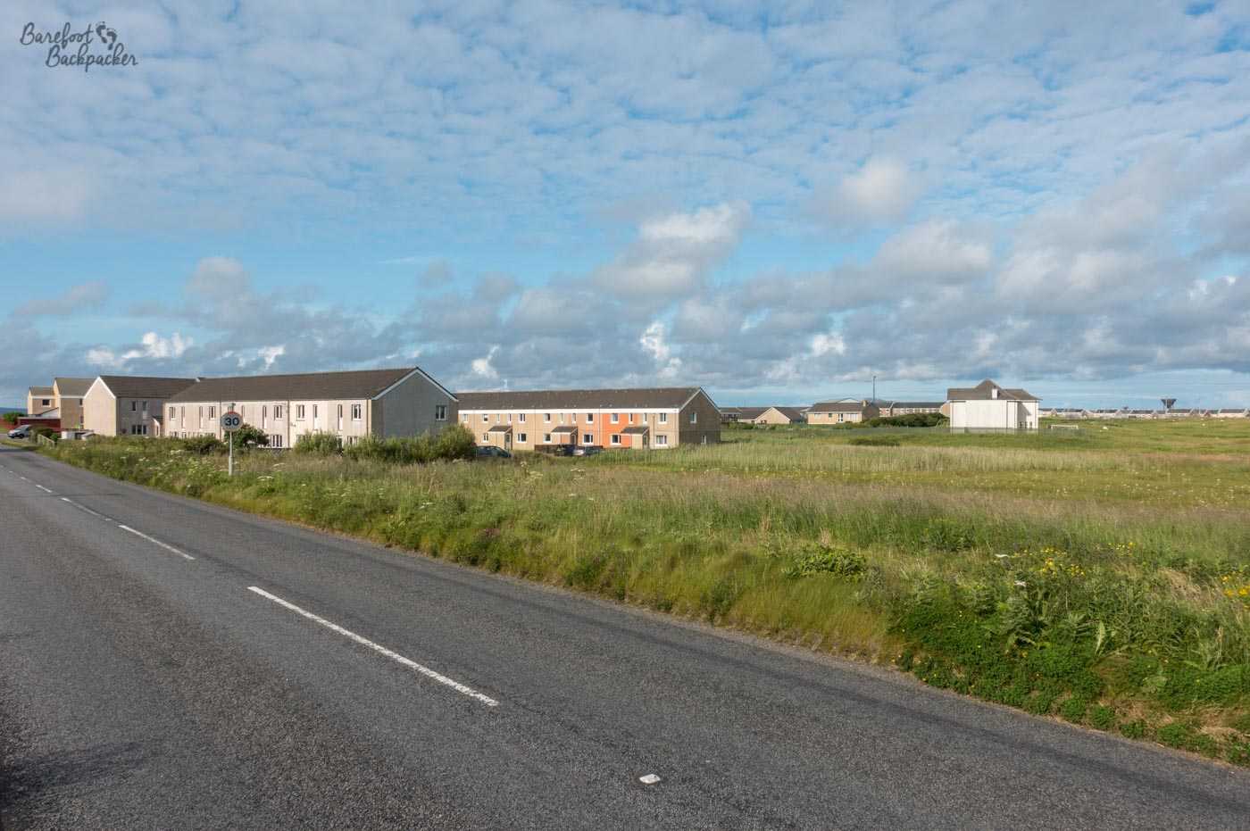
Terraced housing on Benbecula, looking a bit out of place over here, and built to standard English design
See, for unclear reasons, there’s a cultural dividing line between Benbecula and North Uist. South of this line, stretching down to Barra and Vatersay, there is a very strong Catholic tradition – indeed though I didn’t get to see it, there’s a large statue of Jesus Christ in the north of South Uist, looking out over the heathen North.
From North Uist up to Harris-and-Lewis, the dominant religion is Protestantism. But not of the kind seen down in England, the casual ‘what religion are we? Oh we don’t have one so just tick Anglican’ type. Oh no. This is the evangelical protestantism, the ‘Thou-Shalt-Not-Commit-Adultery Pulsifer’, DUP-style protestantism, who believe in the Word of the Lord, and that the Sabbath shall be kept holy. And by ‘holy’ they mean – no business (or indeed pleasure) shalt take place on the Sunday, which must be kept respectful.
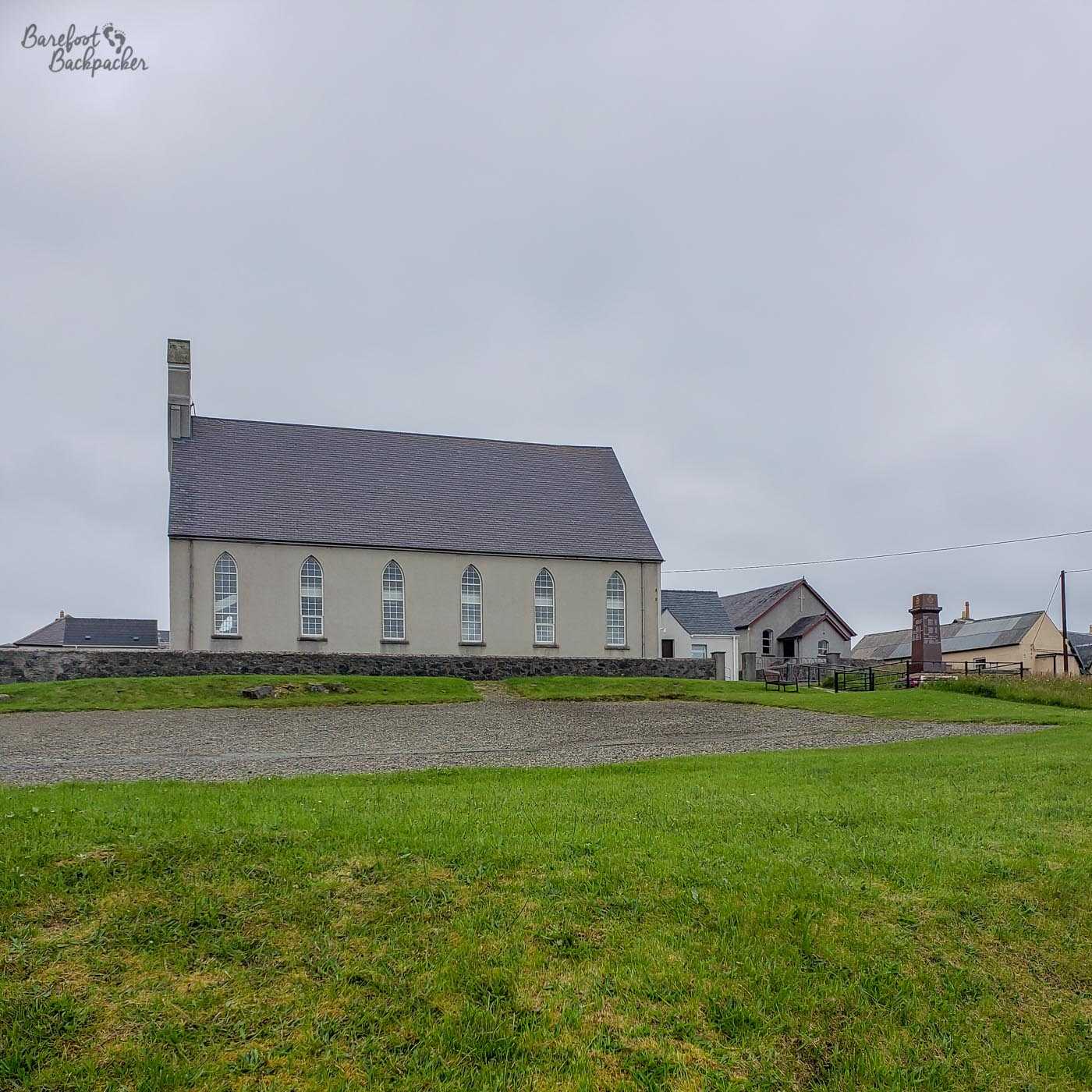
The “Free Church of Scotland” church building at Carloway, on Lewis
There are no buses. No shops are open. No hotels are open (because checking in a guest is counted as a work activity; if you’d arrived on the Saturday you’re fine, but don’t expect dinner). Only one petrol station is open, and that only because it only takes card payments (though I did hear a rumour of a second petrol station now doing the same thing). You’re not allowed to do sports or games; they’ve even been known to close children’s playgrounds and lock up the swings in a twisted mess. It took a great deal of outside pressure to even make the ferries operate, and even they get picketed – for a long time Harris-and-Lewis was effectively cut-off from the outside world on Sunday, so woe betide you if you fell ill or your waters broke.
Reader, neither of these things happened to me. Which is obviously just as well.
Language and Culture
The largest settlement on the Outer Hebrides is on Lewis. Stornoway and surrounding villages are home to around 10,000 people, or just over a third of the entire population of the island chain – the next biggest settlements don’t have much more than 2,000 people in them. Even though it’s small by British standards, it’s still a culture shock to arrive there after a week of exploration on the islands and find shops! and people! and traffic that goes both ways down a road!
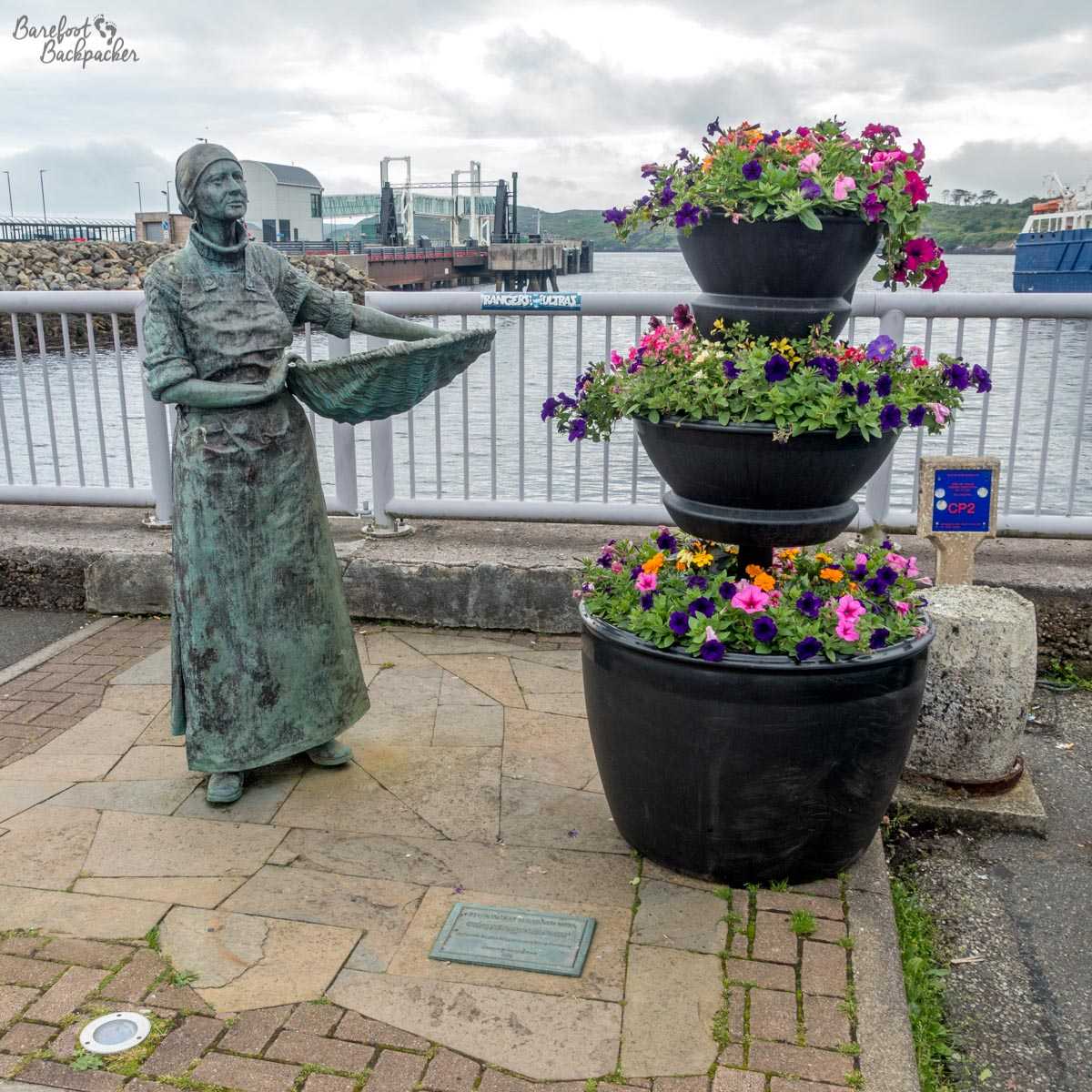
One of the ‘Herring Girls’ statues, at Stornoway Harbour
The town itself is famous for black pudding (a protected name under EU legislation) and herring fishing, the latter commemorated by statues around town of the ‘herring girls’ – women who used to process the herring once ashore. Interestingly, in low season, they often relocated for work to Lowestoft. It’s weird how sometimes my travels are quite circular. The island of Lewis is also noted for the Lewis Chessmen, distinctive 12th century chess pieces found here in the 1830s.
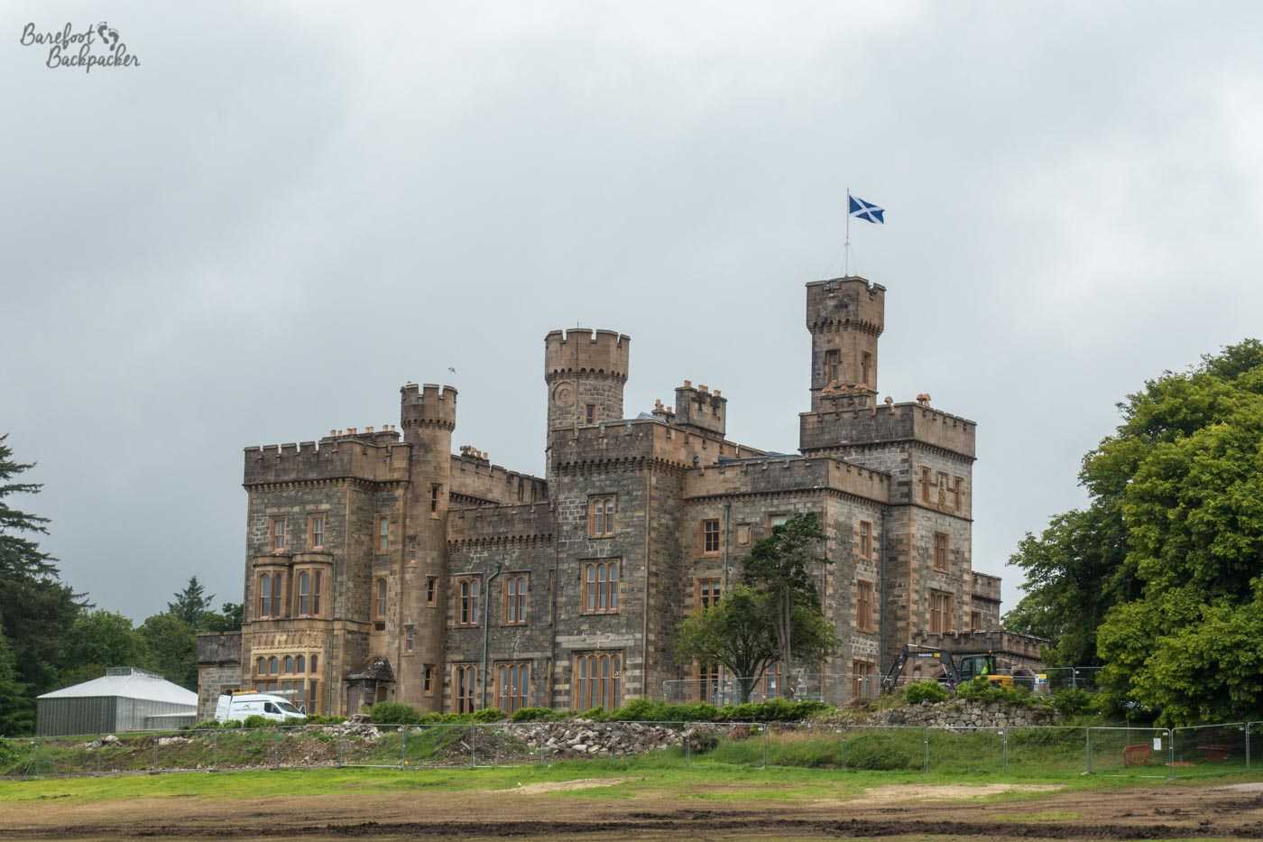
Lews Castle, Stornoway, home to a museum and apparently a hotel too
Lews (not a typo) Castle, in Stornoway (don’t get excited, it’s Victorian!), has a museum dedicated to Hebridean life, including discussion on the future. One of the big issues is around preserving the culture and the language in the face of modern pressures; population ‘flight’ onto the mainland has been a problem for a while, and some islands have seen their population drop by over 60% in the last hundred years. The council’s own estimates believe the population of the Outer Hebrides as a whole will drop by just over 6% in the next decade (to 2028), the largest population fall in any Scottish council region – the other reason for this being fewer births than deaths as the population naturally ages and those of childrearing age move away.
The whole Outer Hebrides area is also a stronghold for the Gaelic language; estimates of around 60% of the population speaking it to some degree. Certainly there’s a lot of Gaelic seen in everyday life – from the signposts on the roads to the name of the council area itself (“Comhairle nan Eilean Siar” – literally ‘Council of the Western Isles’).
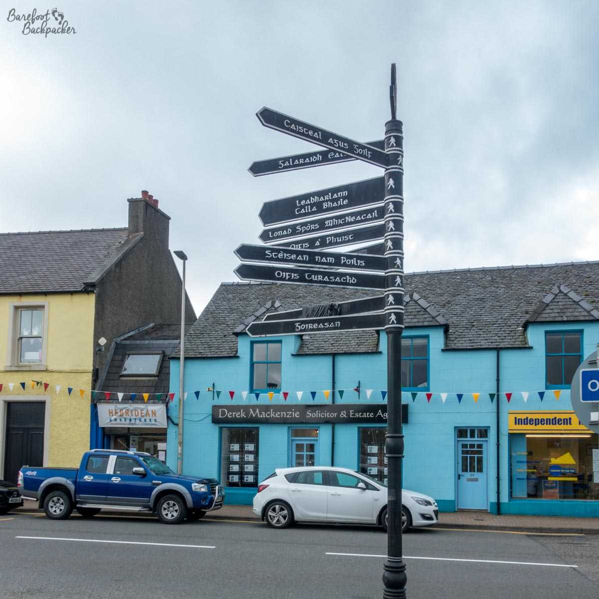
Gaelic-only signpost in Stornoway
It’s a (Goidelic) Celtic language closely related to Irish Gaelic and Manx (spoken on the Isle of Man), with origins in Ireland. It’s slightly more distantly related to the (Brittonic) Celtic languages spoken further south – Welsh, Cornish, and Breton. Unlike Welsh in Wales, however, Gaelic isn’t an official Language (because the UK as a whole doesn’t have one at all; we’re a very weird country), so while the use of Gaelic is permitted and encouraged (it’s classed as an ‘indigenous language’ under European Charter, and the Scottish government set up a board to promote it), it’s not mandated. This means, of course, that there’s no true incentive to teach or learn it other than for its own pleasure.
‘S e coisiche casruisgte a th’ annam. Apparently. Don’t trust Google Translate. 😀 The most well-known word in Gaelic is, of course, ‘uisge’, meaning ‘water’. Doesn’t look familiar? The ‘g’ is pronounced more like a ‘k’, and the ‘u’ is a rounded vowel, like ‘oo’. Now try it 🙂 That said, whisky is more of a Highlands and Inner Hebrides industry, although there is a distillery newly opened on Harris.
Unsurprisingly, the Gaelic culture and language extends to having a festival every year – HebCelt – hosting Scottish music (often from famous and mainstream acts as well as local bands), workshops on local culture, language lessons, and the like. I believe the 2019 festival actually took place while I was in the region, though I didn’t get to go to it.
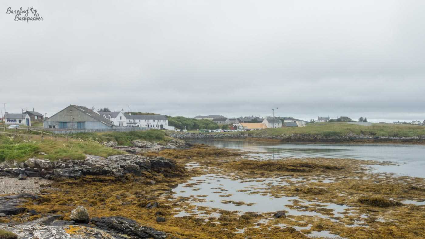
Lochmaddy, North Uist, home of Runrig
One of the bands who often featured at HebCelt were Runrig. They were the archetypal Scottish band, folk-rock with lyrics (often political) pertaining to Scotland – indeed one of the band members (the former lead singer Donny Munroe) is a native Gaelic Speaker who stood for parliament for Labour twice (one in the UK, once in the Scottish Parliament), but lost both times. I mention the band though because two of the other members – brothers Rory and Callum McDonald, the group’s main songwriters – came from Lochmaddy on North Uist. There’s a small museum and cafe in the town, detailing some local artwork and showing some of the geological history of the area, but on my visit there was a special exhibition on the band Runrig, to commemorate their farewell concert the previous year (‘The Last Dance’, Aug 18-19 2018, Stirling Castle), with snapshots of the concert and vox pops from audience members saying how they felt about the band and being there for the final show.
Another cultural and historic museum on the islands is at Kildonan on South Uist. This is quite an expansive museum going into the history and culture of the islands as a whole. There’s a few rooms each depicting a different aspect of life, including recreations of traditional kitchens, textiles, and a bit on the history of the crofting practices that dominate agriculture.
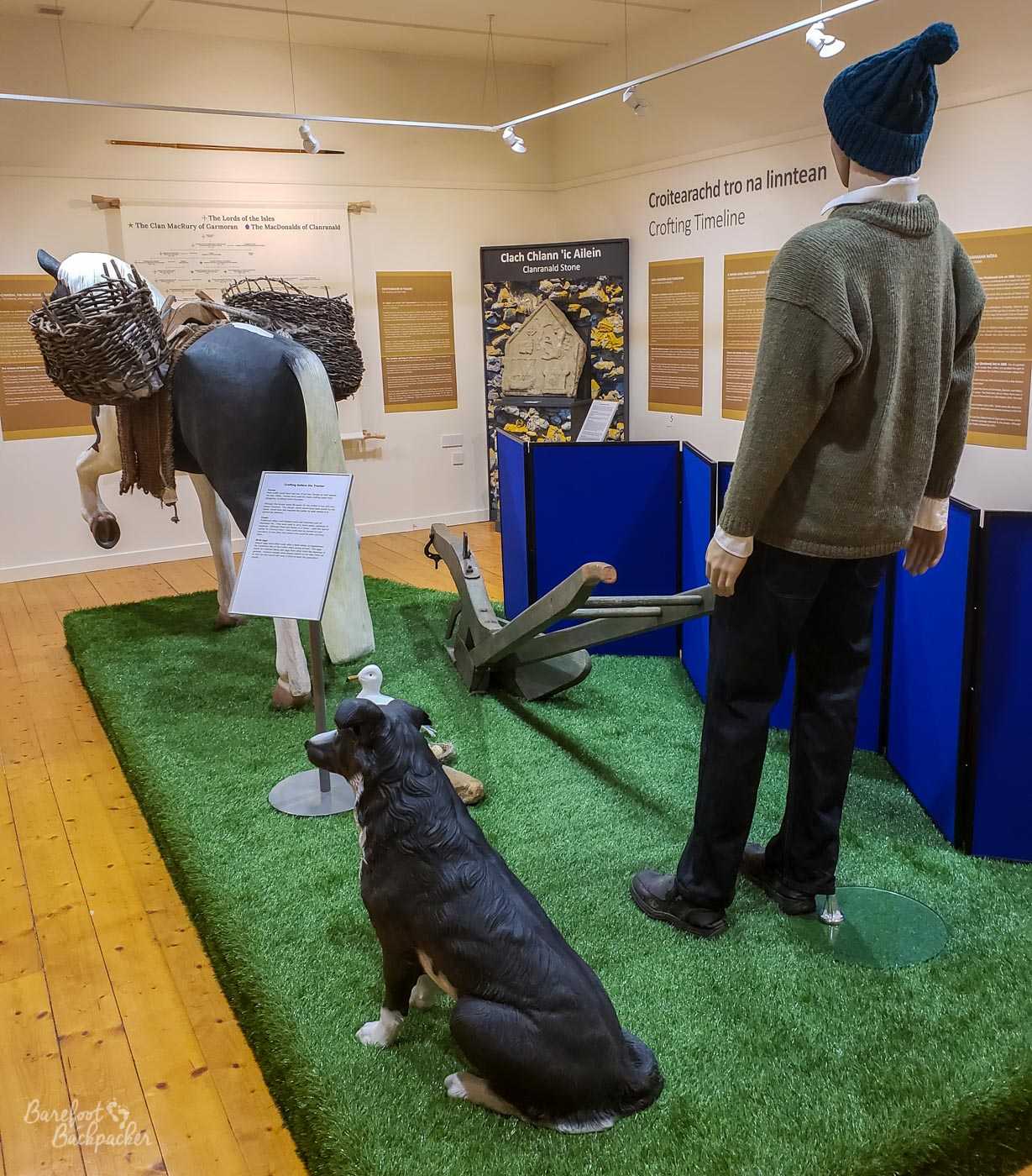
Exhibit inside the Kildonan Museum – this looks at farming and cattle-driving
Crofting is a combination of farming that utilises poor land; individuals or families tend to small parcels of land for small-scale vegetable growth on the best quality land available, whilst the poorest land tends to be held communally by the village and is where the animals are grazed. It’s barely even subsistence living but it’s often the best that can be done out here.
One of the leading industries in the Outer Hebrides though is of course the manufacture of Harris Tweed, and the museum goes into this in detail too.
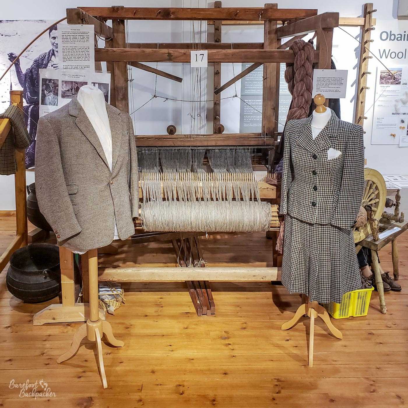
Examples of Harris Tweed
Harris Tweed is a legally-protected trade mark and covers a particular style of handwoven cloth made with virgin (ie never previously used or reworked) wool, the origin, dyeing, spinning, and weaving of which is all done in the Outer Hebrides – despite its name (and the arguments of manufacturers on Harris) the trade mark covers the whole island group; indeed Lewis seems to produce the most.
It’s seen as a prestigious brand and style for jackets and tops, and Harris Tweed is used across the world in places you might not expect, from the panels in running shoes to hotel interiors.
The Kildonan museum also highlights one aspect of history worth noting about the area. Above it stands the unofficial (though recognised, in 2017) South Uist flag, which … looks like it belongs elsewhere. It’s a green background, a white cross with the meeting point slightly off-centre to the left, and a smaller blue cross superimposed on it.
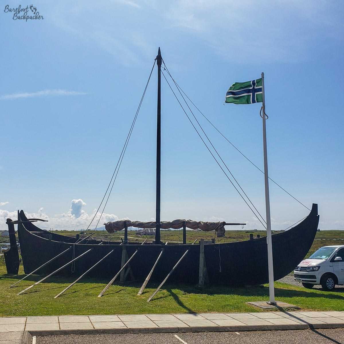
Viking ship outside the Kildonan Museum, South Uist. Note the flag.
It’s representative of the days of the Vikings. While most of Great Britain views 1066 as an important watershed year, up here the year often quoted is 1266. This was the year of the Treaty of Perth, which led to peace between Norway and Scotland after several centuries. Despite Norway ceding control of the Hebrides to Scotland as a result, you can definitely sense in the air a slight ‘Norse’ feel to the place. I mean, the museum even has a Viking ship outside it.
Scottish Independence
Pretty much everywhere I went in the Outer Hebrides, I kept walking past lampposts covered with stickers with the word ‘Yes’ emblazoned on a Scottish flag. It may come as a bit of a surprise to learn therefore that in the 2014 Independence Referendum, the council area as a whole voted ‘No’ to Independence (53.4%), albeit one of the lowest ‘No’ votes (10th out of 32 council areas).
Evidently support has increased since the vote, as people realise everything that has happened since, although accurate opinion polls for support for independence are quite … hard to source as, more than most topics, it seems to be very much dependent on who’s doing the asking.
As an aside, there’s related support for the EU, although again it’s quite ‘middling’. Although, along with the entirety of the rest of Scotland, the council area as a whole voted to Remain in the EU in the 2016 referendum, the proportion of Remain here was only 55.2%, the fourth lowest of all council areas in Scotland, and indeed a couple of communities on the Lewis coast voted by majority to Leave.
There is one other aspect to consider up here though with regard to Scottish Independence, and that’s a mythical “third way”, although it’s something more centred on the other island groups of Orkney and Shetland – the concept of devolving power specifically to these regions and making them more self-governing, and ‘independent-lite’, similar to how the Isle of Man or the Faeroe Islands operate in the relation to the UK and Denmark respectively. Certainly these island groups do have different needs and cultures from the mainland, though whether it would work in practice, who knows? The Faeroes have twice the population of the Outer Hebrides, which may help them.
—
Like this post? Pin it?
Visited: 18-26 July 2019