Hiking on Orkney was one of my major reasons for travelling there. My original aim was to walk around several of the islands, including some wild camping. In the event I did a lot less of it than I’d intended, and only really did hiking on two of the islands – Mainland and Westray – and though they were very similar in scenery, they were both absolutely worth it.
Hiking on Westray
Westray is, relatively speaking, quite a large and irregularly-shaped island, vaguely lobster-shaped, and while only about 13km end-to-end (and little more than 4km wide), its coastline stretches for some 80km in total. The vast majority of this, especially in the central portion of the island, is made up of sheer cliffs and sharp inlets. Kind of like Norway as seen from a long way away. Unsurprisingly therefore, it makes for some wonderful coastal hiking.
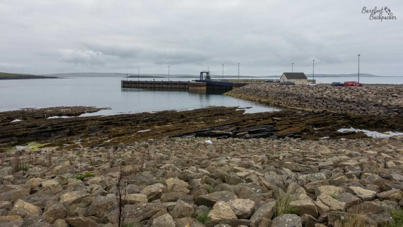
Westray’s ferry terminal. There’s very little here; a waiting room, a car park, a house nearby, that’s it.
The ferry from Mainland docks at the very south of the island, some 9-10km from the main village of Pierowall, and while there’s a community bus service that links the two (it actually links with the ferry to Papa Westray which docks a couple of km north of Pierowall), my plan was to walk up the island, mostly along those coasts where possible. I figured I had the best part of two days to see a lot of the scenery, so I wasn’t going to be rushed.
While the bulk of the southern half of the island was spent on the main road (with the occasional car and tractor passing), I did wander off to the so-called Castle O’Burrian on the east coast not far from the ferry terminal. It’s not a castle, it’s a rock stack, but its steep sides resemble those of a castle, I guess. In case you don’t know, a rock stack is a … theoretical island of hard rock. They’re often formed out of cliff erosion, where the sea erodes the softer rock around it, leaving a column of harder rock isolated from the mainland. They’re generally quite small, and usually have sheer cliffs; not habitable by humans (though many have been used in the past as monkish hermitages), but incredibly popular with seabirds. The coastline of Scotland as a whole is littered with them – as I mentioned in the Outer Hebrides post, there’s many around St Kilda which is why those islands in particular are home to so many North Atlantic seabirds. In Orkney the common birds are skuas and puffins. Lots of puffins. One of the few birds I can probably recognise, give they’re quite distinctive.

Part of the Castle O’Burrian ‘complex’. Full of birdlife.
The path up there is a little fraught in places, and you, well, I, had to concentrate lest I slip a bit and go careering down the cliff. That said, the area around the Castle O’Burrian itself is quite open with a couple of flat spots and would be great places to wild camp, if you could stand the sound of the birds. I didn’t – it was still quite afternoony when I was there tho so I wanted to press on elsewhere. Although only a relatively short distance from a farm path, it feels very empty and isolated.
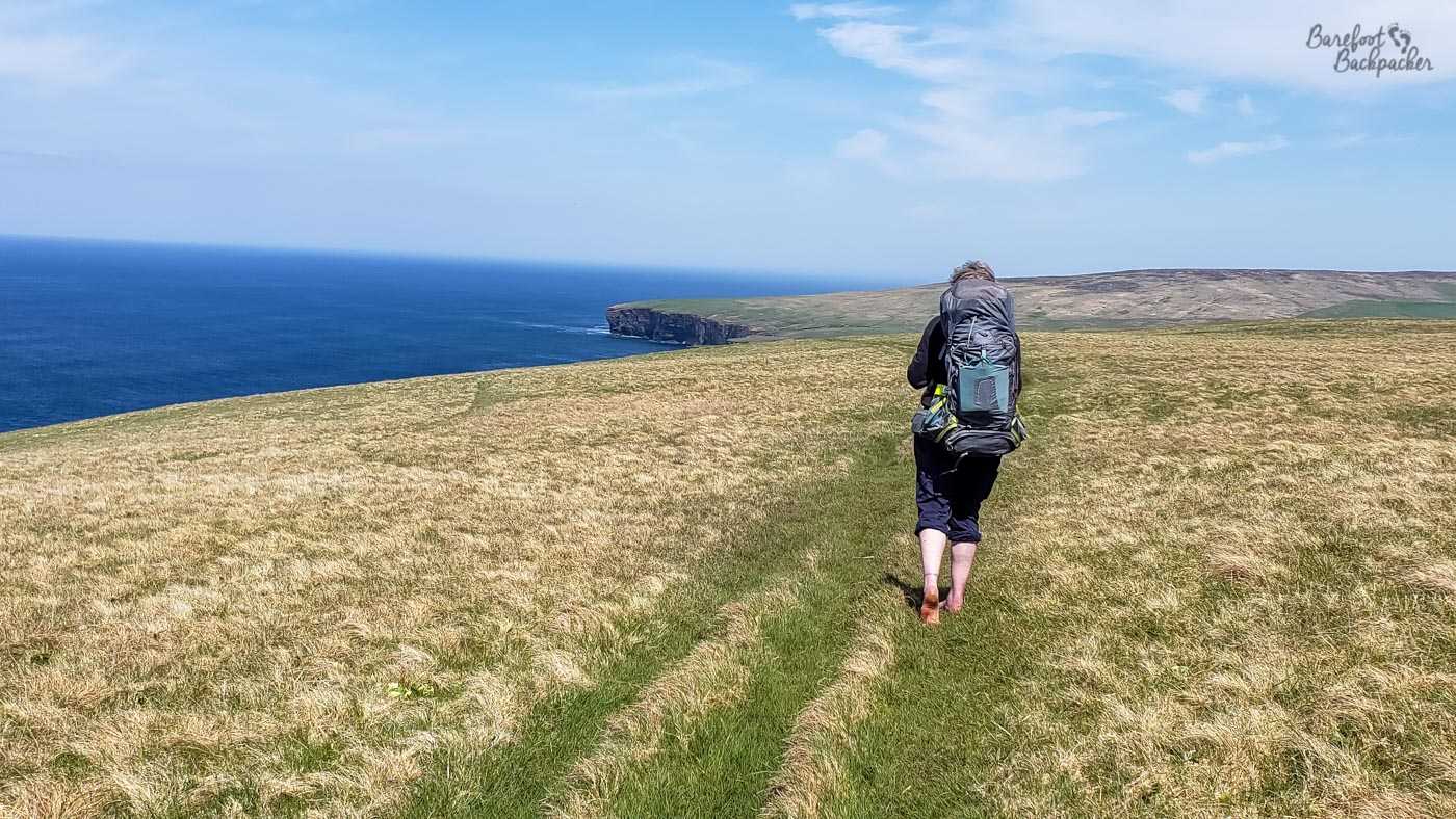
My main off-road hike though was on the other side of the island, along a footpath from Kirbest, halfway up, to Noup Head lighthouse at the very NW end of the island. It’s maybe 8km in length, but it’s not a simple 8km. There’s no major hills to climb, but the terrain is quite undulating.
Westray’s west coast.
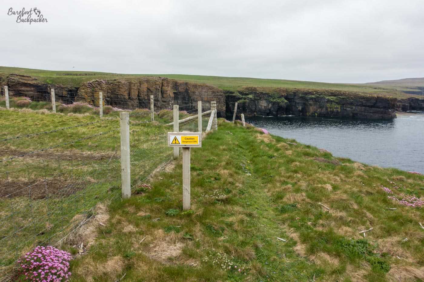
In addition, while the path is clearly visible, it’s mainly because other people have defined one rather than it being a specifically built and designated path. It mostly goes over the grass near (but not at) the edge of the cliff, tho there’s a couple of tight sections, especially near the north end where there’s a spot where one slip could mean a very rapid descent and the path is little more than your own walking style in width. There is a fence though. Occasionally.
In parts the path isn’t wide enough for a dyspraxic hiker! I guess that would have made a good tale for the podcast though!
But much of the path is open country, grass with occasional flat boulders, easy walking where you can be as far away from the cliff as you feel comfortable with. And while steering clear from the edge is generally preferred, obviously the views from closer are quite stunning – rock stacks, birds, deep narrow valleys and inlets, and of course a view right out to sea where at times you can hopefully see whales and other sealife. The cliff edge sometimes feels like it wends quite a way inland as a very narrow, but very steep, fjord comes in from the coastline, and of course the cliff sides here are generally lined with birds.
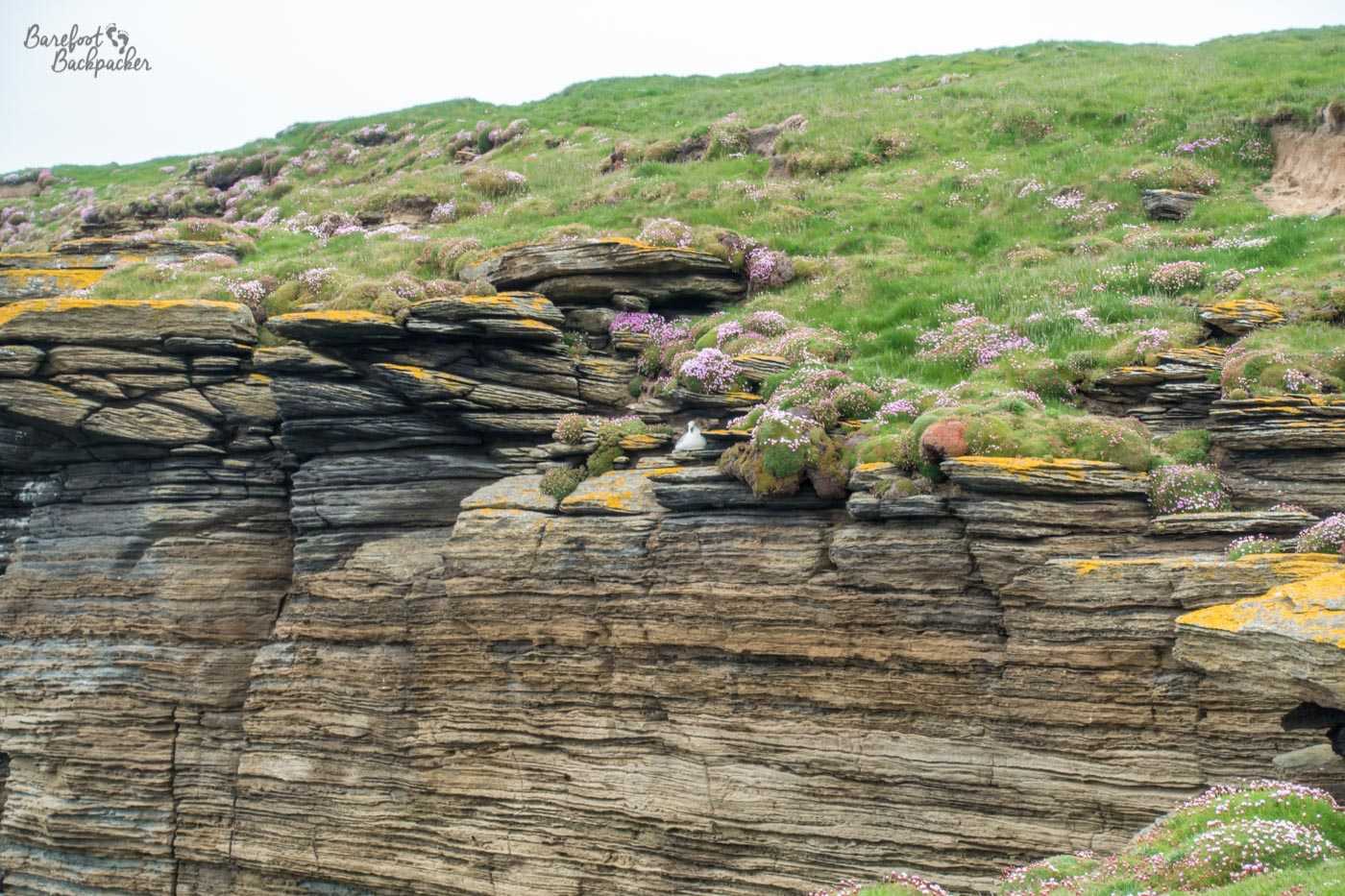
Close-up of a bird on the cliffs of Westray.
There’s also enough spots on the path where you can set up a tent and just camp, and go to bed watching the sun set over the ocean. I didn’t make it that far on my first of the two days I was on Westray; instead I camped out in the graveyard around the ruins of an old church – the Cross Kirk – halfway up the island on a south-facing coast neat Kirbest. I’d planned to reach the western coastal path but the path to the Kirk was horrendously overgrown and by the time I reached the ruins I was knackered. I’d never camped in a graveyard before, but it felt fine. I just had a bit of trouble finding a truly flat piece of ground because, well, bodies. The church dates from the 12th Century and is a scheduled ancient monument. Mmmh. Given the population of Westray is just less than 600, most of whom live several miles from the Kirk, and given that the path both sides was theoretical rather than absolute, I figured no-one was going to shout at me.
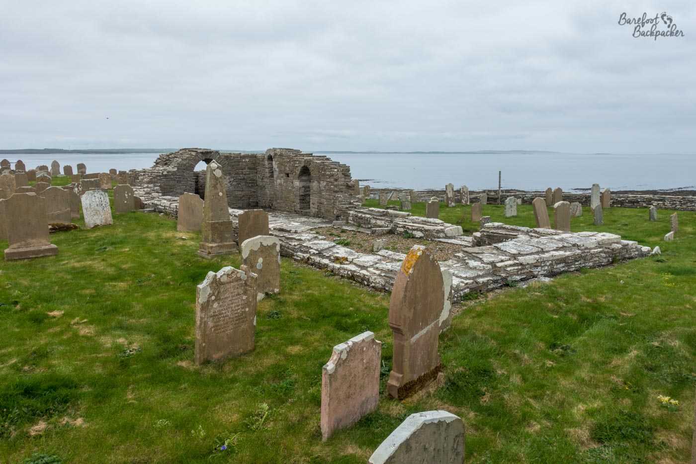
The remains of Cross Kirk. I camped just off shot to the back right.
As for watching the sun set over the ocean, well that’s what I set out to do. However, the Kirk is 59° 16′ N, and this was late May. Sunset itself was around 10pm and it was light enough to read outside for the best part of a further hour. Not gonna lie, I got bored and went to bed first.
The path ends at the Noup Head Lighthouse, an isolated building 24m tall which was automated in 1964. The cliffs behind it are almost vertical, but the wind acts as a barrier to prevent you getting too close. Bear in mind that the next land due west of here is Labrador in Canada (passing just south of the tip of Greenland), while due north you hit nothing until the North Pole. It’s bleak.

Noup Head Lighthouse, as seen from the footpath to Kirbest.
From the lighthouse, a road wends its way around 7km across the north of the island to the village of Pierowall (population around 400-500). You can still see the sea for most of the journey, but access to the cliffs is restricted by the fact that the land around here is mostly farmed, with a particular preference for cows. I don’t care about the “right to roam” legislation that’s legal here, I’d rather stay on the road than take my chances with huge bovines.
I have to say, by the time I reached that road, I was pretty well dead, because I was carrying rather more in my backpack than perhaps I’d intended (and is one reason I tarried on Papa Westray for longer than I’d planned – I needed to recover). This means I did miss out on a couple of historical and natural sites on the north coast (the beach at Grobust – which apparently feels like those on the Outer Hebrides, with machair -, the ruins of the village of Quoygrew, and a few brochs), tho I did walk past what remains of Noltand Castle (closed, because, well), a small but heavily fortified manor house from the late 1500s, built by a chap called Gilbert Balfour who by all accounts was exactly the sort of man who needed a fortified manor house.
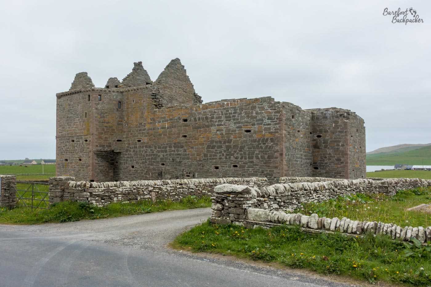
What remains of Noltland Castle.
Hiking on Orkney Mainland
A few days later, indeed on my last day in Orkney, I took the opportunity to do a similar hike along the west coast of Mainland, from Stromness up to Yesnaby. You can take the path all the way to Skara Brae, but that would have added an extra three hours to my hike and I wanted to get back to Stromness in good time to eat before I caught my ferry back to Scotland.
My backpack was lighter by now – I’d eaten more food and left a couple of things at the Papa Westray hostel, including my camping gas, because I flew rather than sailed back – but I was still carrying two bottles of Nigerian Guinness for my friend Laura to try, who I was meeting in Glasgow later that week. As it turns out, not only was she unimpressed with it, but the very first night she spent in the flat last week, we ordered West African takeaway food including three bottles of the stuff. Sometimes I wonder why I bother lol.
Anyway.
Stromness itself is a small town with a nice-looking vibe; many of the streets are cobbled and have the feel of side-alleys. It is very much the ‘second town’ of the Orkney Islands, and is definitely a lot smaller than Kirkwall, but nevertheless it’s bigger than you imagine, and much prettier.
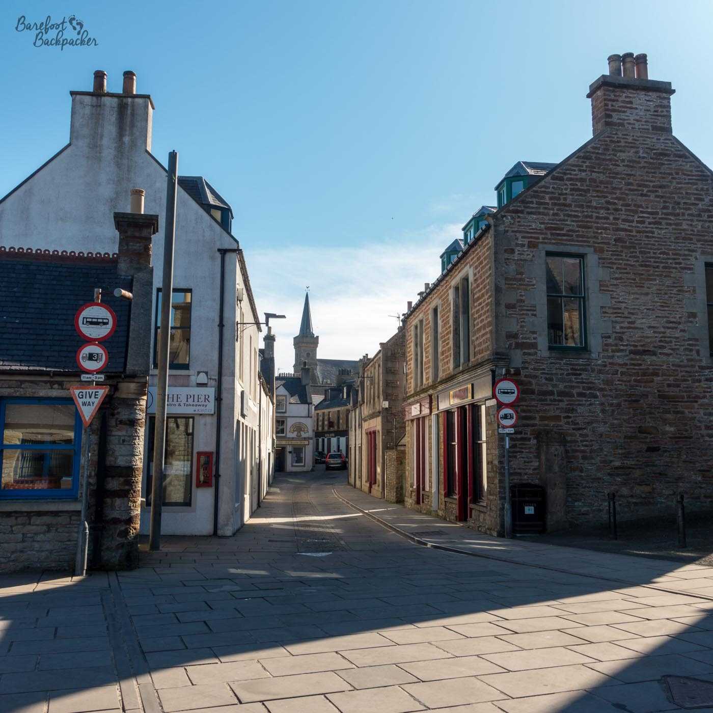
Stromness town centre. Comfortable place to walk, although the lack of actual pavements and the narrowness and bendiness of the streets make it slightly scary at times.
I stayed in a campsite on the southern edge of town and right by the sea lane where the ferries to Thurso and nearby islands like Hoy and Graemsay pass through. I stayed at a campsite on the south side of town; one of the most scenic campsites I’ve stayed at as it provided great views over the sound towards the other islands. The downside was the wind, of course.
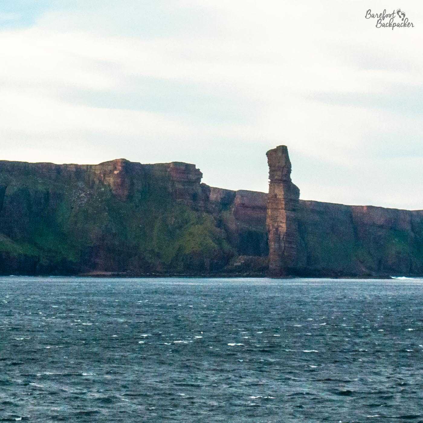
The Old Man Of Hoy, as taken from a passing ferry.
The coastal footpath begins pretty much at the campsite, at Point of Ness, and the first couple of km are fairly easy going. This part of the path has good views over the sound that separates Mainland from the island of Hoy, so you see the cliffs of the island in the distance and the ferries back to Scotland in between. Hoy, of course, is famous for ‘The Old Man Of Hoy’, one of the largest rock stacks in the UK at 137m and a good hike in itself across the whole island, though it’s in danger of falling down any time soon. You can’t see it from Mainland but you get a good view of it from the ferry to Scrabster.
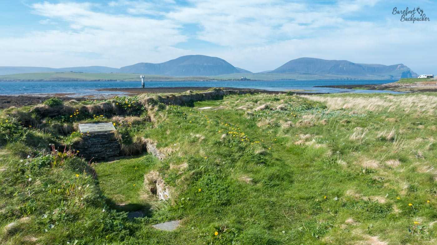
Some of the ruined remains of the Ness Battery artillery.
One worthwhile site in the area to visit when it’s open is the Ness Battery. Although the artillery and beacons are now merely concrete ruins, the huts have been converted into a small museum about the military history of the area and life amongst the guards. Its location, along with the remains of some WW2-era artillery next to the path, is fairly self-explanatory as it provided solid defence for the western approaches to Scapa Flow, though in the event they weren’t much used in anger.
On the landward side, after the golf course, is firstly what remains of and then after a short walk, Warebeth cemetery. It feels like an odd place to have a graveyard, as literally the width of the grassy coastal path is all that separates it from the shingle beach and the sea, but it’s quite expansive, and there is a ruined chapel here too.
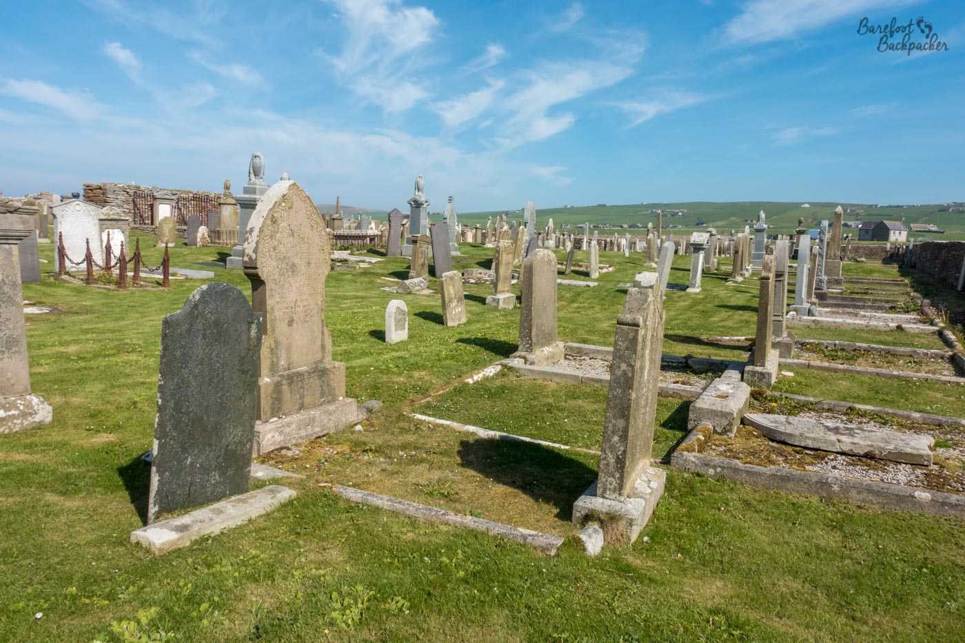
Warebeth cemetery.
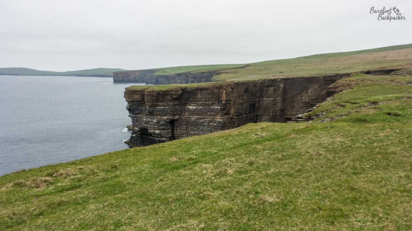
Beyond Warebeth cemetery, the path continues a little across scattered boulders until it turns sharply inland and takes trails and minor lanes between a series of farms. Eventually, past a new build, it climbs up a steep grassy hill, past a small building that converts wave power into energy (magic), and then follows several km of wide open space at the cliff edge, with views right along the coast and across all the stacks and fjords that pockmark it.
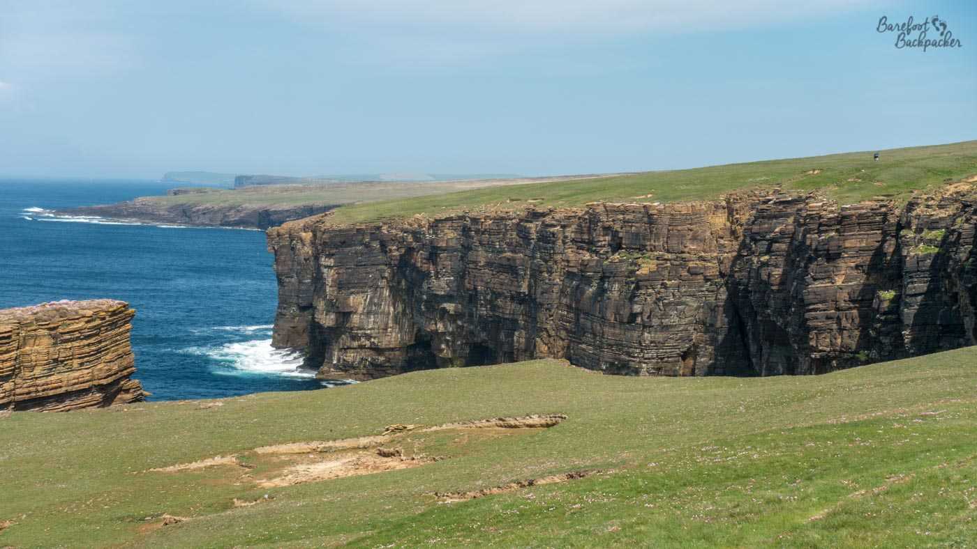
Typical view along the path from Stromness to Yesnaby.
Although this trail feels less remote than the one on Westray – you seem to be much more aware of the nearby farms, and the walk itself is much ‘safer’ – it’s no less spectacular for that. The fjords are just as steep and craggy, the rock stacks just as sheer and tall, the birdlife just as impressive, and you even get to drop a little into a couple of the valleys that drop streams into the ocean just beyond. There’s also a couple of ancient brochs just off the trail – there’s more north of Yesnaby on the part of the trail I didn’t take, but this is Orkney so it’s not like I missed out on something unique.
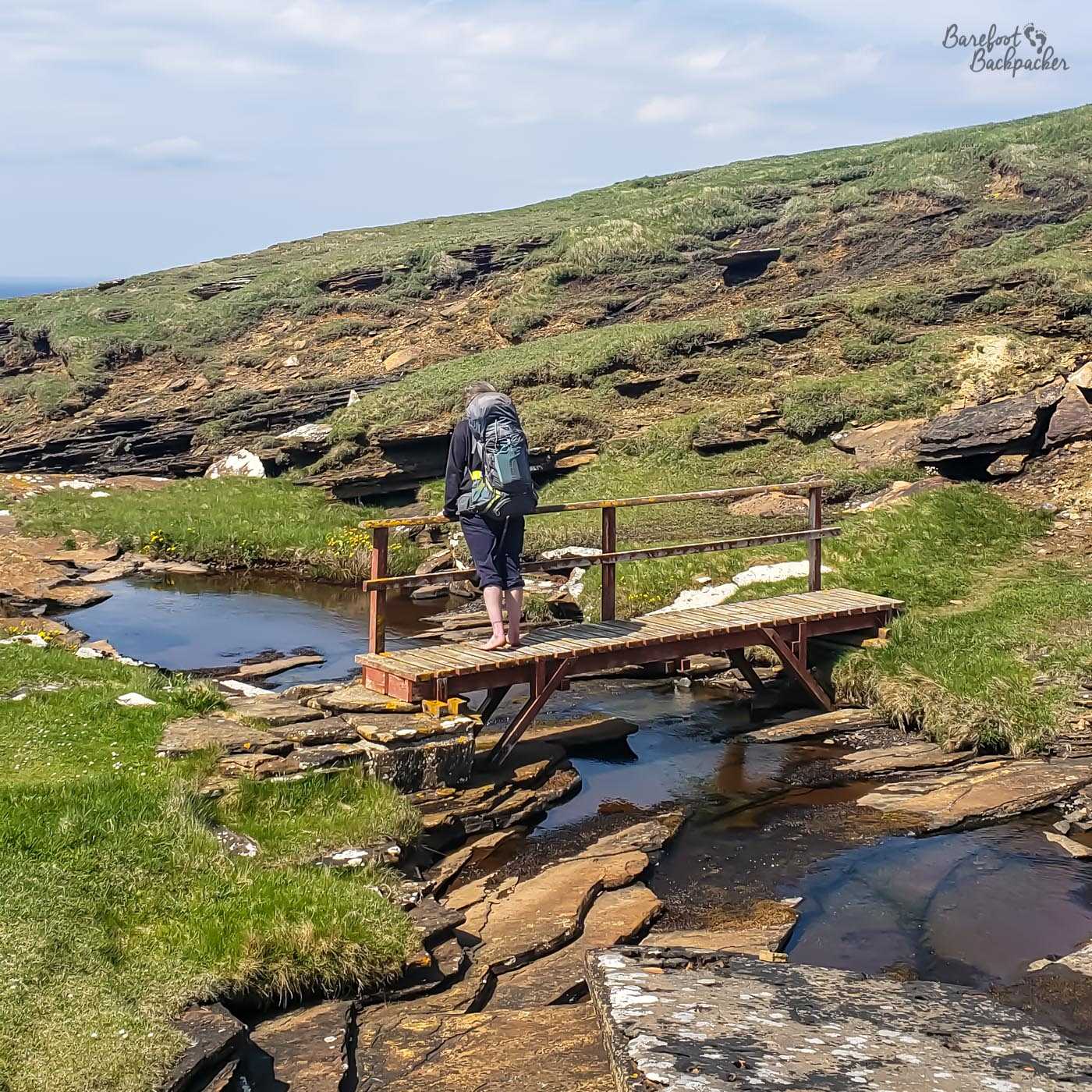
Stopping to rest on a small bridge, looking out to sea (not pictured, but straight in front of me).
Yesnaby is a good place to stop and rest. There’s not a lot here in terms of provisions/services – a couple of ruined WW2 artillery and related buildings, and a car-park, but the surrounding area is breathtaking. The sandstone and cliffs here have ensured a large collection of rock stacks and fjords, and certainly there were many people here with binoculars looking at the wildlife. There’s also allegedly stromatolites in the cliffs but I didn’t venture close enough to check that out.
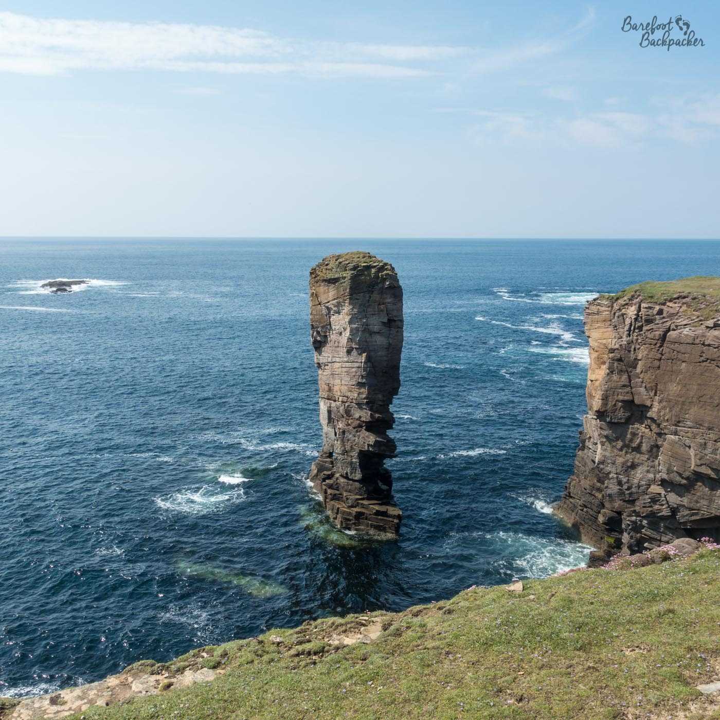
A rock stack just off the coast near Yesnaby. From a certain angle it looks like a man’s elongated face, don’t you think?
As I say, the path from here goes for a few more km up to Skara Brae, but I turned back towards Stromness down some quiet and empty country lanes, and of course past the road-sign towards one of the most infamously-named villages in the UK. My original plan for my trip was to head up that way, to the north of Mainland, and visit the Broch of Birsay, a small tidal island with another ancient neolithic ruin, but my elongated stay on Papa Westray meant I didn’t get a chance to do that.
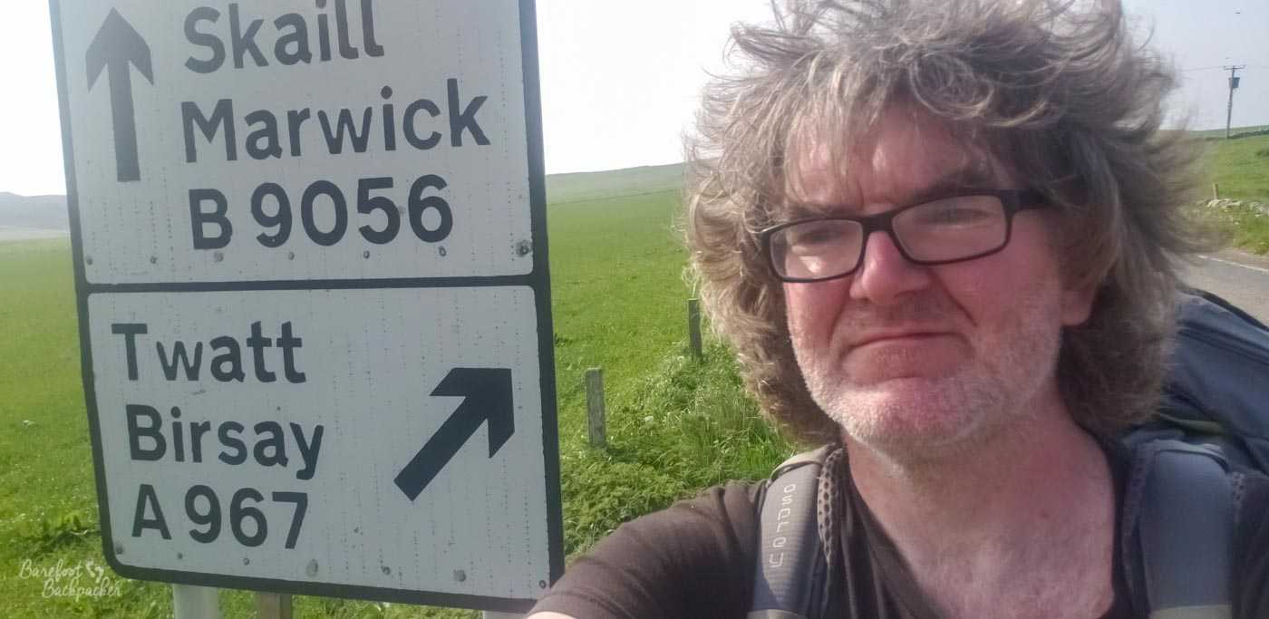
Obligatory tourist selfie with the roadsign to Twatt. The name comes from the Old Norse (obviously) for ‘small bit of land’. But teenagers don’t care.