Ardnamurchan is a peninsula in the far west of Scotland, lying about halfway up, kind of between Fort William and Oban. It’s a Gaelic word, meaning “The Hill of the Great Sea”, and given it’s surrounded on three sides by what is effectively the Atlantic Ocean, the name feels apt. In general the word is used for the whole area west of Loch Linnhe, south of Loch Eil, and north and west of the sea, which includes the districts of Sunart, Ardgour, and sometimes Morvern, Kingairloch, and Moidart – about 60km in length. In practice, it means strictly only the peninsula west of Sunart, but even that is still just under 30km east-to-west (around 130 km²) of some of the most stunning countryside you could want to walk through.
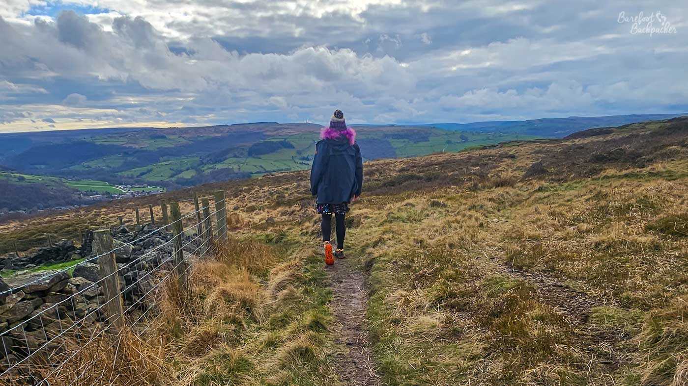
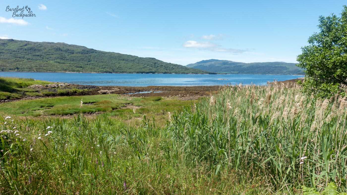
Part of the wild scenery on the north coast of the Ardnamurchan Peninsula.
It lies at the very south of The Highland Region, a huge council area over 25,000 km² (or about the size of North Macedonia or Rwanda). It was previously part of the Lochaber District, famous for the traditional Folk Song ‘Lochaber No More’, a ballad about leaving home to find adventure on the high seas. Historically, however, it was the very northern part of Argyll, a region that reaches all the way to the Mull of Kintyre, another place immortalised in song.
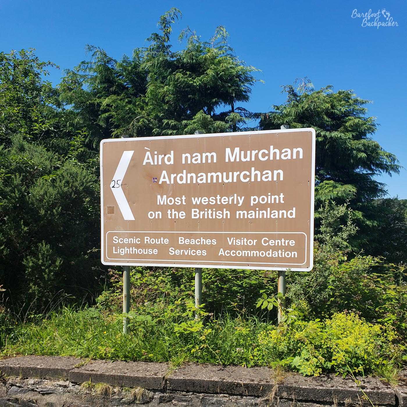
The westernmost tip of the Ardnamurchan peninsula is, much to people’s surprise, the most westerly point of mainland Great Britain. Not Land’s End, which is only the most westerly point of mainland England (not even the most southerly – that would be nearby Lizard Point), and 37km further east than here. Although the lighthouse is at Ardnamurchan Point, the actual most westerly headland is a shade to the south, at Corrachadh Mòr (Gaelic for ‘the tapering great field’), which ends about 30 metres further west than the lighthouse.
Signpost in Salen, near Acharacle, directing people to the lighthouse and the end of the world.
According to Wikipedia, at the time of typing this blog post, around 2,000 people live in Ardnamurchan proper (making the region have roughly the same population density as Mali – 176/194 in the world), and a remarkable 20% of them speak Gaelic. While lower than on the Outer Hebrides, this is still one of the largest Gaelic speaking areas on the mainland.
It’s a wild and remote place, as you will see. It’s also an important spot for geologists, as the rocks here form and indicate a peculiar and specific kind of volcanic activity took place millions of years ago; magma chambers under a volcano have are believed to have been filled, left to solidify, and refilled again, several times over, causing a kind of ‘ring structure’ of rock to form. It’s called a ‘lopolith’, apparently. Evidence of volcanoes are present across the whole region – the island of Rum, along with parts of Mull and Skye are also extinct volcanoes.
It was the end point of our Hike Across Great Britain, from east to west, in the summer of 2019, and we ended up hiking in Ardnamurchan for the best part of four days in total. This is how we got on:
Day One: Fort William to Glenfinnan
It wasn’t quite a rest-day, but we set off from Fort William mid-afternoon after a morning’s rest and some picking up of provisions for the last section of our hike. There’s a small passenger ferry that runs only a couple of times a day from Fort William across Loch Linnhe to the jetty at Camusnagaul. I say ferry, it’s akin to a small tourist boat that’s one step up from, and two decades older than, the sort of thing you might have won as a prize on a dodgy 1980s TV game show.
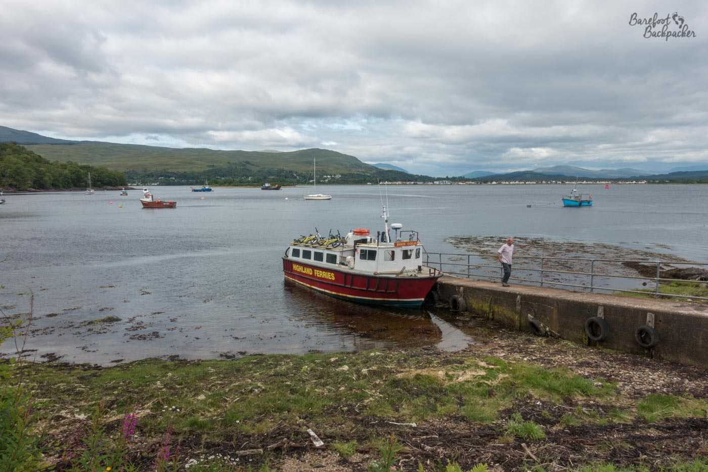
There were only about six people on it, and they all quickly disappeared into waiting cars.
The moment you set foot on this side of the loch, you’re in Ardgour and everything is much quieter. There is only one road – south takes you along Loch Linnhe to the Corran ferry, where cars can cross, and eventually to Strontian and Ardnamurchan Point, while west takes you along the southern edge of Loch Eil, to meet with the main road to Mallaig. Our plan was always to hike as little as possible on public roads, and considering Ardgour is kind of square, we headed west to pick up a service trail later on. We also knew that while this road was quite quiet, it being the only road into Ardnamurchan meant the southerly route would be much busier. And probably didn’t have a pavement to escape onto.
The road is quite a pleasant route, to say it’s a designated ‘A’-road (A861). It’s single-track, with passing places, fairly straight, and largely passes under the shade of trees. There’s no villages along the way, just the occasional set of houses, mostly set back from the road. Most of them are on the left – the road sticks pretty close to the edge of the loch. Occasionally we had to ease to the edge to let a passing car through, with a wave from both parties, but mostly it was a nice, flat, comfortable hike.
Because this is Scotland and, within reason, we can, we camped right by the edge of the loch on a piece of flattish ground, somewhere between cottages on the map named Duisky and Garvan, that seems to be used as an occasional sheep field. We saw the sheep on the other side of a small river, but they never bothered us. It was a gloriously sunny evening, and we even saw a steam train pass on the railway line on the north side of the loch.
Taken at our makeshift campsite along Loch Eil.
The next morning was a bit greyer and mistier, but not unpleasant. Once we reached the end of the road we had a short hike (about 4km) along the main road to Mallaig, a much busier road and again, one with no pavements. Fortunately the verge was quite wide, enough for us to comfortably wander down, where undergrowth was more dangerous than speeding vehicles. Becky had contemplated us hitch-hiking but we decided it wasn’t necessary. Just after a bridge under the railway line, we took a forestry trail off to the left that ran kind of parallel but a couple of hundred metres deeper into the trees, until we reached the shores of Loch Shiel.
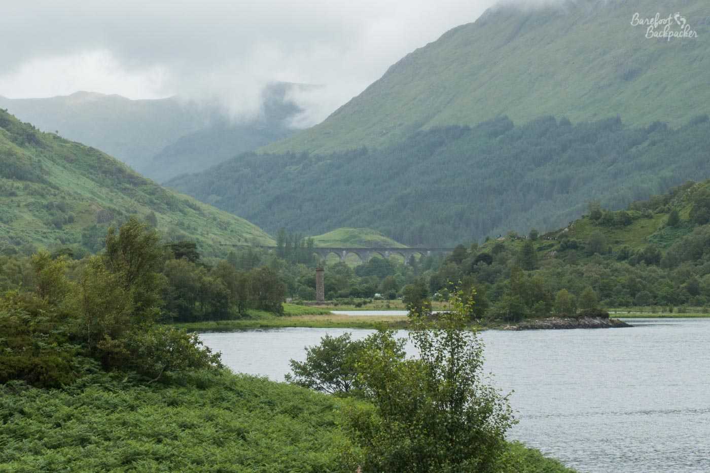
Now, the steam train. It had felt odd to see it on a mainline railway, but once we reached Loch Shiel we realised why. In the distance we saw a viaduct, and next to the viaduct it was clear there were a whole gaggle of people waiting … waiting for what? From a raised stone at the loch shore we got a clear view. The Glenfinnan Viaduct, of course; opened in 1901 and famous for being the largest (concrete) railway viaduct in Scotland at 380m long and 30m high. It also appears on some Scottish £10 notes, the TV series Monarch of the Glen, the film Ring of Bright Water, and … something about a boy wizard, idk, I’m not good with modern pop culture. It seems we timed our hike quite well – the steam train passed by after about 20 minutes of waiting.
We were, to be fair, quite a way away from the viaduct. Yes I have video of the steam train going over it.
Day Two: Along Loch Shiel
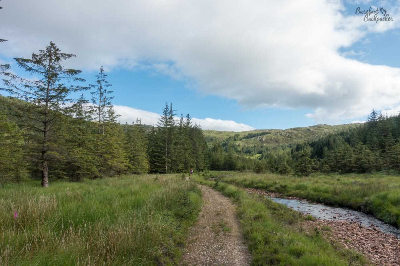
Most of our hike this day took us along Loch Shiel, on a forestry commission type road – wide enough for cars but restricted use, and rough and uneven with stones. The only vehicle we saw was from the post office, delivering mail to some of the remote cottages and farms we passed. It wasn’t the only traffic we encountered though – at one point we had to wait for a gaggle of cows to move from one field by the loch, along the trail for a bit, and into another field in the hills. We’re not overly fond of cows but on the road, these didn’t feel all that dangerous.
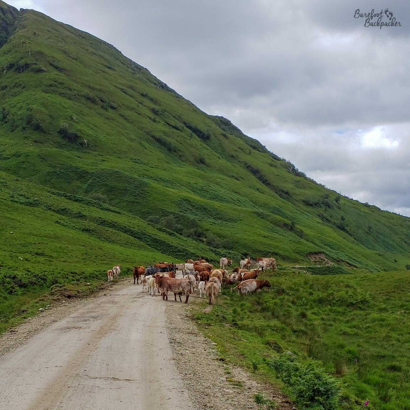
Cows on the road, being placid, but you never know …
Loch Shiel is nearly 30km long, and is one of the longest lochs in Scotland. Its southern end is at the village of Acharacle, and it would be lovely if you could walk down the entire length of it as that would have shaved about 15km of steep hill and busy road off our journey, but you can’t. That said, we had 20km of undulating trail with the loch our constant companion to the right, and hills to our left.
And there is nothing here, apart from the trail and the occasional farm. The views across the loch are of the mountains of Moidart, thickly green with tree, shrub, and grass. For those of you with a more natural bent, this is a good place to go to look out for Black Throated Divers (birds, in case you were wondering), Golden Eagles, and Red Deer. With regard to trees, plantations of Conifers were created in the 1930s; these are now being removed in favour of the more traditional Scots Pine, Oak, and Birch.
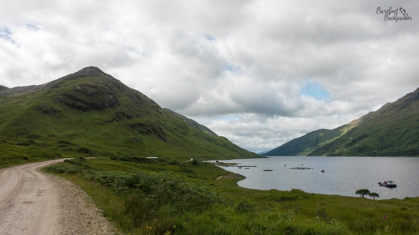
Loch Shiel, from the road we walked along.
Near the mouth of the River Polloch, where the trail turns inland rather than crossing the river, is a small jetty. You can wander onto it and pretty much sit in the loch – the jetty is flat, and made mostly of wooden boards, and it juts out a good few metres into the water.
As the trail turns, a small path leads to the top of a nearby mound. From here you can see quite a wide panorama of the loch, the river, and the surrounding hills and forests. There’s even a large picnic bench here and a set-up for a barbecue, so it would be a great place to stop a while for lunch.
Overview of Loch Shiel. Great spot, if you like trees and water.
The main trail heads into the small settlement of Polloch – a rough scattering of maybe a dozen buildings at the end of an official road. This road heads into the village of Strontian, possibly the largest settlement east of Loch Linnhe at a staggering 350 people. It’s certainly the location of the regional secondary school and has what might be regarded as a shopping centre. Strontian is also notable as being the location of the discovery of the only chemical element named after a place in the UK – Strontium (atomic number 38) was found here in ores, and isolated around 1800.
However, our hike didn’t take us into the town. Rather, from Polloch we took an old path called the ‘Coffin and Miners Road’. This is a trail running over the hills that was originally used to take dead bodies from Strontium to a sacred island in Loch Shiel for burial, and later provided access to a lead mine (named Corrantee). This isn’t a trail to be taken lightly – although only about 10km long, the sign at Polloch says “Take care. You are entering remote, sparsely populated, potentially dangerous mountain country. Please ensure that you are adequately experienced and equipped to complete your journey without assistance”. And as if to remind you of the fact, the first couple of km, through the trees, are an incredibly steep climb.
This part of the trail is not on the map, but there’s only one way to go – forward. This feels like somewhere far, far, away to me.
Once at the top though, as the land opens out a bit, you really feel the remoteness hit you. There are hills on all sides, the trail is narrow, and your only companion is a shallow, pebble-strewn stream. Indeed, the trail marked on the map doesn’t quite match with what appears to be the trail on the ground at times, if you’re using GPS up here, and it would be so relatively easy to get lost, at least if there weren’t so many hills blocking your way. When I was walking that section of trail, I felt like I was in Siberia or Central Asia – trees, hills, streams, and nothing else.
Further along the trail, nearer to Strontian. Still feels very remote.
The ruins of the lead mine eventually become easily visible, and provide a good waypoint; from here the path down to Strontian is much more discernable. Wild camping in these sections is theoretically possible, although there’s not a lot of flat ground at all and what there is, while we were hiking anyway, was a bit too damp. Given the old lead mine at the top, even tho it’s not been in use for decades, I’m not sure I’d trust the water from the streams that start up here.
Strontian does have a campsite; we didn’t quite make it that far, choosing to set up tent in a small woodland to the west of the village.
Day Three: Strontian to Kentra Bay
It’s just over 18km from Strontian to Acharacle, all of it on the same A861 we walked along on the first day. It’s a single-track road, with passing places, and for much of its length the grass verges on either side aren’t very wide. In addition it’s the only road heading west, and is therefore relatively busy, in as far as any road in remote Scotland can be said to be busy. Unfortunately, apart from a couple of side footpaths into the trees for maybe half a kilometre, it’s also the only trail of any kind heading that way.
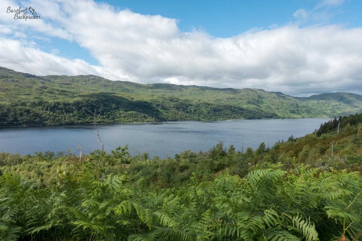
It’s quite a pretty road, in fairness. It’s undulating, mostly through the trees which is useful to keep the hot sun off you as you plough each kilometre, and occasionally you get views of Loch Sunart off to the left, but there’s relatively few places you can safely stand to enjoy the view.
View of Loch Sunart from the roadside, taken from the side of the road we weren’t walking along, between cars passing.
Just under 10km in is the campsite at Resipole, whose small shop and toilet were both fortunately open as we passed, so we could pop in and grab some chocolate and a drink. The owner didn’t mind us doing this, and when we told him we were nearly at the end of a hike across the entire country, he was pretty impressed.
The road became a little quieter at Salen, where the route to Kilchoan turns off. That road eventually ends at Ardnamurchan Lighthouse, signposted at 25 miles away – or just over a day’s hike. So close to the end now! But of course that’s 25 miles down a relatively busy road, and this journey is all about hiking the countryside, so we stayed on the main road to the village of Acharacle, which as you remember is the other end of Loch Shiel – a footpath from Polloch to here would have been pretty awesome, but alas not.
Acharacle isn’t very big. It’s a long series of buildings, maybe a kilometre, maybe more, stretched out on either side of the road, not so much a compact village, more as if someone’s been throwing houses like dice and left them where they landed. What it does have, however, or at least did when we passed, was a lovely little cafe called Tioram (‘dry’ in Gaelic, named after a small ruined castle just off the coast a few km further up), which sells very nice home-cooked soups and baguette fillings.
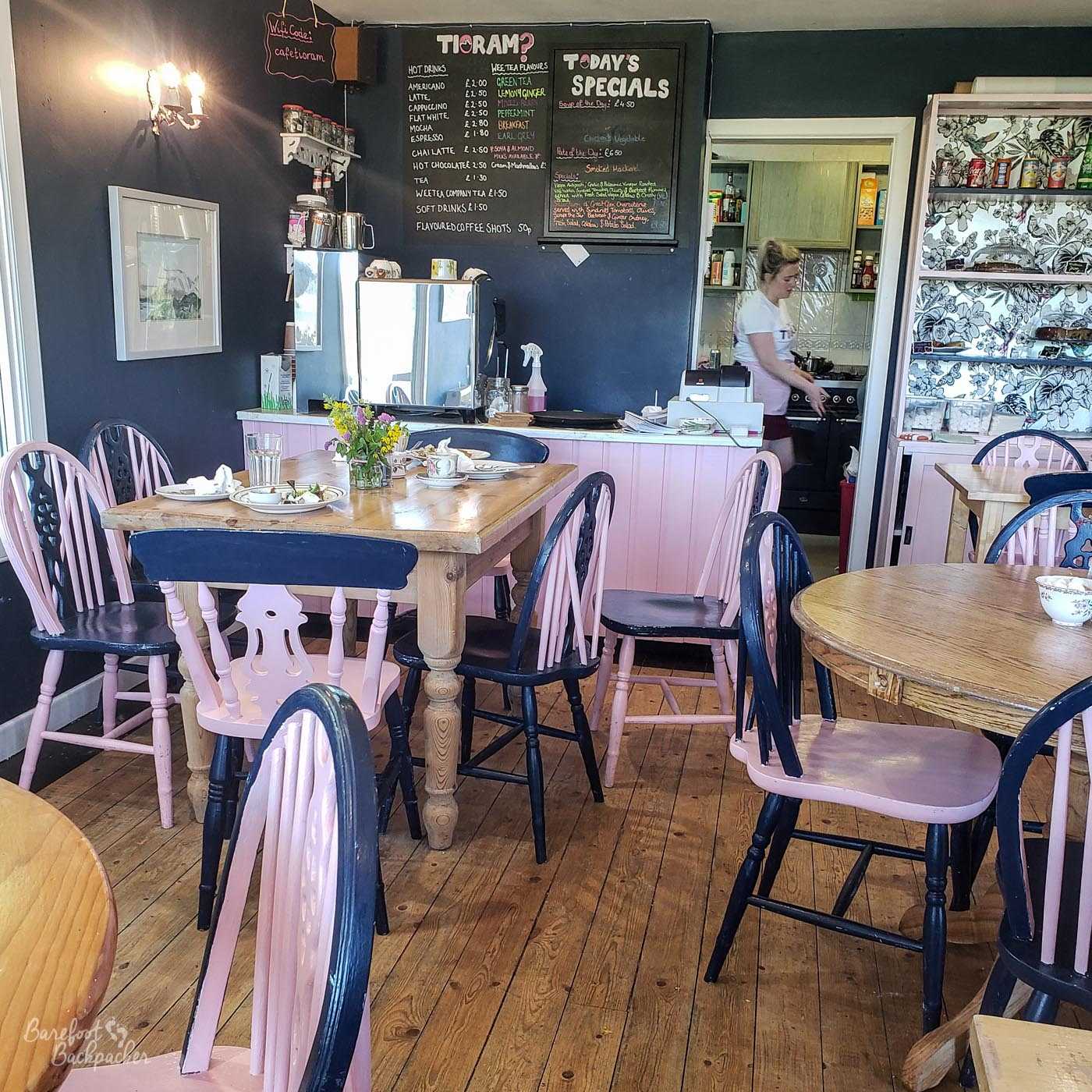
Inside the Tioram cafe, Acharacle.
We turned off the main road just north of Acharacle, then turned off that road and headed to Kentra Bay along a lane that slid through what felt like wide open country; the hills seeming strangely distant. By doing this we did miss out on the delights of meeting the Monster Midge, a large rock on the road to Ardtoe, painted with a midge’s scary face. Our aim was the south side of Kentra Bay – an almost cove-like bay where the land and the sea merge in a fairly wide expanse of mudflats, salt-marsh, and bog. It’s one of those places where I suspect my generation’s childhood fear of quicksand might well be realised. It would be, however, a great place for botanists and wildlife experts. At a car park, the road becomes a footpath and heads into a forest for a short distance, before the wild coastal hills take over.
Just before the forest ends, however, there is an intriguing short path off to the right. “Singing Sands”, it proclaims, and below it, in larger type, “Danger, Unexploded Munitions”. It seems in the past this area was owned and operated by the Ministry of Defence (as many parts of the wild north-west coast of Scotland are, especially up towards Cape Wrath). Taking the view that if it was truly dangerous they’d have fenced it off, rather than inviting people down, we turned to have a look.
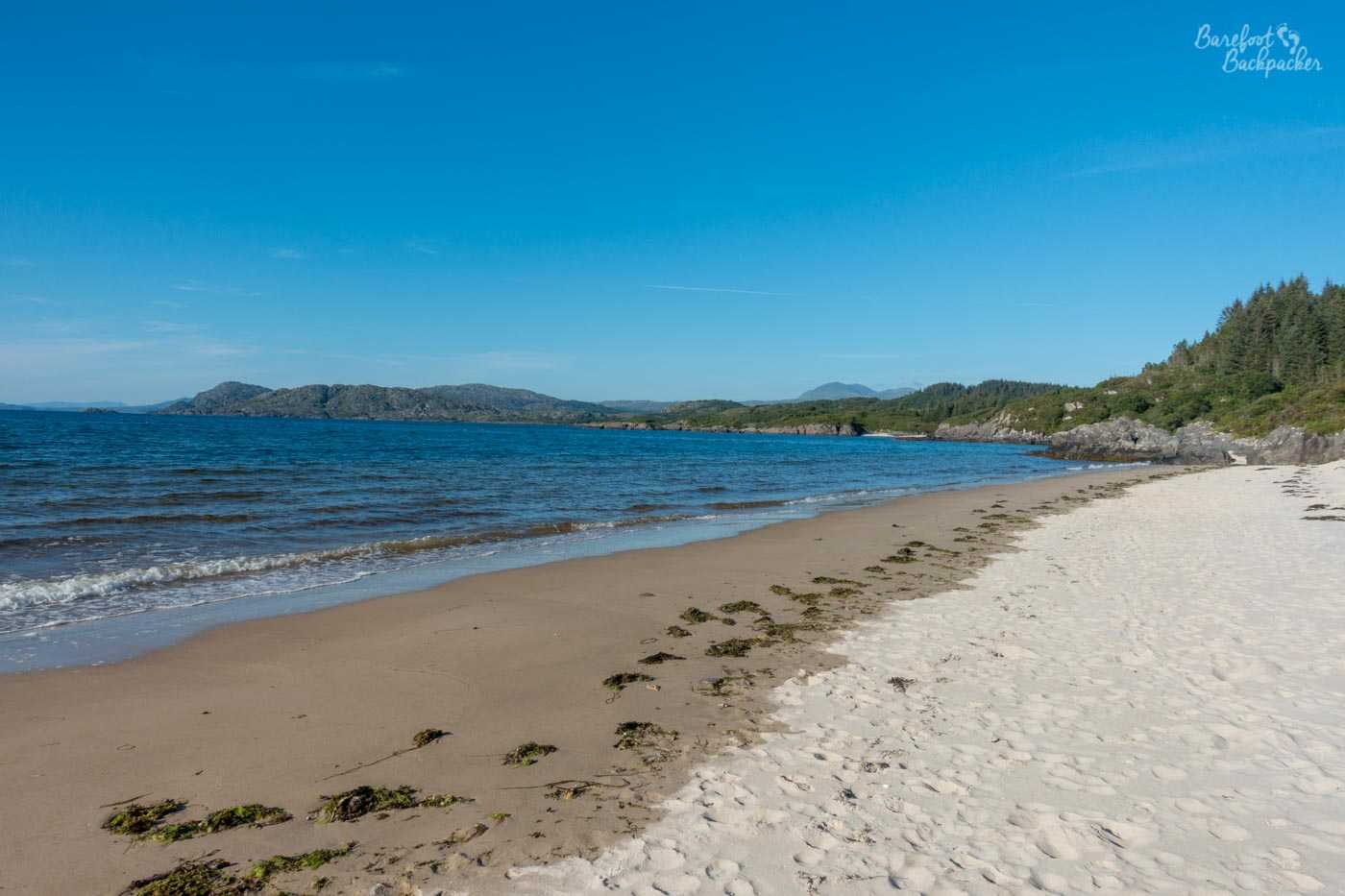
The Singing Sands beach, slightly to the west of Kentra Bay.
The Singing Sands are so called because they sing. Well, not exactly. Rather, for reasons to do with physics that I can’t honestly explain, they ‘squeak’ at different pitches when you walk or drag your feet on them. Wikipedia tells me scientists aren’t 100% either but it’s probably something to do with uniformity of sand grains. There’s quite a few beaches around the world where this happens, including 33 in the British Isles alone, so while an uncommon occurrence, it’s not exactly unusual. It’s also quite popular; we passed quite a few people in the woods who were walking back to the car park and since there’s nothing much noteworthy beyond the trees, we figured they must have all been visiting the beach. By the time we got there though it was late in the day and we had it pretty much to ourselves. Well, us and the jellyfish.
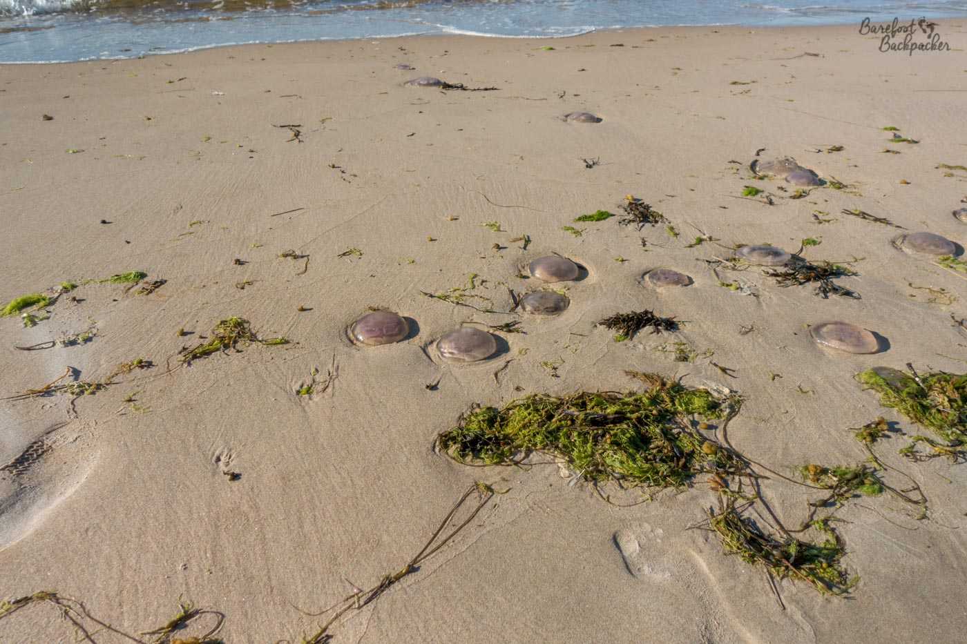
Be wary if you’re not wearing shoes. Even I’m not that hardcore, and especially not here.
So much so, in fact, that we stayed a bit longer there than we’d anticipated – we pitched up our tents on the harder sand nearer the forest, watched the sun go down over the sea, and fell asleep to the sound of the waves on the shore. Who needs a meditation app when you have the real thing? People in comfy beds who don’t want sand everywhere, that’s who – I was still finding sand in my tent two weeks later.
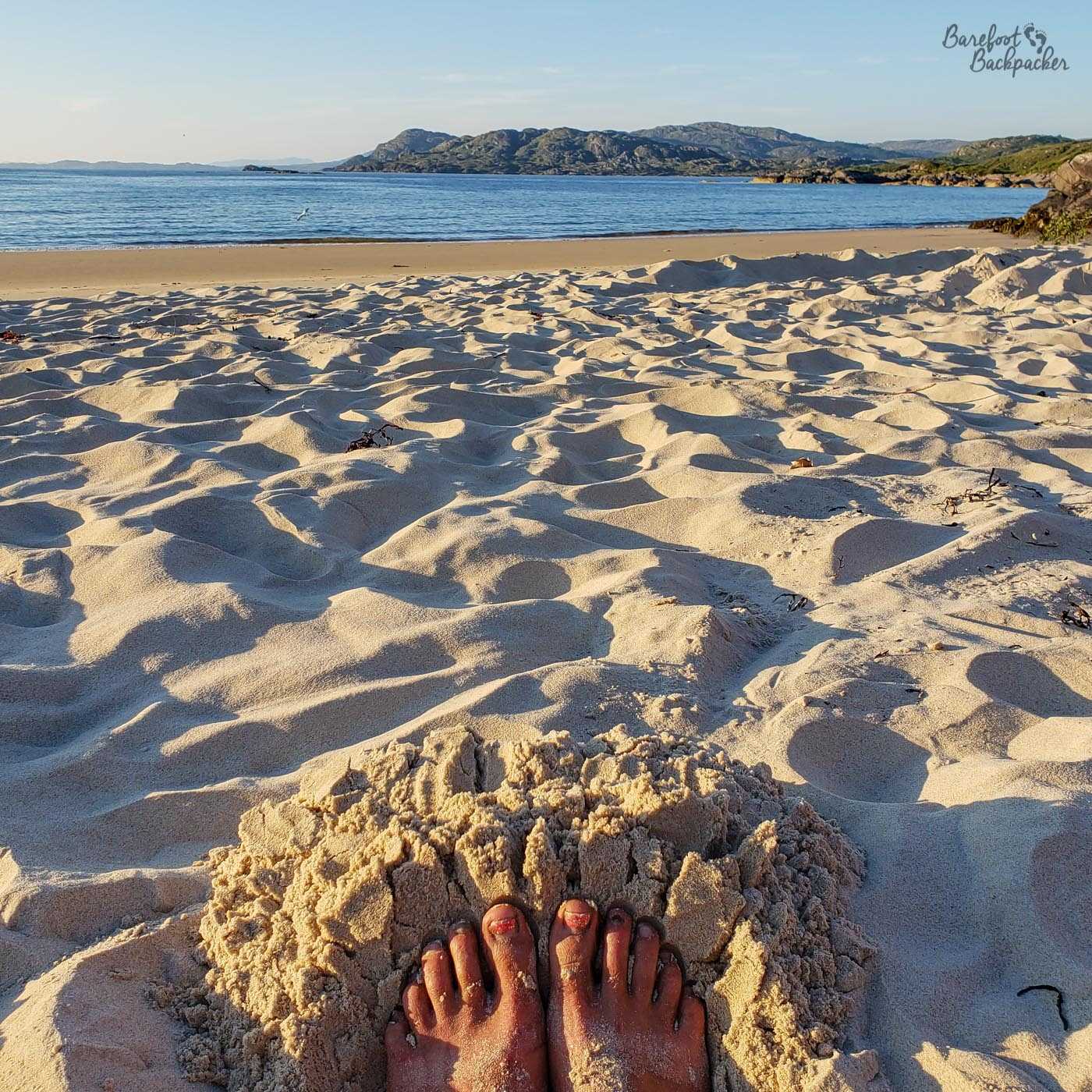
Obligatory ‘sandy toes at the beach’ shot, regardless. I stayed away from the jellyfish though!
Day Four – Ardnamurchan’s North Coast
We started the morning with a decision to make. We knew we could get to Ardnamurchan Lighthouse by nightfall, but it was still quite a way – maybe 35km on footpaths over the hills, so it would be quite the effort to do – or do we camp up and have a short day tomorrow. We decided to see how far we could get, and set off around 7.45am.
The first part of the journey is on a farm trail, but the footpath bears left not long afterwards as the lane bends to the right, and it’s easy to miss. Another good reason for having both a map and a GPS in this part of the world. This path is narrow, sometimes hard to distinguish amongst the shrubland, and despite the sun having been shining for most of the previous three days, very, very muddy on our visit.
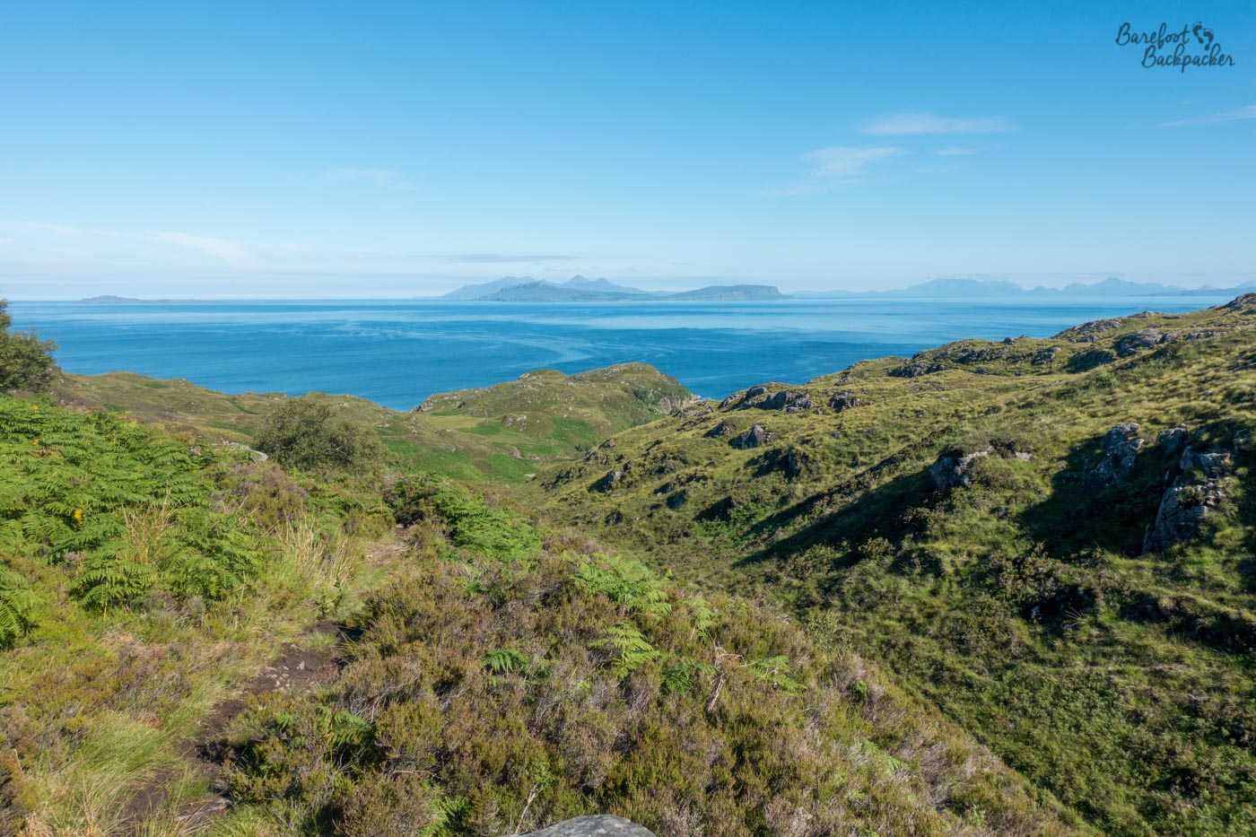
View out to sea – visible might be (at least) Eigg in the middle and possibly Skye on the right.
All of a sudden though you’re greeted with sight of the ocean. In the distance you can make out several islands (Muck, Eigg, the southern tip of Skye in the distance) as well as the peninsula of Arisaig, in South Morar, near Mallaig on the mainland. This was a particularly special moment for us as it was, aside from very distant glimpses on the Pennine Way and from up a hill near Linlithgow, the first time we’d seen the sea for over a month, when we’d left the North Sea near Sutton Bridge, in Lincolnshire.
The path slowly gets better as it winds through the rocks, eventually becoming another farm trail, then country lane, as it winds past a couple of houses at Ockle until a road junction at an old burial ground and public telephone box at Kilmory. From here we could have again walked down the roads all the way to Ardnamurchan Point, but of course, we did not. A path and further country lane heading west takes you to the farmstead of Fascadale, and a nice hill on which to look out to where a small river flows into the sea, and have a spot of lunch overlooking the Inner Hebrides. 1pm, for those interested.
Looking back towards the farmhouse at Fascadale – the rocky outcroop just to its left is probably the one we had lunch on.
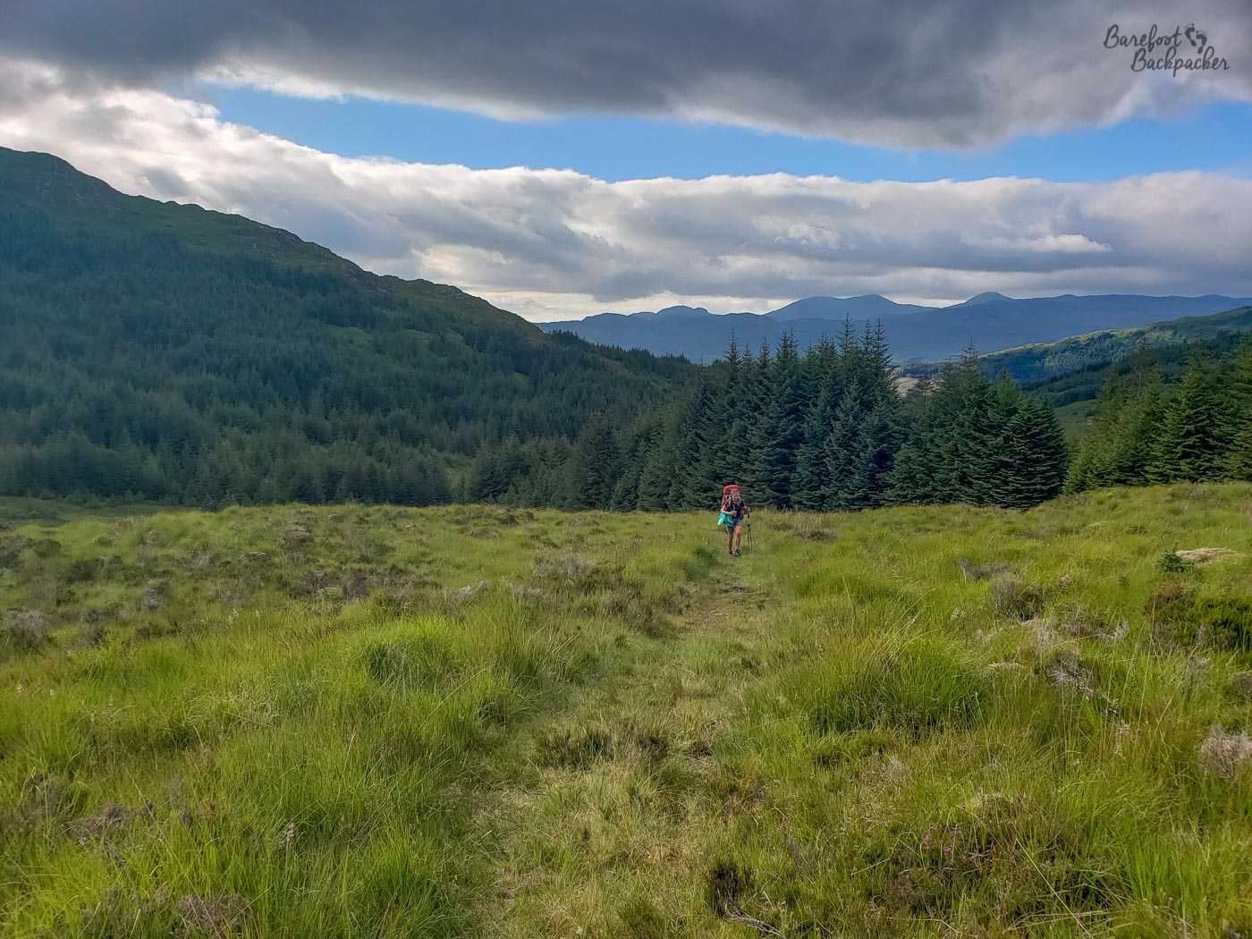
The path immediately to the west of Fascadale is much more … I’m going to say haphazard. It exists (like the Nene Way, in Cambridgeshire), more on paper than in reality. In theory it weaves round the mounds of hills over the grasslands, before turning southwards to follow a small river valley. In practice it regularly disappears and you find yourself either on top of a ridge facing a very steep drop, or wading knee-deep through gorse, heather, and fern. At one point, a large fence blocks you way, but is traversable through a metal gate, the size of which feels like it comes out of some kind of fantasy adventure novel. Definitely feels somewhat out of place. It goes without saying there’s no-one here; this is wild hiking of your dreams, following a mythical trail through a wilderness, clambering over rocks and wading through streams. No orcs, though. Possibly snakes, though I didn’t see any.
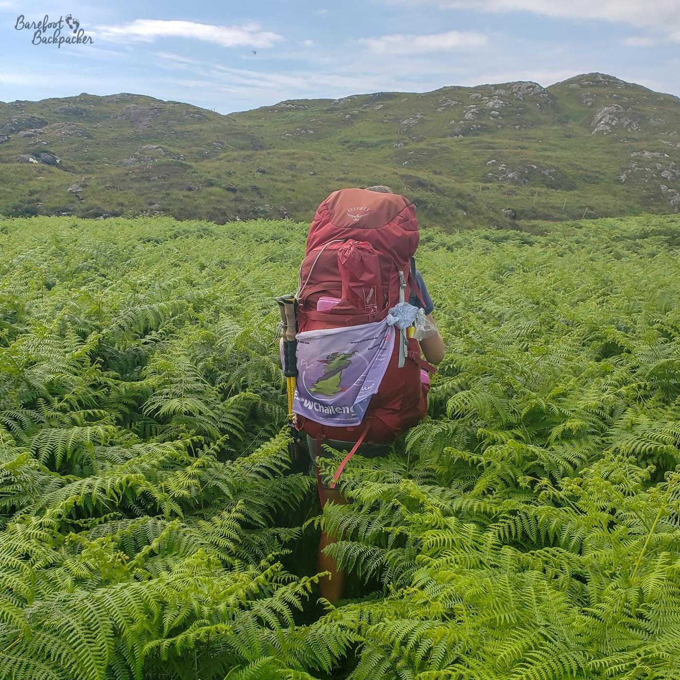
Becky The Traveller, almost disappearing in the ferns. This is the marked trail, would you believe.
At length, the trail becomes wider and more stable, and soon enough the buildings of Glendrian come into view. This is not a village you’ll find on a map, however; it was abandoned in the 1940s and only the framework of the stone cottages remain. It was a farming village, first settled at some point in the early 1600s, and had a high-point population in 1861 of 47. Though the land around isn’t great for arable farming, the residents here did farm cattle, and in later years (as was common across Western Scotland) turned to crofting – the area is reminiscent, in a way, of St Kilda, a small remote crofting settlement abandoned when it became easier to live elsewhere. Unlike St Kilda, there seems to have been no wholesale abandonment; rather here, people just kind of moved away or died off and no-one moved in to replace them. The last resident, named as a Mrs MacLachlan, moved in with her nephew in a neighbouring village not long after her husband died, in about 1941.
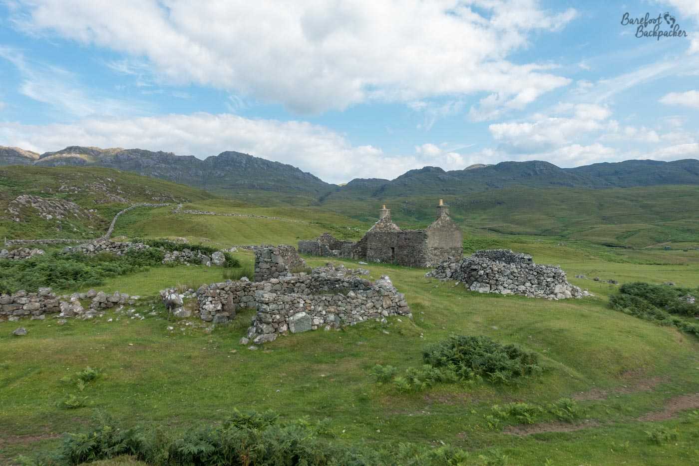
Some of the ruined cottages in Glendrian.
The trail from Glendrian reaches a proper road, and we’re now only 10km from Ardnamurchan Point. It is about 5pm. Heading north-west, the next stop is Sanna Bay, another beach, with dunes and a fairly wide expanse of sand in one of those clichéd sweeping bay vistas so beloved of tropical islands. It’s a nice place to while away an hour or so, although a little too busy and close to town to set up camp peacefully. It’s also only about 6½km from the end, marginally more than a Parkrun, albeit it would be the most difficult Parkrun in the world. (For those tracking our progress, we leave about 7pm).
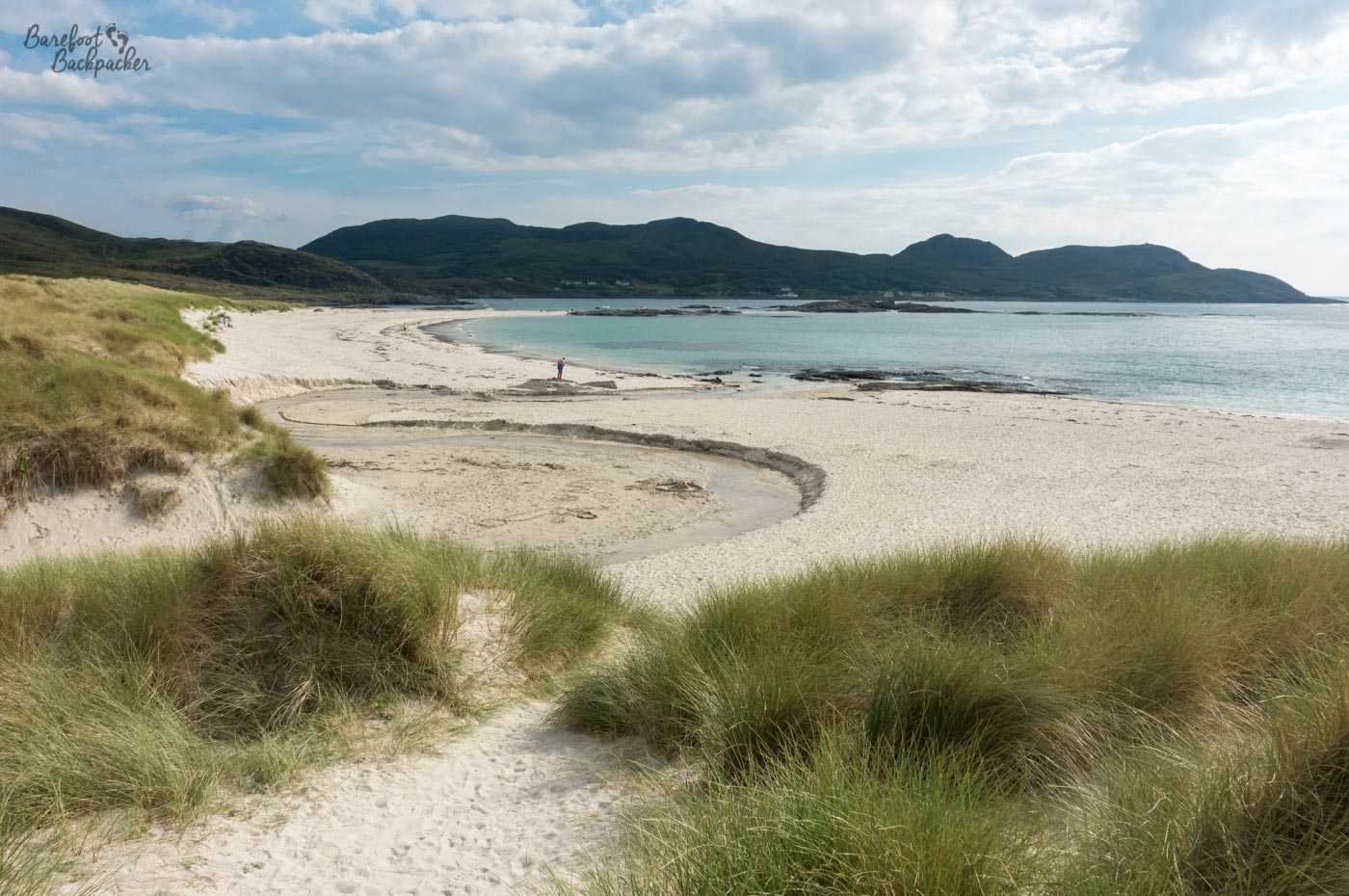
An overview of Sanna Bay. There’s quite a few beaches on Ardnamurchan.
The last few km are precarious. The trail is signposted, but narrow and creeps up and down steps that feel like they’re simply hewed into rock. There is brief respite as you pass through the township of Portuairk, the westernmost settlement in Great Britain, before heading onwards through a narrow gap in the cliffs.
Much of these hills are fenced off. This isn’t simply to do with land ownership trumping the right to roam; rather these fences help to protect the wildlife. This is an area where red deer roam free, and you can, if you’re lucky, see a herd on one of the neighbouring hilltops. The trail goes down a narrow valley towards the sea and then, on the left, you can see it, Ardnamurchan Lighthouse.
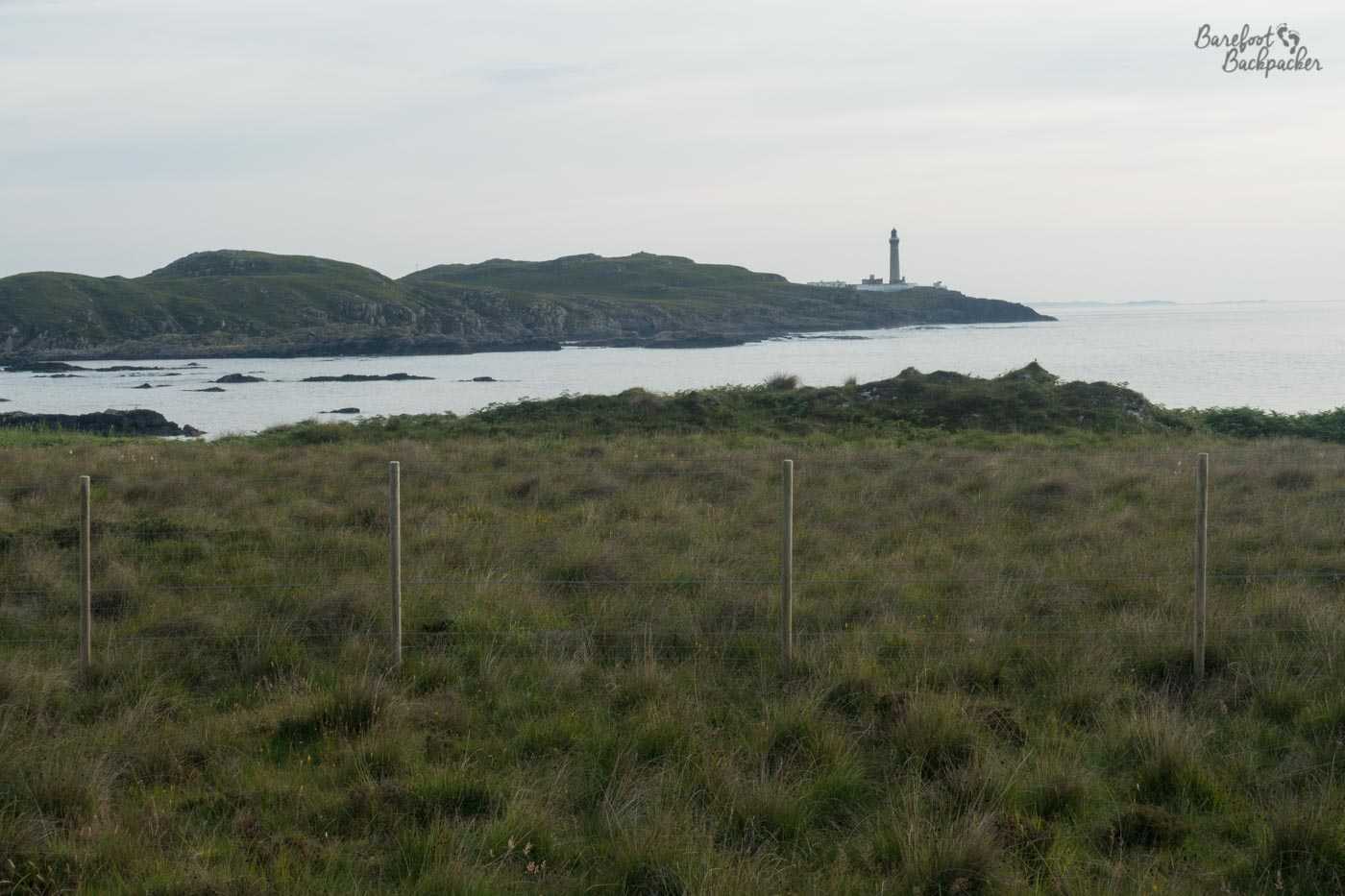
The first view of Ardnamurchan Lighthouse, taken from a distance in slightly fading light.
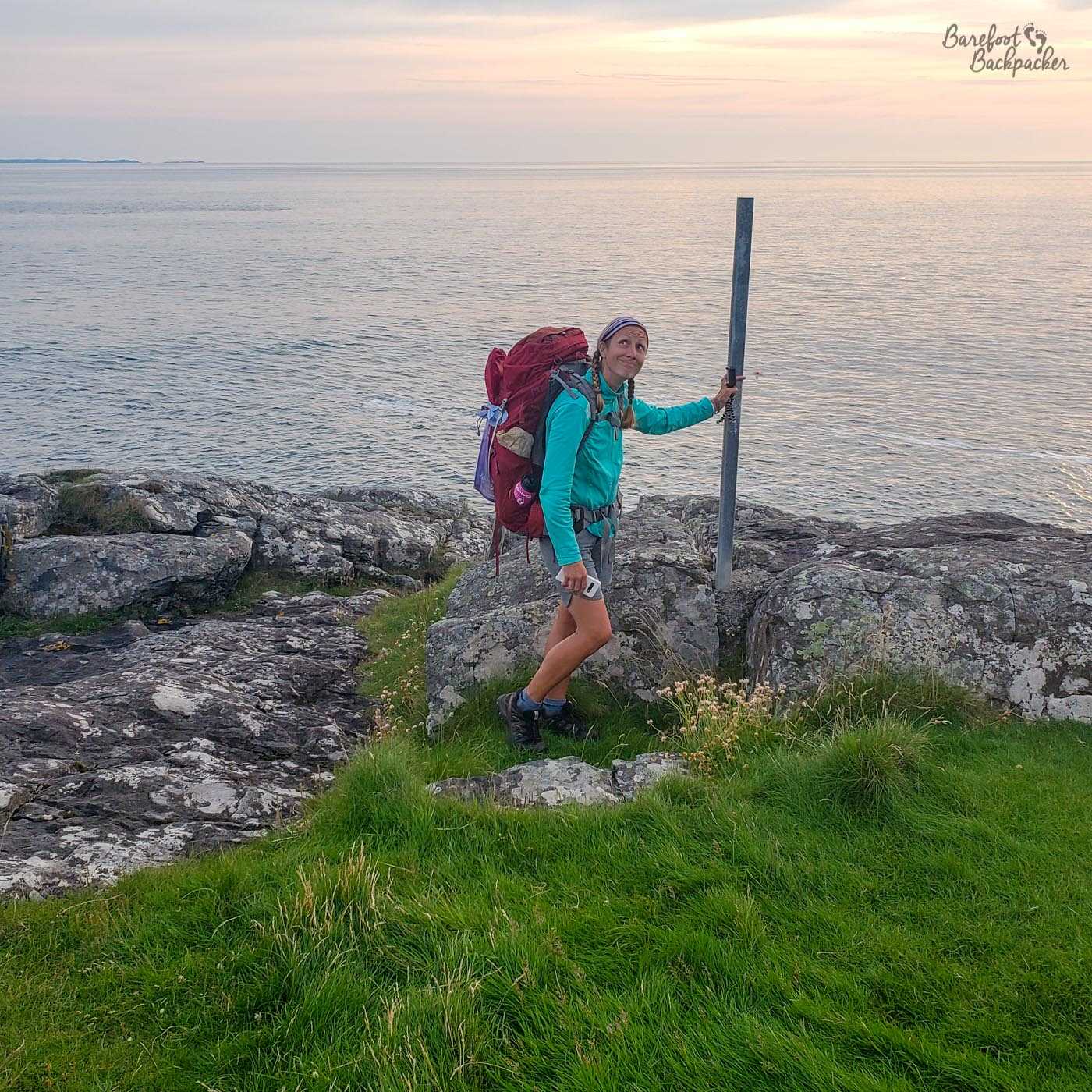
Getting there still requires a little effort though. The designated path skirts the edge of a caravan park (not a campsite; this is more a mobile home complex) before kicking off in what seems to the the wrong direction, right through a field of heather and deer, before reaching a rough-tarmac road for the final ascent. At almost exactly 9pm, the sun just about still in the sky, we reach the sign welcoming us to Ardnamurchan Point.
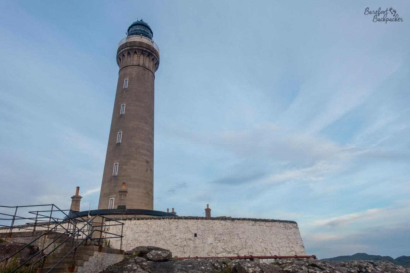
Close-up of Ardnamurchan Lighthouse, looking back towards the land.
Ardnamurchan Lighthouse was built in 1849 and is 36m tall. According to Wikipedia it is the only lighthouse built in the Egyptian style, but without seeing pictures of lighthouses and someone actively telling me what the differences are, I don’t know what that means. I’m telling you just in case you know, or are more interested than me in finding out (by which I mean, I won’t remember, even if I look it up, that information won’t stay in my head). At the lighthouse is a small cafe and visitor centre, neither of which are open at 9pm. Instead, we head to the base and look out to see, safe in the knowledge that when you’ve hiked 1,530km across the width of a country, no-one’s really going to criticise too strongly that you’re actually looking North and not West.
Becky The Traveller, standing at the End Of Great Britain, having successfully walked 952 miles from Lowestoft, 57 days earlier.
We wild camp, slightly dubiously, on a grass plain at the bottom of the ramp up to the lighthouse; we get permission from the staff living at the lighthouse monitoring the wildlife to do so, as long as we’re packed up before the gates open to visitors in the morning. Which we do, after a night with a small bottle of port, and a good sleep.
The wildlife in the area consists of seals and birds; I take no heed of either in the morning and, after we breakfast, I hike the 10km to the village of Kilchoan and the ferry to Mull, the first stage of my journey to Oban and my next adventure – heading even further west, to the Outer Hebrides. My hiking companion, Becky, sticks around by the lighthouse for a bit to seek out said wildlife, before hitching a lift in stages all the way back to Fort William. She has mountains to climb. This was the last time we ever saw each other ….
Hints and Tips for Hiking in Ardnamurchan
The trouble is, because it’s not a well-known place and there’s not a national or notable trail that runs through the area, information about hiking in Ardnamurchan itself is quite sparse. Certainly when we were plotting our route across the country, we (literally!) left this bit until last to plan, because we didn’t know how we’d feel until we got there.
Much of the routing was done by scouring detailed Ordnance Survey maps, and going ‘oh that looks like it’s marked as a footpath, where does it go?’, but even cross-referencing with online resource meant much of it we were a little unsure about. It wasn’t until we reached Glasgow that we found a book of wild Scottish hikes in an outdoor shop that listed a couple of potential routes, so the final journey we chose was very much a last-minute decision.
This also affected our accommodation choices; as you read, we wild-camped every night. Note though at no point did we look on a map at the start of the day and say ‘we’ll stop there’, rather we put up tents at convenient places when we were feeling a bit weary. On the second day this did mean we pushed on a little further than we’d intended as there weren’t suitable spots on the hills, but taking that lesson in mind is why we stayed on the beach on the third day; we suspected the hills beyond the forest edge would be more-of-the-same. There do seem to be a lot of B&Bs and holiday cottages in the region (especially around Strontian, but there’s also a few on the northern side of Loch Eil), but you’d have to check with them that they’d be okay with one-night stays.
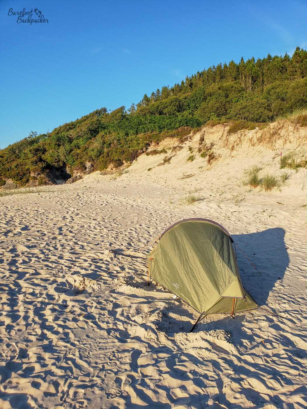
My tent, at the Singing Sands beach.
There are very few shops in Ardnamurchan, and nothing resembling a supermarket. There are small stores in Kilchoan, Acharacle, and Strontian, but that’s about it. Therefore, if you allow four days to hike to the lighthouse, it would be definitely wise to stock up in Fort William beforehand, and make sure your camping stove etc are all fully functional. There’s a decent outdoor store in the town centre (Ellis Brigham Mountain Sports); in any case remember the town itself mainly serves people heading into the mountains (don’t forget, Ben Nevis is a short, casual, stroll away) so while small, it’s a very convenient place to start from.
The peninsula does at least have a lot of water, of course, and with a decent enough water filtration system or bottle, you shouldn’t have too much trouble staying hydrated. There’s something kind of magical about waking up in the morning and drinking pretty much straight from a loch, though.
At the time of our hike, by the way, there was one daily bus from Kilchoan to Fort William that leaves early in the morning (7.50am) and takes 2½ hours; the return journey leaves Fort William just before 2pm. It serves both Acharacle and Strontian, so if you get stuck or it’s raining too hard, it’s possible to go back by public transport. Maybe. In addition, Kilchoan has a ferry that runs to Tobermory on the Isle of Mull a couple of times a day; Tobermory itself is a nice place worth a visit, and Mull in general is large and popular, and it’s also a much easier journey to get from there by bus and ferry to Oban on the mainland – as I say this is how I returned.
We were mostly lucky with the weather – possibly on the third day it was slightly too hot to be hiking but fortunately that day was mostly on the roads under shelter from trees. That said, the more remote trails were over hills still laden with mud from rain the previous week, and because Ardnamurchan is both western and on higher ground, it’s likely you’ll get al least one day of rain. Be wary of this; the trails on the northern coast we hiked on the last day especially are quite narrow, relatively unmarked, and under-used; they’re also quite open with not much shade, so I’d imagine if a rain shower hits, it’ll be quite unpleasant without much hope of a respite. Take waterproof clothes, and, er, footwear that won’t slip. Be also aware that in some places the undergrowth is quite tall/deep, and given the presence of wildlife like red deer and sheep, be mindful of the potential for ticks. It goes without saying you should prepare for midges (head nets, midge repellent, wipes), though oddly we were plagued by them more the previous week on the West Highland Way.
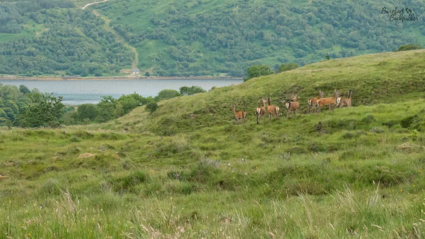
As near as we got to the red deer in the end. They kept running off. And who can blame them.
You can gather from all of this that the Ardnamurchan peninsula is a very remote place. Make sure you have offline and online maps, portable electronic charging devices, compass, all the works. Although it’s not very high, and the proximity of the sea may have you believe you’re never going to be lost in the wilderness, remember very few people live out here, and there is, to all intents and purposes, only one road. If you get lost, or injured, it’s going to take quite a bit of time for someone to come out to rescue you, even bearing in mind this whole part of Scotland is ‘hiking country’ so resources and facilities are set up for it.
But, as long as you take precautions, and stock up well on food, hiking in Ardnamurchan is a beautiful and rewarding experience, and one which will definitely bring you close to nature and the environment.
—
Authorities visited: Highland. Dates Visited: 12-16 July 2019.