St Kilda, as far as we know, never existed. The name is likely to have come from the Norse word ‘kelda’ or ‘childa’, meaning spring or well, with a less than certain attribution for the first part. Despite this, the name has resonated through the centuries and is probably most famous now for being a suburb of Melbourne, Australia, and an associated Australian Rules Football team.
This St Kilda, however, is the original, and very different.
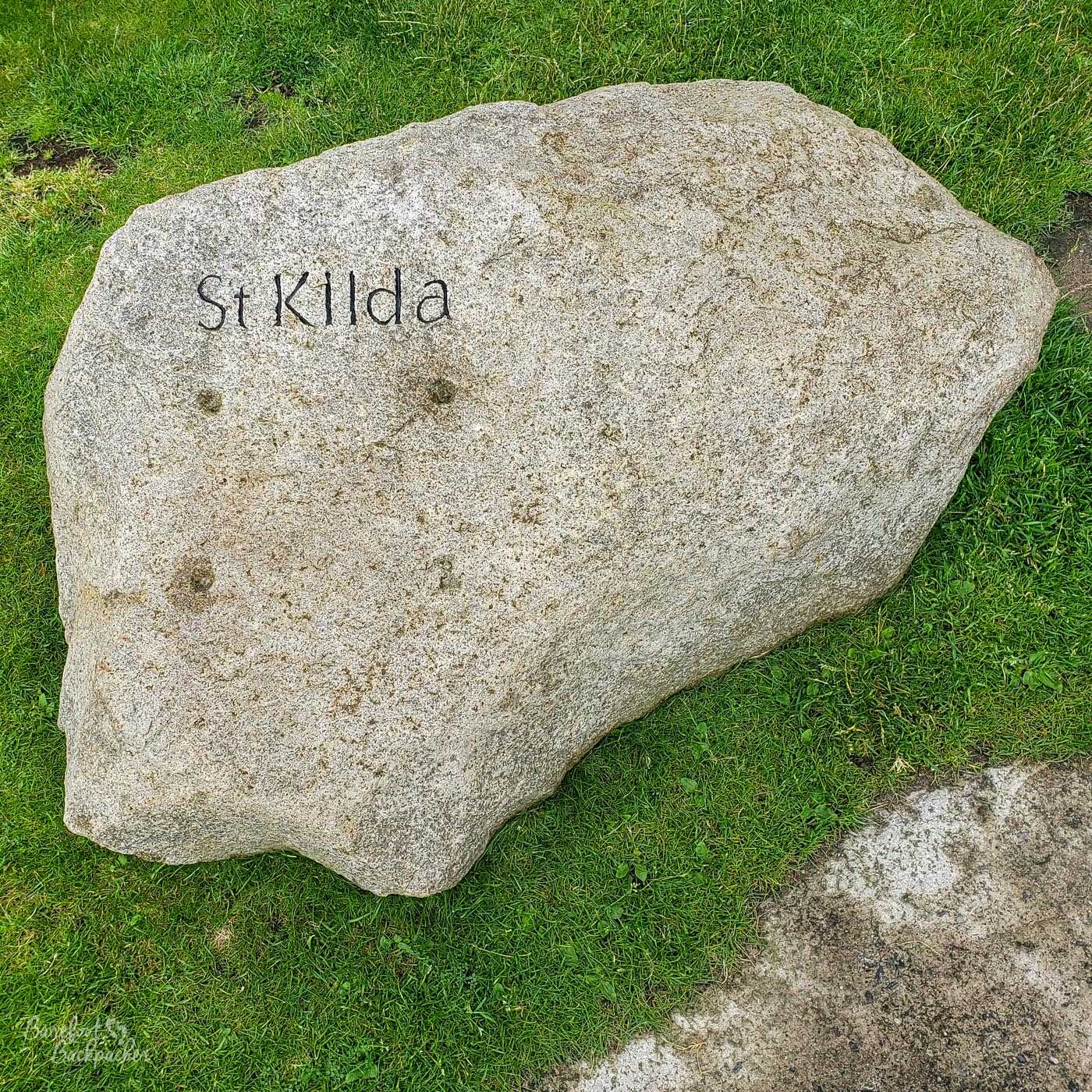
The St Kilda name on a rock in the grass, near the harbour at Hirta.
So where is St. Kilda?
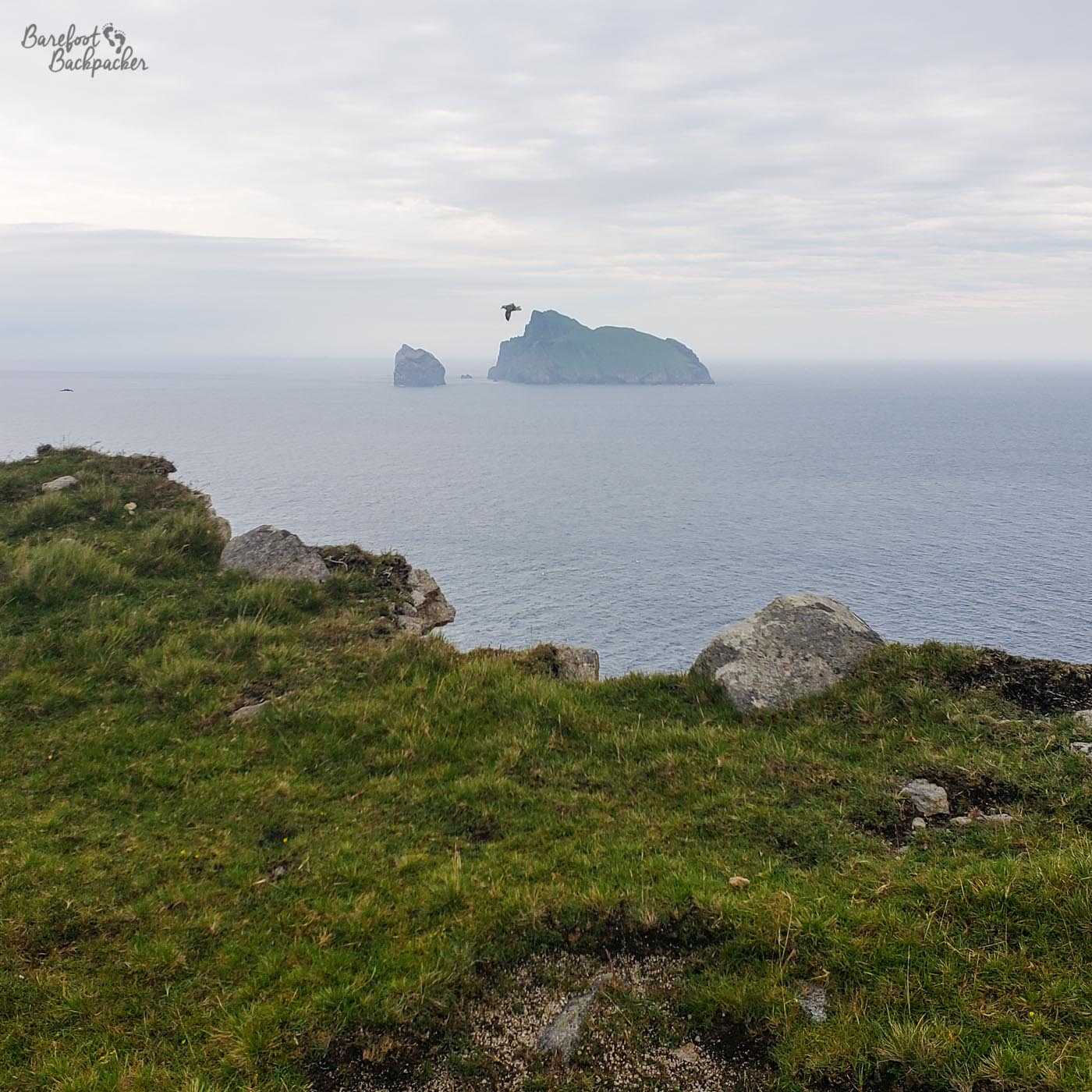
It is a small archipelago in the Atlantic Ocean, made up of four more-or-less significant (and named) islands (Hirta, Dun, Soay, and Boreray), and a number of small islets and rock stacks, some rising up to just under 200m with almost sheer vertical cliffs. The group is believed to be the remains of an ancient volcano; certainly the main island Hirta has a crater-like feel, with a semi-circular ridge defining much of the island and in parts stretching over 400m high, while the land by the main bay drops almost to sea level.
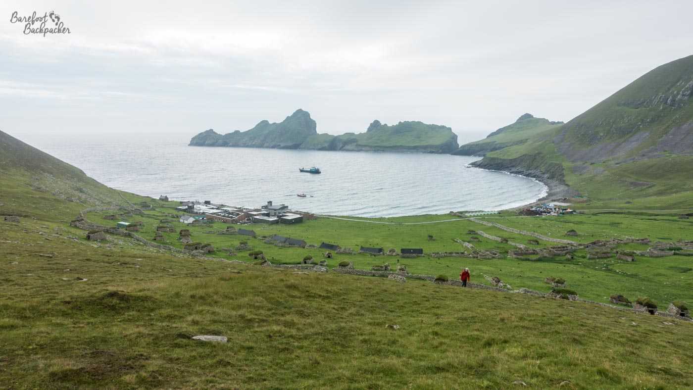
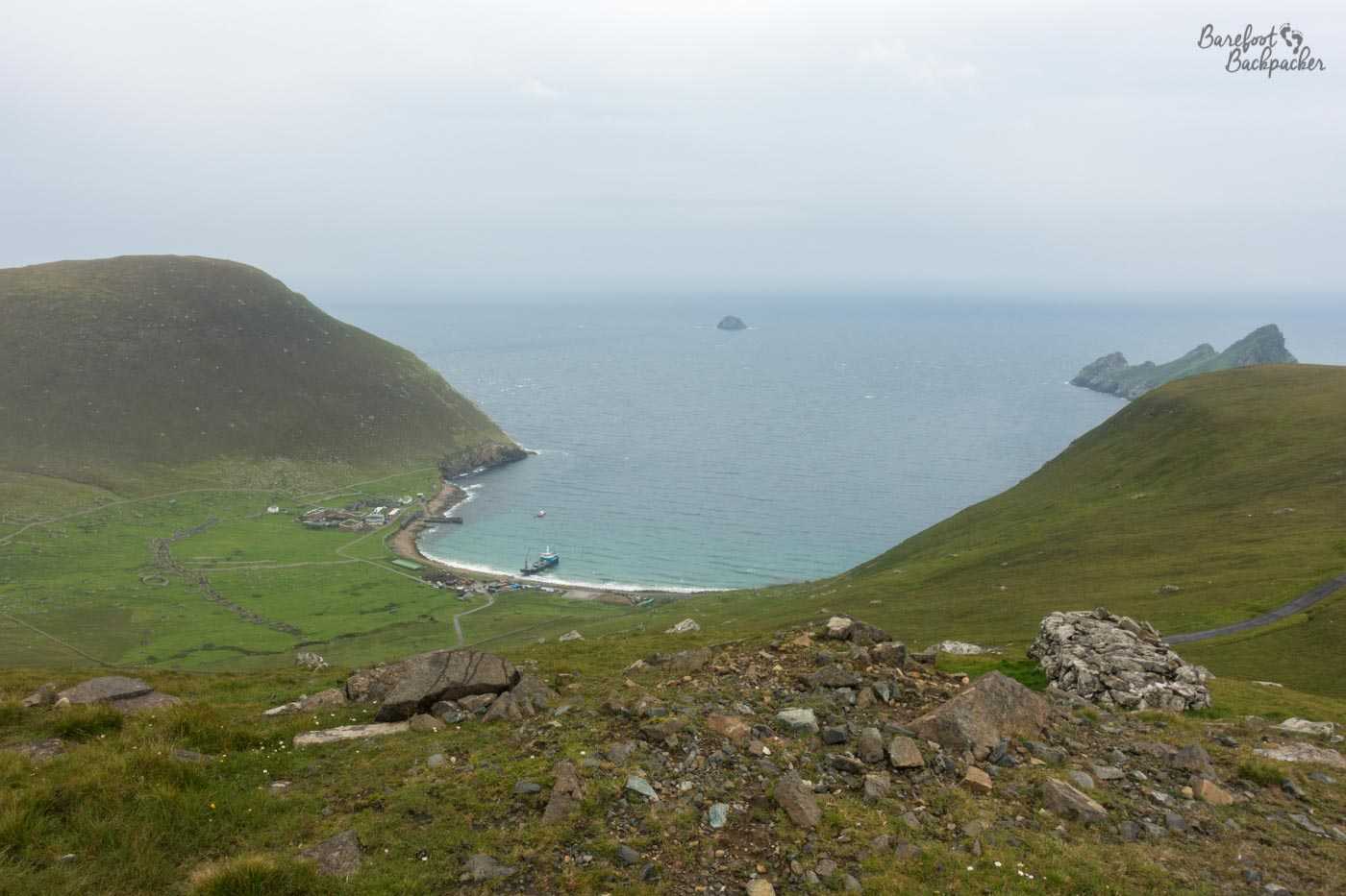
The settlement on Hirta, as seen from the top of a nearby hill.
The island group lies just over 60km west of North Uist, in the Outer Hebrides of Scotland, are amongst the remote islands of the United Kingdom, and indeed are the furthest westerly inhabitable point in the whole of the country. It makes it somewhat fitting then to end a journey there that started at the furthest east point of the UK, at Lowestoft, a couple of months previously.
I say ‘inhabitable’. This is an important but quite subtle point. The most westerly point of the UK is a small barren lump of rock some 300km further west of St Kilda, deep into the Atlantic ocean, called Rockall. The existence and provision of this rock is a slight bone of contention between the UK, Ireland, and Iceland, involving whether or not ownership of the rock affects the Exclusive Economic Zone that surrounds each country. The rock itself is insignificant; what matters is the sea – the fishing rights and the mineral resources. There had been several landings on Rockall in the past with a view to proving its habitability, but we seem to have given up on that foolish endeavour. It’s a rock. In the middle of the ocean.
St Kilda, though.
The island group, like much of outlying Scotland, has been inhabited for a couple of thousand years; once again suggesting either that bronze and iron age humans had a particular passion for cold, wet, windy places, or that the climate in those days was slightly different.
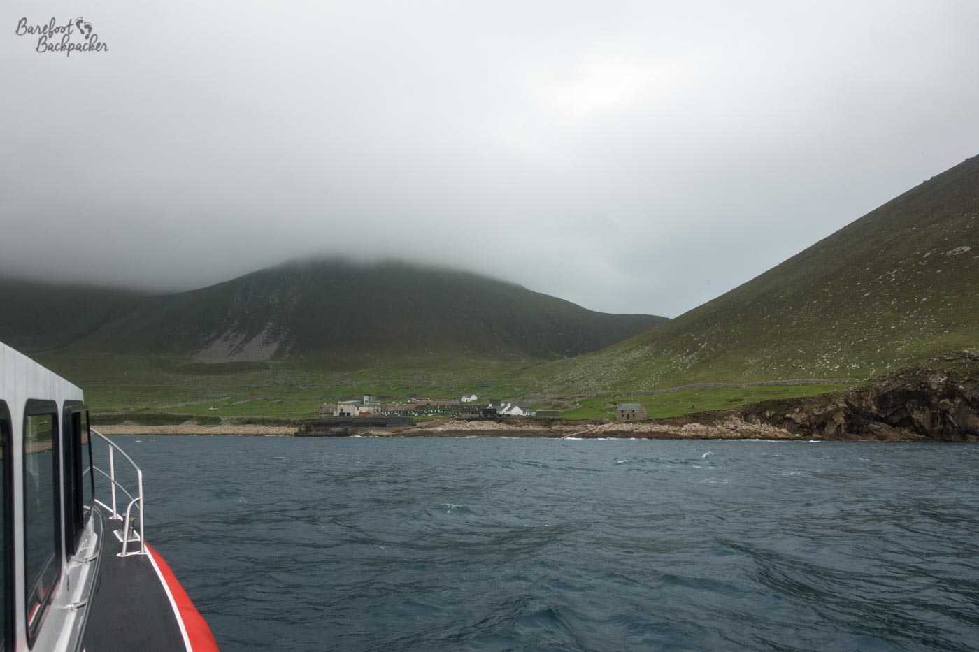
The first view of the harbour on Hirta, from the boat in.
Nevertheless it’s still quite an isolated and foreboding place, regardless of era or civilisation. Due to their size and location, there’s not a great deal that can be farmed on the islands, but conversely it’s rather difficult to maintain regular supply lines, even today. There’s no room you can put anything more than a heliport on Hirta, and while it has a natural bay for small boats to dock up, the natural swell in the harbour makes landing difficult. Indeed, visiting the islands is quite hit-and-miss even in the heigh of summer, due to the constant presence of Atlantic winds making both the journey over and the landing on Hirta fraught with danger.
Who would live on St Kilda these days?
So, you might well ask, what about the people who still live on it – how do they cope with the harsh conditions. The simple answer is, er, they don’t. For much of the 19th Century the population bounced around the 100 mark, but a series of events at the start of the 20th Century caused the population to decline to below a critical level. These including crop failures, the arrival of the military to protect the island during World War One leading to closer links with the mainland and the subsequent feeling that ‘life is better elsewhere’, and the lack of healthcare. The last residents were evacuated off the island on 29 August 1930 and rehoused in the west of Scotland. For the record, the last permanent resident evacuated in 1930 died four years ago (April 2016) at the age of 93, so their story has now officially passed from living memory into written history.
Looking down the main road on Hirta, away from the harbour.
In actual fact, people do still live on the islands, but not in the traditional way. Part of Hirta is now occupied by a small military base, whilst scientists and environmentalists also live in the island group, monitoring the local wildlife and sealife.
Why visit St Kilda?
So, you might well think, a small group of islands far out to sea, occupied by specialists, with no shops, pubs, hotels … what possible reason could there be to visit? Indeed, can you even visit? Well, the St Kilda group is almost unique. It’s one of the few places in the world to be on the World Heritage List twice – once for nature and once for culture.
What wildlife can you see on St Kilda
Unsurprisingly the islands have few short-range creatures – there are no bees and very few butterflies – and the windy and salty environment makes grasses and flowers, rather than trees, the dominant form of plant life.
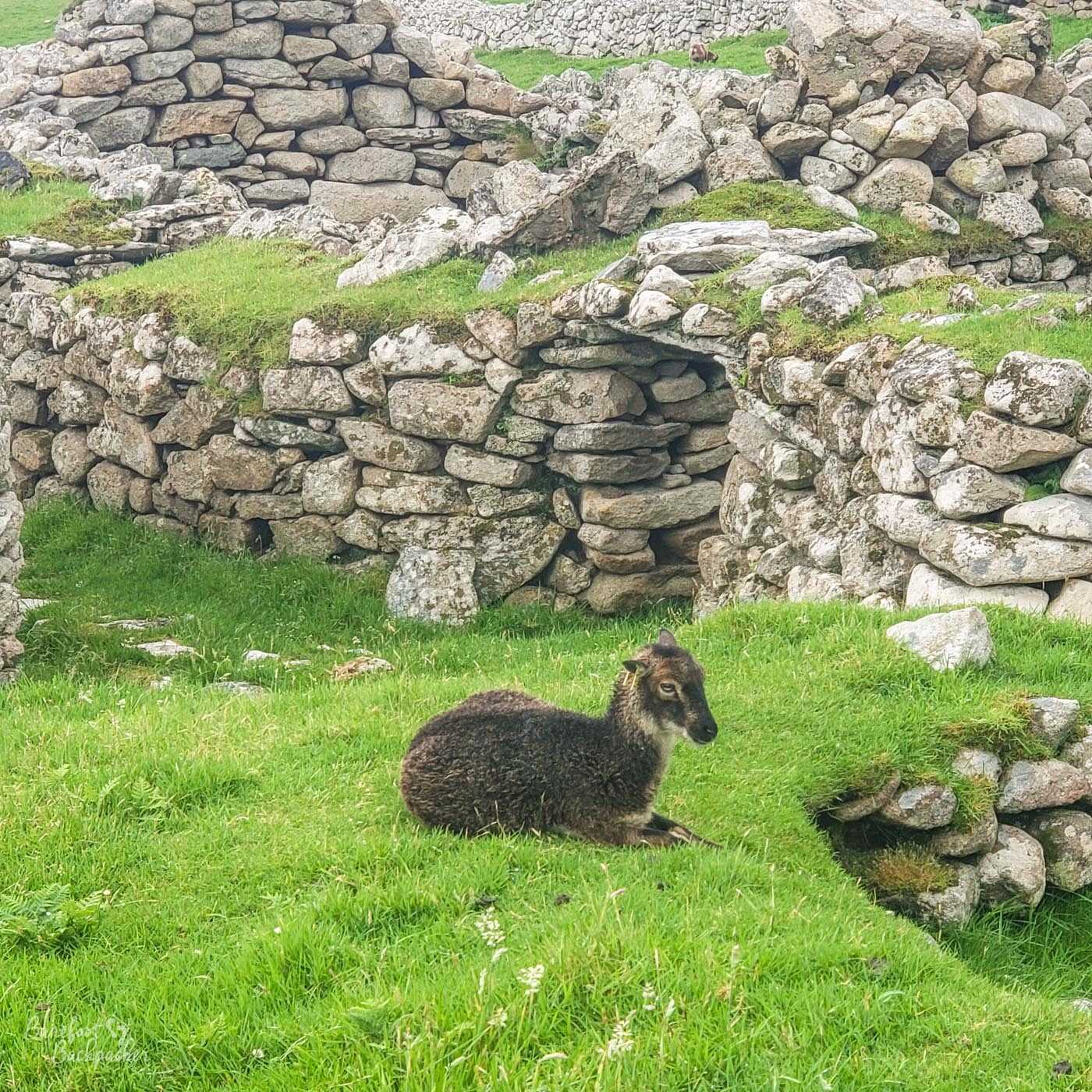
St Kilda sheep, on Hirta.
The remoteness of the islands has meant land-based wildlife is stable, but quite limited. The most notable example is a couple of rare breeds of sheep which are common on the islands, including the Soay and the Boreray; these are quite short beasts which apparently naturally moult, and seem to be amongst the closest modern relatives to the kinds of sheep that the bronze age civilisations would have known and used.
What St Kilda does have a lot of though is birdlife.
![Birds flying around one of the rock stacks [large rock columns and islets that are scattered around the sea] in the St Kilda archipelago. Lots of birds.](https://barefoot-backpacker.com/wordpress/wp-content/uploads/2020/07/DSC00281-St_Kilda_Stack_Birds.jpg)
Birds flying around one of the rock stacks in the St Kilda archipelago.
The islands and associated rock stacks are the breeding ground for tens of thousands of seabirds, including (checks Wikipedia) gannets, puffins, and fulmars. Indeed it’s estimated that 90% of the European population of the Leach’s Petrel (vaguely related to the Albatross), and 24% of the entire global population of Northern Gannets use the St Kilda area as their home. The effect of this is astounding – take a boat past some of the rock stacks and the sky is black with flying birds, the air sodden with the sound of their cries. Even their rocks themselves look more bird-coloured than stone-coloured due to the sheer numbers flying around. And yes, that does include the poop.
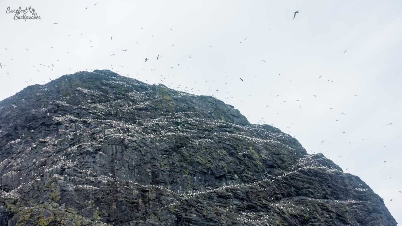
Lots of birds flying and sitting around one of the other rock stacks.
Hirta itself has a population of skuas (or jaegers); these are nasty buggers, vaguely related to gulls and terns, who tend to feed off not just the remains of other birds’ food (often while they’re still eating it), but in fact the other birds themselves – they’ve been known to attack puffins and even herons. They have a wingspan of around 120cm, and are very territorial and aggressive, seeing nothing wrong with attacking anything that comes too close. This includes humans; Alfred Hitchcock would approve.
This is as near as I wanted to get to those bloody things!
There is also the possibility of seeing larger sea-life this far into the ocean too – not just seals on the shoreline but also dolphins, basking sharks, and even orca whales.
What are the ruins on St Kilda?
St Kilda’s cultural heritage is related to its history and and isolation. There are still some ruins from the bronze age era, although some are fairly indistinct and no-one really knows quite what they are – boat-shaped stone rings that are found nowhere else in Europe. The island is also littered with cleitein – stone domes used as storage huts for grain, hay, etc, and despite being prehistoric, were still used for this purpose right up until the islands were evacuated.
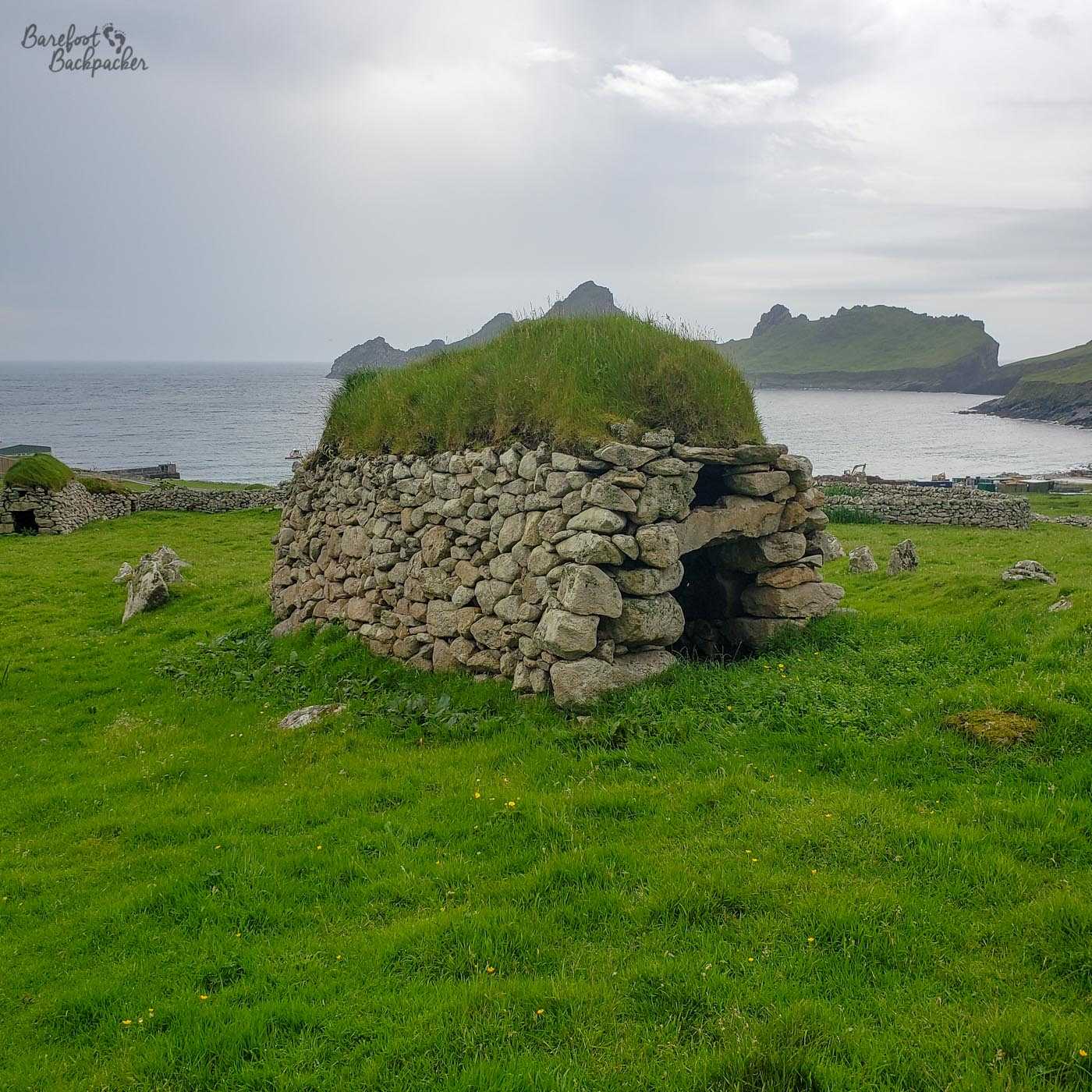
An example of a cleit on Hirta.
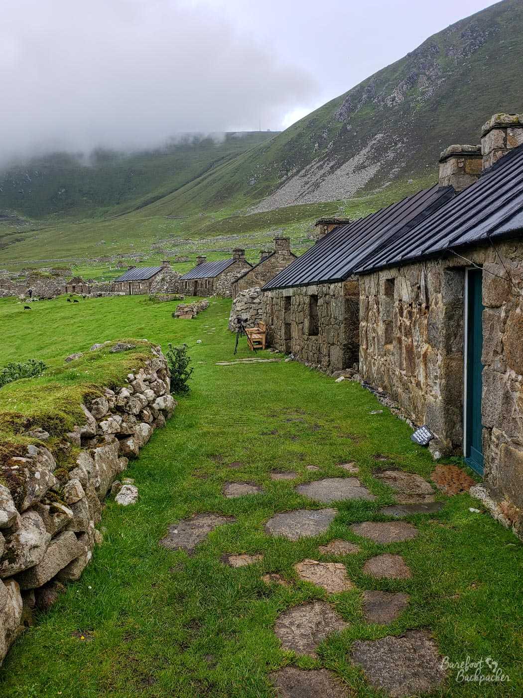
The most iconic human remains on the island of Hirta though is the old stone village used up until the end, and which doesn’t have a specific name, being known only as ‘The Village’, but not in a ‘The Prisoner’ sort of way. Although I guess if you wanted to create a village in a place no-one was allowed to leave, Hirta is a more fitting location than North Wales.
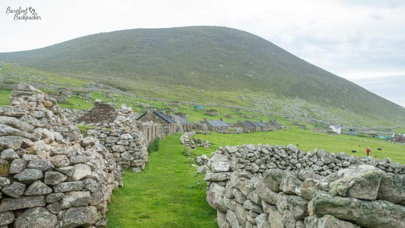
View looking down the main street on Hirta, looking towards the harbour.
Starting from close to the bay, a grass road curves gently to the west. The south, seaward, side of the road is delineated with garden, or rather, allotment-type areas where the residents would have grown stuff for communal use. The houses themselves stand on the north side, originally a series of around thirty stone houses, built in the blackhouse style seen elsewhere in the Outer Hebrides, fairly small, usually single or two-roomed, and quite prone to clogging up with soot from the indoor fires.
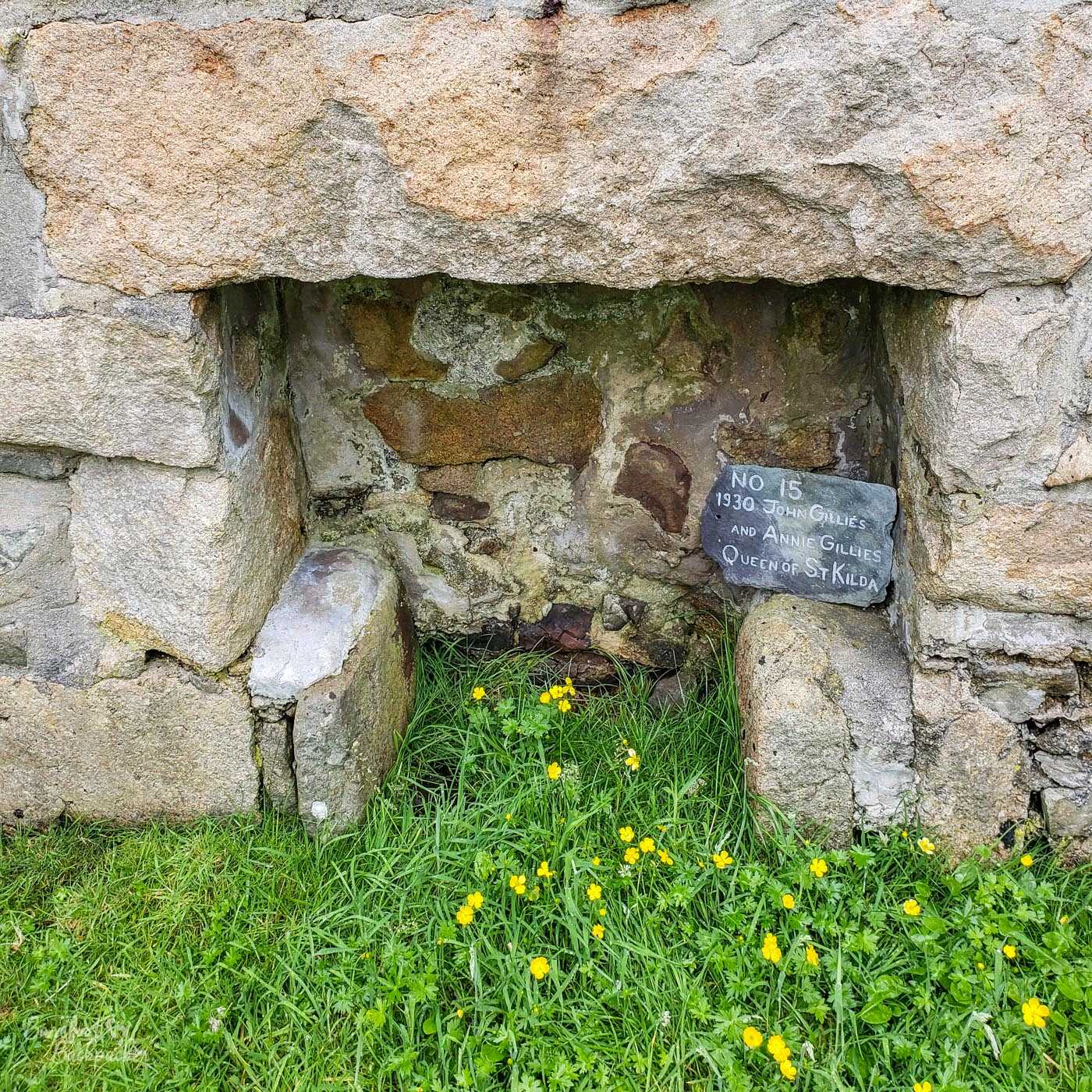
Stone fireplace inside one of the ruined cottages. The sign shows who last lived here and when; this was one of the last houses to be inhabited.
Although cleared of fixtures and fittings, and in some cases in quite severe disrepair, it’s still pretty easy to wander along, poke around inside, and get a good feel to how these people lived. The walls are quite thick so with the fire too they would have provided a good deal of protection from the Atlantic elements, but even so by modern standards they’re not ideal places to live. Some of the houses have little plaques inside that tell you who the people living in them at the time of evacuation were; their names, ages, that sort of thing. Abandoned villages like this are fairly common across Scotland, such as at Glendrian in Ardnamurchan, but each still has its own unique tale to tell.
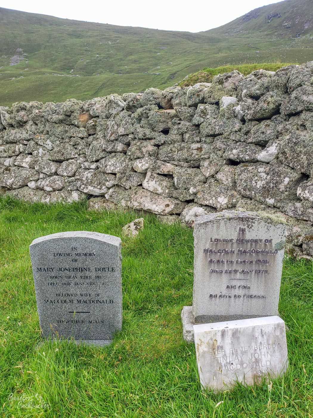
Graveyard on Hirta, St Kilda.
What’s quite interesting is that, while the village has a church (near the bay, and which you can still go in and look around – it’s presumably still consecrated and used), the graveyard is at completely the other end of the village. This is because the church that used to stand near the graveyard became too small for the population it served, so they had to build a new one.
How do you get to St Kilda?
Unless you work for the military or the National Trust, or are a noted biologist or bioscientist, pretty much the only way of getting there is to go on a tour through a recognised company. There’s a couple that run daily trips to the islands, mostly operating out of Leverburgh on Harris. You get about 4-5 hours on Hirta, where you can explore the village and the surrounding hillsides at your leisure, and the journey back takes you past the rock stacks and the birdlife. It’s not cheap for a day trip – when I went in July 2019 you’d be looking at about £220; when I was travelling around the Outer Hebrides and mentioning St Kilda, several people told me they’d love to go but they’ve never had the opportunity, either for time or for financial reasons. It is possible to stay overnight on the island, if you tell them in advance and take your own tent and supplies, but it means you would have to buy two trips, in effect, as you’d be taking a return place on two boats (if they leave you there it means they run on the return trip with an empty space, ditto on the trip where they pick you up). Obviously you also run the risk of being trapped there longer than you intended, if the boats can’t run on the day you’d planned to return.
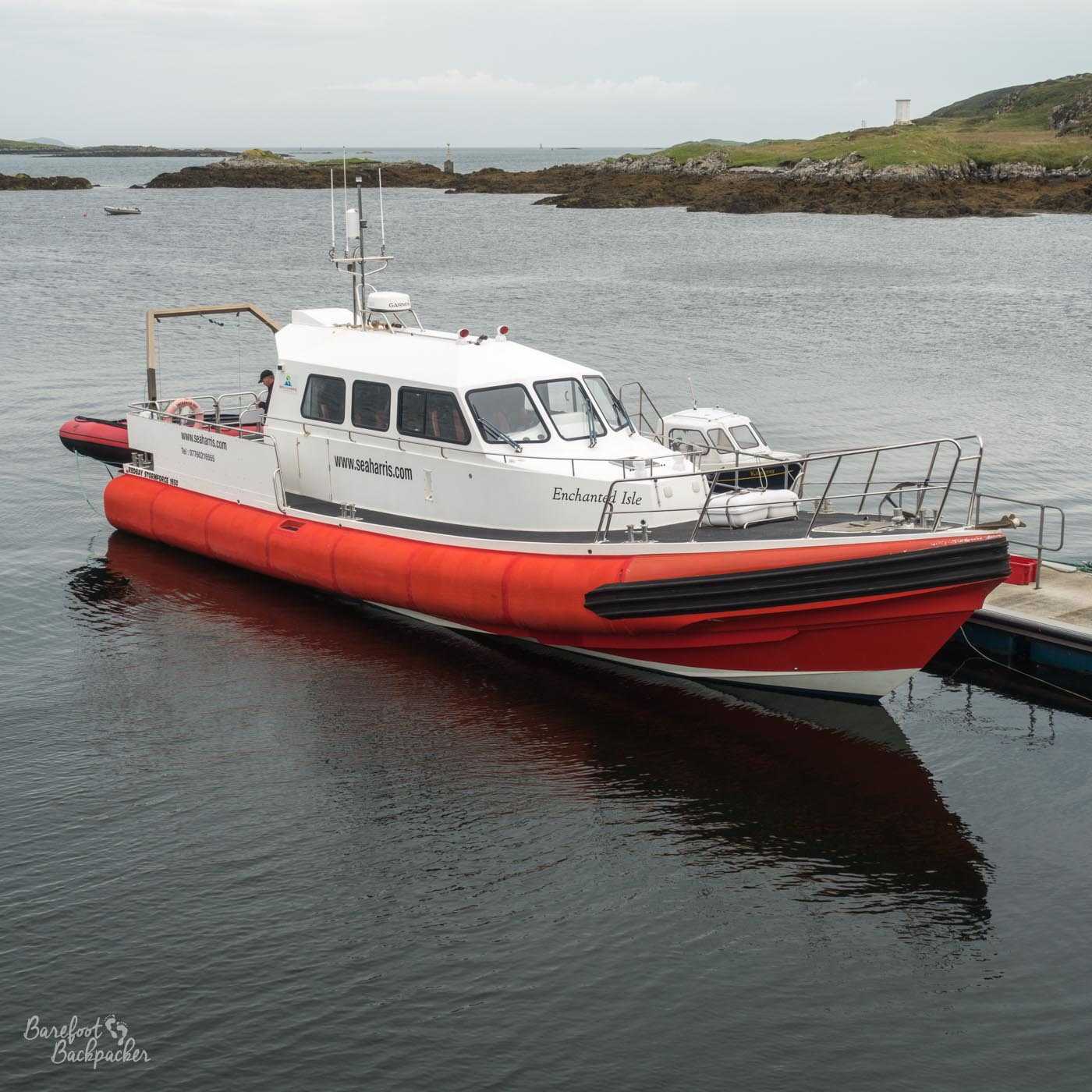
The boat that took me to St Kilda, in Leverburgh harbour.
As I said at the start, one of the major problems with visiting St Kilda is the weather. The boats that take you there are fairly sturdy and low-lying speedboat type things, but even they have trouble in gale force winds. The main problem though is the landing at Hirta; the boats themselves aren’t allowed to dock up on the shore and have to stay in the bay – this is mainly for environmental reasons. This means on arrival in the bay, you’re transferred off the boat onto a smaller vessel. The swell in the bay can make this a very dangerous job, and as a result the trips don’t operate in anything above forecasted force 5 or 6 winds – remember too that the winds over there could be stronger than the winds even in Harris, making this the only time I’ve ever paid attention to the Shipping Forecast for anything more than aesthetic pleasures.
How do you book a trip to St Kilda?
To mitigate for all this, booking a trip is quite unusual. Each trip can only hold about 12 people, but you don’t book for a day; rather you choose a two-day window – say ‘Monday and Tuesday, or ‘Wednesday or Thursday’. If you’re not one of the first 12 people to book that particular ‘window’, you go into ‘standby’. Essentially, what they’re doing is trying to guarantee passage for the first 12 people – if the weather’s fine on the Wednesday then they go, and those on ‘standby’ go on the Thursday. If, however, the weather on the Wednesday isn’t suitable for a trip, then those first 12 people go on the Thursday instead and the people on standby miss out. To complicate matters further, if the weather is borderline but scheduled (and pretty much guaranteed) to improve, it’s not unknown for the people on ‘standby’ to be given the Wednesday slot, allowing the initial bookers to be taken on a much better day for weather,
What’s the journey to St Kilda like?
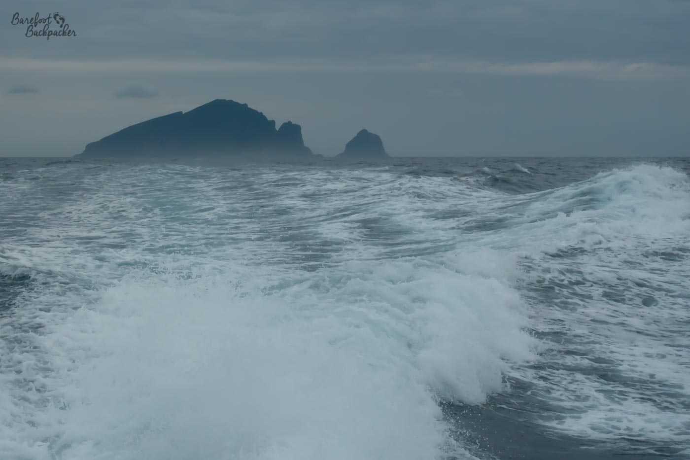
Sea spray as seen from the boat, with the St Kilda rock stacks in the distance. You can tell it wasn’t a calm day :p
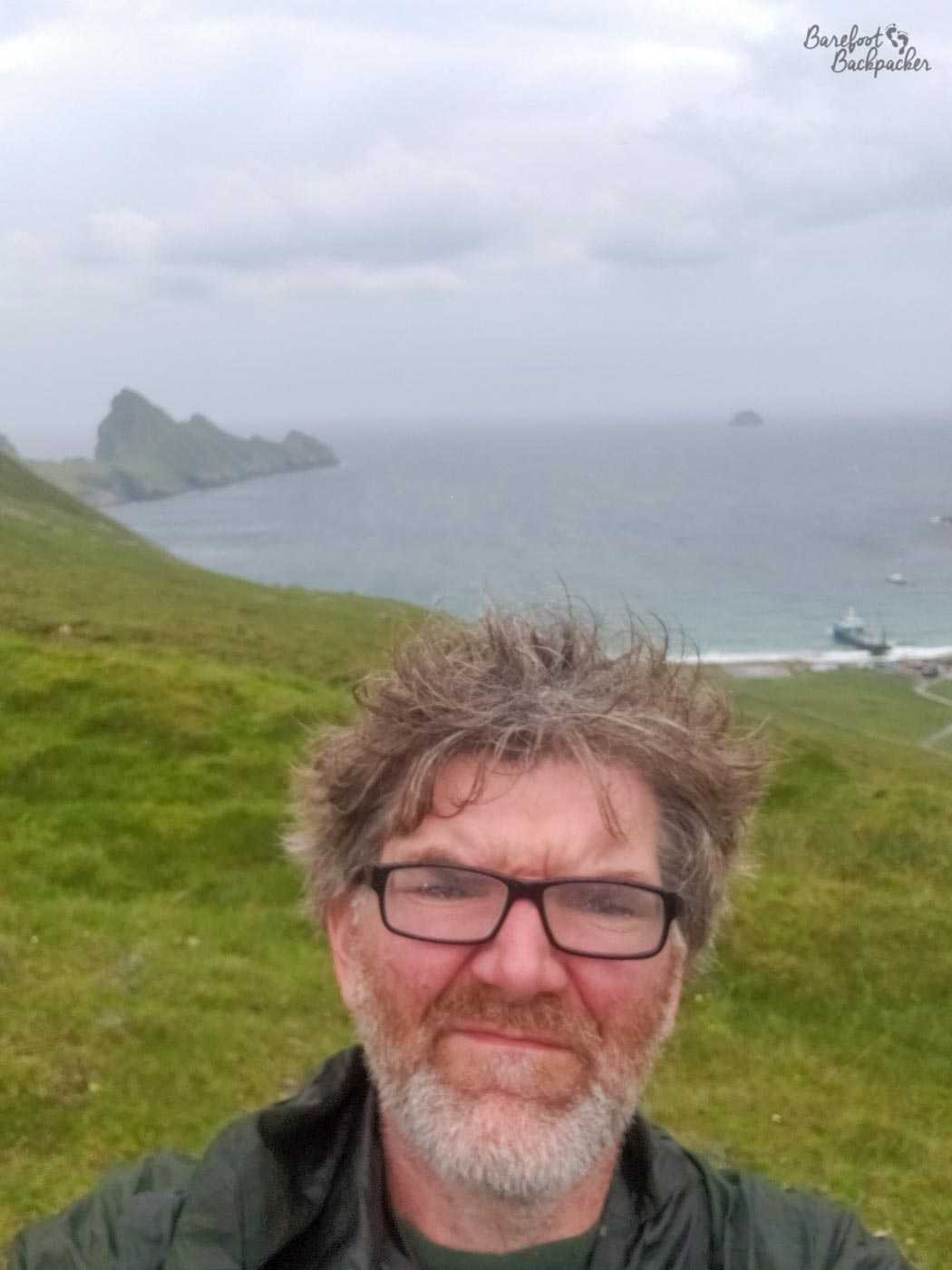
The journey over there takes a couple of hours, and can get quite rough. I was on Standby and it was pretty borderline as to whether we’d make it out on the Thursday or not – indeed one of the other companies who run trips decided they wouldn’t risk it that day. The day after was so windy, the ferries from the Outer Hebrides to the mainland were disrupted, and those are much bigger beasts than the St Kilda boats, so I think I just got very lucky; what it shows too is that no matter what the overall regional weather is like, St Kilda is so far removed and remote that it pretty much has its own climate, and brings to home just how bleak the islands must have been to live on; on top of the hill on Hirta I was wrapped in my coat, getting blasted by wind and rain in my face, and wondering what happened to summer. Despite going on what turned out to be the hottest day recorded in the rest of the country. A couple of people on my trip did feel a little seasick on the way there. The boats have an indoor area and some seating outside, which is great for getting the sea breeze and spotting the birds, but does get quite cold when the wind hits you.
One of the best things about the trip though is the view of Hirta once you glide into the bay. It’s an absolutely stunning vista – the shoreline is almost a perfect arc, the village is clearly visible in the distance, the steep hills defining the island stand upright and are a solid green against the grey backdrop, and it just feels somehow magical.
A different view of the harbour on Hirta, as seen from another hill.
Then it all goes awry when you realise you have to step into a small boat which is jolting up and down more than the height of the boat you’re on, and you realise that everything has a price.
For the purposes of my #E2WChallenge journey across the UK, while I was officially the furthest Easterly person in the UK in Lowestoft, I can’t say for sure I was ever the furthest westerly person in the UK while on St Kilda. I was absolutely without doubt the most westerly civilian, but I don’t know about any of the resident workers.
Hottest day ever recorded in the UK. I … have questions.
—
Visited: 25 July 2019.