The West Highland Way is the archetypal and most famous of the long-distance Scottish footpaths. In many ways it’s also one of the easiest – at 96 miles it’s long enough to be a challenge but still short enough that it never becomes a slog. It goes through and around some spectacular scenery but very little of it goes up and over the mountains. It also sticks mostly very close to either a main road or to a railway line, so getting on and off is really easy. And while it does sometimes feel really remote, the trail passes through, or at least close by, a couple of towns where you can stock up on food. Or just find a pub.
Because of its popularity, there’s a whole raft of people who have written about it, including the best way to hike it, how long it takes, what to pack for it, and the like. People who have made informative posts like that much closer to their niche than I. Examples include:
- My hiking buddy Becky The Traveller
- Ioanna, who is A Woman Afoot
- Sheree at Winging The World
Becky’s post I’ve listed first, btw, because I hiked the West Highland Way with her in July 2019, as part of our much longer Hike Across Great Britain, and her post about it details the trip we shared. If you look closely enough, you might even notice I’m on one of the pictures she’s illustrated her post with. I’ve also had to nick a couple of her pictures because it seems I didn’t take pictures at two of our camping spots.
As such, this post isn’t going to be a specific guide to the West Highland Way. Rather, it’s going to be more about my experiences of hiking it. Your Mileage May Vary (although not by very much; it’s not the easiest of hikes to take detours from!), but regardless, I hope if you decide to hike it, that you enjoy it.
What’s the West Highland Way like to hike along?
As stated, the West Highland Way is around 96 miles (154 km), and runs along part of the western side of Scotland (though, due to the geography of the area, it’s always quite far from the sea). Calling it the Highland Way is pushing it a little – it’s fairer to say it’s a path that goes more *into* the Highlands than through it for its entire length. Indeed the first quarter of it is pretty flat.
You can walk in either direction, obviously, but it’s suggested to make it a northbound journey. This is generally easier both logistically, as all the signage etc assumes you’re going North, and it means you don’t have the sun in your eyes the whole journey. In addition it also means the path steadily improves in ambience as you head along it; the feeling that you’re going somewhere. The disadvantage is there’s a couple of very steep sections, which we’ll come onto later.
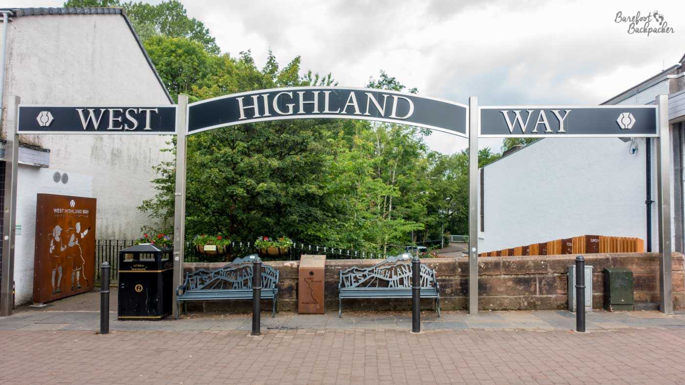
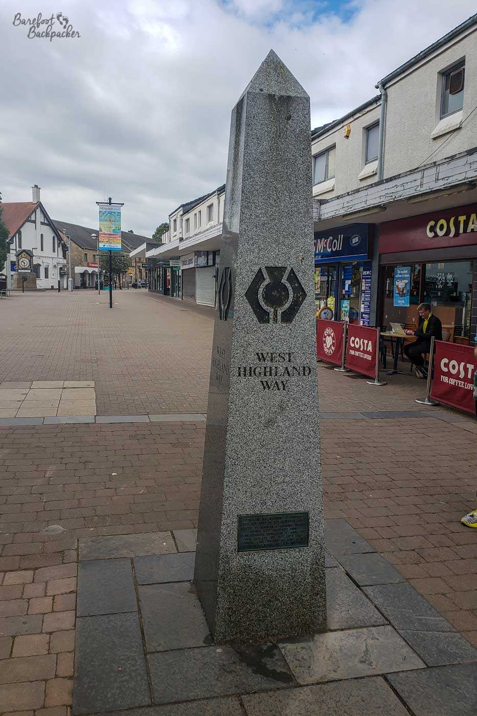
If going northbound, it starts in the incorrectly-spelt town of Milngavie, and ends in Fort William, at one end of the Great Glen that geologically splits Scotland apart. Milngavie is a town in Dunbartonshire but is effectively a Glasgow suburb, making it a really easy place to get to and start from. Indeed, the start of the West Highland Way itself is literally on the High Street, and very close to a large supermarket.
What a beautiful location for the start of the hike.
The first quarter of the trail, to Loch Lomond, is pretty flat. After a short hike through woodlands on the edge of Mugdock Country Park, there’s a long section along a disused railway line (closed to goods traffic in 1959) until just after Gartness, when you hit a few country lanes. Avoiding Drymen, the path goes through Garadhban Forest before hitting Loch Lomond. A side path here goes up and over Conic Hill, which at 360m makes it by far the highest point reached thus far en route. There’s a good view from the top that stretches out over much of Loch Lomond and the surrounding countryside. You could climb nearby Ben Lomond; at 974m it’s one of the most accessible of the high mountains in the country. We didn’t.
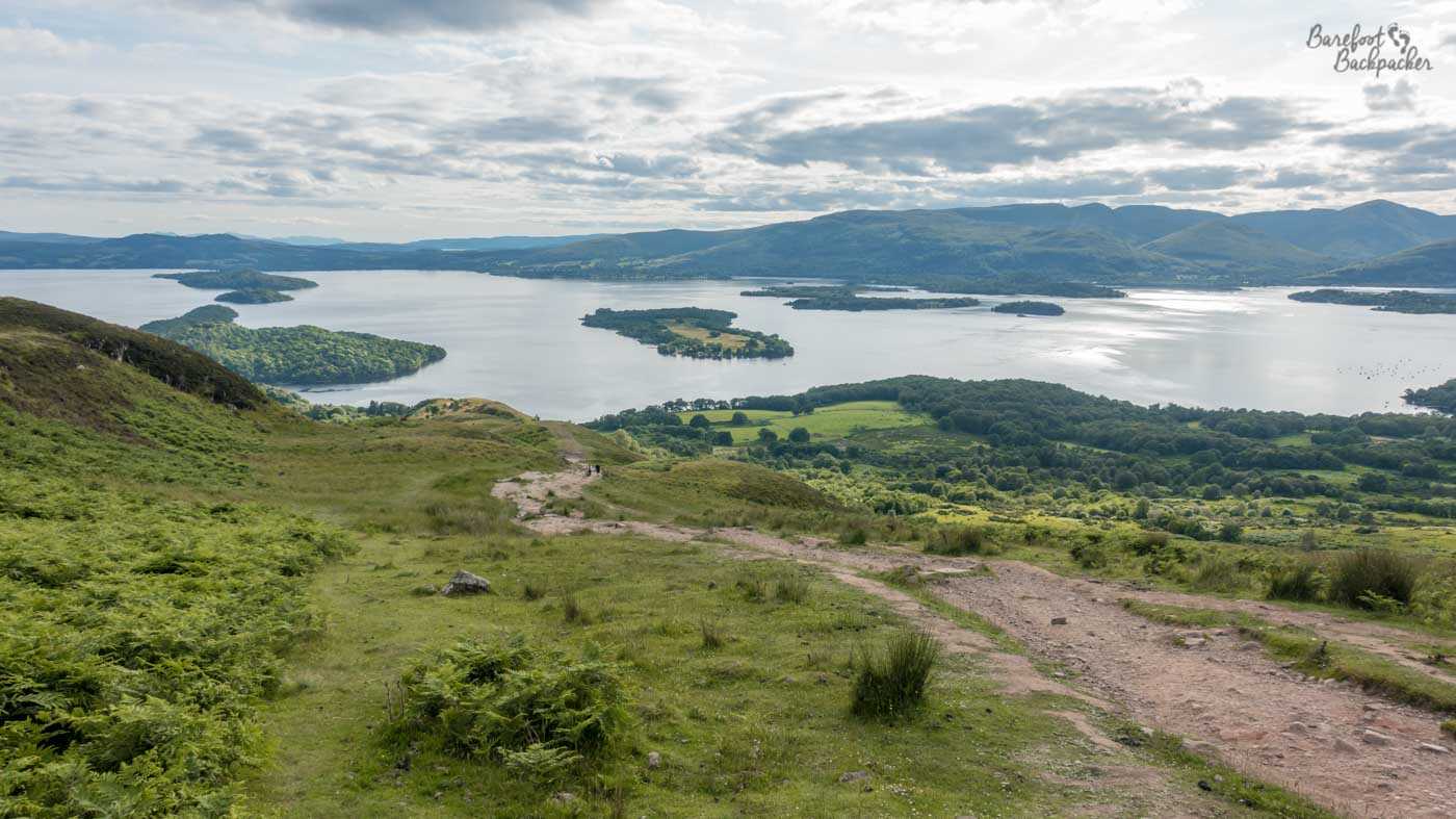
View of Loch Lomond from the top of Conic Hill.
The section up the eastern side of Loch Lomond is either: really interesting and fun, if you’re an experienced mountain hiker looking for an easy and varied change; or it’s annoying and stressful, if you’re a 1m90 tall dyspraxic wearing sandals that in damp conditions allow the foot to slip inside them just that bit too much.
The trail for much of the length of Loch Lomond looked like this. It was very hard, mentally, for me. Pic by Becky.
It’s over a day hiking along a stone trail in woodland, pretty much at the loch’s edge, but rather than being flat it’s constantly up a couple of steps then down a couple of steps; well, not ‘steps’, just endless small boulders and tree roots. It’s really hard to get into any kind of rhythm on this section and I was constantly over-thinking about where to step without slipping or tripping. Still, the setting is lovely and there are times when you can even get into the water.
Baby Ian and Dave enjoying the ambiance at Loch Lomond.
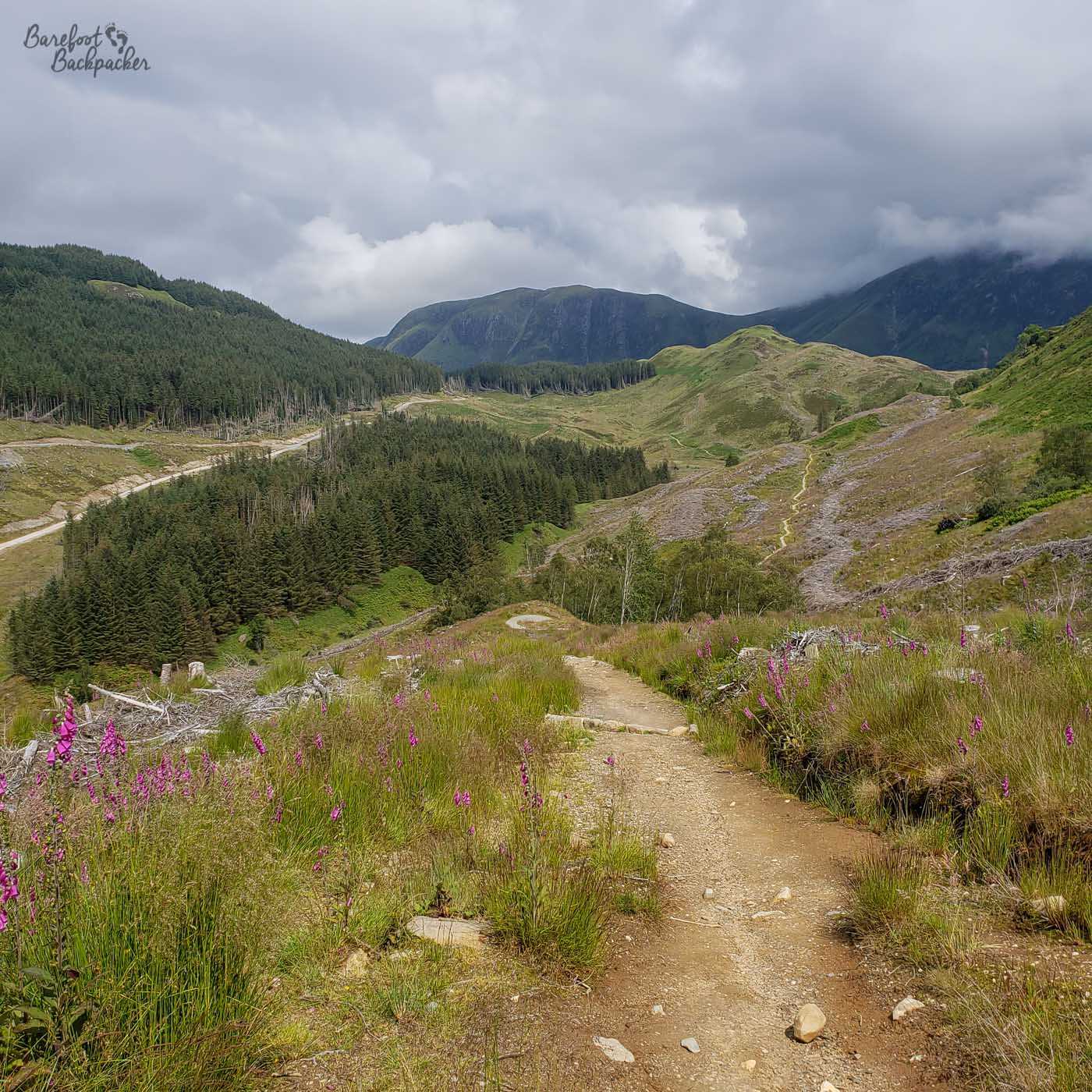
Once you’re north of Loch Lomond the path settles down a bit, running along Glen Falloch and through a series of woodlands around Crianlarich and Tyndrum. Here is where it starts to get generally hillier, and more the scenery you might expect from the West Highland Way. Beyond Tyndrum, the path follows the Coire Chailein and Kinglass rivers and here the land is much more open, almost wild countryside. The path is squashed between the A82 main road to the Highlands and the railway line to Fort William, along the river valley as it divides the higher land either side. In a sense, this is where I felt the Highlands started.
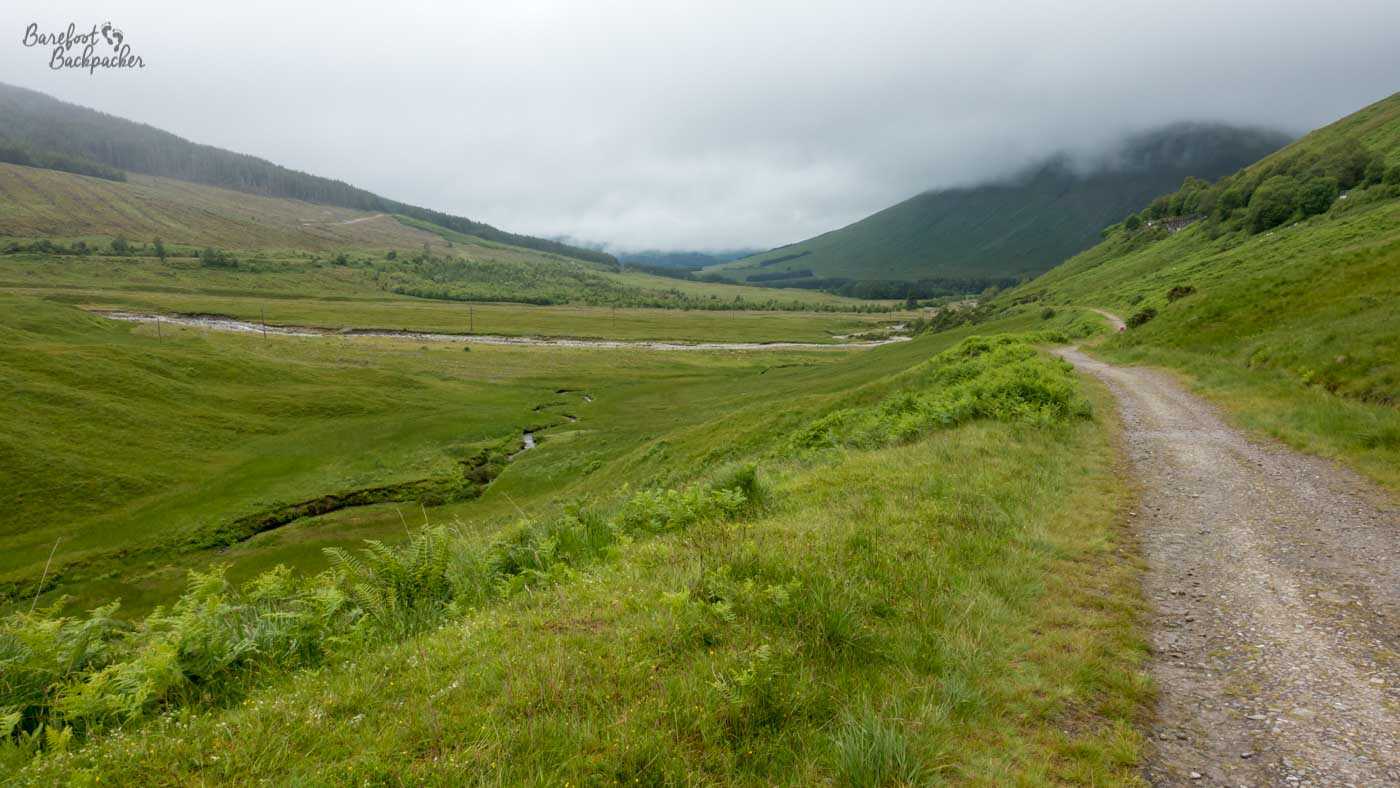
The path between Tyndrum and Bridge of Orchy.
After crossing the River Orchy, the path becomes an old drovers road. It’s one of many in the region used and designated by the military in the early 1700s – they were created largely by General Wade and his successor, Major Caulfeild, for, uhm, ‘reasons‘. Some, including this one, were later upgraded in the 1800s by Thomas Telford, who also incidentally built the Caledonian Canal that runs the length of the aforementioned Great Glen. And lots of other roads, canals, and bridges across the UK. This particular military road runs around 320m in altitude at the foot of the Lorn Mountains on the western edge of Rannoch Moor, before crossing Glencoe and taking a short-cut to Kinlochleven. At the point it finally bades farewell to the A82, it rises 260m in 1.8km in a switchback path; the incline being known as the “Devil’s Staircase”, in reference to the pain the soldiers felt transporting stuff up and down it.
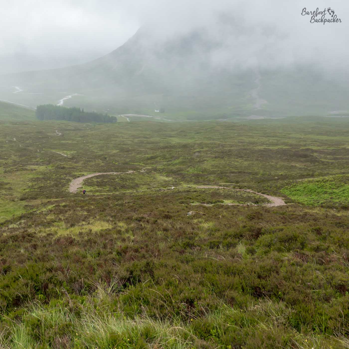
You can’t easily judge the steepness of the path here but you can see the way it meanders. You can also, if you look closely, see Becky hiking up it.
The rest of the West Highland Way is pretty much simply this old military road wandering through remote countryside with substantial hills on either side, punctuated only by a descent to and then a very steep ascent from the village of Kinlochleven, at the end of Loch Leven. It’s the last place with a shop en route to Fort William, 15mi/24km away. This ascent, btw, was notable on our hike because we passed lots of people struggling up with daypacks. By this point we were so fit that we were pretty much running up that hill even with 20kg backpacks.
Much of the land here, especially on the run up to Glen Nevis, has been deforested over the centuries, leading to wide open spaces with not much in them. Although the old military road section ends at the campsite at the foot of Ben Nevis, you can never actually see the UK’s highest mountain from the West Highland Way, as there’s always another mountain in the way. We were going to climb it, but we … didn’t. Honestly, I think because we just wanted to get the full Hike Across Great Britain over with by that point. Or because Becky didn’t trust me climbing it and surviving. Either way.
The scenery around Glen Nevis – the mixture of bare hills and deep forest.
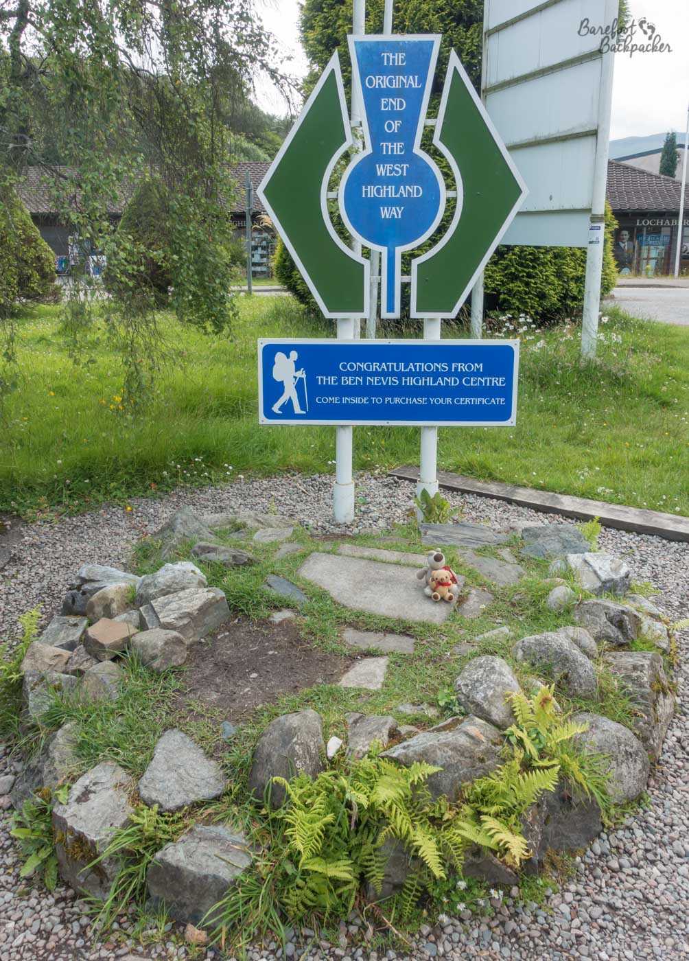
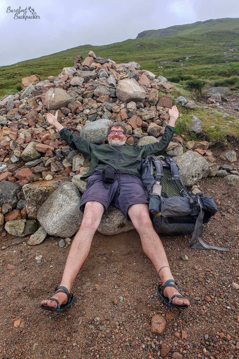
The final couple of miles into Fort William are somewhat of an anticlimax as the official path follows the main road along Glen Nevis. There is an alternative route that goes over the wonderfully-named Cow Hill, but because Becky is a stickler for doing things right (on the Pennine Way we turned back at one triangular junction to retrace our steps about two metres just so she could say she followed the designated route rather than taking the third path around the junction), we trudged along the footpath by the roadside. Interestingly, the West Highland Way has two end points; the original which lies to the north of town, where the main road (A82) heads off north along the Great Glen, and the new end point partway down Fort William’s main high street. I mean, most hikers would probably have done that bit anyway, so it seems a little superfluous.
Reader: we did not purchase our certificate. Nor did Baby Ian and Dave.
Fort William’s a sizeable town and a good place to take onward connections for other hikes; we headed west to Ardnamurchan but alternative long-distance hikes from here include going back over Rannoch Moor to the east, up the Great Glen Way to the north-east, or heading due North along the Cape Wrath Trail to Cape Wrath itself, the remote most north-westerly point of Great Britain. As such, the town is great for stocking up on hiking and camping equipment.
Where did you stay on the West Highland Way?
We had four nights on the West Highland Way and this covered a variety of settings, although three of them were in a tent.
Scotland has legislation allowing you to camp pretty much anywhere, albeit with a few set criteria (mainly to do with distance from housing which, once you get beyond Balmaha at the south end of Loch Lomond, isn’t really an issue). One of the major local restrictions though is, during summer at least, you’re not allowed to wild camp for much of the section along the eastern bank of Loch Lomond, where the trail goes. There are signs at either end of the restricted area reminding you of this. Fortunately, there are official campsites at points along; we stayed our first night at Sallochy, which is a lovely little spot in the woods. Complete with midges.
View from the Sallochy campsite. Pic taken from Becky’s website because I’m inefficient.
Our second night was at one of the bothies en route, at Doune Byre, very close to the northern end of Loch Lomond. A bothy is basically a stone building, like you’d find in a farm or maybe as an old crofting cottage, that people use to rest, lunch, or even sleep overnight in. For the most part they’re owned/operated by the Mountain Bothies Association, but they’re open access and free. Think of it as being a bit like camping, but indoors. Don’t expect any luxuries.

Doune Byre bothy, before the rains came.
Ours was a large space and had a fireplace, but we had to source our own wood and fuel to light it. There were also a couple of flat stone raised platforms that people can use to sleep on. This was useful as the next morning I discovered a mouse had nibbled inside one of the small pockets of my backpack to get at some nuts I was carrying. I still ate the nuts later. We were first to the bothy that day, but by the time we went to sleep we’d been joined by at least five other people, all of whom were also hiking the West Highland Way. A couple of other people came in late but realised there wasn’t much room, and headed off again. To be fair there’s a campsite at Inverarnan, only 4km further north. Though it did start raining quite hard overnight. No midges though.
Night three was spent on what might be regarded as an unofficial campsite. We’d been looking for flat land on the walk along the Kinglass river but nothing seemed suitable, and it wasn’t until we reached Bridge Of Orchy that we found somewhere. Opposite the Bridge of Orchy Hotel, on the far side of the river, is a large grassy area with picnic tables; when we arrived there were several tents already set up there. It seems this is a popular place to set up camp, even if it feels like it stretches some of the spirit of the wild camp legislation somewhat . It’s a pretty spot, right next to the river, with small rapids and a bridge. Unfortunately, rain and midges.
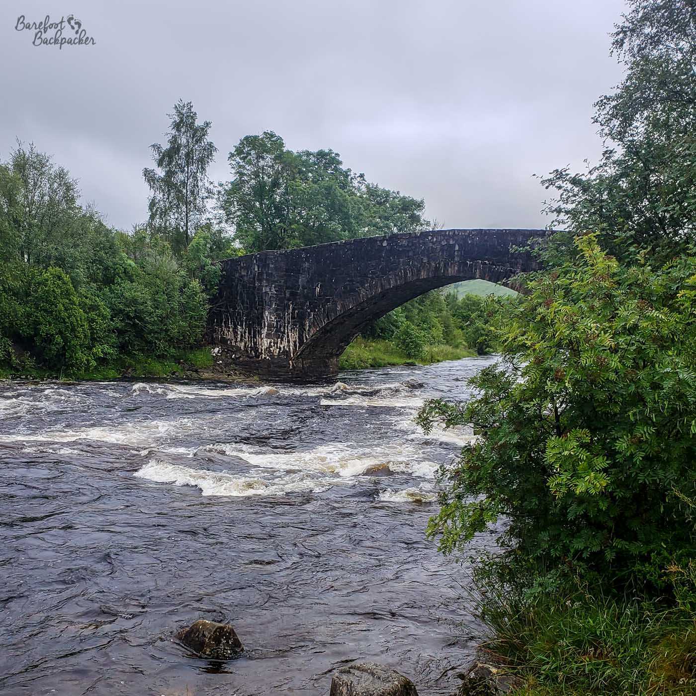
The Bridge Of Orchy itself, taken from the camping area.
Our final stop was … somewhere on the Old Military Road, up the hill on the southern side of Kinlochleven. It wasn’t a passing place or a lay-by; it was a specific patch of rough and unused ground next to the road, but it had the vibe of being somewhere we’d get beeped at for being in the way. We never were, obviously. We wanted to find somewhere before we reached Kinlochleven and that was the best we managed. Some midges present, and the rain came down just as we were packing away the next morning.
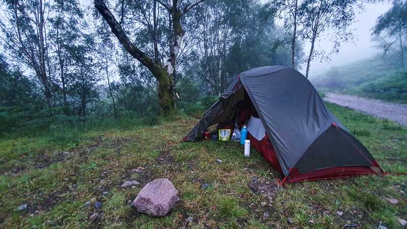
Wild camping by the road near Kinlochleven. Pic is Becky’s and it is her tent; I’m kind of just behind and to the left of where she took the pic from.
We were lucky enough to grab beds at one of the hostels in Fort William on the final night.
Does it rain much on the West Highland Way?
So, there’s no easy way to sugarcoat this. Parts of Western Scotland get over 2000mm of rain on average per year, and Fort William itself is regarded as one of the wettest towns in the whole of the UK. While true that the majority of this rain falls in the winter months, there’s certainly no guarantee that any attempt to hike the West Highland Way won’t result in periods of you resembling a drowned rat.
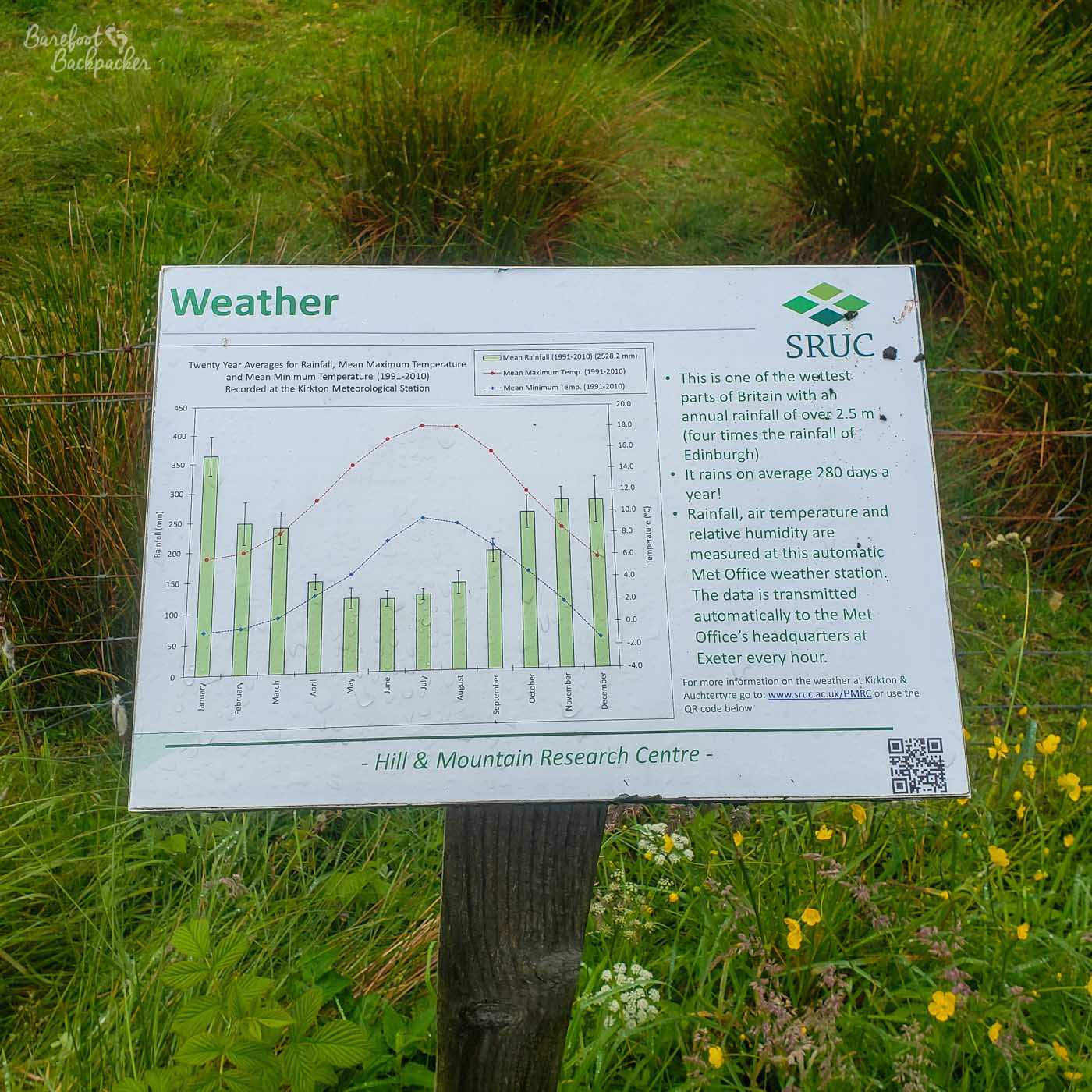
A sign near St Fillan’s Priory that tells us it rains a lot here – like, 3 in every 4 days.
The hike I did took 4½ days; it rained for part of the second, most of the third, and half of the fifth, which in the greater scheme of things actually wasn’t too bad. It did make that third day quite a slog, but the majority of it was through forest and, it must be said, we spent about two hours in a cafe just past St Fillan’s Priory at lunchtime while the worst of it passed over.
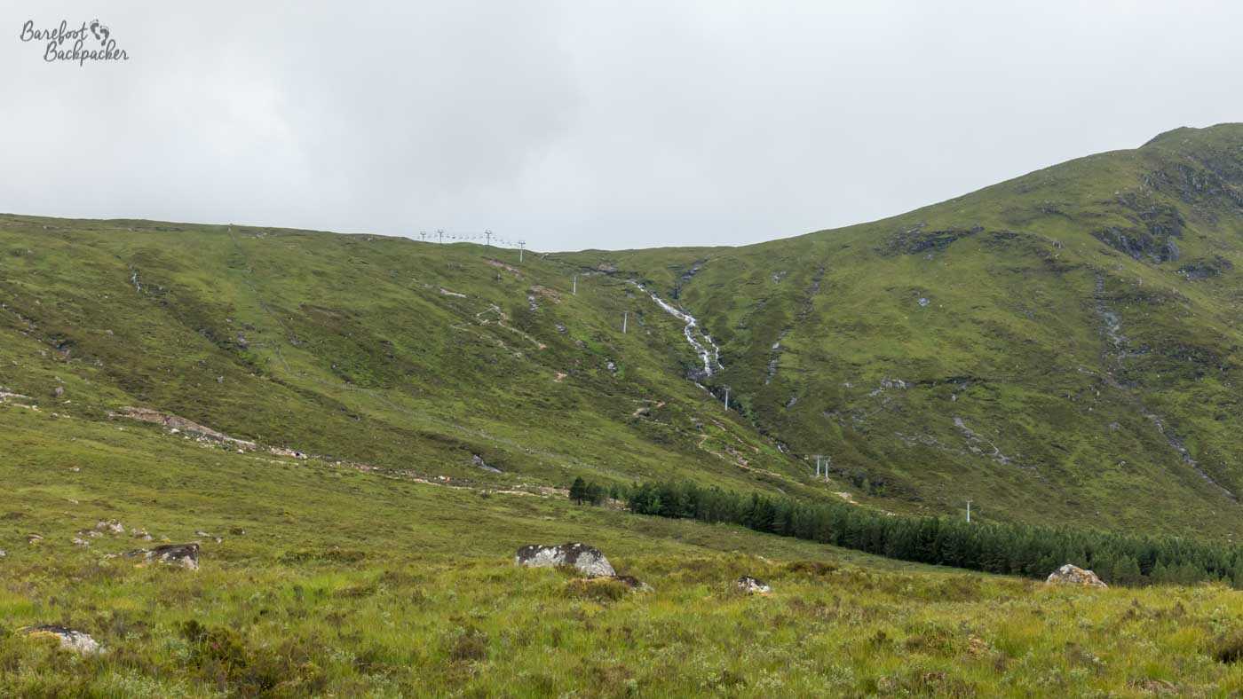
A ski resort at Glencoe. In summer. Snow not in evidence.
Obviously, hiking in July, we didn’t come across much in the way of snow, so the Glencoe ski resort was pretty quiet. That Scotland has ski resorts is something that never ceases to amaze me; I know we have mountains and I know those mountains do get snow in the Winter, but they’re hardly the Val-d’Isère.
You’d have hoped the rain would drive away the midges, but no, they like damp and humid conditions, of the kind that are very common in western Scotland. Only the wind does that. And we didn’t experience much wind on the hike, though it is why they’re far less of a problem on western islands like the Outer Hebrides.
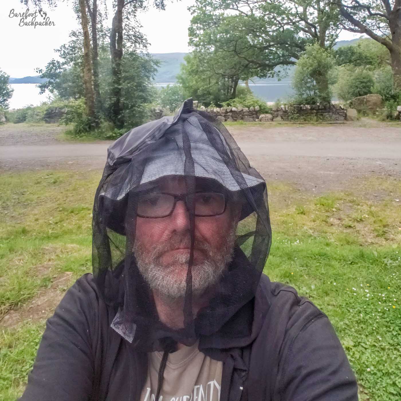
Wearing a midge net at Sallochy Campsite. It was unfortunately necessary.
Oh, yeh. The midge. Culicoides impunctatus. Annoying little creature. Most active early morning and mid-evening. You think you’re safe to cook outside, when all of a sudden … zoom, and everything is covered in a legion of little biting insects that are almost impossible to swat away. I wouldn’t normally recommend dangerous chemicals, but hike the West Highland Way without some kind of DEET and see how long you last, ya know?!
What interesting things can you see on the West Highland Way?
As befits a footpath almost 100 miles long, there’s quite a lot of things to see along the West Highland Way; aside from the obvious like mountains, forests, and lochs, there’s all manner of smaller things you might not necessarily spot if you weren’t looking out for them. This section is mainly going to be pictures, which Past Me will have griped about having to find, edit, write captions and alt text, and upload. There’s a reason I do podcasts.
Four miles into the walk, just after the forest section north of Milngavie, on the left of the path going northbound, is a small cottage called “The Shire”. I can tell you nothing about the place; I don’t know if it’s someone’s house, if it’s a holiday cottage, a business; it’s not even on Google Maps. However it’s an eclectic mix of gnomes, stone animals, and lots of colourful accessories that it would be a shame to miss.
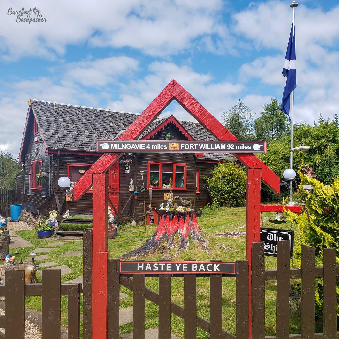
Someone loves this place.
A few miles further on is the Beech Tree Inn at Dumgoyne. Leaving aside its history as a railway station, and obviously it being a spot for lunch (or would be if we didn’t have our own food etc), it’s also home to a random couple of huts of small ponies. In fact the Inn has a menagerie of small animals (eg guinea pigs), presumably to keep the kids busy as there’s not much else around here.
Once the West Highland Way reaches Balmaha there’s a couple of things to look out for. Balmaha itself is quite a pretty place, although because of its location (being one of the first towns on Loch Lomond), it’s often quite busy with tourists and hikers. By the shore of the loch though is a small memorial area to Tom Weir.
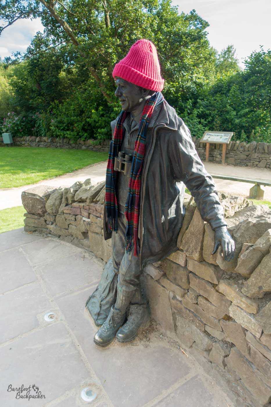
The statue of Tom Weir.
He was a climber and broadcaster who for a period of time hosted a programme on STV (the main ITV television region in Scotland) called ‘Weir’s Way’, where he’d go wandering all over Scotland and speak to people along the way. Similar to how celebrities do travelogues these days, but this was obviously much more genuine. He was born in Glasgow and is buried in nearby Drymen, along with (the ashes of) his sister, actress Molly Weir who for people my age is likely best known as having starred in the TV series Rentaghost. Which I never watched.
But anyway. Just north of Balmaha is the weirdest-looking war memorial I’ve seen. It’s a ring of metal, with a pyramid built inside the bottom of the ring. While it looks quite ‘at ease’ in its location, and reflects the environment it’s located in – the pyramid representing the nearby mountain Ben Lomond – it looks very odd for a war memorial. It’s part of the Ben Lomond National Memorial Park, and is dedicated to ‘those who gave their lives in the service of their country’ according to a nearby engraving on top of a tree stump.
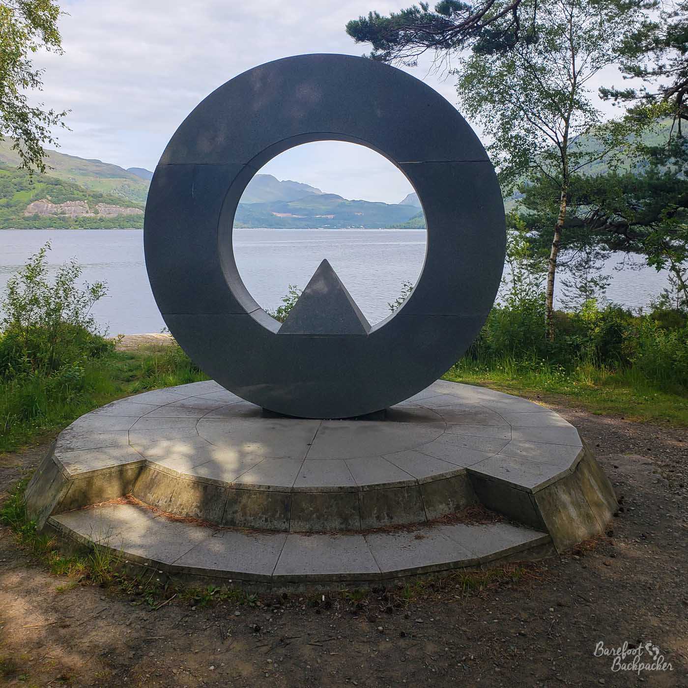
It looks cool but without reading the nearby blurb, I’d have no idea what or why it was.
Along the section from the northern edges of Loch Lomond until the path leaves Glen Falloch just SW of Crianlarich, there are a couple of waterfalls – the most notable are the Falls of Falloch, but these were slightly tricky to see from the path for us (better access is gained from the other side of the river), but slightly further back towards Loch Lomond are a series of cascades that don’t appear to have a name, but which are clearly visible and look pretty swell.
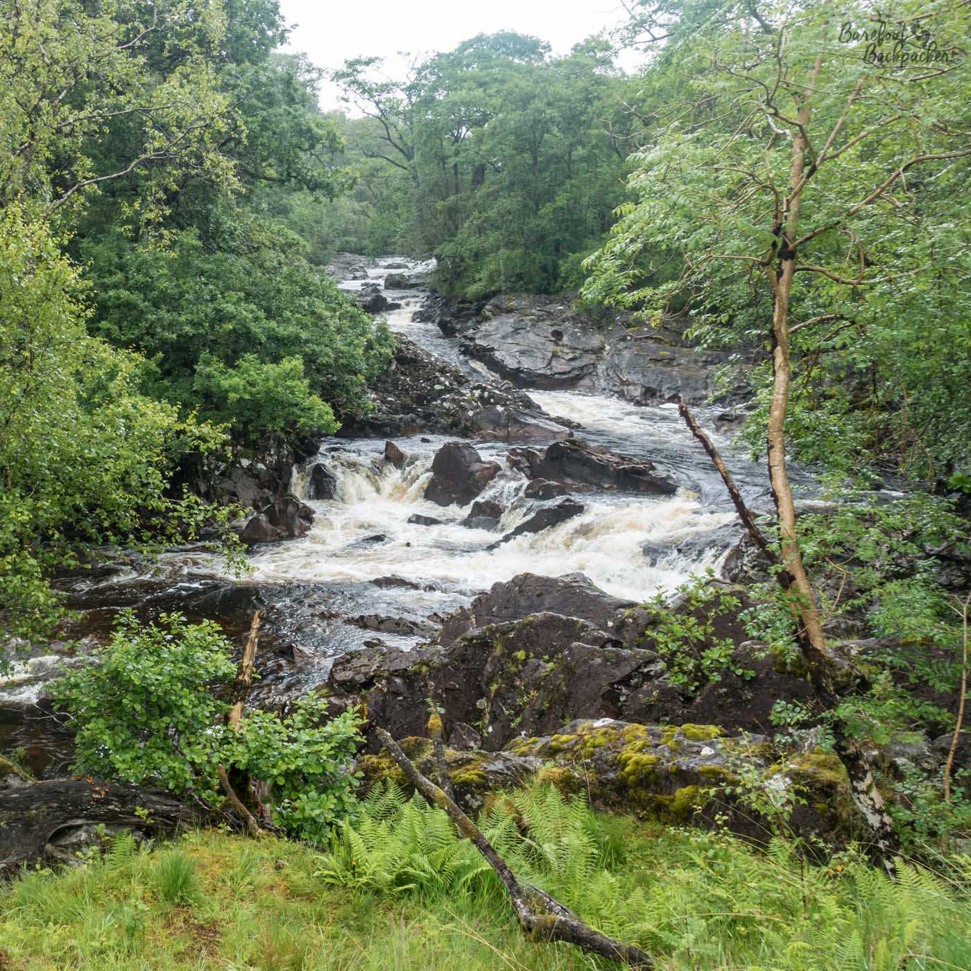
One of the examples of rapids, cascades, and mini-waterfalls present along the stretch of the hike from Balmaha to Crianlarich.
Between Crianlarich and Tyndrum are several curious sites that are easy to miss. The first are Kirkton Burial ground and the remains of St Fillan’s Priory. While most of the graves date to the 18th and 19th centuries, a couple of much older stone slabs were found here that are believed to be from around 1,000 years earlier. One of the stones found was believed to have been engraved with an arm, a reference to St Fillan himself.
The priory was endowed by King Robert the Bruce in 1317, which suggests the abbot ‘reused’ an existing (or at least already known) place of worship. Although little remains now, it seems the Priory was around 50m in length, and was believed to have been a place of some importance, having a number of (mostly now lost) holy relics.
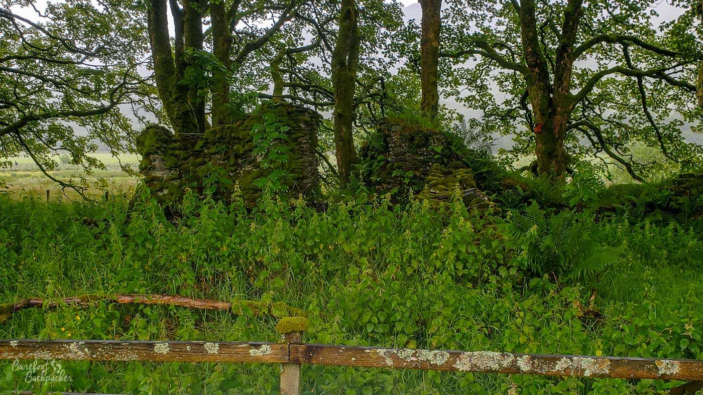
All that remains of St Fillan’s Priory, demolished around 1600.
As to St Fillan himself, he was a Christian missionary from Ireland around the 8th Century who made a couple of the valleys here his home; he is thus contemporaneous with the early stones in the Kirkton Burial Ground. He was said to have had healing powers, and his left arm was alleged to glow in the dark, giving him the power to write and copy holy works over the long Scottish Winter evenings.
Now, I mentioned Robert the Bruce a couple of paragraphs ago. He has another connection to this specific part of Scotland; he lost a battle here in 1306 at Dalrigh, the next village along. The backstory is a tale for another time, but essentially his army was fleeing from having catastrophically lost a battle near Perth against the English King Edward I. Upon reaching Dalrigh, his way through the rest of the valley was blocked by the MacDougalls, who supported Edward. He barely escaped with his life, and his army was pretty much annihilated.
You might well then ask, how (and why) could he have given funding to build a priory here a decade later? Well, he fled eventually to Ireland to recuperate (and it’s here the myth of him in a cave watching a spider comes from), before launching a fresh attack on Scotland the following year. This time he was more successful, waging a very successful guerilla campaign, culminating of course in the famous Battle of Bannockburn in 1314 over Edward I’s son (obviously called Edward II because English kings only ever had three names). One of the myths around the battle is that, just prior to it, Robert obtained a reliquary of St Fillan (an arm-bone, obviously, but not necessarily *that* arm bone) and this helped him win the battle, so it would make sense to reward the Saint’s memory with his own priory.
As a side issue, one of the tales around the Battle of Dalrigh is that, before fleeing from the battlefield, the few that remained in Robert’s army, including Robert himself, threw their weapons into one of the small lochs nearby, including his personal longsword. Despite recent exploration into the lochs using metal detectors, no weapons cache has ever been found, so either someone retrieved them in the years following the battle (maybe Robert himself upon his return), or this is just another local myth.
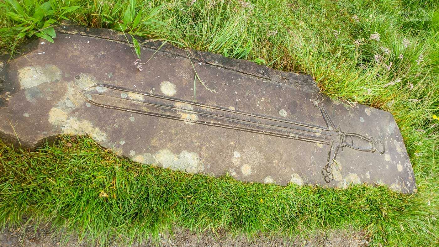
A representation of Robert The Bruce’s sword.
Once you get beyond Tyndrum, and into the Highlands and the moorlands, there’s not a lot to observe apart from hills and valleys. Kingshouse, just beyond the Glencoe skiing resort, is now one of the main accommodation sites on the West Highland Way but it has a long history. It was built around 1750 as a barracks (as it stands on one of the old Military roads) but also as a ‘safe house’ and inn/restaurant for travellers; pretty much exactly what it does now, in fact. Obviously it’s expanded and been repaired quite a bit since then; in fact one of the complaints back in the 18th century was its location meant it required a lot of upkeep (it was a very weather-blasted place) but equally it wasn’t deemed important enough or in an easy location to be maintained well.
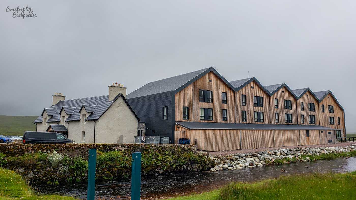
I’d imagine this looks very different to what travellers would have seen in the 1700s.
The last spot on the West Highland Way worth mentioning, just above Glen Nevis near to Fort William, is somewhere we never got to, tho we saw the signpost for it. Not that there’s a lot to see; it’s a small array of stones on top of a hill; easy to miss even if you were standing amongst it. This is the site of Dun Deardail, an iron-age hill fort notable for being vitrified’ at some point in time. Vitrification is the act of rendering a substance into glass, and requires a large amount of heat (this is rock, remember). This isn’t accidental either – to achieve this requires very controlled application of heat, and, for example, lacing the ramparts with burning wood. No-one really knows how or why this was done, but historians have suggested either it was a ceremonial event to commemorate the passing of a King, or an attacking army making sure the fort was completely destroyed and no-one could ever use it again. It’s not just a one-off either – this fort was one of a whole series of similar structures in this part of Scotland which have all been vitrified.
Maybe it was aliens. Reader: it was not aliens.
We never did find “Rob Roy’s Prison” or “Rob Roy’s Cave”; caves on the banks of Loch Lomond in that awkward up-and-down section. Both are places that Rob Roy is supposed to have holed out to avoid capture (the ‘prison’ being where he imprisoned people, not where he himself was imprisoned). Possibly we didn’t quite know what we were looking for in the first place, mind. Anyway, they’re there, somewhere; have fun exploring.
Can you hike the West Highland Way barefoot?
No. Well, I mean, you can, if you’re a masochist. I wouldn’t.
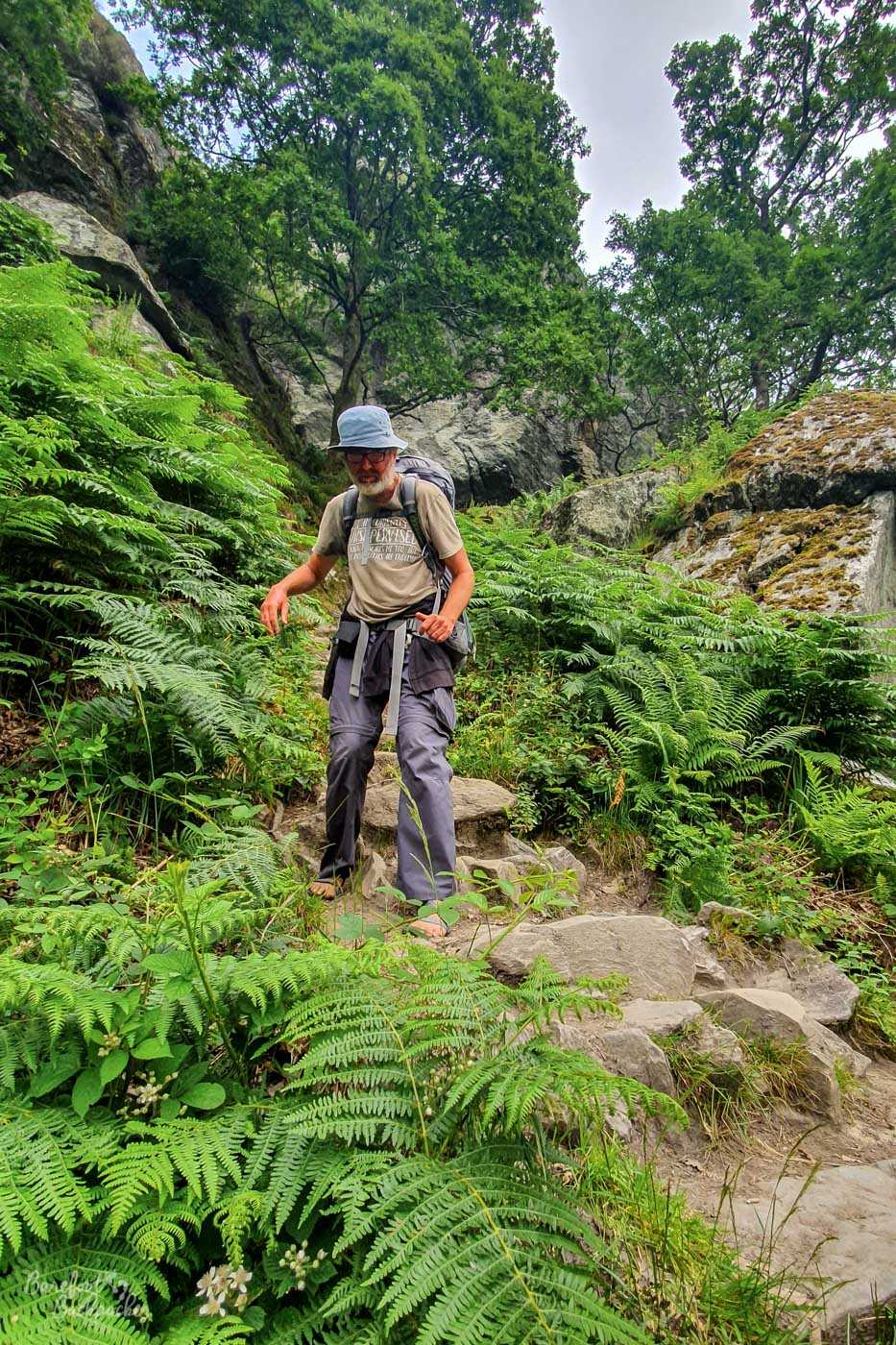
The main reason for this is that for the majority of its length, the trail is gravel, rather than paved, grass, or mud/stone – even the old military/drove road section near Glencoe is rough stone underfoot. The section along Loch Lomond is more rocky, but even there there’s a lot of rock chips on the ground that act in the same manner. I don’t know about you, but I’m not fond of walking barefoot on gravel in the first place, let alone when I’m being weighed down with a 20kg backpack.
Minimalist Hiking Sandals. I mean, you don’t think I’d actually wear *boots* do you?!