Overview
The Sunshine Coast of Australia is, well, it’s a legion of seaside resorts. It’s the less-noted cousin of the Gold Coast further south – one of the reasons the Gold Coast is so well-known and popular is because it’s so close to Sydney, whereas the Sunshine Coast is a little more ‘provincial’, lying 100km north of Brisbane. In addition, a little further north is Fraser Island so it’s a region that many people may well quickly pass by along the well-named ‘Bruce Highway’ (named after the State of Queensland’s Minster of Works in the 1930s, and not a reference to the Aussie bloke stereotype; there is no corresponding ‘Sheila Highway’).
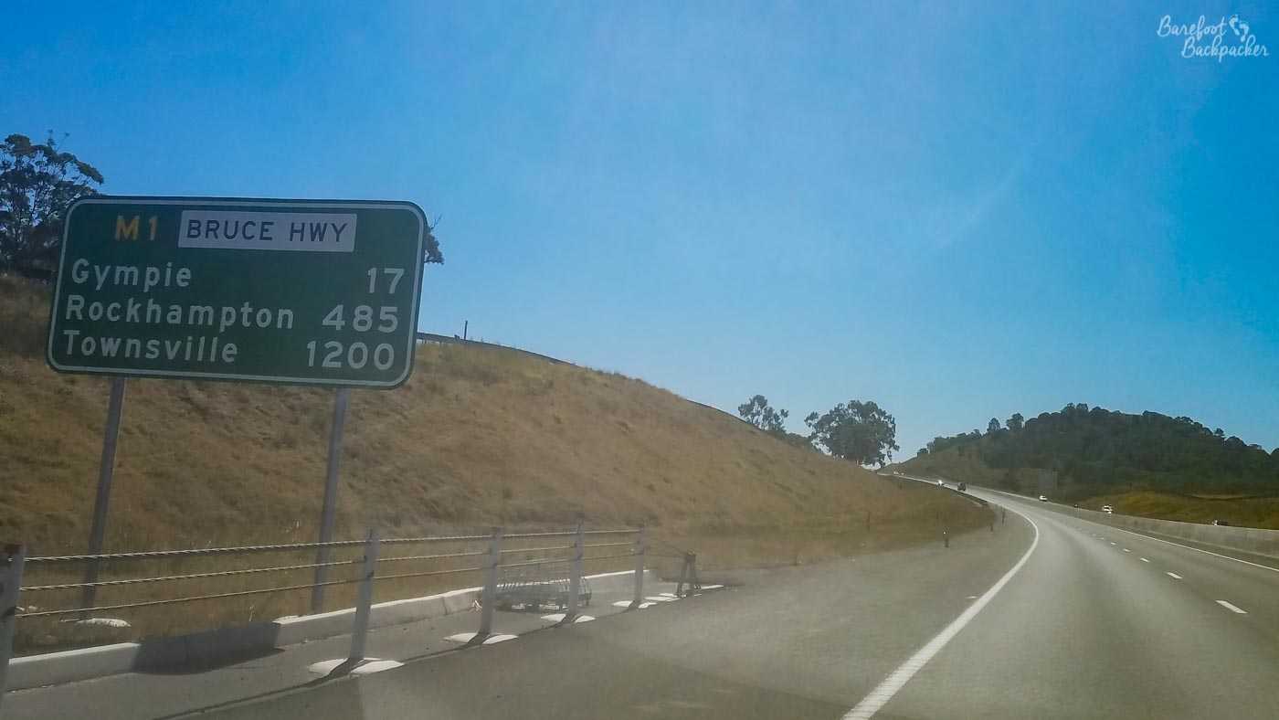
The Bruce Highway. Even though that’s in km, it’s still clear how big Australia is!
There is another difference too – I’ve got the impression that the Gold Coast is more of a party-and-surf area, while the Sunshine Coast seems to be more of a place where people would retire to; a little more relaxed, a little quieter, and a bit prettier. Life here feels pretty relaxed and casual (the sort of place where even in the middle of winter, about 10% of people go to the supermarket barefoot, so it’s not like I felt out of place).
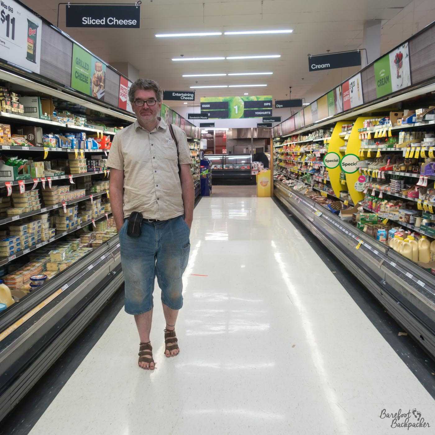
Barefoot in the supermarket in Nambour.
That of course doesn’t mean it’s not worth considering, and there’s certainly things in the area that warrant some time. Obviously though this is me writing, so there won’t be a list of ’23 interesting things to see’ or ’14 places to eat’ on the Sunshine Coast. Rather, this is an overview of my three visits to the area over the many years.
I’ve been there more times than most other places, simply because I have a penpal there. Well, I say penpal. While Lisa started as a penpal in about 1998, we mostly chat online now. This also makes it one of the few places (like Belgrade) that I’m writing about through experiences gained being with a local resident rather than as a tourist.
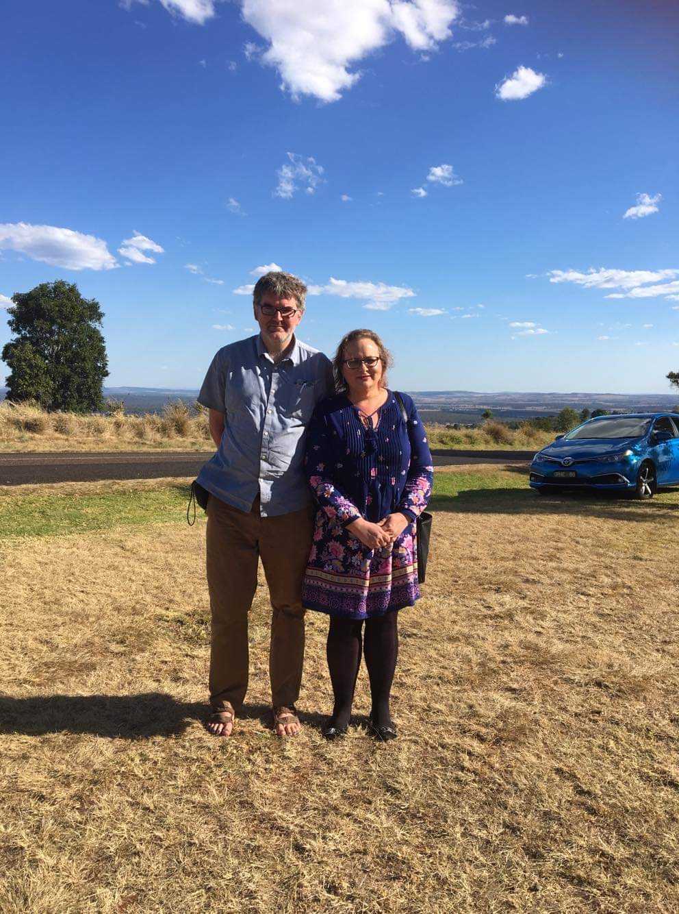
Me and Lisa standing in a field at someone else’s wedding. Lisa took the pic.
Buses here, by the way, are incredibly expensive, relatively. The tickets are priced in ‘zones’ (pseudo-concentric circles emanating from Brisbane) and the cost of the ticket is determined by how many zones you pass through. There’s a lot of zones. The Brisbane area is said to have one of the world’s most expensive public transport systems, behind Oslo and London. What doesn’t help is, certainly on my visits, you couldn’t get all-day tickets, nor return tickets. Each ticket is valid for 2 hours so you can transfer onto other buses within that time, but of course it means you can’t stay long in any given place. So if you wanted to take a trip down the whole Sunshine Coast, you’d need to buy a lot of tickets. Or drive.
Maroochydore and Mooloolaba
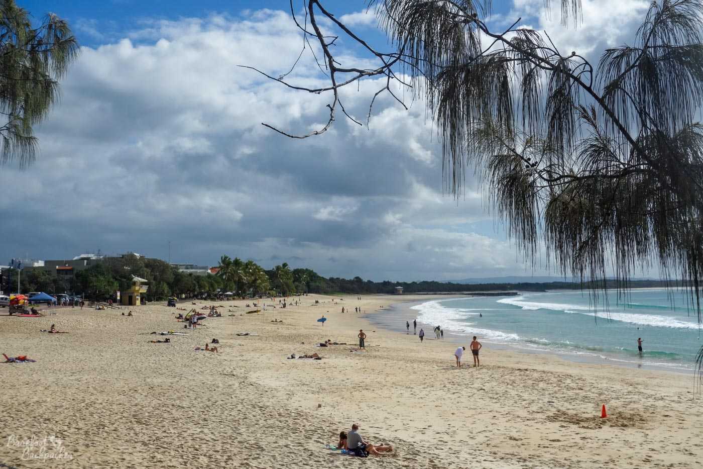
Let’s start on the coast itself. Maroochydore and Mooloolaba are two neighbouring towns that pretty much merge into each other, and are arguably the most central point on the Sunshine Coast. Maroochydore, at the mouth of the Maroochy River (which we’ll talk more about later) is more of the commercial centre. It’s where you’d go for weekly shopping, or to visit a restaurant. Mooloolaba is just a little way south-east, and very much more the stylish beach resort – the first time I went it reminded me a little of the stereotype of Miami Beach, a place to cruise the roads in an open-top car and sip cocktails on the seafront as the sun sets. Maroochydore has houses; Mooloolaba has condominiums.
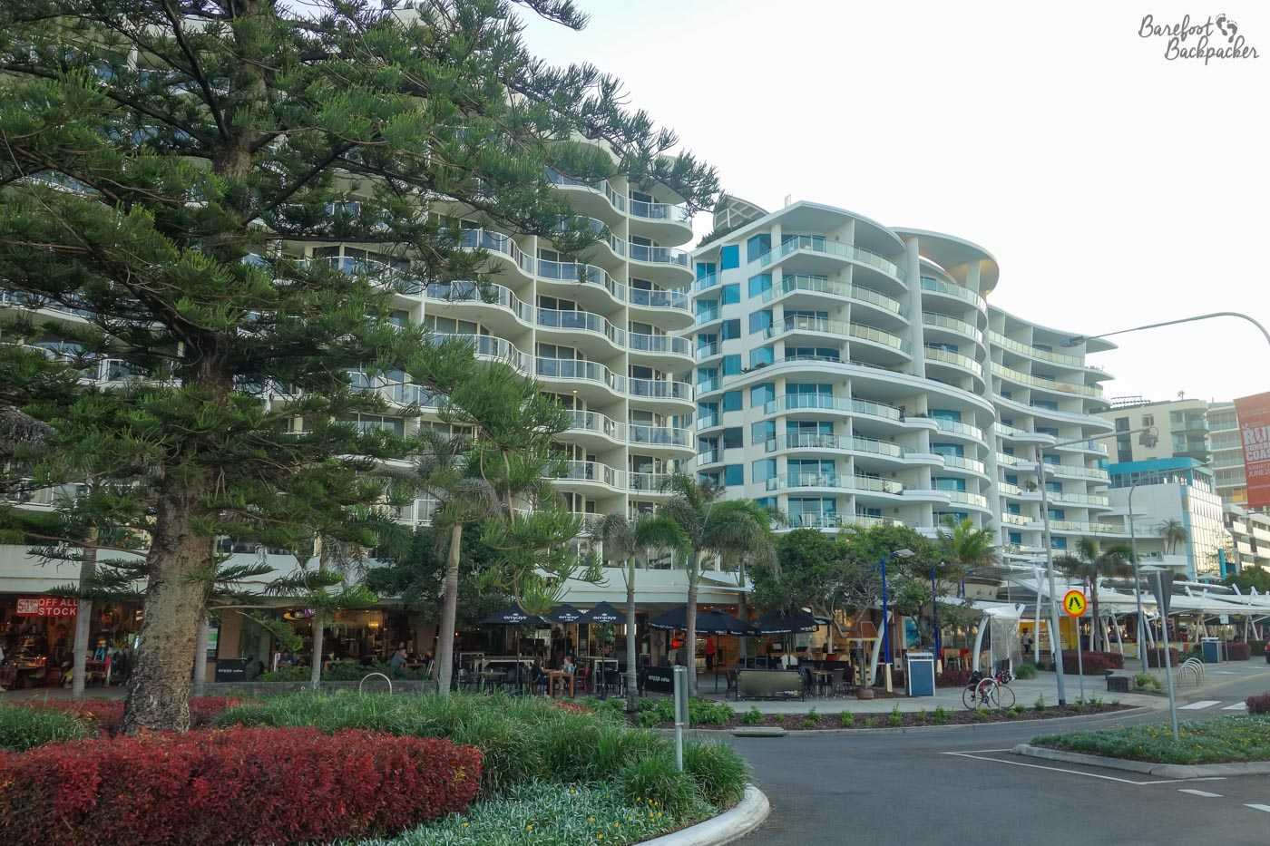
Mooloolaba town centre.
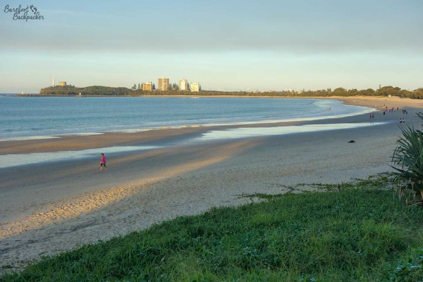
Mooloolaba beach.
Mooloolaba has a couple of interesting statues and memorials, for example a ‘geotag’ and a ‘war memorial to all the dogs who’d served in the Australian army, both those who came back and those who didn’t’. At the beachfront itself there’s also a commemoration to Steve Irwin, whose Australia Zoo is half an hour South of here and heavily advertised. I went there on my first visit, back in 2003, and pretty much got assaulted by a turkey/goose-like thing.
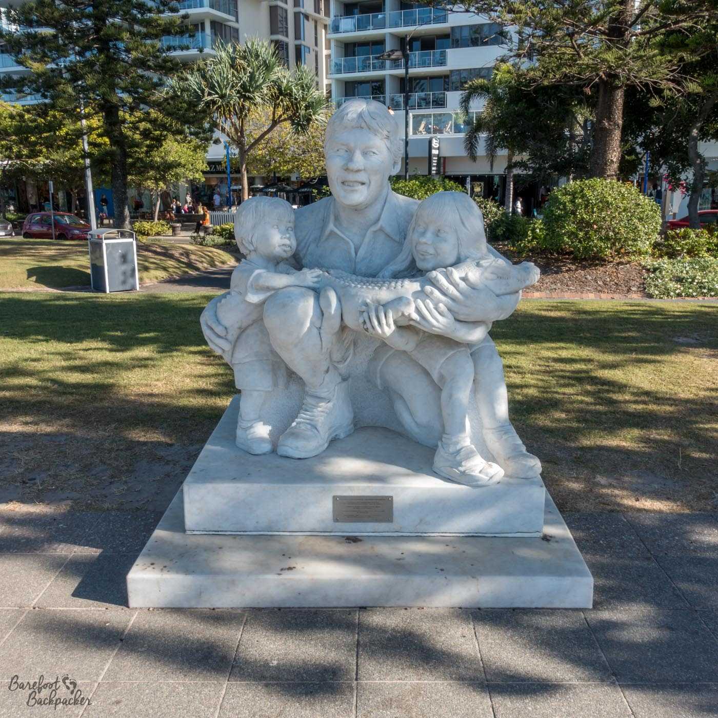
Steve Irwin statue. It’s … not that great, is it?
Also on the seafront is something known locally as “The Loo with a View”, a slightly bizarre iron structure (with an even more bizarre piece of modern art in front of it made of metal and trampolines (?) that wouldn’t look out of place in several English cities) that functions as both a look-out station over the sea, and public toilets. The toilets themselves don’t have much of a view (in fact they’re pretty naff), but they’re convenient for the beach I suppose.
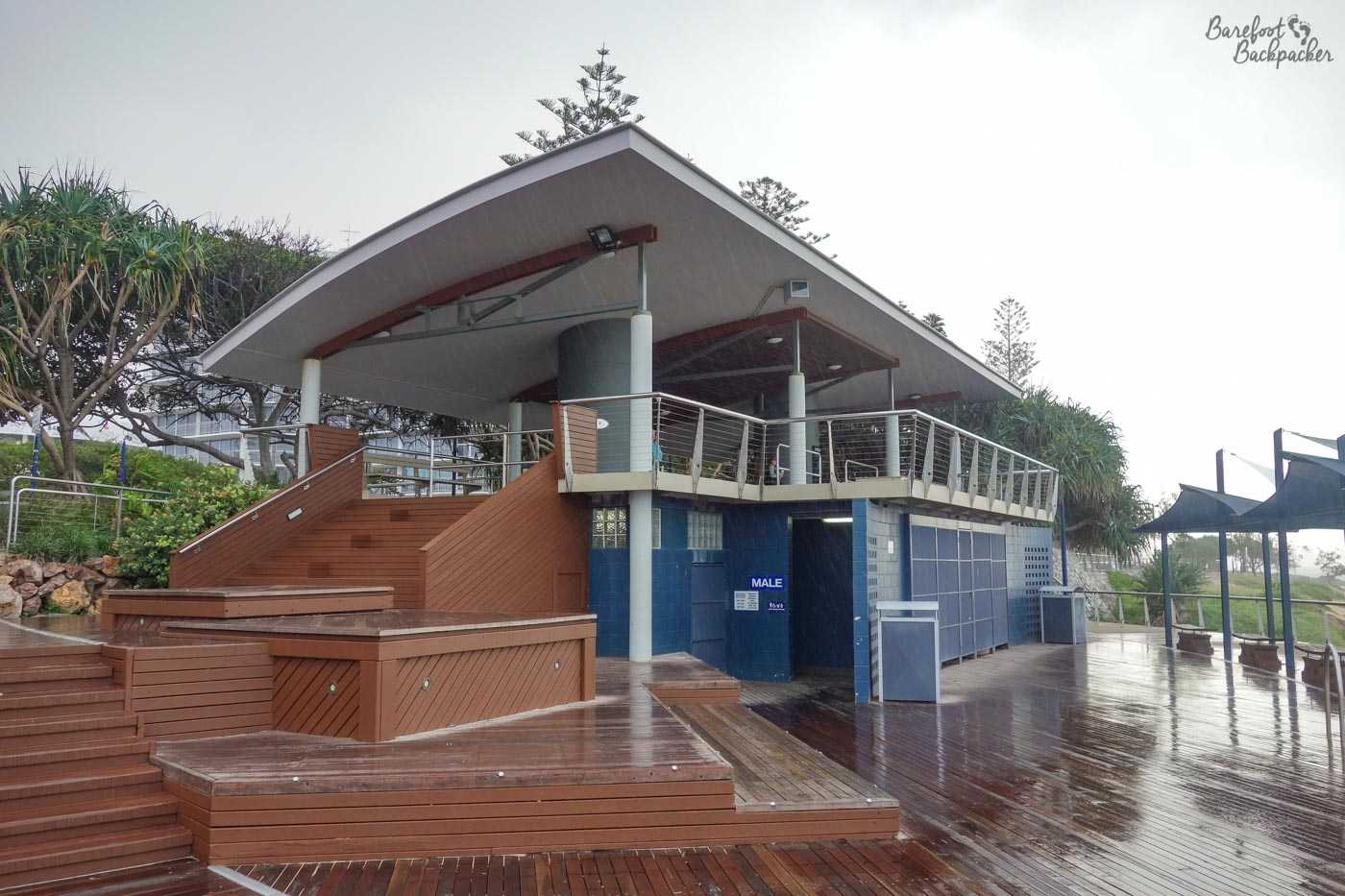
The Loo with a View.
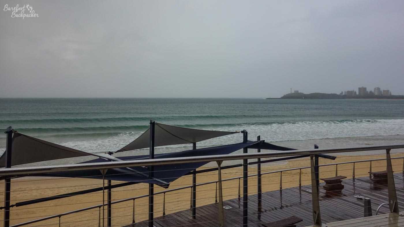
The view from the balcony of the loos with a view.
Back towards Maroochydore are a couple of other little places to explore the coast. One such is Chamber’s Island, a small island just off the coast, accessible by a short iron footbridge. There’s not a lot to do on the island – it’s a place for walking through the trees and having a picnic next to the sea (there are picnic tables and a small beach). As it’s slightly out of the way, there’s often not that many people here.
A view of Chamber’s Island – picnic benches in the background.
Nambour and Bli Bli
I’m giving this its own section because this is where my friend Lisa lives, so it’s the area of the Sunshine Coast that’s most familiar. I’ll concede it’s not necessarily the most scenic or touristy, but then where I’ve lived for most of the 21st Century isn’t ever going to be on any tourist’s itinerary and I’ve blogged about that before, so, you know.
As an aside, Lisa lives on a housing estate that has obviously been designed by someone who is both ‘Sunshine Yellow‘ and big in Corporate Management. The road are called things like ‘Innovation Place’, ‘Perception Road’, ‘Anticipation Close’, and ‘Imagination Drive’. What horrid blue-sky thinking has brought those to the map of the world?
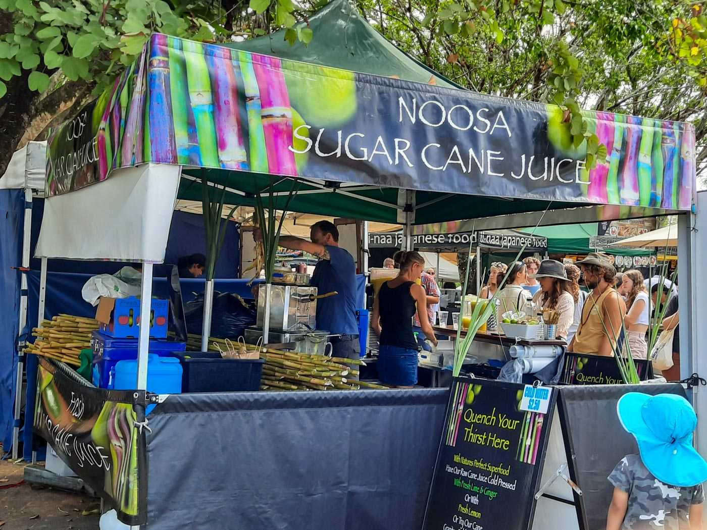
A stall at the Eumundi Markets selling ‘Noosa Sugar Cane Juice’. Pic taken by @witch_lisa on Twitter
The town of Nambour (named after the Aboriginal name for the ‘red flowered tea tree’) is about 30 years older than my house, and seems to have existed for logging and sugar cane harvesting, although now most of both industries are pretty much dead. On my first visit in 2003 we drove past fields of sugar cane, over two metres high, in much of the surrounding area, but they’ve all gone now, replaced by farms or housing. One thing in Nambour’s favour these days is it’s the location of a significant railway station on the regional line to Brisbane, a little over an hour away, so despite the travel cost, this is prime commuter territory. I think I’d still surprisingly rather live in Perth though. There are reminders of both the industrial and the aboriginal history in the town, but only if you look carefully. For example, in one of the small parks in the centre of Nambour is a seven-panel mural depicting the history of the area.
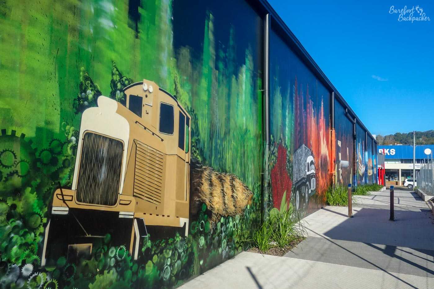
The history of Nambour, in mural form. This shows the sugarcane history.
There’s a couple of scenic points just outside Nambour. In the marvellously-named area of Image Flat is a large lake formed by the building by Wappa Dam on the (South) Maroochy River, around which is a national park/forest reserve, quite reminiscent of parts of Scotland. Apart from the bright sun in the way. In the heart of the forest (accessible down a dirt track that school buses travel down – Australia is noted for its remote communities), is Jack Harrison park, with picnic benches, a large mural designed by schoolchildren designed to represent themselves and how we all fit into the natural world, a zip-line (broken) and some swings (which we tested and they work fine). Very calming.
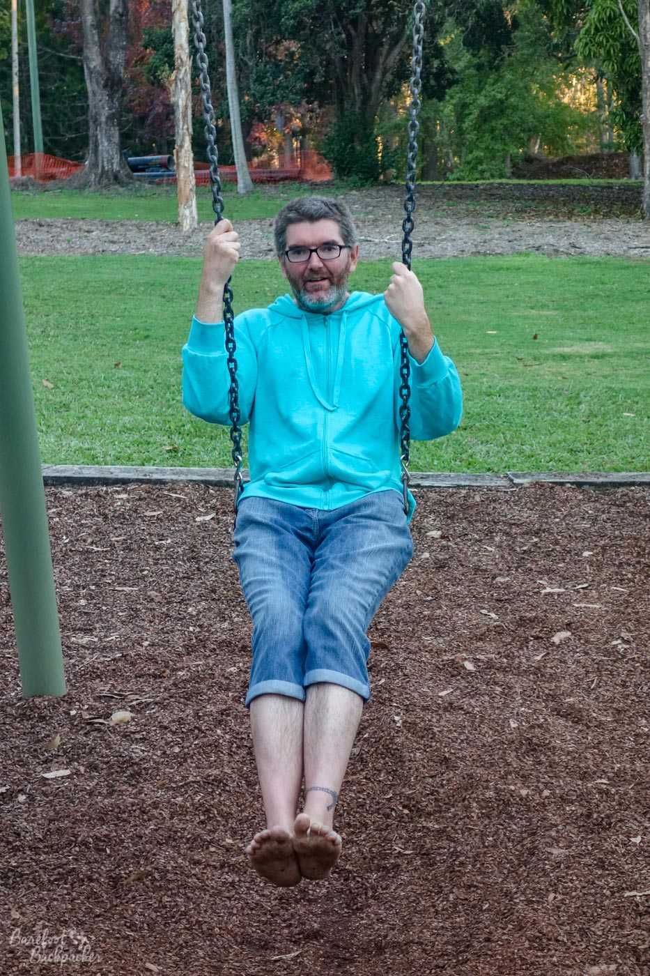
Reconnect with your inner child.
Nearby are a couple of waterfalls; there’s some very close to Wappa Dam but we went to ones a couple of km further upriver. Kiamba Falls, as they’re known, lie just off the Nambour to Mapleton Road. They’re not signposted, or even indicated on Google Maps, but if you know where they are they provide a nice little jaunt over the rocks along the river. I mean, I wouldn’t recommend doing it when the river’s in full flow, but it’s a nice and pleasant scramble over the rocks in quite a scenic place. And you know how much I love a good rock scramble, especially barefoot.
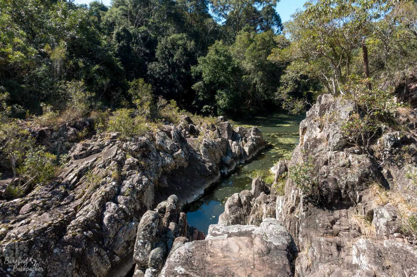
The rocks at Kiamba Falls. Easy to fall in.
A little closer to Nambour town centre is Cilento Park. This is the location of yet another waterfall (Robinson Falls) – not as spectacular as those at Kiamba or Wappa, but located at the end of a really nice woodland walk (mainly palm trees, I’ve been told). The park is apparently 10.5 hectares in size (nope, no idea), and there’s a couple of walks that traverse it. While not overly impressive, it’s really nice to have something like this so close to the town centre – especially as the countryside around the town is largely agricultural and slightly dull.
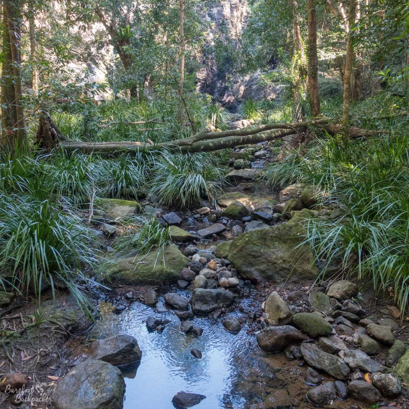
The stream running over rocks in Cilentro Park.
Another scenic spot is just outside the nearby village of Bli Bli – the Maroochy Wetlands Sanctuary, which lies in a bend of the Maroochy River, some way downstream of the Wappa Dam. It’s a small rainforest type environment, with mainly paperbark trees (called so because their bark is quite thin and flimsy, resembling paper). Closer to the river the trees give way to mangrove, which prefer wet (almost swampy) conditions, and it feels similar to the Ratargul swamp forest in Bangladesh. The area is noted for both small crabs and birdlife, and on the wooden boardwalk over the swampy bits there were a couple of areas where birdwatchers could stay and look out over the land.
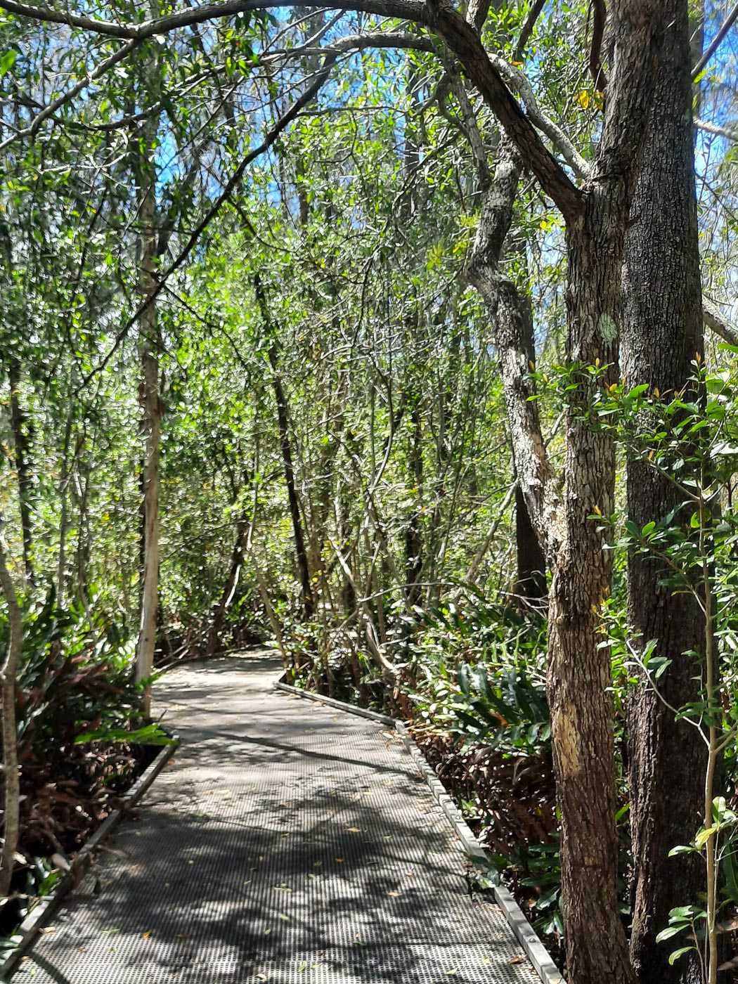
Boardwalk inside the Maroochy Wetlands. Pic taken by @witch_lisa on Twitter.
The path ends at a small jetty on the Maroochy River. Apparently you can take boats from this jetty up and down the Maroochy River, although be aware this is quite close to the sea. The wetlands are situated where the freshwater of the river meets the tidal flow of the ocean, which leads to an interesting blend of nature and wildlife. 50 years ago this would have been mostly dominated by sugar cane farming but now it’s fully returned to nature.
In the centre of Bli Bli is something somewhat more … bizarre. It may seem strange to find what looks like a mediaeval castle in a small Australian village, and you’d be right. This is Sunshine Castle – purposely built in 1972 as a tourist attraction, because Australia Is Weird.
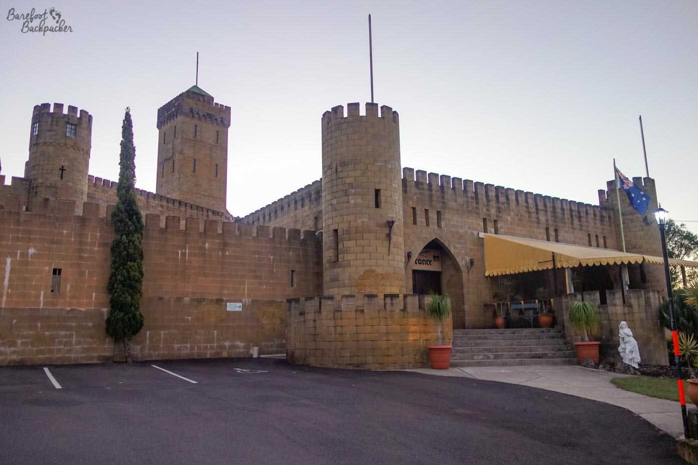
It is exactly as you might expect.
Although it only looks small on the outside, it’s quite intricate inside, with towers and passageways everywhere. Inside there’s quite a lot to see, including dancing dolls (although the music wasn’t working) all dressed up in clothing of many different world nationalities, a whole room full of play-dolls (eg Barbie) from around the world, diorama depictions of a number of fairytales, a small dungeon complete with cartoons, and a train set, amongst other things. There were also a couple of towers to go up, spiral staircases which in my younger days I wouldn’t have tried. The view wasn’t too bad; it could be seen just how much Bli Bli had expanded over the past couple of years.
You can hire it out for mediaeval banquets and presumably weddings. I wouldn’t.
The Big Pineapple
Another example of how Australia Is Weird is that across the country there are over 100 roadside ‘big things’, including a Big Banana, a Big Pigeon, a Big Beer Can, quite a few Big Miners, and several Big Apples. Just because they can.
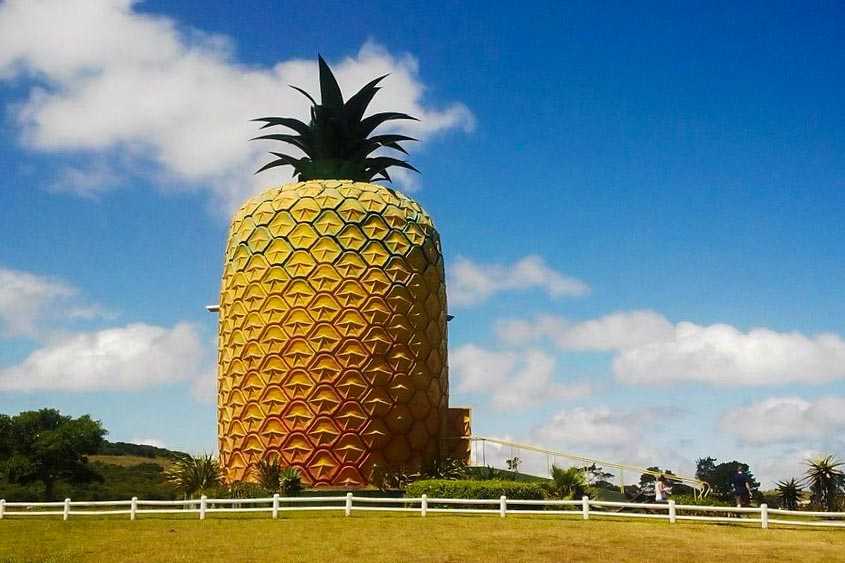
The Big Pineapple.
One of the most visible around the Sunshine Coast is a couple of junctions south of Nambour on the Bruce Highway – it’s a great big pineapple. There’s more to the site than just a large fruit though – it’s a large pineapple farm and visitor centre, with a small train running through the plantations where the driver shows you how pineapples are grown, and gives you tips on how to grow them yourself. Because of course that’s going to happen in central England.
There’s also a small zoo-like area, with koalas (cute, like teddy bears, but fierce!), turtles (which I felt move like an early 80s stop-motion cartoon), brightly coloured small birds, and a couple of emus. Elsewhere in the complex are kangaroos and alpacas, llama-like creatures with a spit fetish. Fortunately on my visit they were they were just satisfied with being fed.
Noosa and Coolum
The area of Noosa is just over an hour from Nambour by direct two-hourly bus. There’s no town called “Noosa” – rather this is name of the wider government district. Its name is Aboriginal, meaning ‘shady place’. Until the last hundred years, the area around Noosa was thickly forested and swampy, and very difficult to get to. These days it’s made up of several interlinked suburbs; ‘Noosaville’ is a seaside village town centre, ‘Noosa Junction’ is the central business area, whilst ‘Noosa Heads’ is a small coastal resort with a cheesy shopping street and the beach. It’s also the stopping off point for exploring the headland known as ‘Noosa Spit’, and the Noosa National Park.
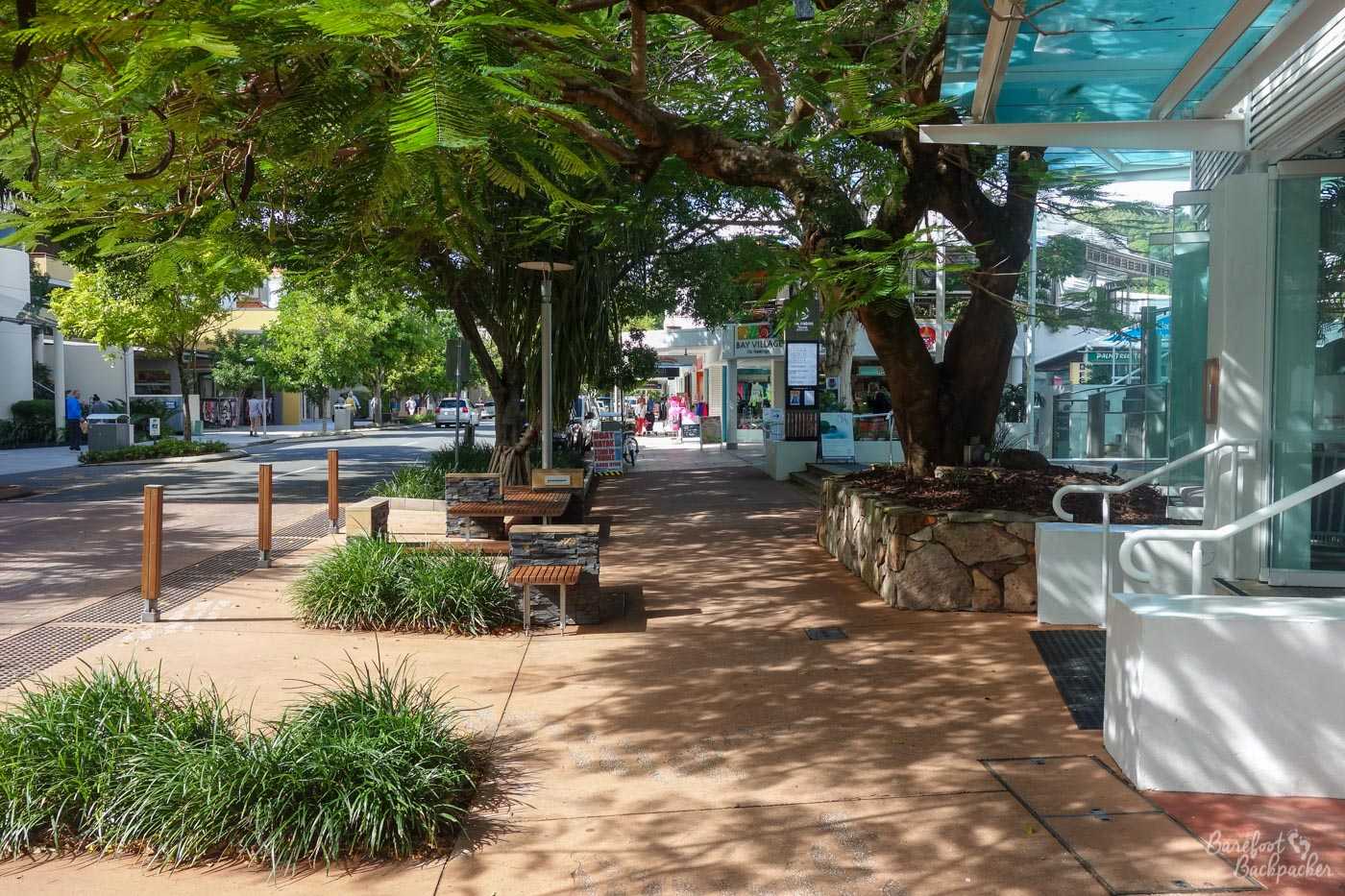
I think this is Noosaville, but it’s certainly one of the Noosas.
I took a pleasant walk through Noosa Woods up to Noosa Spit, past the ‘doggy beach’ (beach for dogs, not whatever you were thinking) and a free telescope for bird-watching (because most seaside telescopes in the UK would require the inserting of coinage). But you know already what my knowledge is like around birds.
After wandering along the beach (very soft sand, the occasional bronzed surfer dude) I wandered the other way through Noosa Heads to reach the ‘National Park’. This was set up over the course of the last 100 years to protect the Noosa headland areas from the same kind of development that has occurred in places further South (eg Caloundra). It’s a mixture of woodlands (including some rainforest-type environment) on the hillsides that run down to the coast, and cover quite a wide area (Wikitravel says 4,000 hectares but I can’t visualise in those terms).
A popular beach at Noosa.
There are several different paths you can take through the park, but I chose one that went right through the centre of the park’s woodland and out the other side to Sunshine Beach. This meant I probably walked around 6km in total. Once I left the main car park area I saw virtually nobody along the whole trail – the only sounds to be heard were the weird calls of different birds. Allegedly there are koalas in the woods but I have to say I didn’t manage to spot any. Nor did I see any snakes or spiders, you may be pleased to know; had I known there were likely to be any, I might have worn shoes. Ha ha ha ha. It was very serene; although it was only walking through the woods and that’s something I do a lot of back at home anyway, this felt a little more .. special, maybe because it was much more remote, or maybe because it felt more unusual – the trees just felt bigger and thicker than those back home. I know even less about trees than I do about animals, so I’m not the best person to be commenting on what it was that I was looking at ….
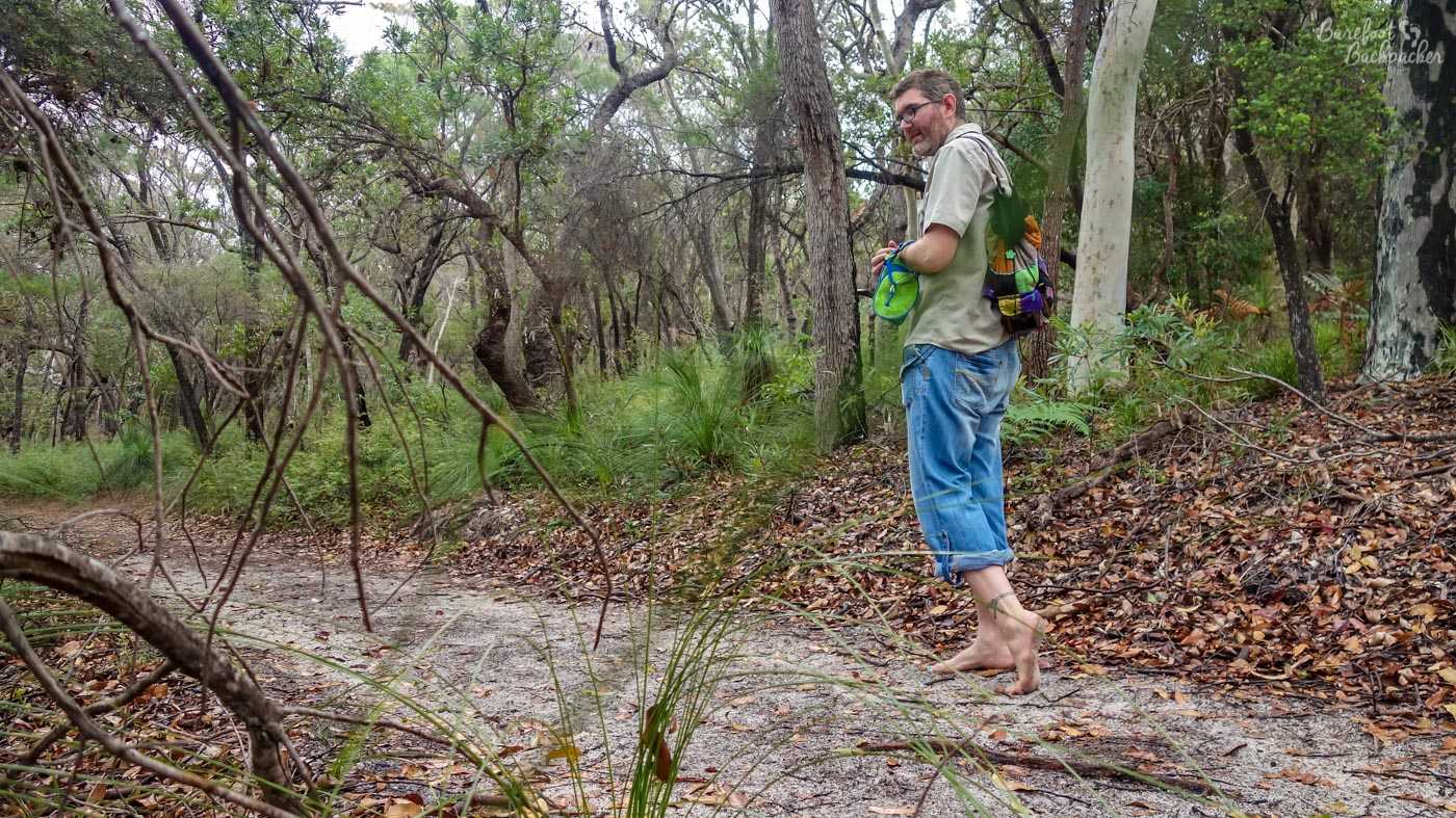
Me hiking through the trails in Noosa’s woodland.
Getting back to Nambour involves catching another bus going along the coast, past a legion of mostly residential seaside resorts – Peregian Beach, Coolum Beach, Mudjimba – each one small and self-contained with low-rise housing and small resort complexes. It’s definitely a place for a relaxing beach holiday rather than an all-night party session.
They’re quite peaceful places, especially at twilight, and it’s odd to think that if you stand on Coolum Beach and go exactly due East, the next land you hit is Chile in South America (specifically, just over 100km north of Copiapo), some 12-13,000 km distant (you’d pass relatively close to the Bass Islands of French Polynesia, Pitcairn, and Rapa Nui, but not touch any).
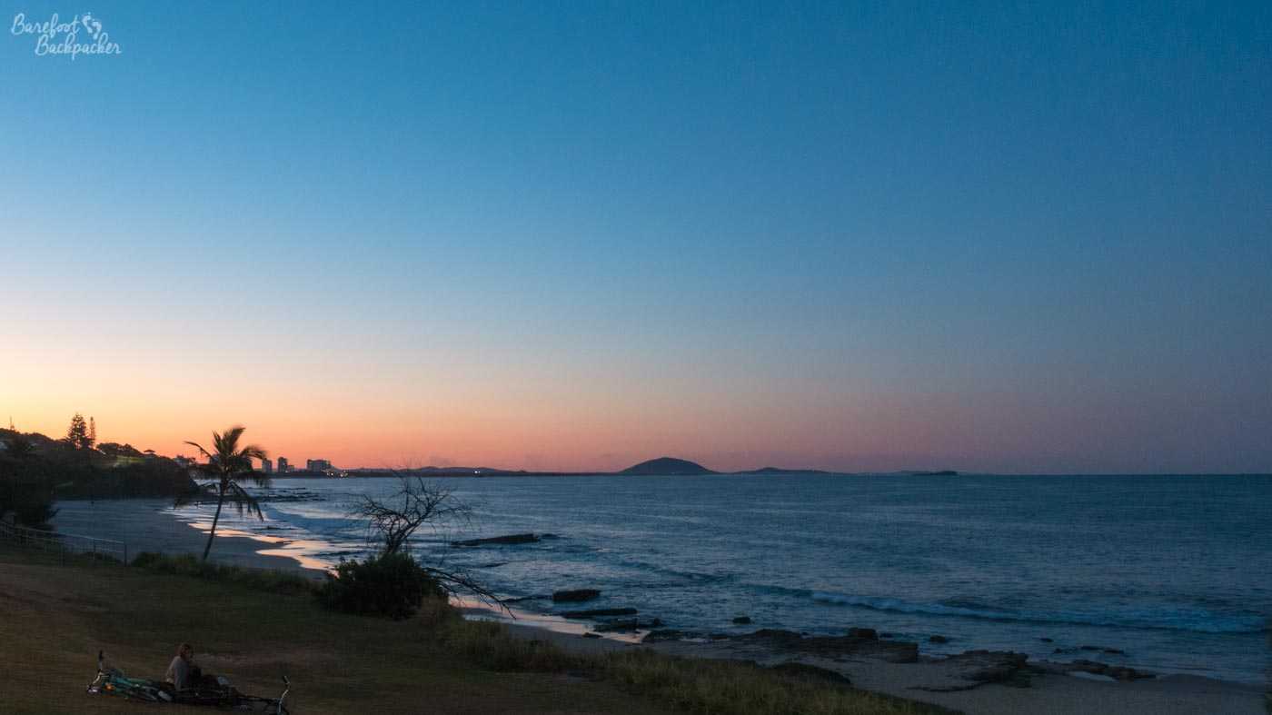
Mount Coolum visible in the distance from Mooloolaba beach at sunset.
Halfway down this coast is Mount Coolum. At 208m it’s (almost the same height as the highest point in Nottinghamshire) not very high and wouldn’t normally be noteworthy, except it’s considerably the highest point on the coast, which is otherwise relatively flat for several km inland. This means it’s an easy place to spot from a distance. It’s another National Park, and there’s a nice walk that weaves up it, starting off as a nice trail in the woods and ending as a virtual rock scramble towards the top. The peak is pretty open, commanding great views of the shoreline, and at the summit there’s a large warning beacon to make aeroplanes aware they’re no longer flying over the sea and to be careful. Sunshine Coast Airport is close by, though despite my best intentions I’ve never yet managed to use it.
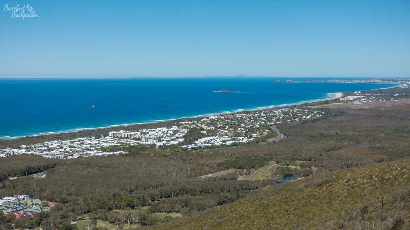
View from the top of Mount Coolum, looking South towards Maroochydore and Mooloolaba.
The Hinterland
Eumundi, a small town just north of Nambour, is noted for its weekly craft market; it’s regionally famous so it gets very crowded and pretty hard to find a parking place if you arrive even just a little too late. It doesn’t look all that big at first, but with a bit of exploration it could be seen to go on for quite some way – there were stalls everywhere and the paths between them were pretty narrow so the whole place was quite crowded. On my visit, I felt it had a weirdly Latin American vibe, which felt unusual for Australia.
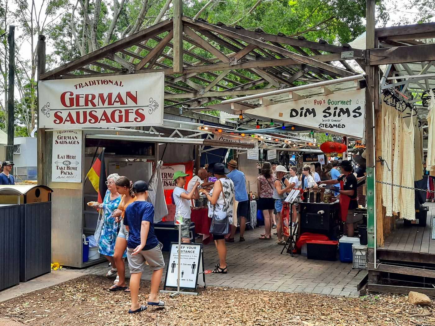
Food stalls at Eumundi Market. Pic taken by @witch_lisa on Twitter.
Although I saw a few interesting things, I didn’t buy any souvenirs there as I felt it was a tad expensive. There were also stalls selling paintings and furniture – imagine the postage costs on them.
Also at the market on my visit were a few circus performers. One was making animals out of balloons for the passing kids – something I’ve always vaguely wondered how to do, but not enough to find out; I’ve never been able to blow one up. Something something blow jobs. Later on he was playing with diablos, something I dabbled with at Uni, but never got the hang of it, even with one; he was at times playing with up to three. I can barely keep three balls in the air indefinitely. His last trick involved him riding a unicycle and juggling with a rubber plunger (!), a beach ball, and a flaming torch. The actual juggling didn’t last that long – it was the methodology used to get there that made it noteworthy. As one of the few visible adults in an audience of children, I even ended up being roped in to help out, holding the juggling balls, helping him on and off the unicycle etc.
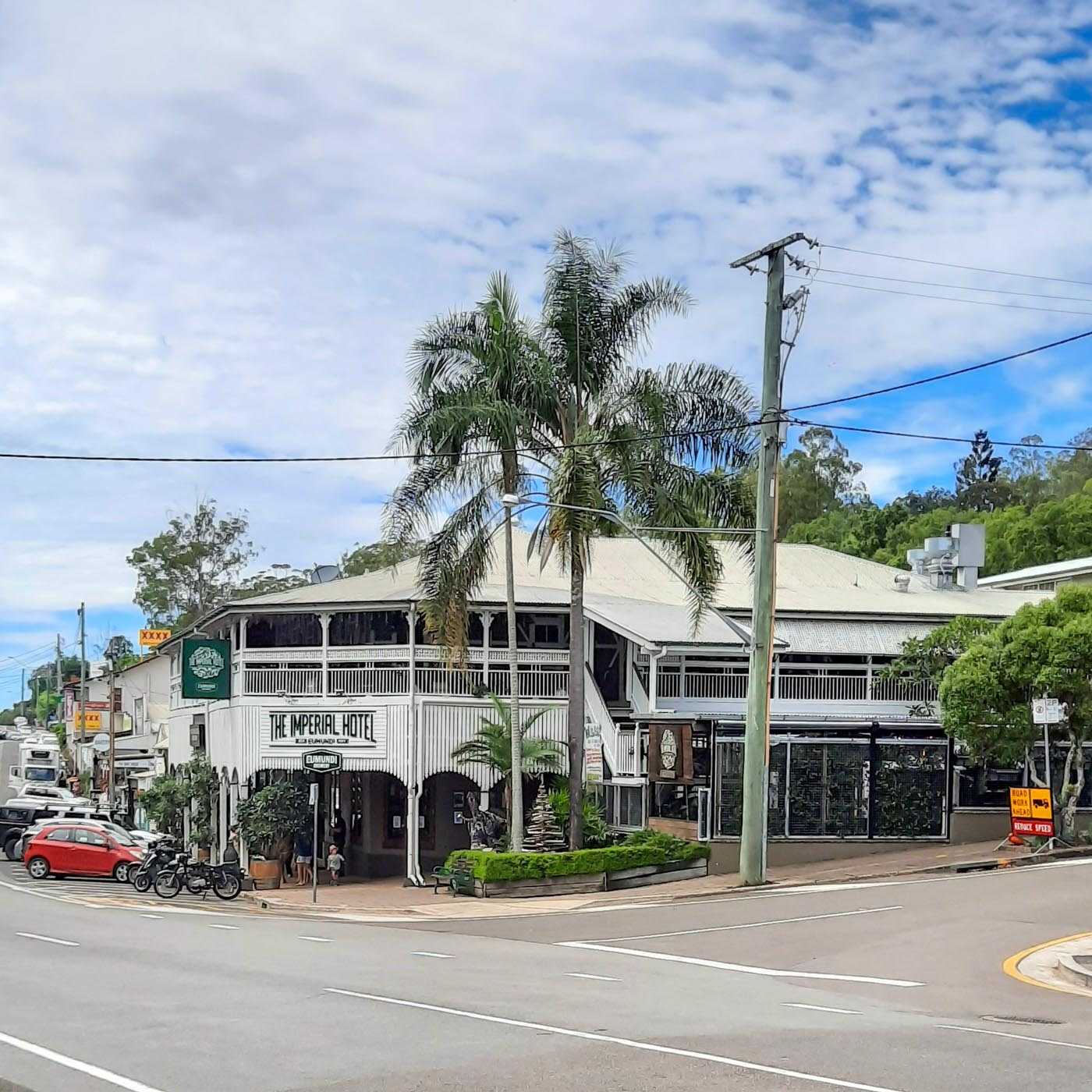
Hotel in Eumundi, but the same vibe is present in places like Montville. Pic taken by @witch_lisa on Twitter.
Away from the main road and deeper into the hinterland are the towns of Montville and Maleny. Montville is a nice, quaint, touristy place in the hills, with stylistic buildings, a bit like something out of Middle England / The Cotswolds. It is, therefore, understandably popular and both times I’ve attempted to go there it’s been really crowded – one of those places it’s best going to after-hours, as it were.
It is quite a weird little place; all that the entire village seems to be is a small, touristy, purpose-built shopping village. There’s a series of small craft-shops, cafés, and specialist stores, including one that has an Irish-theme. Obviously. In the town you can buy such out-of-place things as branded Blackpool Rock, but decided that would have been a little surreal, even for me.
Maleny, conversely, is noted in the area for being the “hippy town” of the area, sort of like California without the beach, a place where just about anything goes. In fairness I did see the occasional skateboarder soar down the severe hill the town is built on. My biggest draw though was the craft brewery; one of those places where you can see how they brew the beer through clear windows from the bar area.
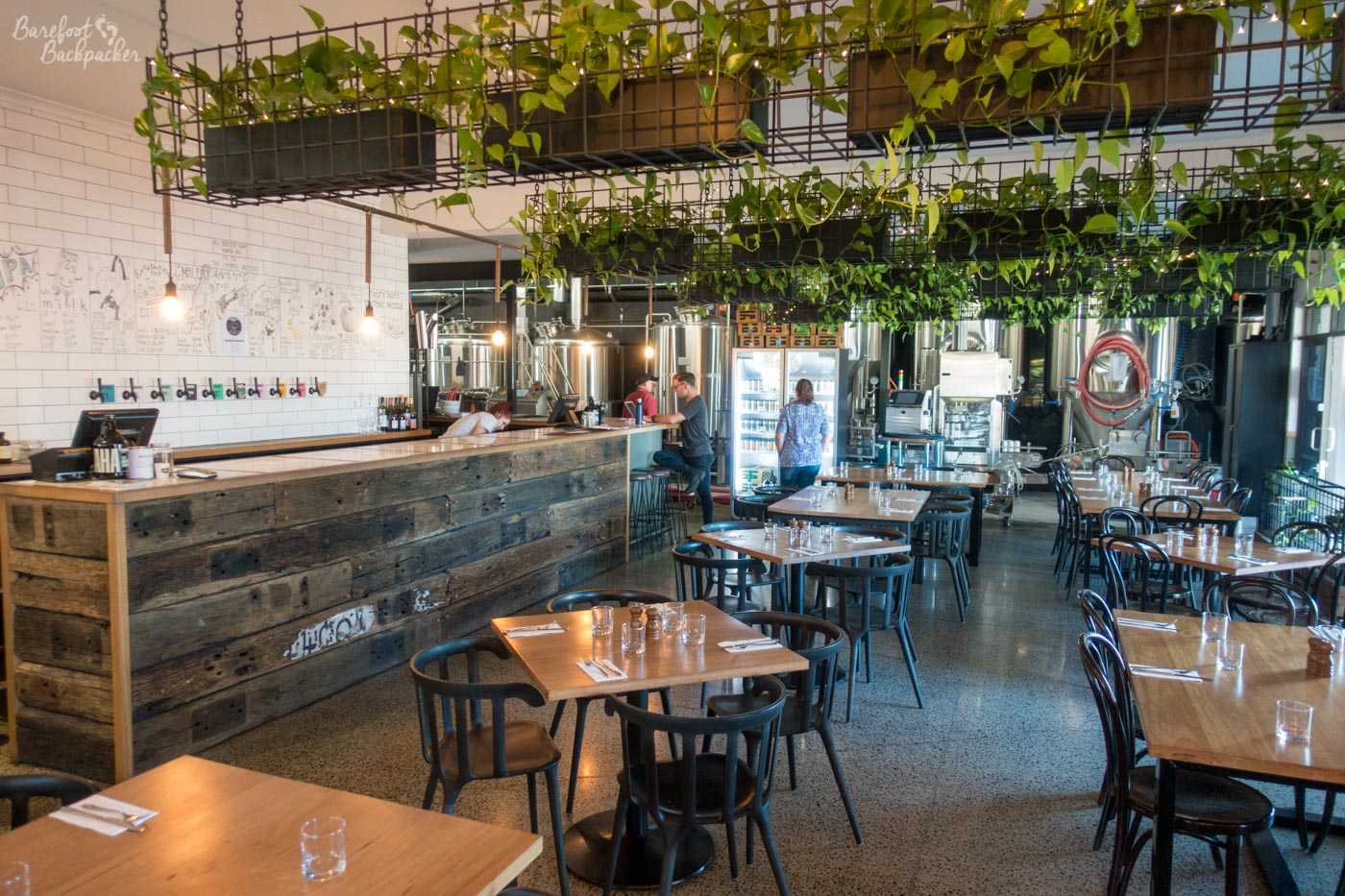
The inside of the Brouhaha brewery in Maleny. Beer not pictured.
Finally, Palmwoods is a small town a couple of railway stations south of Nambour towards Brisbane. It wouldn’t generally be notable, save for a very weird pub I popped into to meet with an even more aged hippie than me, a friend from Twitter also called Lisa. She has additionally provided a couple of the photos for this post. The place is called “Rick’s Garage” and it evokes all manner of 1950s American Diner vibes. There’s period petrol pumps in front a whole wall of old-fashioned advertising signs out front, while inside the whole scene is one of chrome metal, rounded edges, and lots of old photographs.
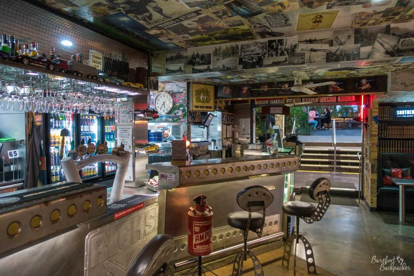
The inside of Rick’s Garage in Palmwoods. 1957 called …