Sometimes, some of the nicest places in the world are just on your doorstep, and one of the nicest areas is the Hope Valley in the Derbyshire Peak District, about an hour from my house.
Padley Gorge, looking towards Grindleford.
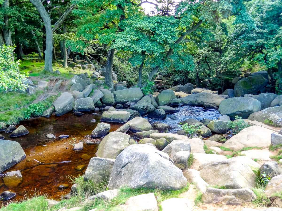
It’s only 29 miles from my house to Padley Gorge, a popular scenic valley in Derbyshire, just across the border from Sheffield. The road in is easily recognisable due to the proliferation of cars and the occasional ice-cream van. While this immediate area, with grassy domed hills and a couple of small streams for children to paddle in, is where most of the daytrippers stay, it’s easy to take a trail from here along the Burbage Brook and through the woods.
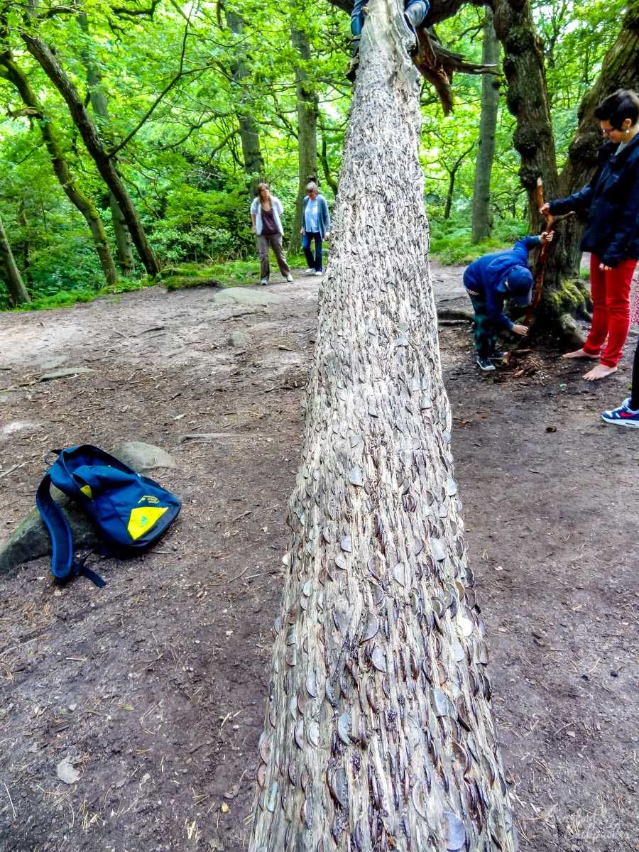
In the woods at Padley Gorge, there’s a tree where people ‘hammer’ in coins into the bark, for good luck. I’ve seen this in other places since, but I think this was the first time I saw it. My companions on the day I took this picture even brought along their own hammer for that purpose!
You can take this path firstly to Grindleford (stopping at the cafe at the railway station to have a pint (!) of hot chocolate), before reaching the Derwent Valley Heritage Trail long distance footpath that runs along the River Derwent between Ladybower Reservoir and Long Eaton near East Midlands Airport.

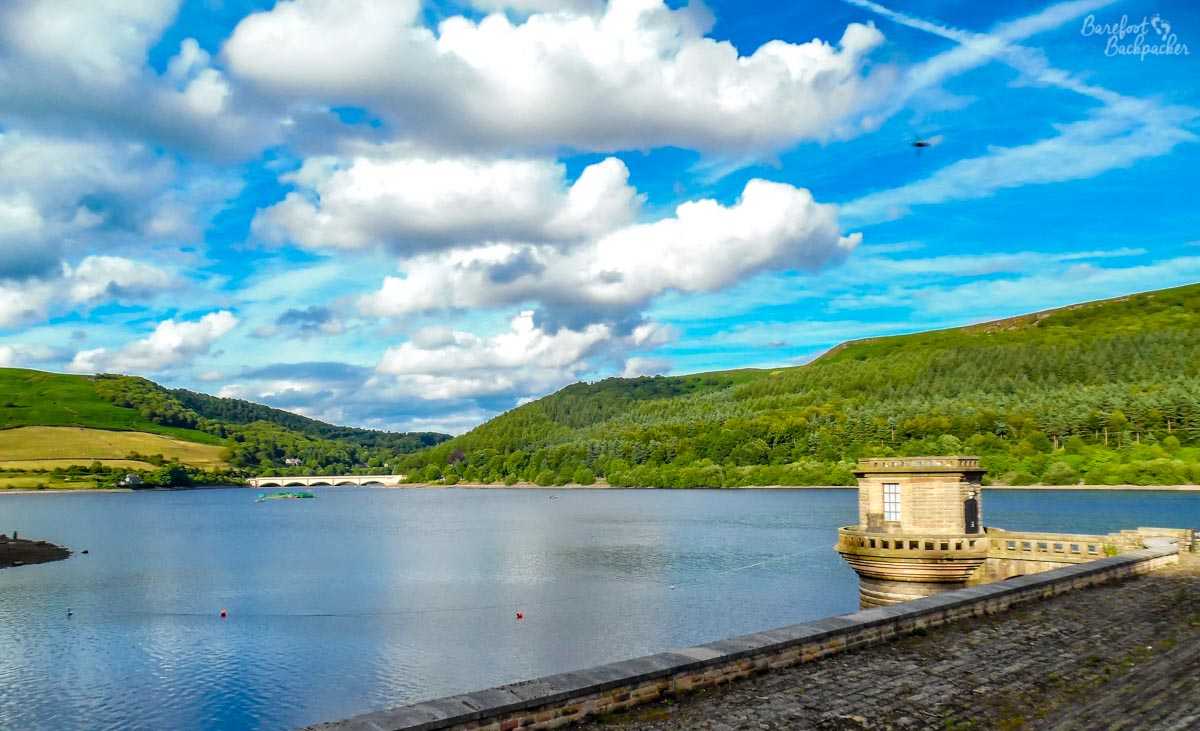
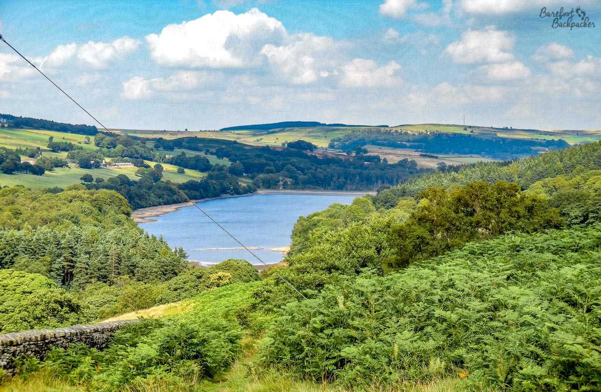
Ladybower Reservoir, looking towards the Ashopton Viaduct.
Ladybower reservoir is the largest of a series of reservoirs in the Eastern part of the Peak District (some of the others being “Derwent” – famous for being where the Dambusters air squadron did training runs -, “Strines”, and “Damflask”). Compared to most of the others, which were created in the late-Victorian/Edwardian period, Ladybower itself is quite recent (1940s), and its size meant that forming the reservoir meant the flooding of two small villages (Ashopton & Derwent Village) – the latter of which is still occasionally visible in times of drought when the water level drops significantly. At around 200 hectares, the reservoir is roughly the size of two large golf courses, and much flatter.
It lies just off the main A57 road, also known as ‘Snake Pass’ – a moniker given not because it meanders through the high peaks like a snake, but rather from the name of a pub located partway along the route which itself is named after the coat of arms of the old local landowners, the Cavendish family. One of the most scenic roads in the UK, it’s a tough but exhilarating drive (would make an excellent stage on a rally video game), and is often closed in Winter due to snow, leading to large diversions.
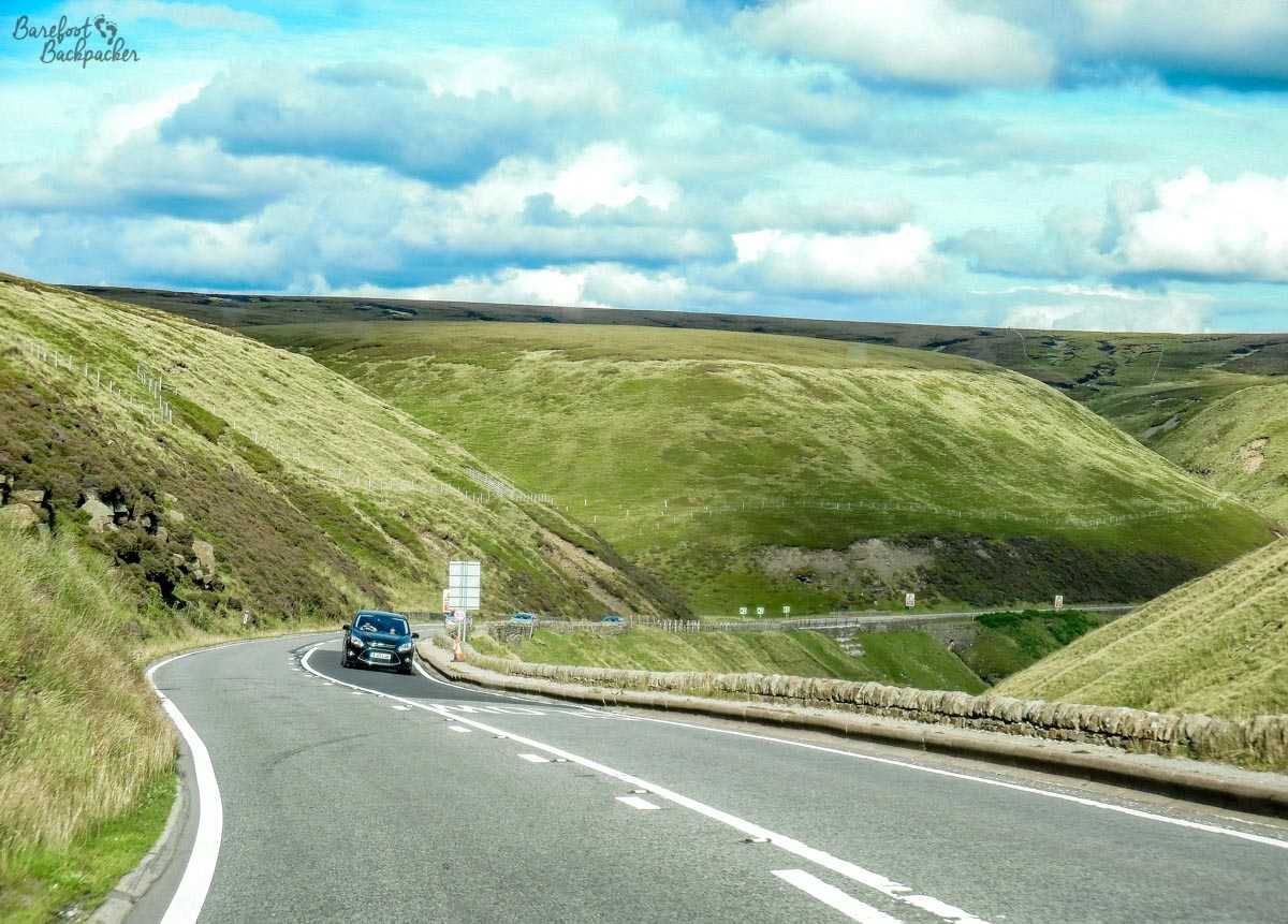
Snake Pass, in good weather, still looks quite bleak.
Water from Ladybower mostly supplies the East Midlands, though some feeds through to Sheffield. The bulk of Sheffield’s water is supplied by the other reservoirs in the area, including Strines and neighbouring Dale Dike. Although technically within the city’s administrative boundaries, they’re even more remote than Ladybower, lying some 2 miles north of the A57. Dale Dike reservoir is notable for a dam failure in 1864 (not long after it opened), causing a flood in Sheffield that resulted in over 240 deaths – this was known as the Great Sheffield Flood and is regarded as one the most deadly non-weather-related floods ever.
The countryside around Dale Dike Reservoir. Remember, technically, this picture is taken within the borders of Britain’s 3rd largest city (by admin area).
These days both reservoirs seem pretty stable. It’s possible to walk between and past them, although at times the path isn’t well-signposted. In addition, the route up the hill on the East side of Strines reservoir, on the opposite side to the Strines Inn (where you might need to go for a rest afterwards) is ‘a little strenuous’. It rises from around 240m by the water’s edge to 320m at the top of the ridge in around 700-800m along a part-stone part-mud trail. Near the top, overlooking the reservoir and surrounded by sheep and goats, is what remains of a small tower. This is “Boot’s Folly”, a 14m high stone tower constructed on the orders of local landowner Charles Boot in 1927; one theory is that it was constructed to provide work for Boot’s workmen during the Great Depression, although the problem with this theory is that the Depression only began in 1929. Another belief is that he built it to be able to see his wife’s grave in the local churchyard. At the time of writing, incidentally, Boot’s home (Sugworth Hall) was up for sale, offers around £1.8million – a 30-year mortgage with a 10% deposit gives affordable repayments of around £5,000/month, or twice my monthly salary … 😀
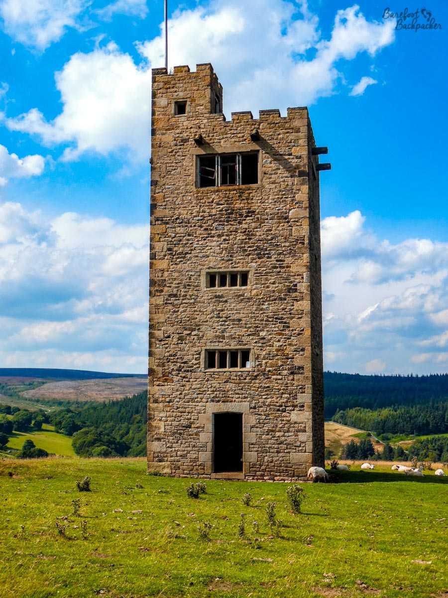
Boot’s Folly, complete with sheep.
This part of the peaks has a number of small towns, filled with visitors on summer weekends.
One of the most famous of these, at least in the UK, is Eyam – a small Anglo-Saxon village noted for lead-mining, and the plague. The history goes that in late 1665, during an outbreak of Bubonic Plague in London, a batch of infected cloth made its way to Eyam (which at the time was a noted trading/market village). After the death of the tailor and several close family members, the villagers (led by the vicar, William Mompesson) took steps to try to prevent the plague spreading to the rest of Derbyshire, including effectively quarantining the village – leading to a nearby hilltop well being used as a drop-off point for goods and payment between Eyam and the local villages, and also to tales of lovers separated by the divide who could only stare longingly at each other for the months of isolation – and, within the village, restrictions on large groups of people meeting up; this meant church services had to be undertaken in the open air, on a hillside some distance from the village itself, where people could stand a reasonable distance from each other. Another edict was that families needed to bury their own dead; given the virulence of the plague, this meant some people ended up personally burying their entire family. It also meant that the graves of the plague victims are scattered around the edge of the village, rather than in the churchyard.
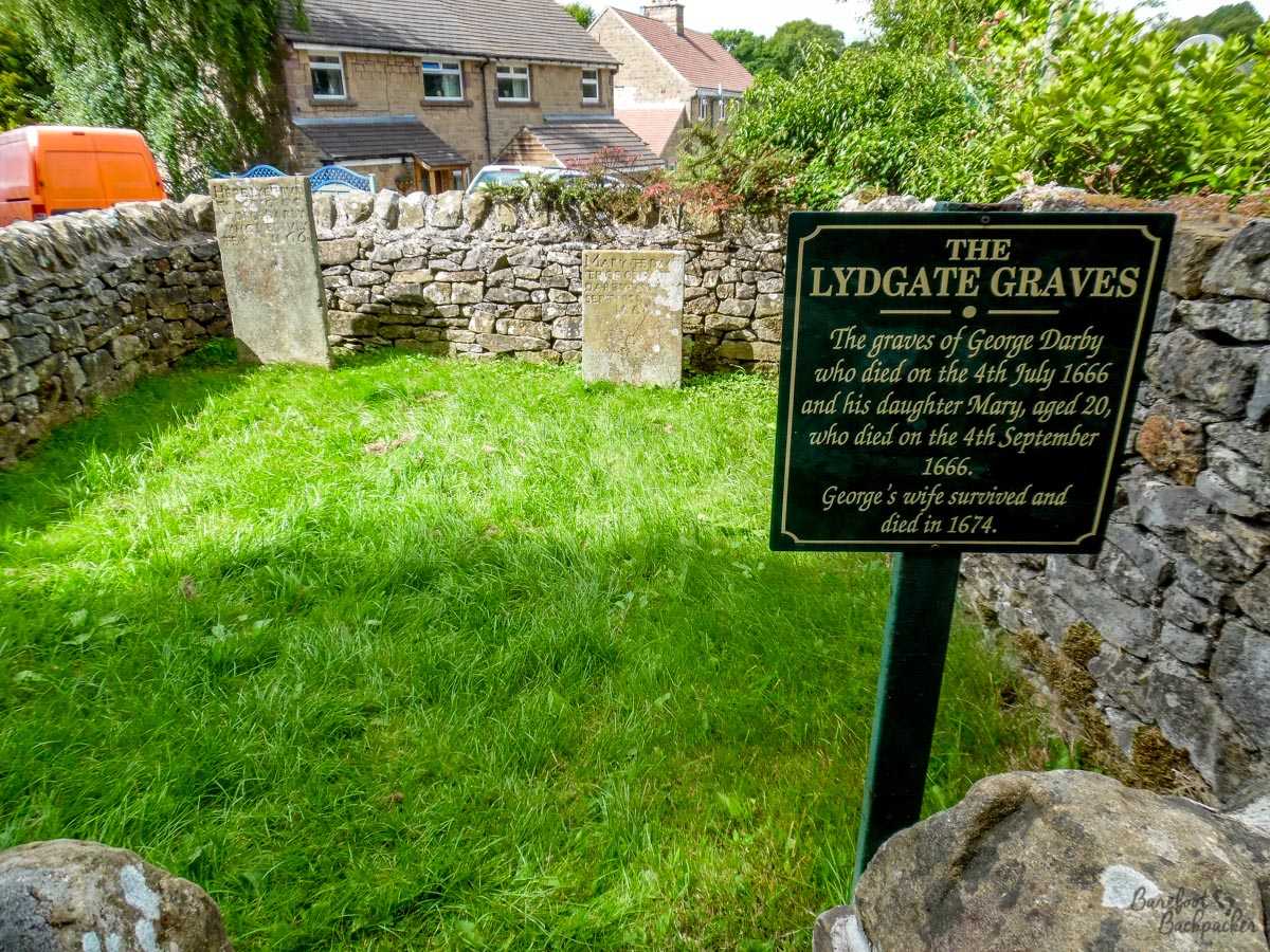
Lydgate Graves, Eyam, just up a small incline from the village centre, and relatively quite a way from the church. One imagines at the time, this would have been the very edge of the village.
This situation lasted over a year and it is believed just over 270 people died (out of a pre-plague population unrecorded but believed to be in the region of 400-500). While such ideas seem logical and even commonplace nowadays (on a much larger scale, the same principles were advised during the Ebola outbreak in the early 2010s in West Africa), at the time these would have been seen as revolutionary concepts.
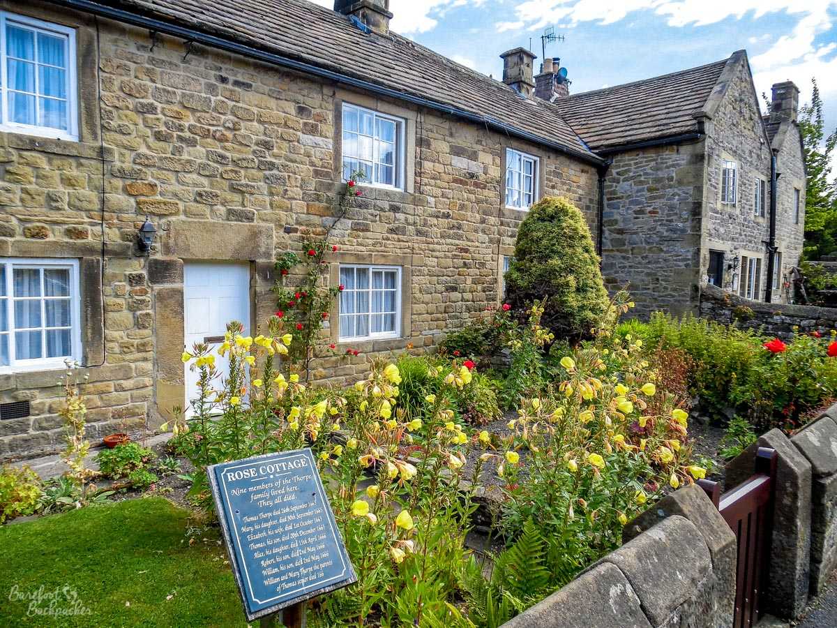
A couple of Eyam’s ‘Plague Cottages’.
Along the road between the later Eyam Hall and the pre-plague Miners Arms are a terrace of old cottages. These are known as ‘plague cottages’ and in the garden of each one is a sign commemorating everyone who lived (and died) in that particular cottage during the plague outbreak. It’s quite chilling to read, to imagine that whole families were simply wiped out over time, that someone died and the rest of the family still lived there, knowing that one of them could well be the next.
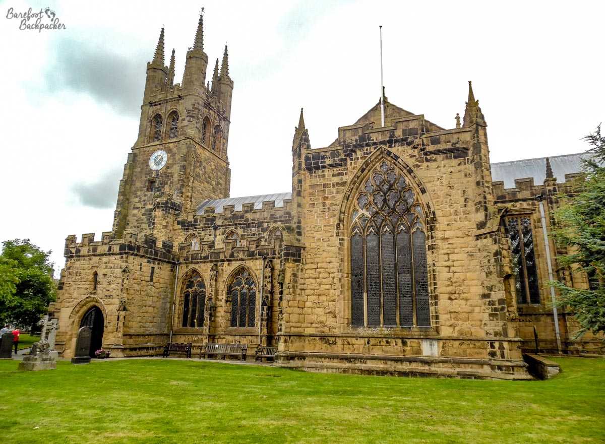
The church in Tideswell. It does look quite ornate and sizeable for such a small village – but it’s the central point for this part of the Peaks; Tideswell village lying in a natural ‘pass’ through them.
While nowhere near as famous, the town of Tideswell also draws visitors, mainly to visit the church of St John the Baptist. It’s known colloquially as the “Cathedral of the Peak”; despite being nothing more than a (relatively large) local parish church, it’s quite overly-grand and one of the more spectacular-looking churches of its type in the region. It’s also quite old; originally built in the 14th Century it was extensively restored (as much as possible, sticking with original-styled materials) in the 19th Century, meaning it looks and feels now pretty much how it must have looked when first built.
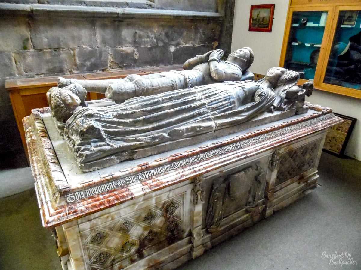
The de Bower grave. Although the inscription mentions Thurstan by name, and it does seem to be of the right period, the details are quite vague and sketchy – although not as sketchy as the details about him himself online where pretty much all the links referred back to the church without telling me who he *was* ….
Noteworthy ‘inhabitants’ of the church include Sir Samson Meverill, who allegedly fought at the battle of Agincourt in 1415, and possibly Sir Thurstan de Bower, squire of King Edward III and shield-bearer to the Baron Furnivall (possibly specifically Thomas Nevil, the 5th Baron, towards the end of the 14th Century, who was Sheriff of Yorkshire and ended up being ‘Treasurer of England and Calais’), who was rewarded with being given a post as one of the King’s own squires and given his own small ‘Lord of the Manor’ title.
Going higher into the Peaks, heading towards Kinder Scout, is the village of Castleton. Now, the problem with Castleton is that it’s too popular for its own good; it’s quite small, with only one rather bendy road with narrow pavements going through it, and there’s not a great deal in the village centre anyway, apart from a few pubs and lots of touristy shops selling trinkets and souvenirs. What makes Castleton so popular is its location; not only is it surrounded by beautiful hiking country, it’s also atop a series of caves and mines that attract visitors not only to visit the bowels of the Earth but also to buy jewellery made of the local stone – a rare form of banded purple-blue-ish fluorite known as ‘Blue John’.
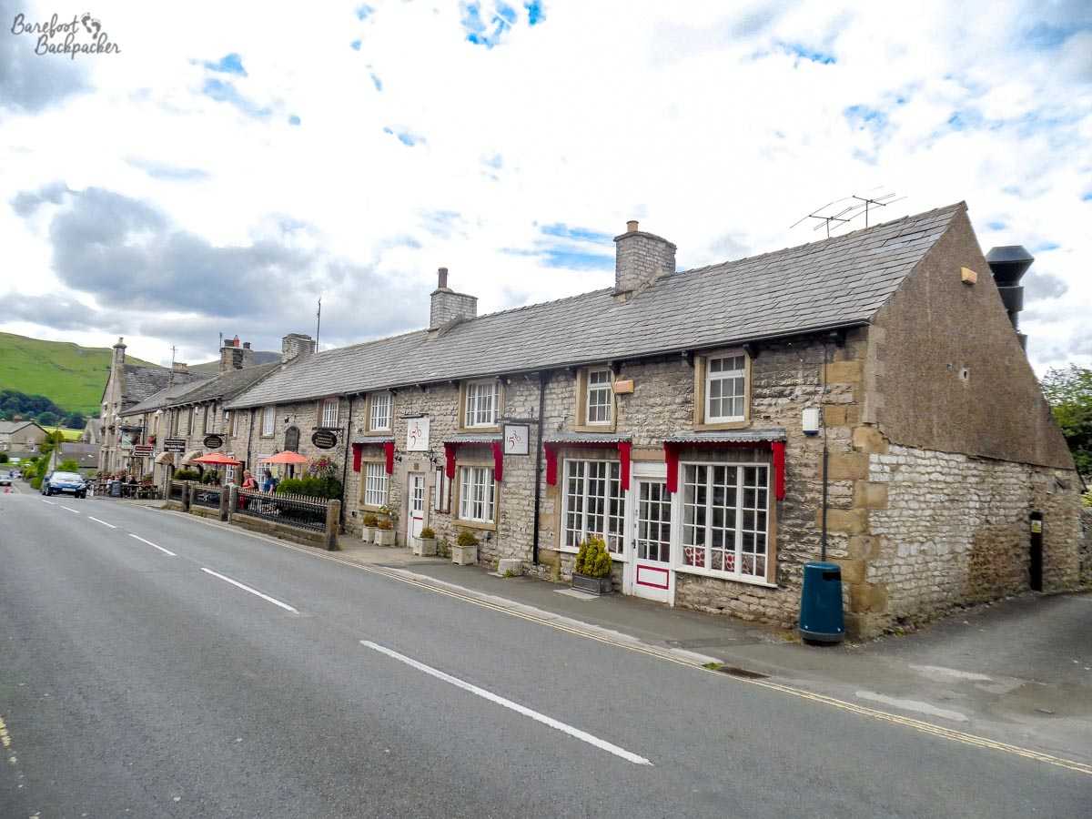
Some houses in Castleton village. Many villages in the area have similar cottages; it’s a feature of the area. Castleton has little else aside from these however.
The other attraction in Castleton, and very popular despite the winding footpath up a steep hill, is the ruins of Peveril Castle, originally built in the late 11th Century by invading Norman knight William Peverel (consistent spelling has been lost through the centuries). Although important in its early days (situated as it is overlooking one of the few easy passes over the Peaks) it had fallen into ruin by the 1500s. Despite this, the walls are in reasonably good condition, and it’s pretty easy to imagine how it must have looked in its heyday.
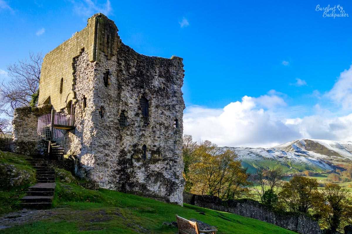
Peveril Castle. It’s a popular hike up a very steep hill; exhilarating but I’m not sure the ruins justify the equally relatively steep entry fee.
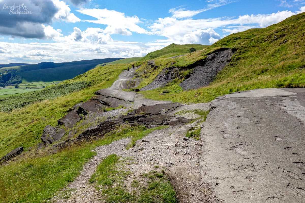
The area’s quite a hotbed for landslides, and this is centred on Mam Tor (a mountain that may or may not be named due to it resembling a breast to the Celts). The best physical evidence of this is on the old A625 road that used to pass over it – continued landslides over the course of the 20th Century caused it to be closed and rebuilt several times, until a particularly bad one in 1977 firstly caused the authorities to make it a single-track road, then two years later give up and abandon it completely. It’s still possible to walk along it, and it’s quite eerie in parts – it shows definitely the power of nature even in a relatively benign country as the UK. Our road management systems would be completely thrown to pot if we had volcanoes or (decent) earthquakes.
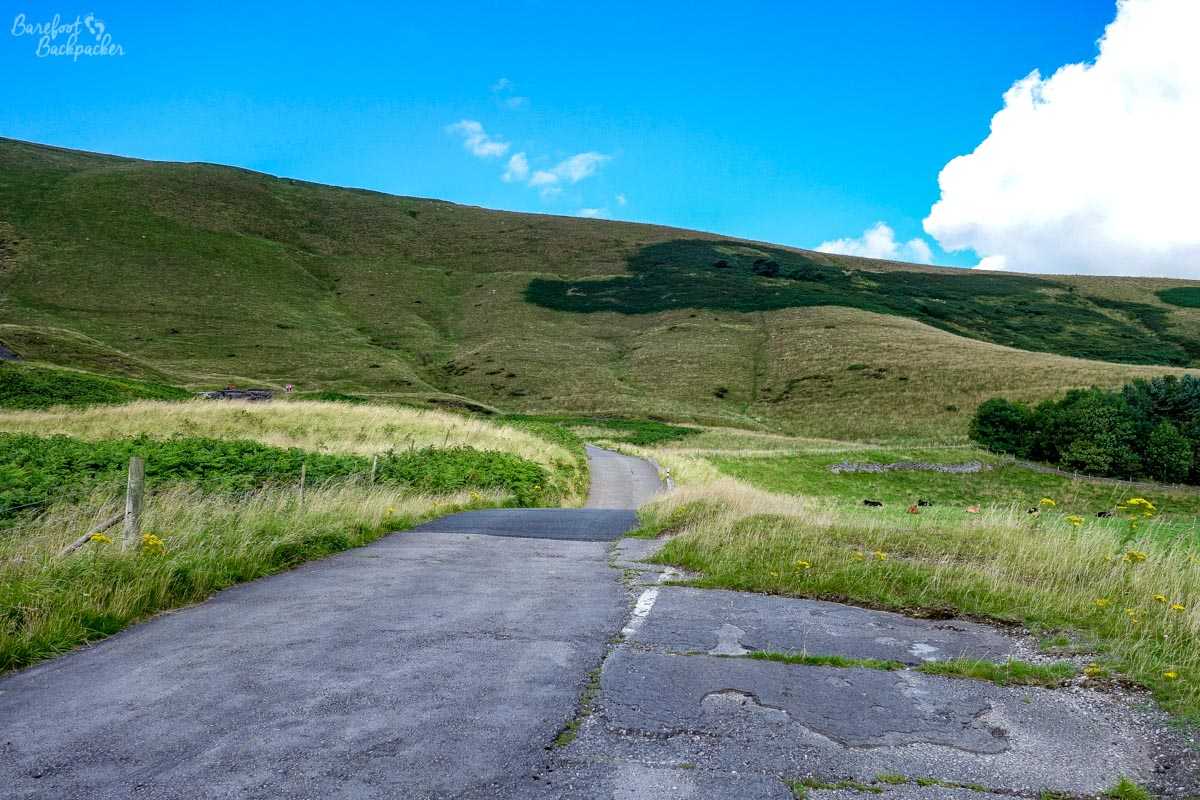
Dead road, looking Northbound, towards the higher peaks. Mam Tor is just off to the left of shot.
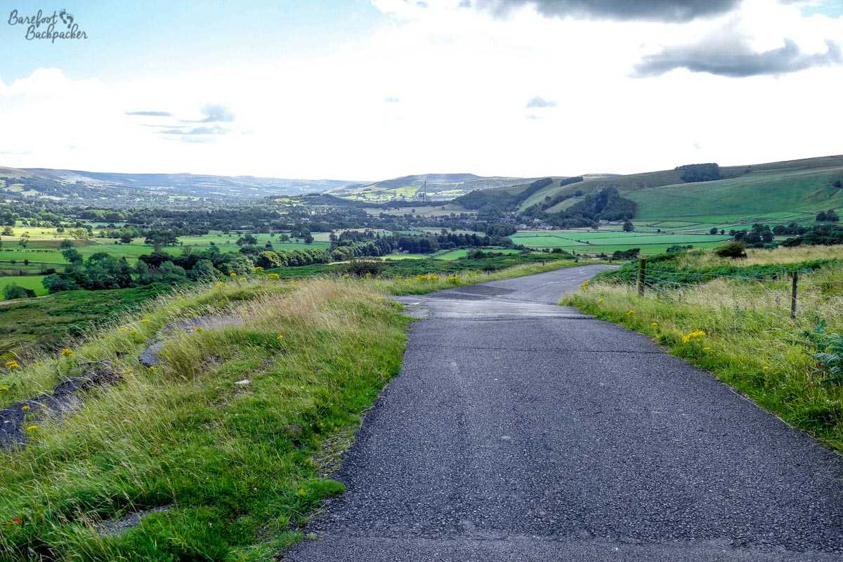
Dead road, looking Southbound, back towards Edale and the Hope Valley.
It’s weird to think cars used to drive on this!
Of course the Peak District is far more than just this area, and I haven’t even mentioned Bakewell yet! For another time, methinks!
Areas visited: Derbyshire, Sheffield. Dates visited: 11 August 2013, 8-9 August 2015, 19 November 2016, & 5 August 2017.