The Sefton Coast is the part of England just north of Liverpool, and stretching some 15 miles to Southport. It’s where the borough of Sefton meets the sea.
Sefton, as a borough, is a new invention. It was created in 1974 as one of the metropolitan boroughs that made up the New County of Merseyside, and when that was abolished in 1986, it became a stand-alone borough, a top-tier admin area and effectively a county in its own right (*). Prior to 1974 it had been part of the County of Lancashire, and many people who live there wish it still was. This is possibly because they feel Liverpool dominated Merseyside so much that places further north felt underfunded and ignored. Doubly so as the borough of Sefton includes the area of Bootle, an area coterminous with Liverpool and which … needs the funds, let’s be honest, so any benefits given to Sefton as a whole tended to end up there. Mostly though it’s a form of snobbery and and unwillingness to be associated with a large city; much of Sefton Borough is quite affluent and middle-class.
Affluent or not, it’s still a seaside resort.
(* The exact nature, definition, and even type name, of admin areas in the UK is a complex mess of semantics that is beyond the scope of this blog. But it’s why my aim to visit every ‘county’ in the UK needs two paragraphs of caveats and explanatory detail.)
It’s not a big place; it has an area of 155 square km, and apart from a bulge in the south-east, it’s never more than three or four miles wide. The name comes from a village in the south-east (‘farmstead in the rushes’), which lent its name to the local landowner’s peerage title (The Earl of Sefton). Part of the reason the borough was given this name was because of the animosity between Southport and Bootle.
The borough was my base for my teenage years. I lived in the suburbs of Southport, in the small town of Ainsdale, and I went to secondary school in the large town of Crosby, some 9 miles south. I’m not saying it was the most exciting place to be a teenager in, but equally the era I grew up in was very different to now, so your mileage may, of course, vary.
What makes Southport interesting?
Southport in general is most notable for being a seaside resort. While a little more, shall we say, posh and refined than places like Skegness (the football show Match of The Day once described it was ‘geriatric’, and indeed that the time I lived there, there were more retirement homes in Ainsdale than pubs. It was, literally, a place where you go to die, like Eastbourne on the south coast, rather than a place where you go to live), it pretty much had the same feel and vibe as most other similar places, just in a slightly more middle-class way. Ainsdale specifically was home to a holiday camp, of the kind beloved by families, where they tell you to have fun.
Southport is very weirdly named. It’s not ‘South’ of anywhere particularly notable, and it’s not a port. It seems to have been named after an old hotel and pub, built at the end of the 18th Century specifically because it was by the sea, and seaside trips were becoming trendy amongst the middle-classes (the only people at the time who could afford to go). There had been villages and small towns in the area – Ainsdale itself for instance is a name of Viking origin – but this South Port Hotel was the beginning of the current town. It really started to grow when the railways arrived in 1848, bringing Victorian pleasure-seekers and sea-bathers, but never achieved the mass-market appeal of places like Blackpool, so always maintained a kind of genteel vibe. You can see Blackpool Tower from Southport beach – 18km away in a straight line, but 55km away by road, because the first bridging point over the River Ribble is all the way at Preston.
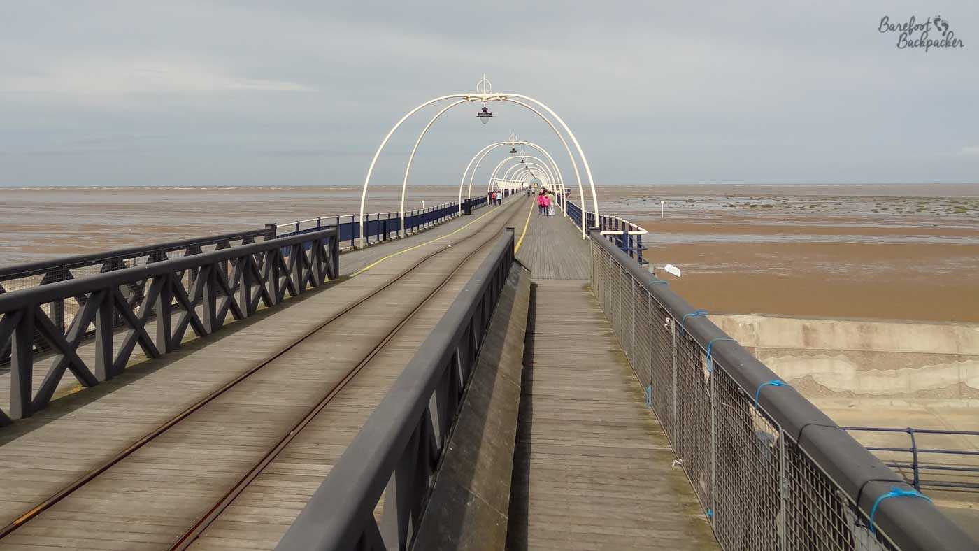
Somewhere along Southport Pier – you can see how long it is.
Southport has a huge pier – the second longest in the country at 1.3km (the longest is at Southend in Essex, a fact I wouldn’t have known without researching) – that stretches out across the sand. There was even a tramway that ran along its length, although for cost-cutting reasons now it’s been replaced by one of those cheesy tourist toy-road-train things. It’s also the oldest iron pier left in the country, having been built in 1860.
The beach at Southport itself is huge, partly because the town lies at a bulge between two river estuaries (the Ribble and the Mersey) so the area has accumulated a lot of sand and silt over the years. The running dark-humour in my childhood was that if global warming caused the sea level to rise, it would flood half the world, but at least you’d be able to see the sea from Southport pier. It’s large enough too to have been used as a training and fitness ground, especially for horses – noted Grand National winner Red Rum was a regular visitor to the beach in his heyday – but also for humans.
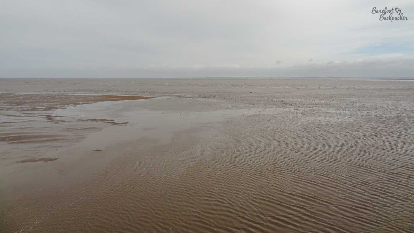
The featureless expanse of Southport beach.
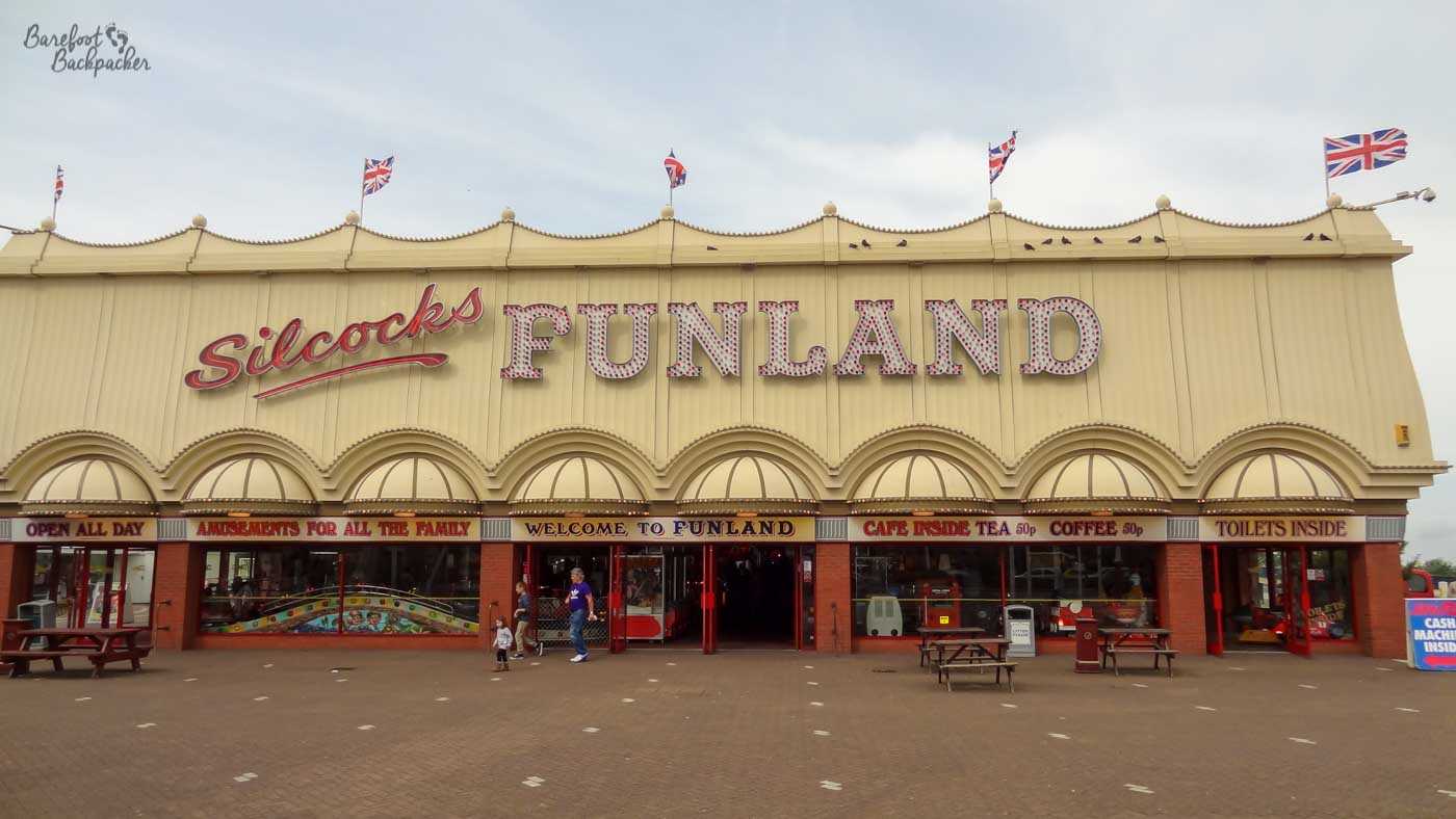
The town itself always felt like a veritable throwback to the Victorian era, with iron aprons covering the pavement in front of the shops on a couple of the streets, buildings that have been in place for over a hundred years, and during my childhood it still had a wooden roller-coaster, the largest in Europe it was claimed. Pretty much on the beach, yes. Although it had some amusement arcades, the entertainment tended towards catering for the older crowd – easy-listening singers and cabaret acts were more popular than pop stars here.
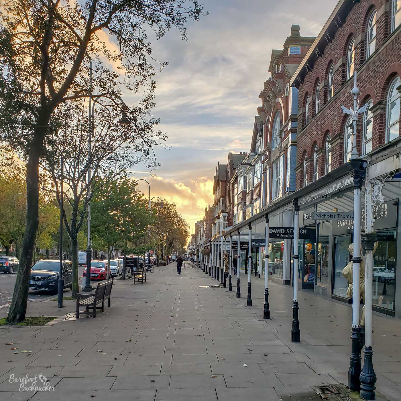
Southport Lord Street – faded grandiose elegance.
On my last visit there, which involved a very good little micropub, it struck me that the town didn’t have a Greggs bakery. Given there’s over 2,000 in the country, I’m going to suggest that, at just under 92,000 people, Southport is the largest town in the UK without a Greggs. It used to have one, but it closed. I don’t know if that’s Sefton Exceptionalism revealing itself again.
What’s interesting on The Sefton Coast
Stretching for about 20km from Southport to Crosby, with an RAF rifle range in the middle, the Sefton Coast is a Site of Special Scientific Interest. Much of its length is lined with sand dunes and covered with marram grass. It’s possible to walk on paths through the dunes, although for reasons of both environmental concerns and safety, it’s not recommended to walk over the dunes themselves.
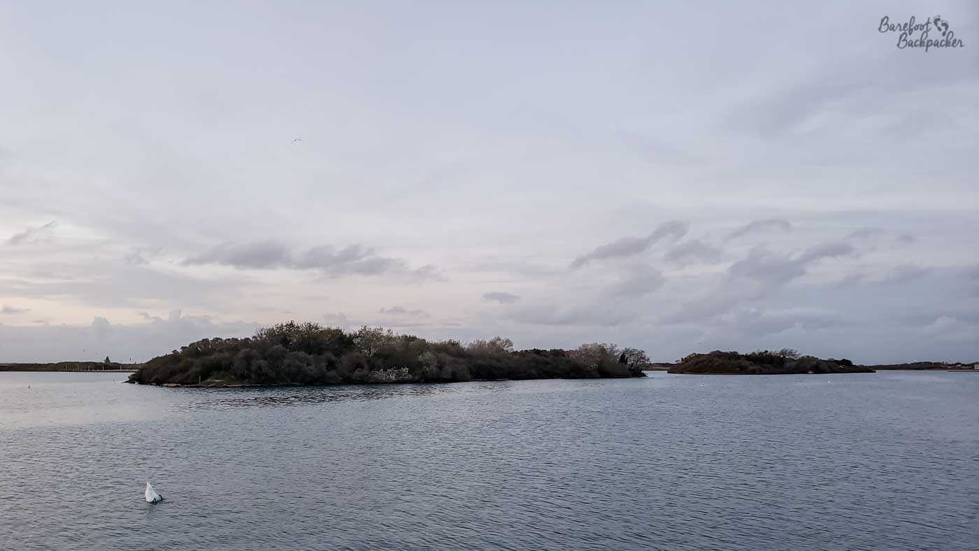
The dunes start just south of Southport itself, but really pick up around Ainsdale and then south to Formby. Formby itself is an incredibly leafy and well-to-do place most famous for its large pine forest and red squirrel nature reserve. Indeed this is one of the few places in the country where the native red squirrel is able to thrive, in the face of the invading grey squirrel.
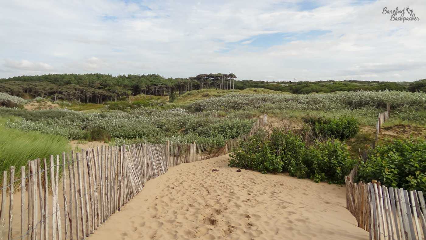
The edge of the nature reserve at Formby, towards the dunes.
As a personal anecdote, I was in the school cross-country team and we used to regularly go training on the sand dunes between Hightown and Hall Road Railway stations, just north of Crosby. I don’t know how many of you are runners, but running on sand is … it’s hard. It really stretches and develops your leg muscles. Especially doing star jumps and burpees on 45º sand hills. To this day, the word ‘burpee’ brings back memories of running. I’m not going to lie, the training worked, but I’d rather not.
Speaking of which, this is, by the way, where I developed my love for both forests and running; my uncle would drive there to take the dog for a walk through the woods while I’d run home. It’s kind of why I feel at home in the woodlands – it was great to be alone in such a natural space, away from the stresses of, well, teenagerhood.
The Sefton Coast is also noted for other wildlife, including obviously birds – which I know nothing about – but also the natterjack toad, a creature I knew even less about than wading birds. It’s a short-legged creature, also native to the UK, but which has again seen a steady decline over the decades. It is now found almost exclusively at a handful of western coastal sites. It is, however, distinctive and specific enough to here to be referenced across shops and businesses in the area.
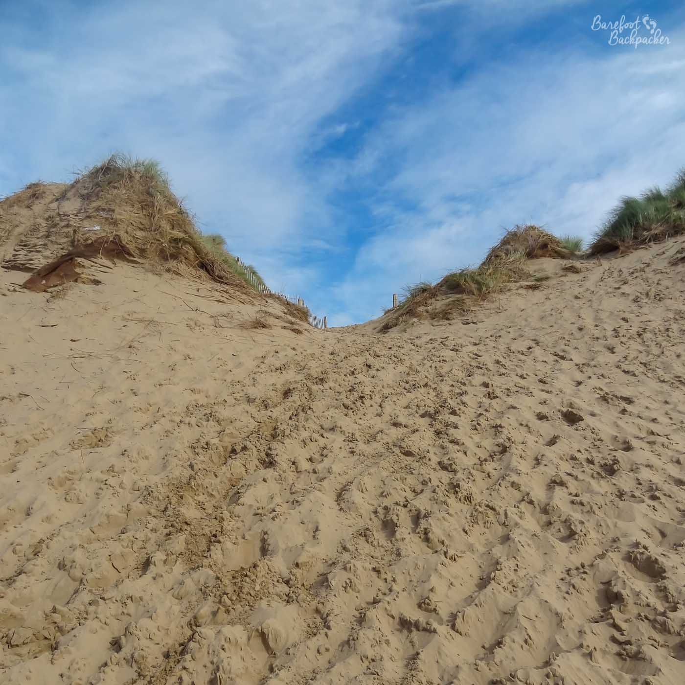
My school cross-country training had us doing burpees and jumps and sprints in places like this!
As an aside, the dunes are probably the nearest thing this area gets to any kind of hill that isn’t an artificial slope for a bridge.
Are Crosby and Bootle worth visiting?
At the southern end of the Sefton Coast lie the towns of Crosby and Bootle. These are very much residential overspill and commuter-belt for Liverpool; indeed the border between Sefton and Liverpool in the Bootle area is one of those ‘but it looks the same; why here’ moments, similar to many other artificial suburban admin boundaries.
Of the two, Crosby is much more the traditional middle-class suburban town, although the southern end, at Waterloo (named after a local hotel, and yes, there’s a railway station there too) does have more of an urban feel to it. Between Waterloo and Crosby town centre was my secondary school, and again we used the roads and the promenade for cross-country running training – which is of course much easier than sand dunes.
These days however, the beach at Crosby is the location of a display of modern art. Installed in 2005 and originally intended to be merely a temporary feature (their next stop was due to be New York at the end of 2006), they’ve become pretty much a permanent attraction.
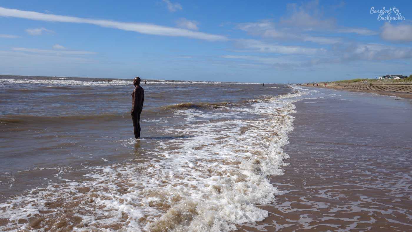
One of the many statues on the beach – placed so when the tides come in, they can paddle.
The whole piece is by Sir Anthony Gormley and is called “Another Place”. It’s made up of 100 cast iron statues (the “Iron Men” as they’ve come to be known) spaced out over 3km along the beach and up to 1km out to sea. All the statues (each one weighing 650kg) are essentially ‘selfies’; they’re casts of Gormley’s own body (including *that* bit, yes!), and they’re placed looking out to sea in that ‘middle-aged man trying to find peace in a busy world, looking wistfully into the distance’ pose that I’ve also always tried to perfect. Tho obviously I’m never naked. Ewww. Shudder.
I didn’t realise they started on the beach – I waded out into the sea when I saw the first few and got hopelessly soggy taking pics; felt like a right nana when I walked South a bit and saw a couple in the middle of the sand.
From here though the coast gets less accessible and much more industrial. Indeed at Seaforth, the famous docklands of Liverpool begin, which stretch down beyond the city centre as far as Toxteth and Dingle. There used to be a railway that ran above and along the docklands, the Liverpool Overhead Railway, but it closed in 1956, which is a shame as parts of it would have made a good commuter route and tourist attraction now. In my youth there was at least a road you could drive down to see the industry and the docks, but they closed part of that off in the late 1990s to expand the Royal Seaforth Dock.
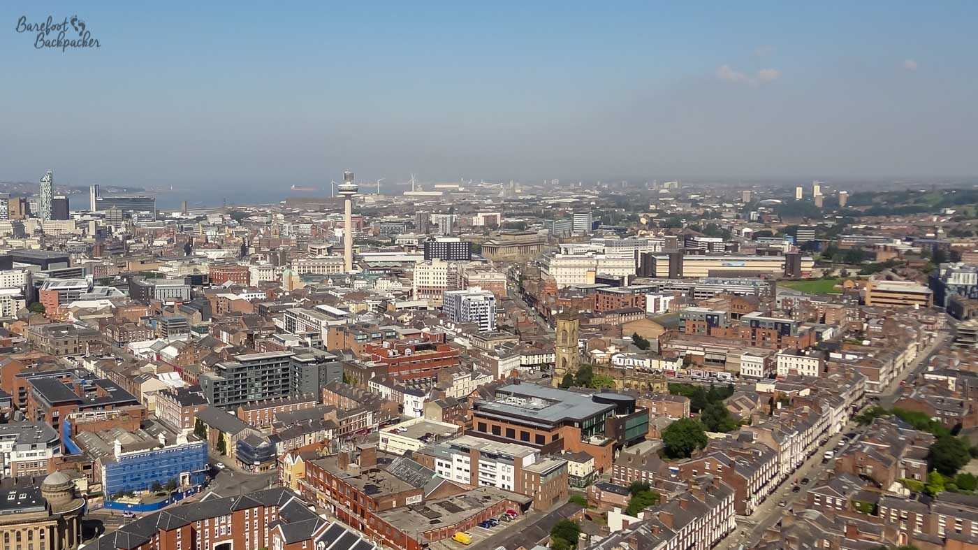
I don’t have any pics of Bootle itself, but this view from the top of Liverpool’s Anglican Cathedral is looking in that direction – Bootle is on the waterfront, nearer to the camera than the ships at and windfarms near Seaforth Container Base in the far distance.
Bootle is where the River Mersey meets the sea, but unlike New Brighton across the river (which has two waterfronts), it used its position for trade and commerce rather than social pleasure. So as you can imagine, Bootle is a very industrial area, with rows of brick-built terraced housing and small gardens; a far cry from the detached houses on the leafy avenues of Formby and Southport. Or at least it was a very industrial area – much of the industry was closed or streamlined in the decades after the 1970s and now it’s … it’s often touted as the most Labour parliamentary constituency in the country (a feat it’s fought with my childhood seat, Liverpool Walton, for), which gives an indication of the sort of place it is. It’s also noticeable that the most popular sites in Bootle on TripAdvisor are mostly pubs, clubs, restaurants, and venues.
What sports are popular on The Sefton Coast?
Golf is a very popular activity along the Sefton Coast. There are at least 10 golf clubs in Sefton, mainly in the Southport and Ainsdale areas. They take advantage of the flat land and the naturally sandy soils to create apparently decent links courses; indeed Royal Birkdale, between Southport and Ainsdale, has hosted both the Open Championships and the Ryder Cup. I’m more familiar with Formby Golf Club, if only because some of the paths I used to take to go back home from Formby Nature Reserve ran through it. It was never a sport that appealed to me (“A good walk, spoiled”), though apparently if we had a natural aptitude, we could have done it at school in the 6th form. I went to that sort of school, yes.
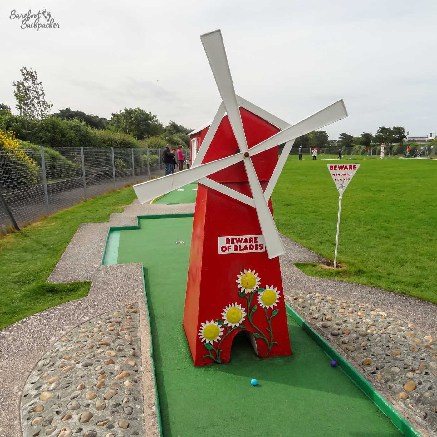
Golf courses are very boring to take pictures of, so here’s a ‘crazy golf’ course near Southport Pier.
The school I went to was also very fond of Rugby Union, to the extent that they had an ex-England international as the specialist rugby tutor. We didn’t get along, as you can imagine. Anyway, he’s dead now. As is the teacher who failed to teach me to swim, slightly ironically as it happens. There used to be a top-flight rugby union team in Waterloo, that the school may have acted as a kind of unofficial feeder for. The club still exists, but are now (at the time of writing) in the 6th Tier, and while ex-international Ben Kay played for them (and was in the year below me at school, incidentally), he left for a bigger club long before he made his name.
Football (soccer) is obviously popular, but that the city of Liverpool is ‘just there’ means most people tend towards Everton and Liverpool rather than the local clubs. Southport had a football league team until 1978 when they were voted out (as was the process in those days) in favour of Wigan Athletic (who achieved more success than Southport ever did). Even when they were in the league, attendances at matches were more akin to non-league than league ones. They’re currently in the 6th Tier of the football league system, albeit given the depth of football in the UK, that’s a much bigger vibe than being 6th tier of rugby union’s structure.
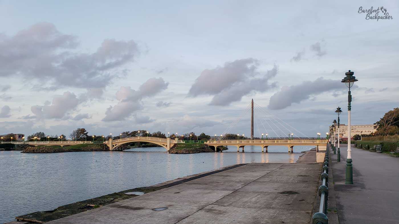
Southport’s Marine Lake at dusk.
Both Crosby and Southport have venues for watersports. In Waterloo there is a huge Marine Lake and lakeside adventure centre, where you can go boating, sailing, etc. Another Marine Lake exists in Southport with facilities for stand-up paddleboarding, jet-skiing, pedalos and kayaking. And of course the sea is ‘right there’, well, ‘over there somewhere, beyond the end of the beach’. None of these are things I’ve ever done of course, so you’d be better off finding some other blog to look for those details and recommendations.