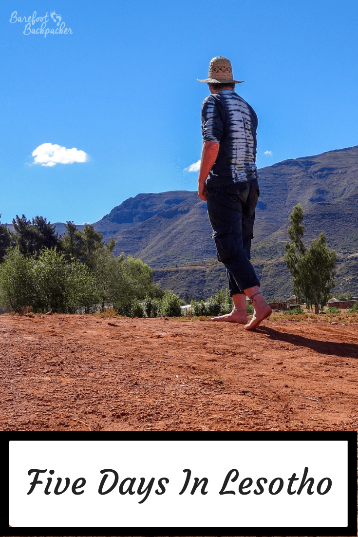
I only had five days in Lesotho, but it was enough to let me see that it’s a particularly beautiful country, friendly, and somehow quite peaceful. A bit like Kyrgyzstan, but with smaller lakes and less cultural desire to play polo with a dead goat.
Facts about Lesotho
- It is entirely surrounded by South Africa. This is a legacy from colonial days, when it was administered as the protectorate of Basutoland. The natives undertook several years of armed resistance and, indeed, open revolt that the Cape Colony could not quell. The British took direct control in 1884 and ruled it separately; when the provinces in the rest of the region formed the Union Of South Africa in 1910, Basutoland was not party to those arrangements. Moves to return control to South Africa stalled once the Apartheid policies started to be implemented; the country won full independence in 1966.
- That being said, there is a movement within Lesotho that calls for integration within South Africa, partly due to being so economically reliant on it, but also as a means to resolve the HIV epidemic; it has the second highest rate in the world (estimates of around one in every four people is infected).
- Ryan Coogler, the director of the film Black Panther, has said that, while the country of Wakanda is located somewhere between Burundi and South Sudan, his vision of it for the movie is based on Lesotho.
- Just like Burkina Faso, Lesotho have never won an Olympic or Paralympic medal.
- It is the country whose lowest point (1,400m) is the highest in the world. This makes the entire country higher than Ben Nevis, the highest point in the UK. Indeed it is the only country in the world entirely located above 1,000m. Yes, it gets very cold in Winter; even in the (haha) lowlands average temperatures are noticeably below zero Celsius.
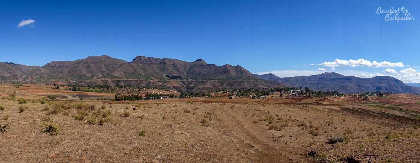
Typical scenery of Lesotho; mountains and wide open spaces
Malealea
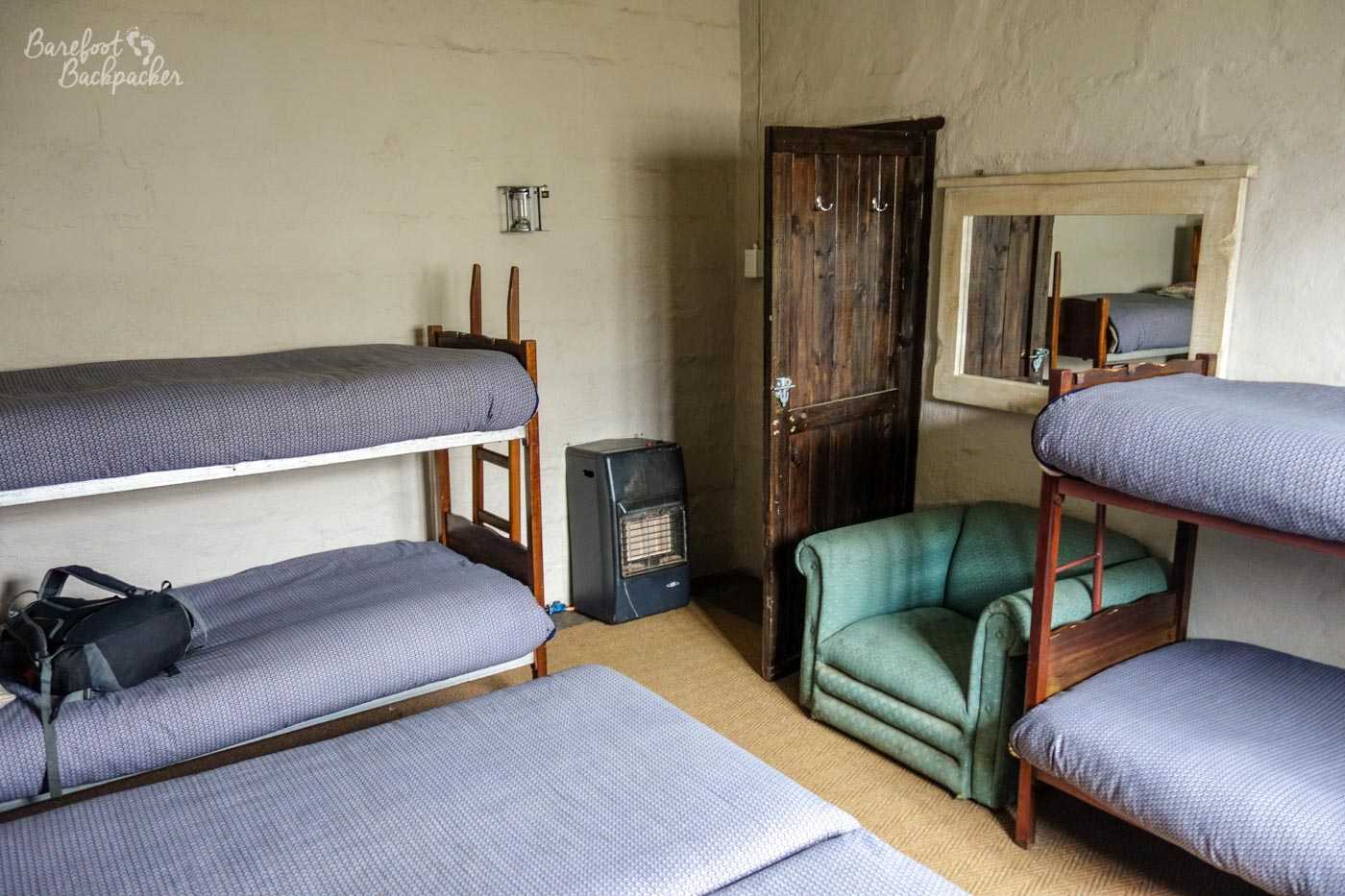
I had five nights in the country, in three different locations, but the bulk of my time was spent at Malealea Lodge, a remote site in the hills in the south-west of the country some 85km from the capital Maseru. I had three nights here, spent in a small Basotho hut – a small rondavel equipped with a bed, linens, and a great view out the door out into the wilds. I could have stayed in something more luxurious, with ensuite facilities, but I’m sure you know me well enough by now to know that was not going to happen. Had I had camping equipment it would have been possible to pitch up and spend the evenings in a tent, but while I’m content to do that in the UK, taking my entire camping equipment on a three-week trip around Southern Africa isn’t my beef.
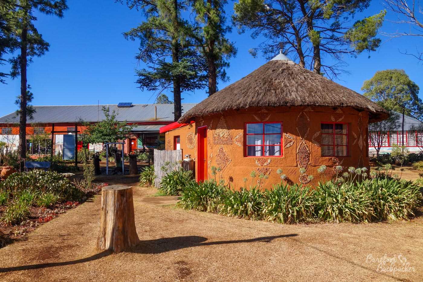
The “rooms” at the Malealea lodge; I think these are the Basotho Huts, like the one I was in.
The lodge was actually pretty large in scope – the rondavels and huts were scattered across the grounds, whilst in the centre was a large communal building where you could eat, drink (they had a fully-equipped bar), and play pool. There was ornamentation around the outside, including lots of plants and cute decoration, and of course they had the obligatory hammock from where you could relax and watch the sun set over the hills.
View from the hammock.
From the lodge it was possible to take trips out – I chose to do some hiking and a pony ride, though it was also possible to arrange homestays or do mountain biking. It was equally possible to just lurk around the local area, spend time away from the noise and bustle of everyday life, and, as they say, crack open a cold one and rest away.
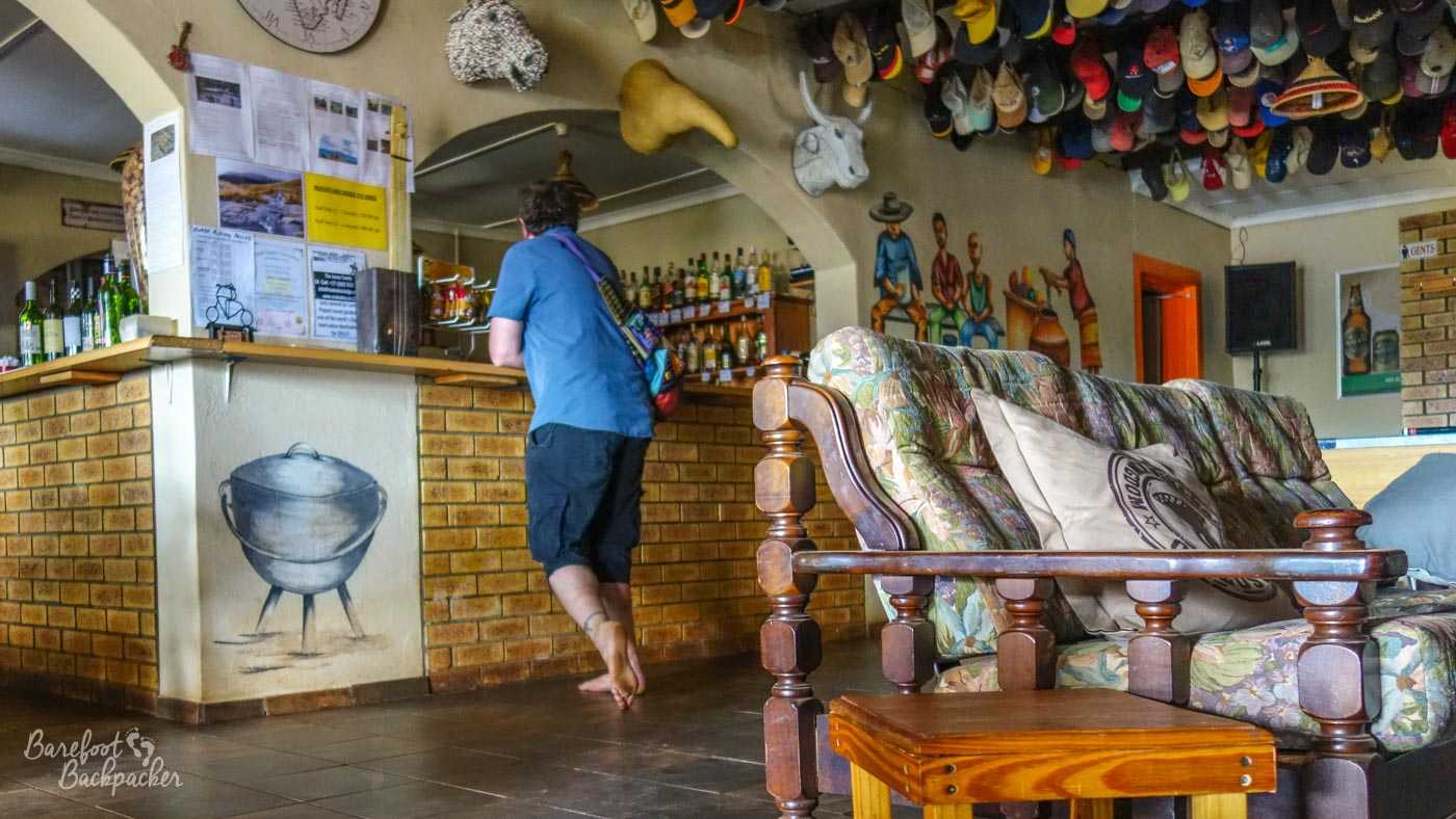
Waiting at the bar in the lodge for a drink.
The pony trekking took place on my first full day – a couple of hours’ ride over to the Botsoela Waterfalls, a journey that takes you through the hills and alongside a small river that eventually opens out into a wide pebble-strewn depression with a small lake.
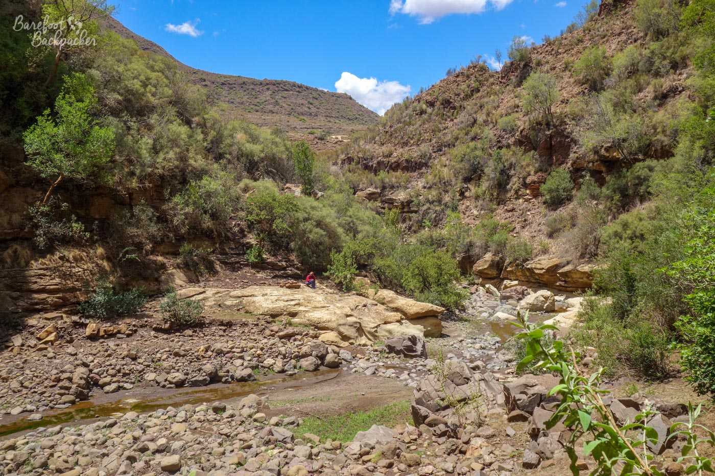
The river valley we followed on the pony trek.
Given that the rains were late this year, the waterfall itself wasn’t necessary as spectacular as others I’ve seen in Africa, but still very much worth the effort to get there, given the wide open scenery.
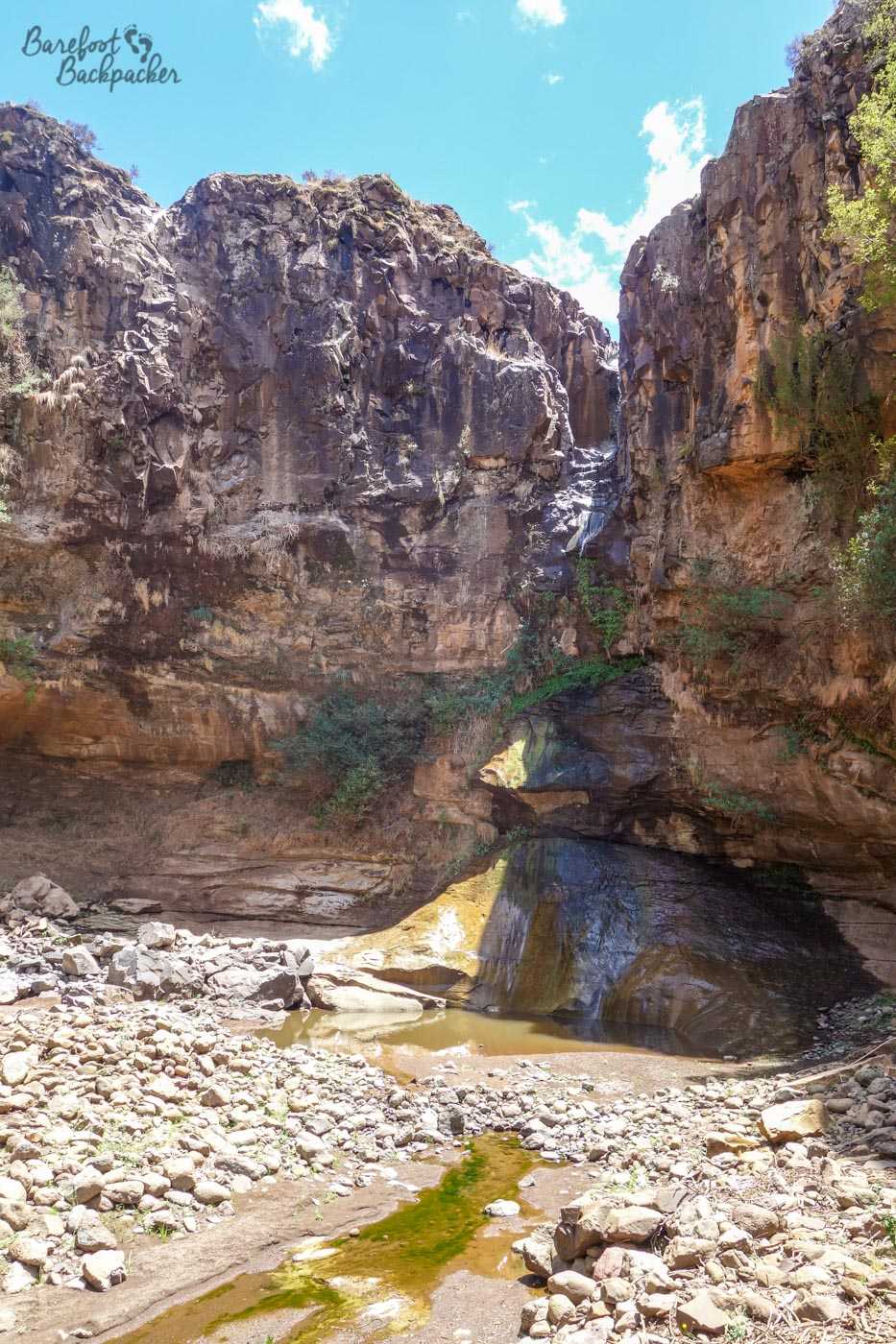
This is what happens when the rains are late .
Obviously this required me getting on a pony. There was a weight limit of 90kg, but no-one checked, and I’m not exactly svelte, so it’s possible I may have been a few kgs over. I’d love to say this is why my pony refused to go any faster than a jog, even at the end when everyone was galloping over the fields close to the lodge, but in truth … riding has never been my scene, partly because of a fear of heights, partly because of a dislike of being out of control, and partly because I’ve just never been that into animals anyway, so I’m actually rather glad for once to have been moving quite slowly.

I am not a cowboy.
Obviously I’m more at home trekking on foot, which is what I did the next day. Whereas on the pony trek there’d been about six of us, on this trek it was just me and one other tourist apart from the guide, and as there were fewer of us, I really felt the remoteness of the landscape much more than the previous day. Indeed once we left the grounds of the lodge it seemed a much emptier and distant place.
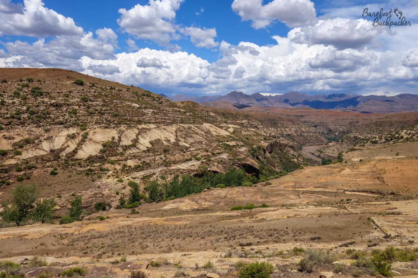
Lesotho’s Mountain Scenery, on the way to Pitseng Gorge.
We hiked down into a river valley; a gorge (presumably the Pitseng Gorge) with steep red rock sides that twisted around like some kind of coiled headphone cable. There wasn’t a lot of water in the river, so it was pretty easy going over the rocks along part of the river-bed, but it was easy to imagine what it would be like in full flow. Apparently further along there was still a spot where you could jump into a deep-ish pool to continue the trek but as I don’t swim, our path took us out of the gorge on one of the steepest inclines I’ve ever walked up.
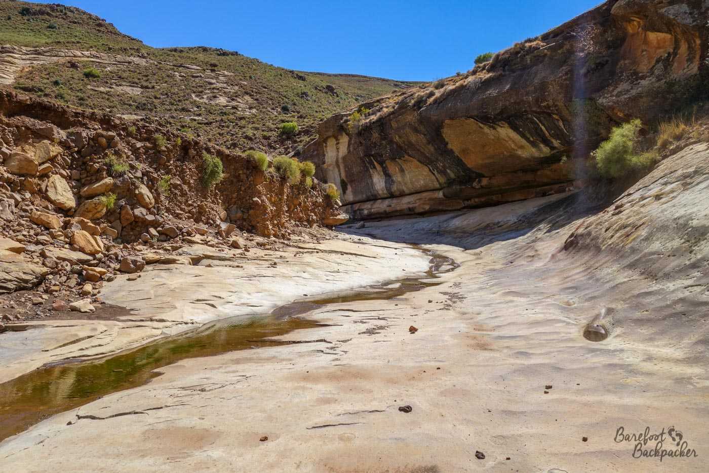
Inside Pitseng Gorge.
We were taken to a cave, hidden behind a section of bamboo forest, partway up a hill along a narrow path, overlooking another valley. Here, we were shown some cave paintings, similar to the ones I’d seen over in the Matapos in Zimbabwe, and drawn by the same people – the San, or ‘Bushmen’. The land they once roamed was thus pretty vast and quite diverse – it’s nearly 1,300km between the two sites, more or less in a direct North-South line – although the term ‘San’ itself is an exonym; a generic name given to a series of nomadic tribespeople by more settled and agricultural tribes (mainly in Namibia), and the name literally means ‘forager’, so it’s likely the actual tribes here and those further North are of a somewhat different ethnic heritage. They were quite an effort to reach, but I think it was worth the hassle.
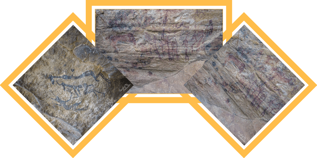
Examples of the San Cave Paintings.
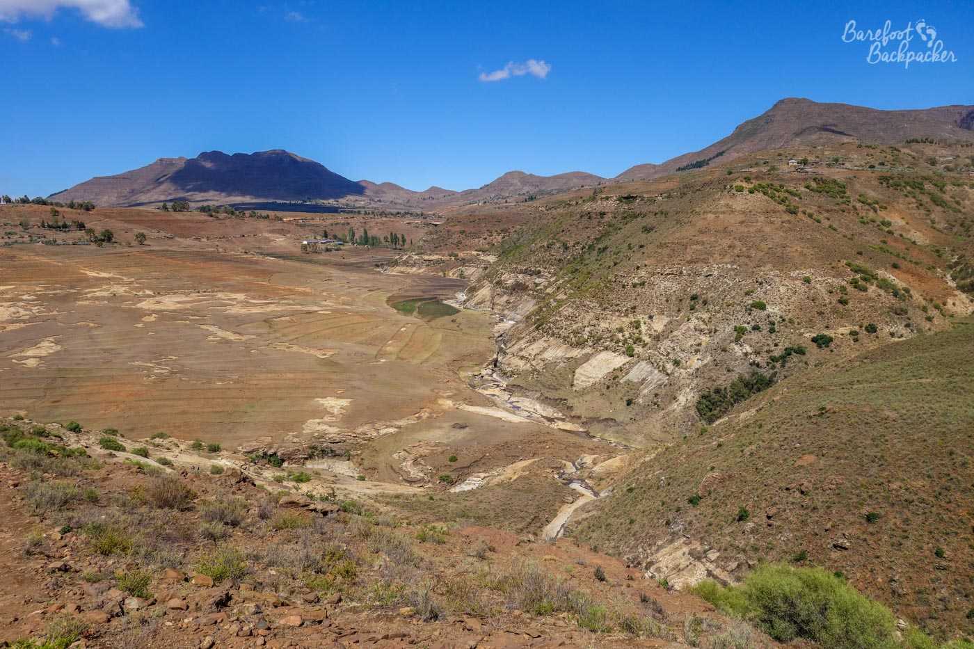
The rest of the hike back to the lodge was along the top of the gorges, in the dry foothills. Though it felt mostly like we were the only people for miles around, we did spot every so often a lone building on the mountainsides, or a solitary herder tending to a flock.
View over the mountain scenery.
We had really good weather for both the pony trek and the foot trek, but when the evening came we were treated to a couple of spectacular storms, and I even managed to take a picture of the lightning from the comfort of my hut’s doorway.
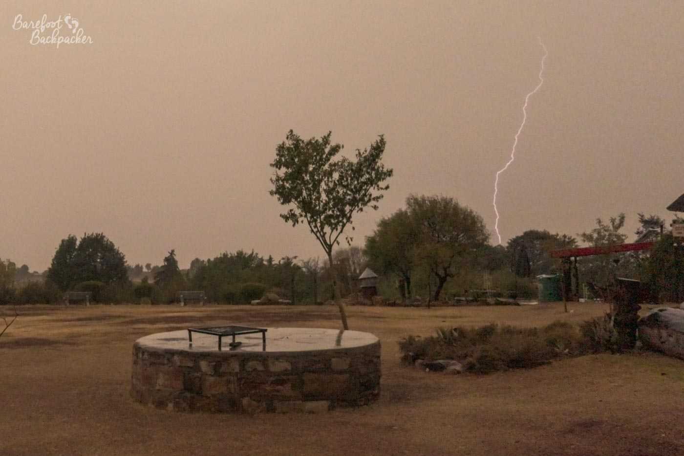
Lightning bolt. I was impressed I managed to capture it.
Mokhotlong
Getting to and from Malealea had been by share-taxi, which on the way out dropped us off a couple of miles shy of the lodge itself because the road in was gravel and best traversed by 4×4 vehicles, which the taxi … wasn’t. The same was true on the way back to Maseru; we had to walk a bit of a way before we could catch a vehicle heading back into civilisation.
Maseru is the capital of Lesotho but I spent only long enough there to catch a minibus pretty much across the entire country, to the small town of Mokhotlong in the north-east; my plan was to overnight here so I could catch the early morning (6am) bus down to the Sani Pass.
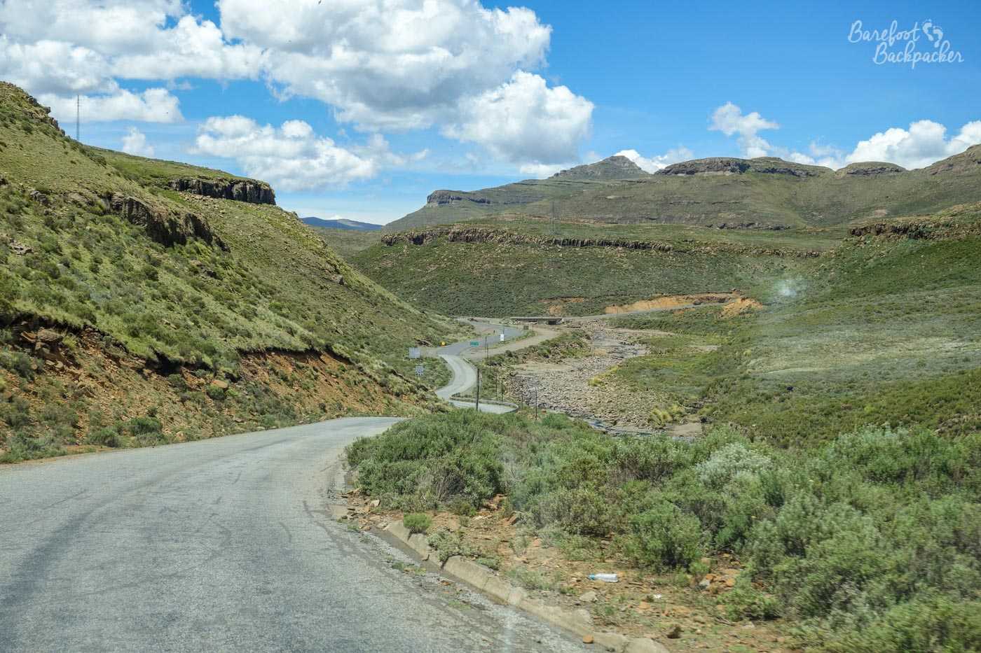
The road from Maseru to Mokhotlong, as seen from the bus
The journey over to Mokhotlong took about 4 hours and went through some of the most spectacular scenery you could imagine – I went along pretty much the only road of any significance through this part of the country, so all I could see out the windows were wild hillsides and brown fields, with the occasional valley or gorge in between.
Mokhotlong town centre
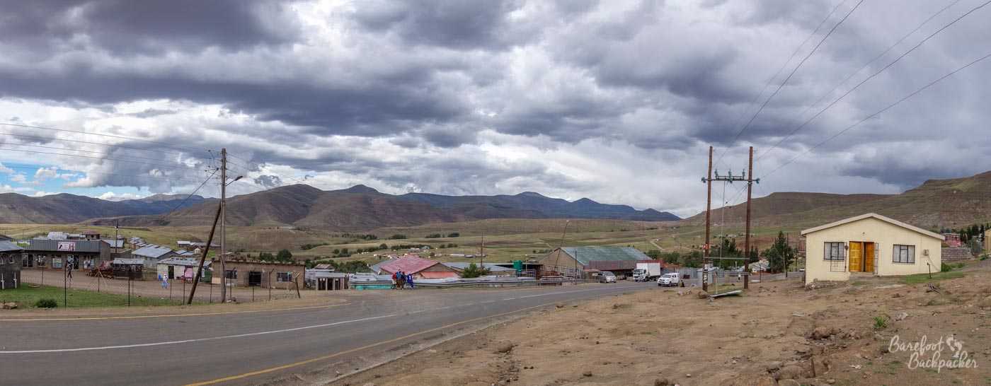
The town of Mokhotlong itself isn’t that big – the District it covers has a shade over 100,000 people living it, though that includes the outlying villages potentially up to 80km away from the main centre. The main road runs more-or-less east-to-west, and there’s scattered shops and businesses both on the road and down side-streets, but it’s a much more spread-out place than anything you’d find in the UK, or even in South Africa; there’s relatively sizeable gaps between the buildings and the main road feels like to goes on for a few kilometres.
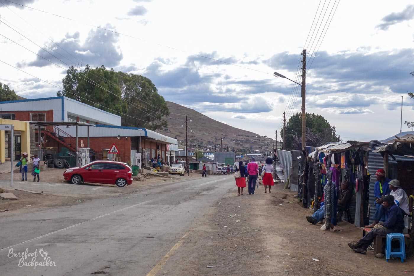
Mokhotlong town centre
I found a hotel not far out the centre, and close to a small supermarket with a relatively limited range. It may have been called the Bafokeng Guest House; anyway it was quite comfortable – nice double bed, ensuite toilet and shower room, not too expensive. My only problem, and this was nothing to do with the hotel, but I had a rather unexpected visitor.
At 2,500m up, the one thing you don’t expect to be sharing a hotel room with, is a mosquito. I’d just got into bed, lights off, when I heard that distinctive high-pitched drone. Cue lots of me getting up, putting the light on, trying to coax it out of the room with successive lights, failing, not knowing where it is because it’s so freakin’ small, giving up, and going to sleep as best I can.
As an aside, the day after I came home, my ankles had erupted with so many mosquito bites that my friend suggested I go to the doctor to check them out just in case I’d caught anything dodgy.
The Sani Pass
I caught the once-a-day early-morning minibus to the Sani Pass without any problem; it usually departs on time and full, and the day I caught it was no exception. Apart from one or two people getting off somewhere en route, and me at the border of Lesotho some 52km from Mokhotlong, pretty much everyone on board was heading down into the South African town of Underberg.
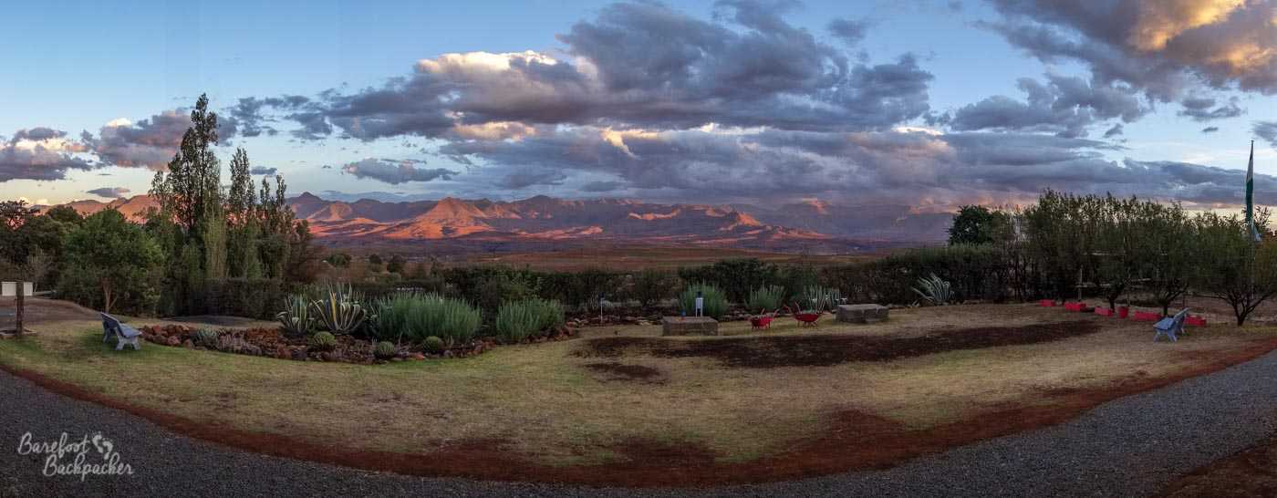
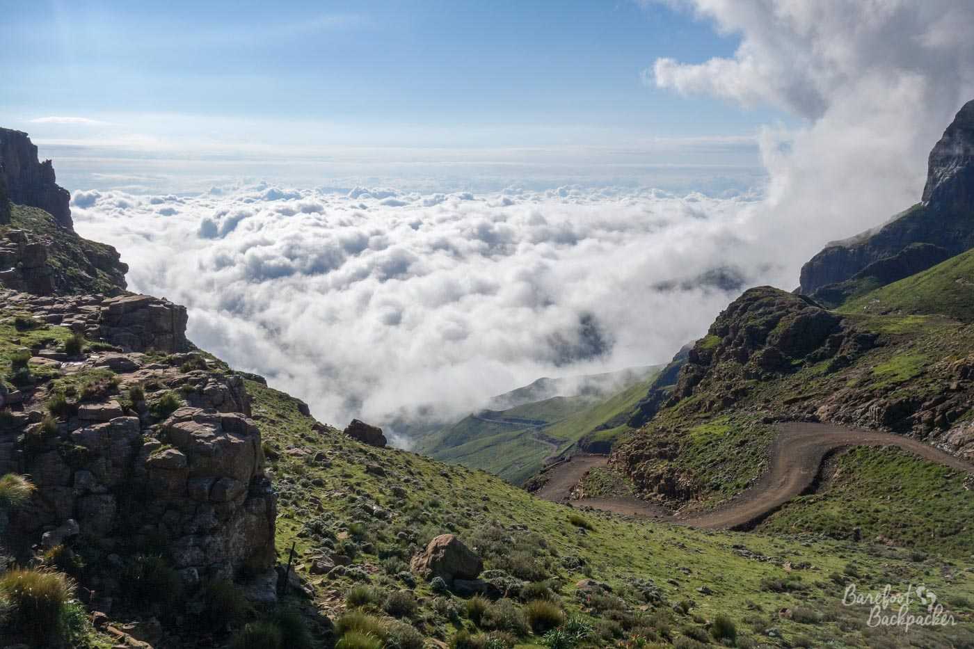
Now, the Sani Pass is the main passageway from Lesotho to the south-east, that gives access to the lands of KwaZulu-Natal Province of South Africa. It reaches its highest point at 3,240m on the way, though the Pass itself at the Lesotho border post is only 2,873m. And it is a spectacular road through south-eastern Lesotho – in the early morning you’re above the cloud-line so you can see the mist below you, like a sea of cloud bathing the hillsides whilst above you is the clear blue sky of a summer’s day.
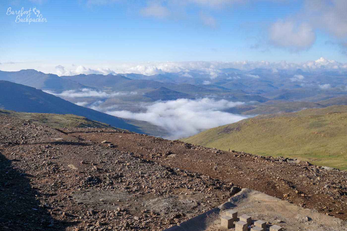
Clouds below the eyeline on the way to Sani Pass
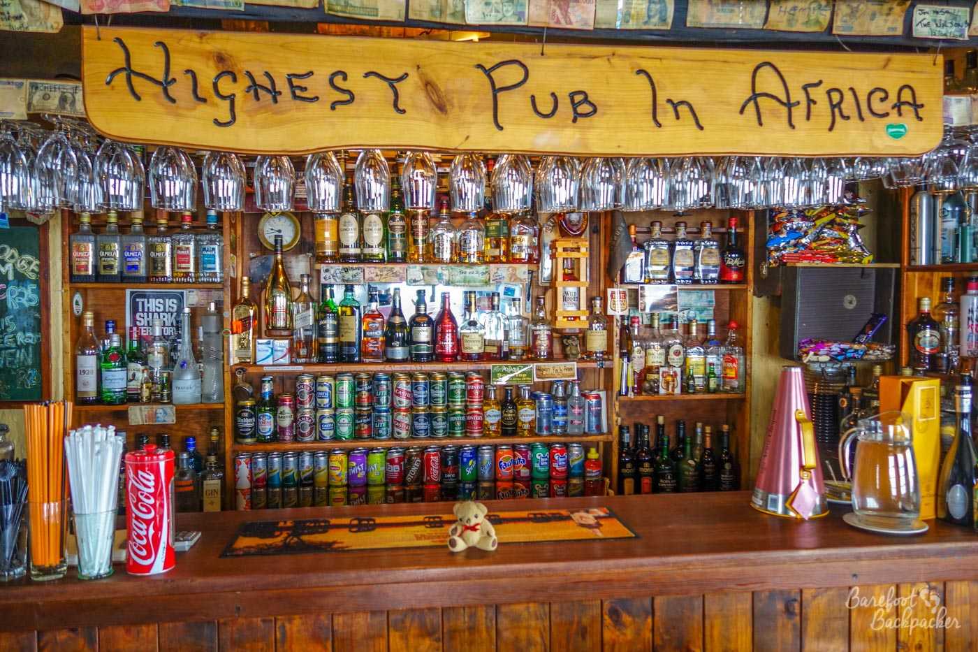
At the border post is the Sani Pass Mountain Lodge – a busy pub and guesthouse that’s most noted for being the highest pub in Africa. The walls are layered with the graffiti of previous travellers, mostly on canvas frames (including TV personality and motorbike fiend Charley Boorman); the previous activity of writing directly on the walls themselves is now expressly forbidden, according to a sign nearby, though it does feel like an instruction of futility given they haven’t cleaned the walls since. Reader, I did not add to the carnage.
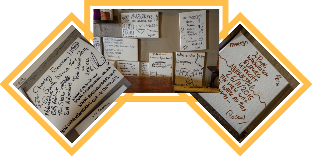
Graffiti at the Sani Pass Lodge
Despite arriving pretty early (8am-ish), it was no problem for me to check-in. I wasn’t staying in the guesthouse itself, because I’m the budget traveller; rather a couple of hundred metres away was an outlying building that served as a dormitory – bathroom facilities, a small lounge area, and a 10-bed dorm room. Which, as a bonus, and despite the pub itself being quite crowded during my stay, I was the only person staying in. It seems most of the visitors were South Africans coming up the pass for the day, or a cheeky overnight stop in more salubrious surroundings.
Dorm room at the Sani Pass Lodge.
My plan for the day had been quite simple; dump my baggage in the dorm, grab a bite to eat, then head out to do a small bit of hiking in the nearby hills – from the lodge there’s a number of defined trails you can do, clearly marked apparently. For about a quarter of an hour, this worked perfectly. Except then the mist rolled in. And if there’s one thing you don’t want to be doing in fog, it’s walking around a featureless hillside following markers that you don’t know what they look like. I was a little disoriented already, having followed the path into a field of sheep and past what appeared to be a derelict stone shepherd’s hut, but when the fog descended, I figured it was probably for the best to try to retrace my steps and try again later. Which was fun when the fog was too thick to even pick out the only active buildings and road for about 50km around. But obviously I got back safely and quite briskly, only tripping over rocks twice. You may, for the record, be pleased to know I was not doing this barefoot.
Baby Ian preferring beer to hikes in the cloud. Don’t blame him.
Anyway, I thought I’d go back to the pub and wait for the fog to fade away in the morning sunshine. Unfortunately … it didn’t. Apparently it’s quite common here for the fog to last all day; it leads to quite pretty views but means I had to stay indoors and drink. Shame. I had a couple of journeys out to explore the immediate surrounds and take in the views down the valley and across the hillsides, but mainly I ended up chatting to a few of the visitors and getting an early night.
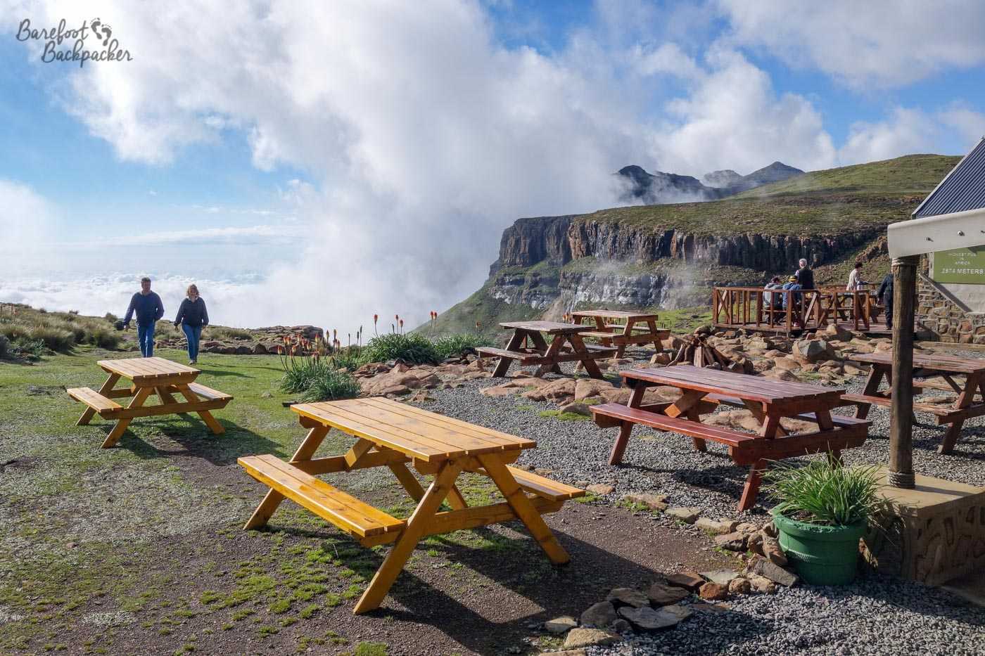
Outside the Sani Pass lodge – you can sit out here and enjoy the view. Sometimes.
It was in a way slightly disappointing to get this far and not be able to explore the area fully, bearing in mind I was only here one day and I’d probably never be coming back this way, but in truth I was just happy to see the place at all. I hadn’t even planned to come here; before I left the UK my original plan had been to go from Malealea back to Maseru and probably from there back to towards Johannesburg, but when I was discussing the trip with my friend Sarah, she did some research on Lesotho and told me I had to go to the Sani Pass because it looked beautiful. She was not wrong.
The Sani Pass, filled with cloud, as seen from the Sani Pass Lodge at the top
I saw rather more of the Sani Pass than perhaps I’d intended …
—
Like this post? Pin it?
Visited: 11-16 January 2016
Beautiful post, Ian.
I had been completely misinformed about Lesotho, thought it was a nondescript township outsourced late during apartheid, but now realise they have a long, proud history. The AIDS bit is terribly sad of course, but the post is very up-lifting.
Highest lowest point, the extreme temperatures, the barren landscapes. My favourite pics are the ones from the pass and, of course, the magnificent “waterfall”.
I liked your writing style before, but this one is my favourite post so far.