To most people, the name “Victoria Falls” conjures up an image of a vast cascade of water, a loud and gushing torrent falling over a cliff surrounded by jungle amid a humid and sticky atmosphere.
To some people, however, Victoria Falls is the adrenaline capital of Southern Africa, where one can swim up to and peer right over the sheer drop of the falls, go white-water rafting over some of the fiercest rapids in the region, and bungee jump from around 130m off a bridge at an international border into a narrow and impressive gorge.
For once, I was ‘most people’ rather than ‘some people’.
See, I can’t swim, and I’m a little fearful of heights. And while I have no particular issue with having rope wrapped around my ankles (you have all seen my tattoo, I assume?!), the idea of then falling through the air with only that to keep me from an overly-fatal splash landing doesn’t thrill me with a great deal of longing. I’m so not an adrenaline junkie – I don’t even like gentle rollercoasters – and my idea of ‘living on the edge’ is going to a new town without either a map or a hotel reservation.
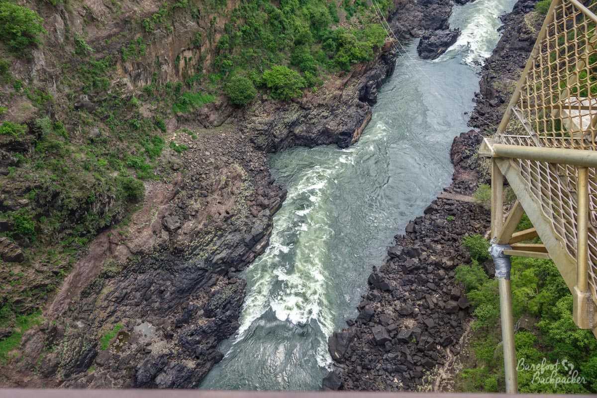
Pretty much the view you have when you take a bungee jump from the Victoria Falls bridge. No thanks!
Therefore, my overview of Victoria Falls might well seem ‘boring’ and ‘incomplete’ compared to other backpackers. But, ya know, I don’t care! I went there to look at a waterfall, and that’s exactly what I did 🙂 I was there for around 3 hours, the vast majority of it was spent walking through the trees looking at the falls from different angles. Because really, when you’re faced with one of the major Natural Wonders of the world, you want to take it all in. And because I like waterfalls. And forests. And the shade that the forests create.
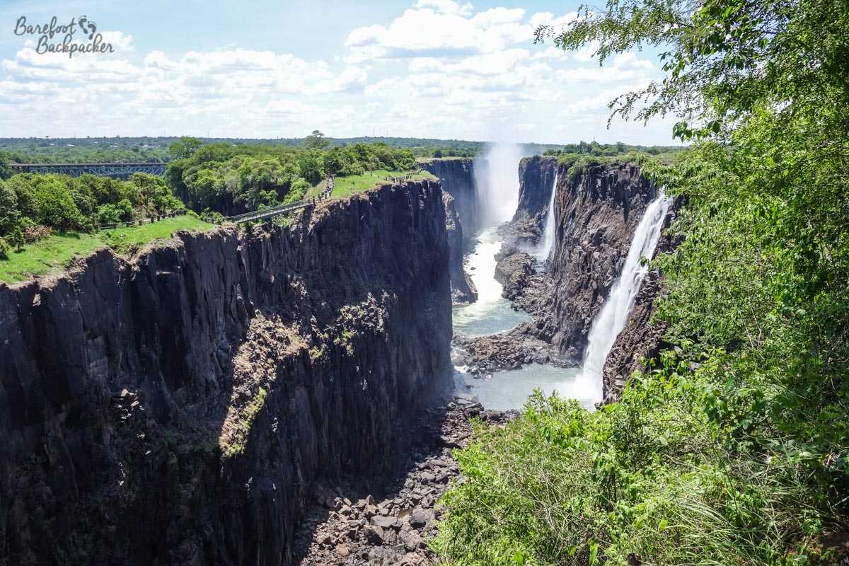
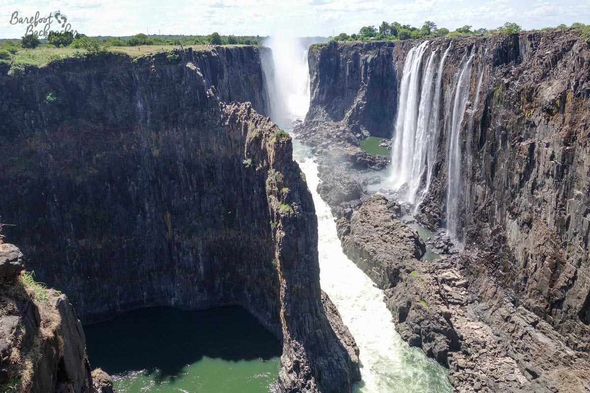
The first thing to state, however, is a slight disappointment. Yes the falls are spectacular and are absolutely a must-see for anyone who admires the beauty and power of nature, no matter what the season. However, I visited them a month into the Wet Season, but the rains were late. This means that rather than a galloping skirt of water draping over the entire cliff, I was merely faced with a whole series of smaller drops and a lot of bare rock. Don’t get me wrong – the vista was still absolutely spectacular and the sound of rushing water alone was enough to deafen you if you got too close, not to mention the spray being visible from several kms away, but for the time of year I went, it should have been even greater.
That said, the feeling is if you do go in say March or April, when you see the full force of the falls, the general consensus seems to be that the spray produced is so intense that it makes it difficult to see the falls at all. Also, for a wider view of the falls, it seems the Zimbabwean side is better, even if you’re a bit further away from them. I could have done that; I even passed through the town of Victoria Falls on my next leg of the journey South, but with hindsight I’m glad I didn’t – partly because I got a good impression from what I saw, and partly because it would have meant having one less day in Lesotho.
On the Zambian side then, there are four separate trails I could walk: ‘Upstream’, which headed off along the river and effectively ‘behind’ the falls; ‘Rainforest’, over the ‘Knife Edge Bridge’, which offered the best and closest view of the falls for those who didn’t want to sail/swim out to Livingstone Island and get on the edge of them; ‘Boiling Pot’ which was a trail that leads down to the gorge, out of view of the falls but gave an impression how big the valley was; and ‘Photographic Trail’ that ran alongside the main road, ending just before Victoria Falls Bridge and giving an overview of the whole valley.
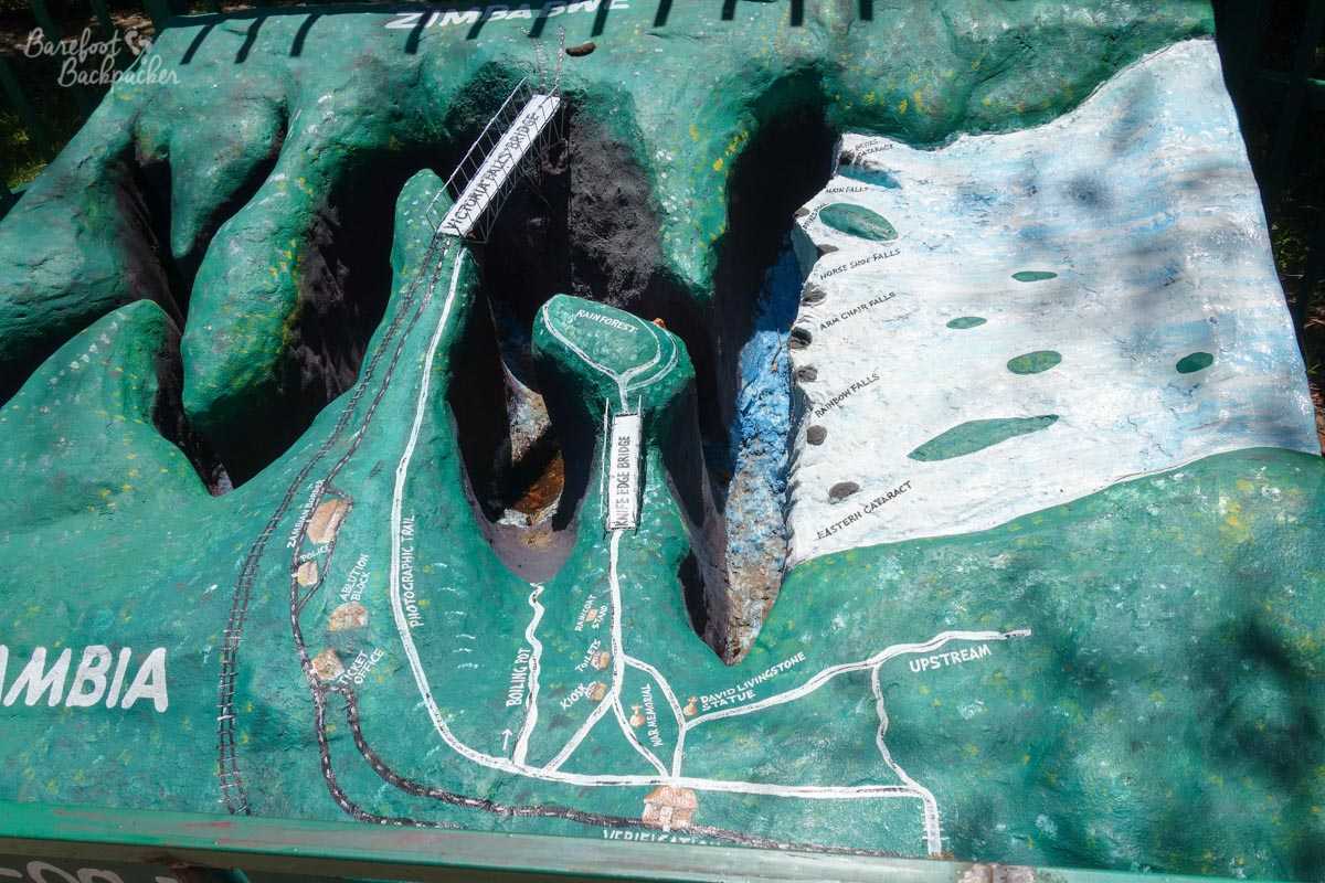
Contoured map overview of the Zambian side of the falls. I walked all the trails. Because they were there.
The ‘Upstream’ trail, as the name suggests, ran away from the falls themselves, along the cliff edge overlooking the Zambezi River. From here I got a good view ‘across’ the falls; it was a fantastic area to see, side-on, the entire scope of the river as it dropped over the precipice – each of the different ‘named’ parts of the falls were visible, at least as far as ‘Horse Shoe Falls’ anyway, before it all disappeared in a combination of distance and spray.
The Falls, as seen from the Upstream Path. The ‘Rainbow Falls’ are nearer the camera, the ‘Armchair Falls’ just beyond. The ‘Eastern Cataract’ drop is hidden by the trees on the near right.
The trail ran for a few hundred meters through trees until it sort of petered out by a limestone pavement and a water works; a quite ignoble end for an important, signed, path. At the other end, close to the main entrance to the Park, the trail started at a statue of the man himself – David Livingstone – looking out vaguely towards the Falls clutching a bible, emphasising his missionary rather than his diplomacy remit.
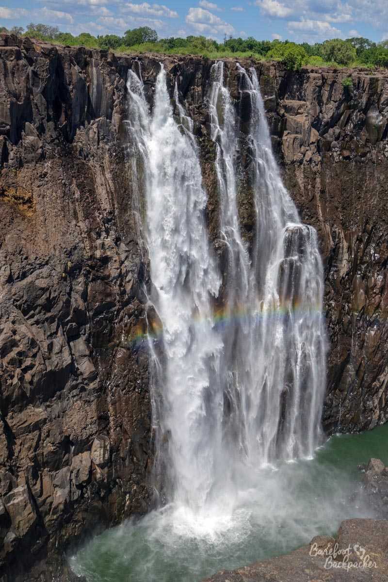
Close-up of the section of the cascade known as ‘Rainbow Falls’. It’s not hard to see why – the sunlight hits this part of the falls in such a way to cause a rainbow effect half-way up them. I’d imagine in full flow the rainbow is quite spectacular.
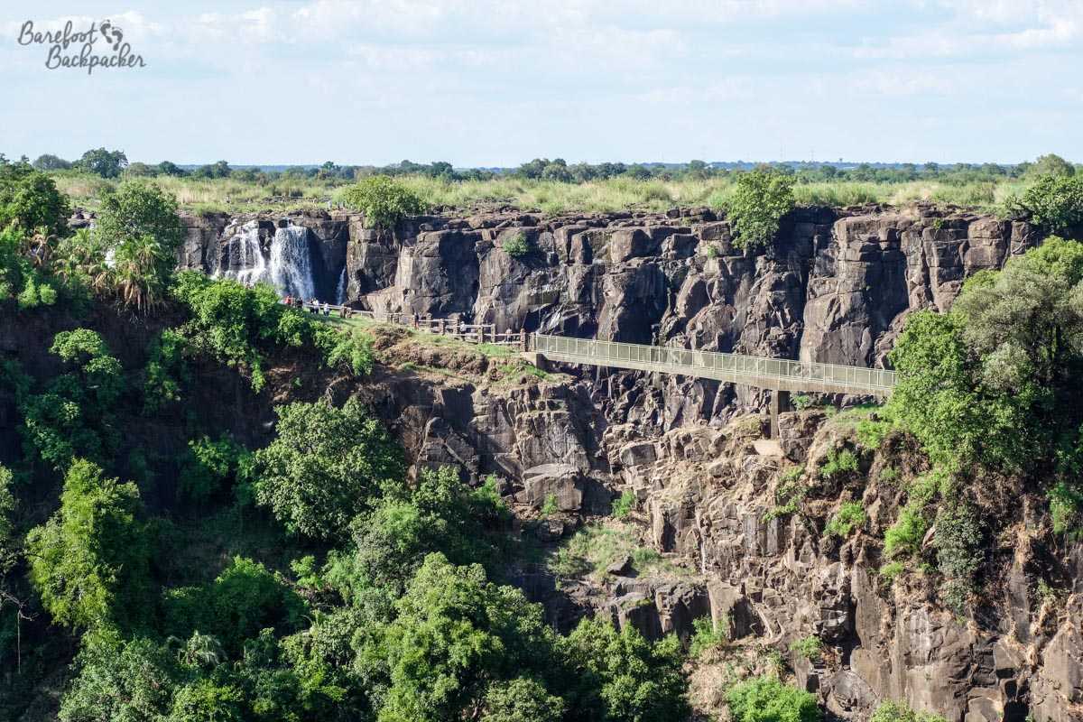
My next venture was along the ‘Rainforest’ path. This ended going in a loop on top of a small promontory that separated two vast chasms of the Zambezi River. To the right lay the falls themselves, giving direct face-on views of several of the separate parts of the cascade (to more-or-less halfway, past the ‘Rainbow Falls’ up to the so-called ‘Armchair Falls’), whilst on the left was a good view out over the forested landscape towards the Victoria Falls Bridge.
Overview from the other side of the Knife Edge Bridge; Victoria Falls bridge is in the distance. It’s impressive just how lush and forested the area is.
Looking further along the cascade, past Armchair And Horseshoe falls, from the tip of the rainforest path. The ridge of green on the deep left is the viewing point from the Zimbabwean side of the river.
It’s called the ‘Rainforest’ path because the end of the path, on the promontory, went through a small area of intense ‘rainforest’. Being totally honest, I’m no arborealist and couldn’t tell if the trees were any different to those on the other paths behind me, but it was a very pleasant and relaxing walk; it also took me along the cliff edge right in front of the falls so I had a very good view of the separate cascades. The humidity at this point was incredibly intense, and both the crashing of water and resulting spray filled two of my other senses. Further up the path, as it rounded towards the left, I got a good view of the Victoria Falls Bridge – the border crossing between Zimbabwe and Zambia and from which one could go bungee jumping into the gorge. I sat for a few moments at a lookout spot and saw a handful of foolhardy tourists do this very activity – to me it looked intensely scary even from this distance and it would never have crossed my mind to pay US$190 to get over my fear of heights. I’ve never hung upside down by my ankles even when I had the chance in a controlled environment and I’m not starting now!
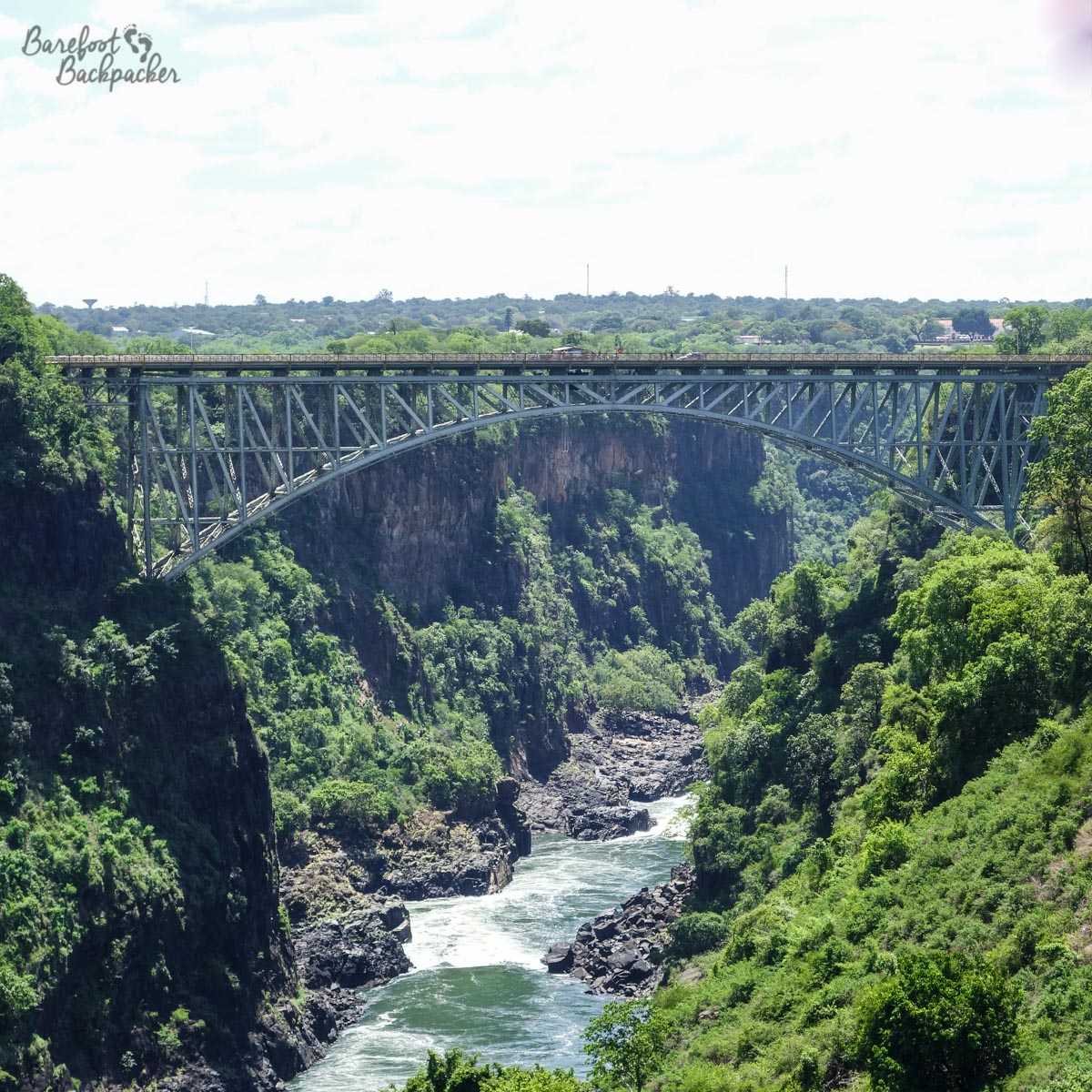
Victoria Falls Bridge. Built in Darlington (UK), and stands 128m above the Zambezi River. When opened in 1905, it was the highest in the world. A legacy of Cecil Rhodes. Him, yes.
The Rainforest Path. This felt like the most humid part of the walking I did – partly because it was so close to the rushing falls and partly through the psychology that a rainforest *should* be humid.
Oddly, I didn’t see that many people in this part of the trail, although the route to get here had been populous – the focal point most people seemed to centre on was the ‘Knife Edge Bridge’; a narrow ledge between two chasms that was ‘protected’ by fenced sides and a boardwalk – it was effectively a bridge, but not over a chasm, rather it provided a safe passage over some uneven and worn rocks. It was quite an open spot, and a good place to just stand and admire the power of nature.
Knife Edge Bridge, with the bare rock behind it that should be covered with water, but isn’t.
Taking the path back to the entranceway, past the hawkers trying to sell you photographs of yourself in front of the falls, the only small kiosk inside the park (selling much-needed water), and the war memorial (it seemed an odd place for it, in a small clearing and thus virtually impossible to take in completely because of the trees), I reached the way down to the ‘Boiling Pot’.
Now, here we have one of my very rare tips/suggestions. It’s normally not my scene to suggest what you should do at any point; rather, I try to explain what I did and how I felt about it, and it’s up to you if you want to follow in my footsteps. However, remember that sometimes I do these things so you don’t have to.
Do this first.
The Boiling Pot is a path down the chasm that ends at a small series of rapids on a small stream, just before it joins with the Zambezi. From any high point you can see, if not this point itself, at least how far below the river is. By estimating where the path goes, you can roughly calculate how steep the path will be.
It’s steeper than that.
There’s a sign at the start that says ‘time down 15min, time up 25min’. I’ll concede I walked a bit quicker than that but I was absolutely dead by the time I returned to the top, an entire 2ltrs of water lighter. Proof that I’m not as fit as I was, I guess.
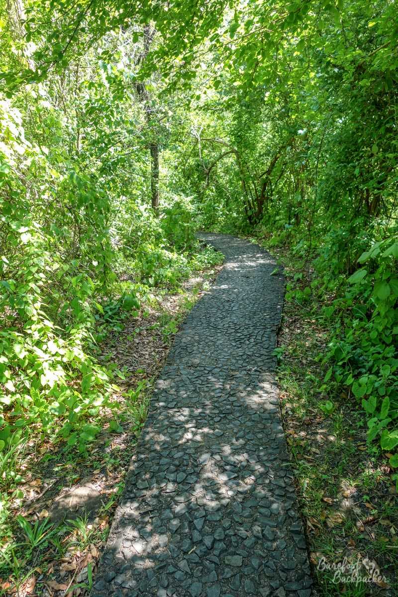
It was a lovely walk though; it was quite easy underfoot, being mostly stairs or stones, and there were a couple of benches at strategic points that allowed you to sit down and rest for a while. For pretty much the whole trail I was walking through trees, and at one point I came across a couple of lurking baboons ready to snatch away anything that visitors hadn’t got a tight grip on.
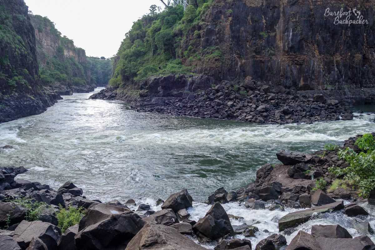
The end of the path to Boiling Pot – this is the Zambezi River; the rapids and pools are just to my right – they made really bad pictures.
At the bottom was a pebbly/rock terrace that jutted out into the river. Several backpackers were here already, bathing or swimming in the fast-flowing waters; all I managed was to dip my feet in for a couple of minutes. While you didn’t get a view of the Falls from here, it was a good spot to admire the chasm from another angle and see the rock up close – almost vertical in places so easy to imagine just how powerful the river would have been in full flight, thousands of years ago. It was also another good spot to see the bungee jumpers from the bridge. Sadly, despite the signs forbidding it, the bulk of the rock terrace seemed to be covered in an array of litter.
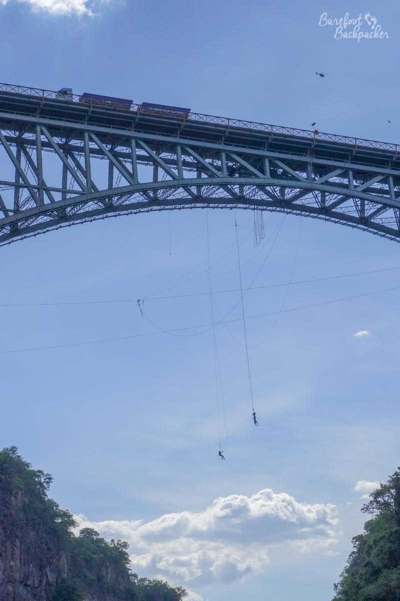
BUNGEEEEEEE!!!
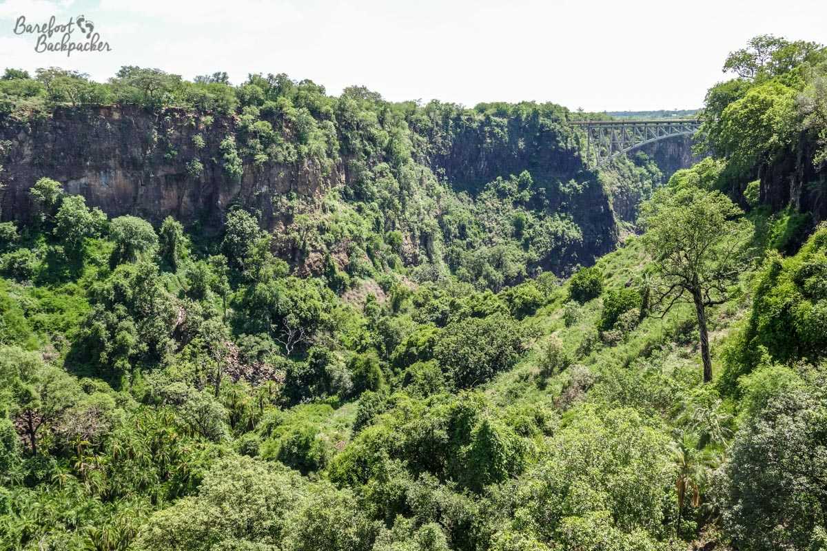
By the time I hit the ‘Photographic Trail’ I was pretty much deadbeat; on the map this trail looked the longest as well, so I wasn’t looking forward to it as much as the other walks. I’d also say it’s quite misnamed – there’s pretty much nothing on it that you wouldn’t have already seen on the other walks – indeed on my left as I walked out there’s nothing but a wire fence separating the Park from the road to Zimbabwe, although at its far end, pretty much at the Victoria Falls Bridge, there was a good view looking back over the chasms, down at Boiling Pot, and up the narrow Zambezi valley where far below, adventurers were white-water rafting and canoeing through the shallow rapids.
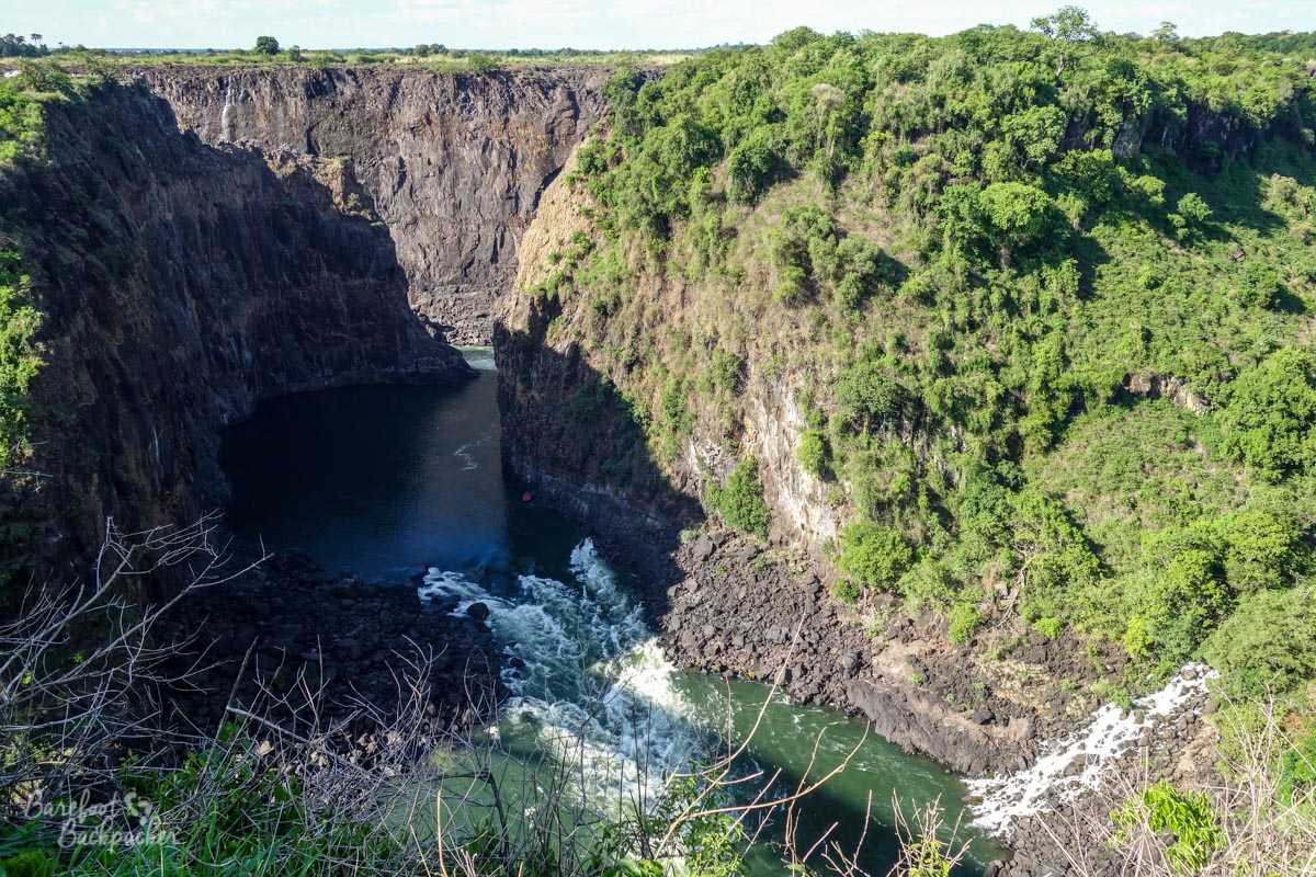
Looking back at the canyon and Boiling Pot towards the Falls, from the end of the Photographic Trail. The Victoria Falls Bridge itself is pretty much directly behind me.
The trail was pretty much deserted as I walked down it in the late afternoon sun – my only companions were the occasional family of baboons blocking my path, which led to a couple of awkward stand-offs. While I’m bigger than the average baboon, I’m pretty sure they could have me in a fight.
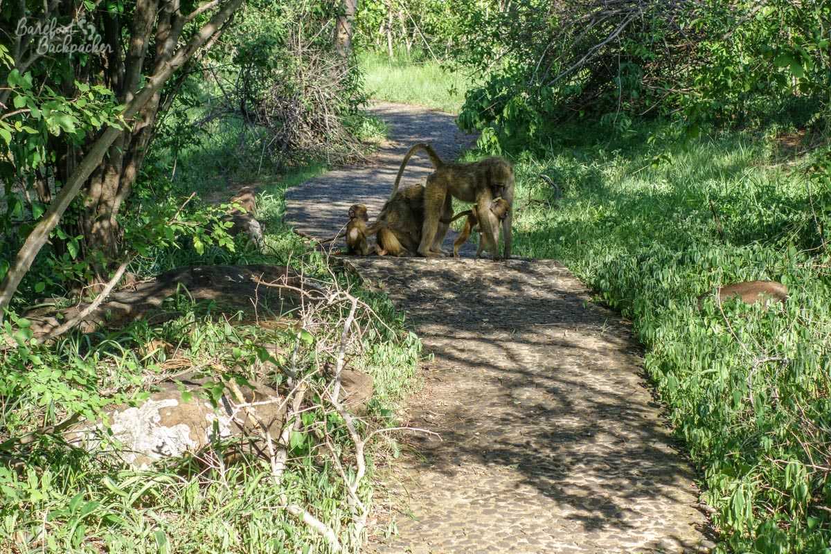
Baboons on the Photographic Trail.
Getting back to Livingstone town was easy – there were plenty of taxis in the car park. There was also allegedly a bus, but given that I never found one going to the falls in the first place, catching one back felt like the easiest way to return.
I’m glad I saw the falls; as I say it’s slightly disappointing the rains were late so I wasn’t seeing them in full glory, but they were still incredibly impressive nonetheless. I suspect the best view would be in the height of the rains, from the Zimbabwe side – from the end of the Rainforest Trail I could see the crowds on the other side looking at the falls, and not only were they a bit further from the Falls anyway, there seemed to be much more open space for them to wander back and get a much wider vista. That said, from the Zambian side, because I was much closer, it was easier to see and feel the sheer power that they have.
Prettier setting than Niagara, too. Next stop at some point will be Iguazu …
—–
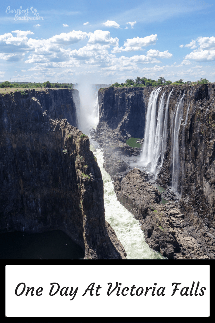
Like this post? Pin it!!
Visited: 31 December 2015
So pretty!!
(I’m laughing at the burn to Niagara Falls at the end )